Surveying Windy Vineyards with the Mavic 4 Pro: What a Rain
Surveying Windy Vineyards with the Mavic 4 Pro: What a Rain-Soaked Mountain Scene Reveals
META: A field-focused look at using the Mavic 4 Pro for vineyard surveying in wind, rain-adjacent conditions, cloud contrast, EMI management, obstacle avoidance, D-Log capture, and reliable flight planning.
A mountain scene in Gansu might seem far removed from vineyard work. It isn’t.
Recent aerial coverage from Kongtong Mountain in Pingliang, Gansu showed something every serious drone operator recognizes instantly: weather doesn’t just change the look of a landscape, it changes the entire operating equation. During the National Day holiday period, continuous rainfall rolled through the 5A scenic area and produced a dense sea of clouds. Peaks and historic buildings appeared and disappeared inside drifting vapor. Beautiful, yes. Operationally, even more interesting.
That kind of scene matters to anyone planning to survey vineyards in windy conditions with a Mavic 4 Pro.
Why? Because vineyards are often worked at the edge of weather, not in perfect air. Low cloud, moisture-heavy atmosphere, shifting visibility, gusts over rows, terrain-driven airflow, and intermittent signal irregularities near utility infrastructure all affect the quality of a flight and the value of the data collected. The Kongtong Mountain footage is a reminder that aerial work is rarely just about the aircraft. It is about reading atmosphere, terrain, contrast, and transmission behavior before small issues become expensive ones.
The real problem: vineyards amplify weather and signal problems
A vineyard looks orderly from the road. From the air, it behaves like a complicated surface.
Long, repeating rows can confuse visual judgment in gusty conditions. Sloped blocks create updrafts and rotor-like airflow near ridgelines. Moist air after rain can flatten contrast, especially early in the morning. Trellis wire, irrigation systems, nearby service roads, and power distribution can all add distractions or electromagnetic noise that show up at the worst moment: during a turn, while descending for a lower pass, or when trying to maintain a precise line over a row.
If your goal is survey-grade consistency, crop health observation, drainage assessment, canopy gap spotting, or simply building a reliable visual record over time, you need a workflow that anticipates unstable conditions rather than reacting to them.
That is where the Mavic 4 Pro earns its place. Not because it magically removes weather risk, but because its flight intelligence, obstacle sensing, tracking logic, and image controls let an experienced operator keep the mission disciplined when the environment starts misbehaving.
What the Kongtong Mountain cloud scene teaches a vineyard operator
The Xinhuanet report described continuous rainfall followed by flowing cloud formations that partially concealed mountain ridges and ancient buildings. Two details stand out.
First, the weather pattern was not a quick shower. It was sustained rainfall over the holiday period. In practical flight terms, that means the atmosphere remained loaded with moisture long enough to create persistent visual softness, shifting cloud edges, and changing background separation. For vineyard surveying, that same kind of moisture-rich air can make it harder to distinguish canopy texture, weak rows, access paths, and erosion lines unless exposure and flight altitude are chosen carefully.
Second, the mountain and architecture were “appearing and disappearing” through cloud. That is more than poetic description. It points to a surveillance problem every pilot knows: intermittent visual clarity. In a vineyard, you may not be flying through cloud, but wind-driven mist, low haze, ridge shadow, and glare can produce the same result. A row that looks crisp on one pass may lose contrast on the next. A stone wall or utility pole hidden by tonal flattening can become a route hazard. This is where obstacle avoidance is not just a safety headline. It is operational insurance.
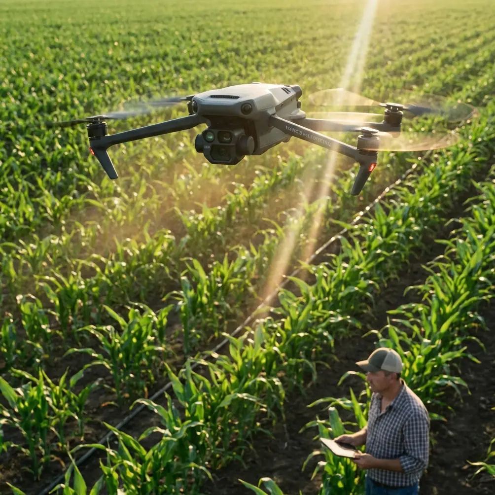
Why the Mavic 4 Pro fits this kind of work
For vineyard missions in wind, you need three things from the aircraft.
Stable positional behavior.
Reliable scene awareness.
Flexible image capture that preserves detail when conditions are visually ugly.
The Mavic 4 Pro is especially useful when the mission blends documentation with inspection-style observation. If you are surveying vine vigor, checking row continuity, evaluating drainage channels after rainfall, or comparing canopy development across blocks, you do not just need pretty footage. You need repeatability. That means cleaner lines, predictable turns, and enough sensing confidence to stay focused on the survey task instead of manually babysitting every meter of the route.
Obstacle avoidance matters most where vines meet structures: windbreak trees, utility poles, farm sheds, netting, edge fencing, and terraces. On paper, every operator already knows obstacles are there. In practice, gusts plus repetitive row geometry can pull attention toward framing and alignment. A robust avoidance system reduces the chance that a small drift becomes a broken prop and a lost morning.
ActiveTrack and subject tracking also sound like cinema features until you use them in agriculture. When following a vineyard vehicle along a service path, documenting worker movement patterns for operational planning, or creating repeat visual references of equipment routes between blocks, tracking helps maintain composition and spacing while freeing mental bandwidth for airspace and terrain monitoring. Used correctly, that improves consistency rather than replacing pilot judgment.
QuickShots and Hyperlapse have a place too, though not in the way casual users think. A Hyperlapse sequence over a block can reveal fog movement, shade progression, and the way wind pushes through canopy sections over time. QuickShots can create fast standardized overviews for weekly comparison, especially when managers want a simple visual reference before committing to a full inspection.
Wind over vines is rarely uniform
One mistake newer operators make is treating vineyard wind as a single condition. It is not.
Wind on the perimeter road can be moderate while the top of a slope is rough and the leeward side of a block is turbulent. Add nearby tree lines and retaining walls, and the aircraft can pass through three different air behaviors in one short leg. The solution is not brute force flying. It is route design.
I prefer to break a vineyard into smaller segments and fly them according to terrain logic, not just property boundaries. Exposed ridges first, lower sheltered rows later. If there is a weather system nearby, I capture the blocks most vulnerable to changing visibility before the safer sections. That mindset comes straight out of scenes like Kongtong Mountain, where rainfall and cloud did not affect every visual layer equally. The tallest features disappeared first. The same often happens in vineyards with upper terraces and ridge-edge infrastructure.
The Mavic 4 Pro helps here because it supports a disciplined workflow: establish a higher reconnaissance pass, identify gust patterns and obstacle zones, then drop to task altitude only after the air reveals its habits.
Handling electromagnetic interference with antenna adjustment
This deserves more attention than it usually gets.
In vineyard environments, electromagnetic interference can come from power lines at the property edge, pumping equipment, repeater installations, nearby buildings, or even your own position relative to terrain and metal structures. The problem is not always total signal loss. More often it is a subtle decline in transmission quality, increased latency feel, or unstable confidence while turning behind a stand of trees or along a slope shoulder.
When that happens, many operators fixate on the screen and forget the simplest response: adjust the controller antenna orientation deliberately.
The goal is not random fiddling. It is alignment. Keep the broad face of the antennas oriented toward the aircraft’s position rather than pointing the antenna tips directly at it. In sloped vineyards, that may require changing your own stance as the drone climbs or drops across elevation. If the aircraft moves laterally behind a row of tall windbreak trees or near utility lines, a small controller repositioning can clean up the link surprisingly fast.
This is operationally significant because transmission stability affects more than confidence. It affects your willingness to hold a steady line, complete a pass, and preserve data consistency. Poor signal behavior often leads to rushed decisions: climbing unnecessarily, abandoning a segment, or turning early. Those choices leave gaps in your visual record. Good antenna discipline prevents many of those problems before they escalate.
If your site has a known interference zone and you want a practical pre-flight checklist built around it, this WhatsApp field support link is a sensible place to ask for one.
Imaging choices: D-Log is not just for “cinematic” work
Flat image profiles are often misunderstood in commercial drone work. D-Log is useful in vineyards because weather does not care about your ideal lighting schedule.
After rain, cloud layers can create bright sky openings above dark rows. In the same frame, reflective wet leaves may sit beside muddy service tracks and shaded retaining walls. A standard baked-in look may clip highlights or crush darker detail that you later need for analysis or stakeholder review. D-Log gives you more room to recover tonal detail when a block contains both glare and shadow.
This matters for documentation. If you are reporting on drainage issues, canopy inconsistency, or post-weather inspection findings, the ability to grade footage for clarity is not vanity. It is part of making the evidence usable. The cloud-and-architecture scene from Kongtong Mountain is a perfect example. When structures are half veiled by moving cloud, subtle separation between built edges and atmospheric haze becomes the difference between an image that merely looks dramatic and one that still communicates terrain and form.
For vineyard surveys, the same principle applies to rows under uneven sky cover.
Use automation carefully in wet-weather windows
Rain-adjacent conditions create a temptation to rush. A weather gap opens, you launch, and suddenly every automated feature looks attractive because it promises speed.
Use them, but with hierarchy.
Obstacle avoidance first.
Route discipline second.
Tracking and automated creative modes third.
If the purpose is surveying, the mission should not drift into casual capture. ActiveTrack is useful if you are documenting a tractor route, an ATV inspection run, or a worker path through a block. But for canopy assessment or terrain review, manually supervised passes are often still better. The Mavic 4 Pro’s intelligence should reduce workload, not dictate the mission.
QuickShots can help create repeatable perimeter summaries. Hyperlapse can reveal weather movement over a site. Yet neither should replace the slower, more boring passes where the real agronomic clues appear: uneven vigor, standing water, washout scars, blocked access lanes, sagging net lines, or stress along a row edge.
A practical problem-solution workflow for windy vineyard missions
Here is the method I recommend.
1. Start with an atmospheric read, not a launch
Look at cloud movement, not just wind speed. Moisture-heavy air can hide contrast and change your preferred altitude. If upper slopes are fading in and out visually, prioritize them first.
2. Run a high reconnaissance pass
Use a safe overview altitude to assess gust behavior over ridges, tree lines, and structures. Watch how the aircraft behaves on crosswind turns.
3. Map interference zones
Note any power infrastructure, pump stations, or metal-roofed service buildings. Decide in advance where you may need to adjust controller position or antenna orientation.
4. Segment the vineyard
Divide the property by wind exposure and terrain, not just by parcel boundary. This improves both safety and data continuity.
5. Capture in D-Log when contrast is unstable
Especially useful after rainfall or during broken cloud. Preserve image latitude for later review.
6. Use obstacle avoidance as a buffer, not a crutch
Trust the system, but still fly with conservative margins near poles, netting, and trees.
7. Reserve tracking for moving operational documentation
ActiveTrack works well for vehicles and route demonstrations. For row analysis, manual control remains the cleaner option.
8. Finish with a consistency pass
Before landing, grab one final standardized overview. This creates a visual benchmark for your next mission.
Why this matters beyond one flight
The lesson from Kongtong Mountain is simple: weather turns landscapes into layered, unstable visual environments. In Gansu, continuous rain transformed a scenic mountain into a shifting composition of cloud, ridges, and ancient structures. In a vineyard, the same atmospheric instability changes how rows read, how hazards appear, and how your aircraft link behaves.
That is why the Mavic 4 Pro should be approached as a field instrument, not just a camera drone. Its obstacle avoidance helps when visibility and contrast are inconsistent. Its tracking tools support operational follow shots when ground movement needs documentation. Its Hyperlapse capability can visualize weather drift and shade progression. Its D-Log flexibility protects image usefulness when light breaks apart after rain. And when EMI starts to creep in, something as unglamorous as proper antenna adjustment can be the difference between a controlled survey and a compromised one.
Good vineyard surveying is not about forcing a perfect mission out of imperfect conditions. It is about knowing which tools matter when the air, terrain, and signal environment stop cooperating.
That is where experienced operators separate themselves. Not in the easy flights. In the damp, gusty, visually unstable ones where the data still has to come home clean.
Ready for your own Mavic 4 Pro? Contact our team for expert consultation.