Mavic 4 Pro for Power Line Surveys in Complex Terrain
Mavic 4 Pro for Power Line Surveys in Complex Terrain: What Actually Matters in the Field
META: Expert look at using Mavic 4 Pro for power line inspection in difficult terrain, with practical altitude strategy, fail-safe thinking, parameter discipline, and safer workflow design.
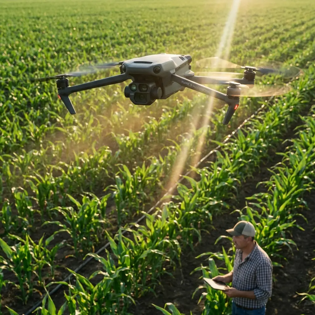
Power line work exposes the gap between a camera drone that looks impressive on paper and an aircraft that can be trusted in broken terrain, shifting wind, and inconsistent signal conditions. If you are evaluating the Mavic 4 Pro for this kind of job, the real question is not whether it can produce attractive footage. It is whether it can stay predictable when the hillside tightens your flight corridor, when line-of-sight comes and goes, and when you need inspection-grade repeatability rather than creative improvisation.
That is the lens I want to use here.
The reference material behind this article comes from an older APM manual, not from DJI documentation. At first glance that seems unrelated. It is not. The APM pages focus on three operational truths that still matter today, even if the aircraft platform is more modern: fail-safe logic must be chosen carefully, parameter changes should be structured by user level, and raw diagnostic access tells you more than polished interface screens ever will. When you apply those ideas to a Mavic 4 Pro mission over power lines, you end up with a much better survey plan.
The central problem: complex terrain turns routine line inspection into a systems test
Surveying power lines in mountains, valleys, or cut slopes is not just “flying along a route.” Terrain interferes with signal geometry. Towers often sit on ridgelines with turbulent airflow. Conductors cross gullies where altitude above ground can change dramatically over a short horizontal distance. Trees and terrain shoulders can block your path and complicate obstacle sensing. Even experienced pilots can be lulled into thinking that a premium drone’s obstacle avoidance and tracking stack will smooth everything out.
It won’t.
For utility work, the Mavic 4 Pro should be treated as a data-collection aircraft first and an intelligent camera platform second. Features people usually associate with creator workflows—ActiveTrack, QuickShots, Hyperlapse, or D-Log—only become useful when they are subordinated to an inspection plan. D-Log, for example, matters because it can preserve highlight detail on bright insulators and darker background vegetation during difficult midday contrast, not because it sounds cinematic. ActiveTrack is not there to chase vehicles; in a power corridor context, the important question is whether automated subject handling adds stability to repeated observation patterns or introduces ambiguity near wires and poles.
That distinction matters because power line surveys reward consistency. Every automated behavior has to be assessed through that standard.
The old APM fail-safe lesson still applies: do not stack automation blindly
One of the most useful facts in the reference manual is also the least glamorous. It warns against relying too heavily on the flight controller’s internal fail-safe logic when trigger conditions are unstable near threshold. In the manual’s example, if a condition such as throttle PWM or battery voltage hovers at the trigger boundary, repeated switching can burden the controller and create dangerous behavior. The document specifically notes that fail-safe options may include return-to-launch, continue mission, or land, but it cautions that unstable triggering can produce worse outcomes than the original fault.
That is an old controller, yes. But the operational principle is current.
For Mavic 4 Pro power line work, the takeaway is simple: keep your emergency logic clean, singular, and predictable. In complex terrain, you do not want overlapping decision chains fighting each other. If the aircraft loses confidence in its route, if signal quality degrades behind a ridge, or if obstacle behavior changes because wires are difficult for sensors to model consistently, your recovery action needs to be obvious before launch.
Return-to-home sounds comforting until you remember what “home” means in steep terrain. A straight-line return at a fixed altitude can be sensible on open farmland and wrong in a canyon shoulder environment. Likewise, an automatic descent or landing routine may be safe over a cleared pad and unacceptable above scrub, rock, or inaccessible slope. The real planning task is to decide which single fallback mode best matches your terrain profile and corridor geometry.
The APM manual also mentions a practical workaround: using the receiver or remote-side behavior to force a known mode change rather than relying on unstable onboard trigger logic alone. Translated into modern workflow thinking, that means your communication-loss plan should not be improvised in the air. It should be tested on the ground and mapped against the exact terrain section you are inspecting.
For a power utility team, this is operational significance, not theory. A false or mistimed fail-safe event over an energized corridor can cost more than flight time. It can break continuity of inspection coverage, complicate recovery, and force a resurvey.
Optimal flight altitude for power line surveys: think in layers, not one number
The context prompt asks for optimal altitude insight, and this is where many articles get vague. Let’s not do that.
There is no single universal altitude for Mavic 4 Pro power line work in complex terrain, because your required standoff from the line, terrain rise rate, vegetation height, and imaging goal all change section by section. Still, there is a practical framework that works well:
Fly by inspection layer rather than by fixed mission altitude.
For corridor familiarization and obstacle reading, a higher reconnaissance pass is usually safer. For detail capture of insulators, hardware, conductor sag behavior, and vegetation encroachment, you step down into a controlled closer pass. In broken terrain, trying to do both from one altitude usually produces the worst of each approach: not enough contextual awareness and not enough detail.
A workable rule for many utility teams using compact enterprise-capable camera drones is to begin with a terrain-aware reconnaissance layer that keeps you comfortably above the tallest nearby vegetation and lateral terrain intrusions while still preserving visual relation to the line. Then, only after the terrain and wind pattern are understood, transition to a lower detail layer with deliberate lateral separation from the conductors.
What matters most is relative altitude to terrain and structure, not just legal altitude from takeoff point. A drone that is “only” at a moderate height above launch can still be effectively low against a rising ridgeline half a span ahead. That is where crews get trapped.
For the Mavic 4 Pro in particular, I would advise operators surveying complex terrain to resist the temptation to hug the line too tightly just because the aircraft has advanced obstacle avoidance. Thin wires, changing backgrounds, and low-angle sun can create edge cases for any sensing system. A modestly higher offset often produces better inspection continuity because it gives the pilot and aircraft more margin to absorb turbulence and route corrections. In practice, many crews find that adding a little extra vertical buffer on the first pass reduces total mission time because they spend less effort aborting and resetting.
So the “optimal altitude” is usually not the lowest one that still gets the shot. It is the lowest one that preserves stable control, clear wire context, and a credible escape path.
Obstacle avoidance is valuable, but power lines are a special category
Power line surveys tend to trigger overconfidence in obstacle avoidance discussions. Trees, towers, terrain edges, and larger infrastructure elements are one thing. Conductors are another. Thin linear objects are visually complex and can become harder to interpret depending on background clutter, sun angle, and aircraft orientation.
That means obstacle avoidance should be treated as a support layer, not permission to fly aggressively near lines.
With the Mavic 4 Pro, the best use of obstacle sensing in this role is to help manage the surrounding environment: terrain shoulders, isolated trees, tower geometry, and unexpected intrusions along the corridor. It should not replace disciplined lateral separation from energized assets. If your survey design assumes the aircraft will “see” every wire and brake perfectly every time, your survey design is weak.
This is also where route pacing matters. Fast passes may look efficient, but slower controlled movement often improves both safety and image utility. Inspection is rarely won by speed. It is won by usable frames, repeatable angle, and clean asset identification.
Borrow another APM lesson: structure your settings by mission maturity
The manual references three levels of parameter management in the ground station: basic parameters, advanced parameters, and a full parameter list. That sounds mundane. It is not. It is a strong reminder that not every setting deserves attention from every operator on every mission.
Applied to Mavic 4 Pro field practice, this suggests a three-tier preparation model:
- Core settings for every crew member: return behavior, obstacle settings, camera profile, storage checks, home-point logic, battery thresholds.
- Advanced settings for experienced operators: route speed tuning, gimbal behavior, custom exposure strategy, subject automation constraints.
- Deep system review for technical leads: firmware behavior changes, log review, controller-link assumptions, environment-specific overrides.
This structure prevents a common problem in inspection teams: too many people touching too many settings without a controlled reason. The result is inconsistency between flights, and inconsistency is toxic to infrastructure survey work.
One reason the APM approach remains useful is that it recognized not all users should work from the full parameter table. For Mavic 4 Pro operations, that same restraint keeps crews focused. If someone cannot explain why a setting change improves corridor safety or image quality, it probably does not belong in the preflight workflow.
Diagnostics matter more than the glossy interface
Another strong detail in the source is the description of the ground station terminal as a DOS-like serial debugging tool. The manual highlights that it can expose raw sensor outputs, clear configuration data, configure features, and download or browse logs. It even gives a small procedural detail: after connecting with the correct port and baud rate, the user enters a test command to inspect gyro output. That tiny sequence matters because it reflects an engineering mindset—trust behavior you can verify, not just behavior you can assume.
For Mavic 4 Pro crews, the modern equivalent is not a literal command terminal. It is the discipline of reviewing logs, validating sensor behavior through test flights, and checking how the aircraft responds in the exact type of terrain you plan to work. Before a power line mission, a short shakedown flight near similar topography is often more valuable than an extra hour of office planning.
If your team wants to compare route strategy or inspection workflow for a specific corridor, I’d rather discuss terrain profiles and fallback logic than buzzwords—use this direct field planning link: https://wa.me/85255379740
The operational significance here is huge. A line survey is not the place to discover that your updated obstacle settings feel different near ridges, or that your camera exposure profile clips reflective hardware in high-contrast conditions. Verification first. Corridor second.
Where Mavic 4 Pro features genuinely help
Some features associated with the Mavic line can be useful for utility inspection if used with discipline.
D-Log: Valuable when towers, sky, and dark vegetation occupy the same frame. It preserves flexibility in post, which can help when identifying condition details that would otherwise get lost in contrast.
Hyperlapse: Not an inspection primary mode, but potentially useful for documenting corridor access conditions, weather movement, or broad vegetation change across time when flown well away from critical assets.
QuickShots: Largely secondary here. For utility operators, prebuilt cinematic movements are rarely central to asset inspection, though they may help create contextual project documentation for stakeholders.
ActiveTrack and subject tracking: Use carefully. In some industrial environments, controlled tracking can stabilize repeated observation of a structure or vehicle-based support activity. Near lines and towers, however, the question is whether the automation understands your true subject and preserves safe geometry. Often, manual control remains the better choice.
The point is not to dismiss smart features. It is to assign them a job. If a feature cannot improve clarity, repeatability, or safety, it should stay off the critical path.
A practical mission pattern for complex terrain
If I were configuring a Mavic 4 Pro workflow for a power line section crossing uneven terrain, I would use this sequence:
- Start with a higher reconnaissance pass to read terrain rise, wind, and obstacle context.
- Define a conservative return strategy before detailed work begins.
- Fly a second, slower detail pass with stable lateral offset rather than trying to sit directly on the line.
- Use camera settings that prioritize inspection legibility over stylistic look.
- Review captured material while still on site, especially transition points where terrain changes fastest.
- Keep emergency behavior simple and tested.
That sequence reflects the same core lesson embedded in the old APM pages: complexity inside the aircraft should be balanced by simplicity in operational decision-making.
The bottom line
The Mavic 4 Pro can be a strong tool for civilian power line survey work, especially where teams need a portable platform that can move between access-limited locations. But the aircraft’s value in complex terrain does not come from having more features. It comes from how you constrain those features.
The old APM documentation reminds us of three things that still separate reliable field teams from casual operators: unstable fail-safe logic is dangerous, parameter control should match user expertise, and diagnostics reveal truths that interfaces hide. For a Mavic 4 Pro flying utility corridors, those lessons are not historical footnotes. They are exactly the kind of thinking that keeps survey flights safe, efficient, and usable.
Ready for your own Mavic 4 Pro? Contact our team for expert consultation.