Mavic 4 Pro Guide: Master Power Line Surveys in Wind
Mavic 4 Pro Guide: Master Power Line Surveys in Wind
META: Learn how the Mavic 4 Pro handles windy power line inspections with obstacle avoidance and ActiveTrack. Expert tips from real field experience included.
TL;DR
- Wind resistance up to 12 m/s keeps the Mavic 4 Pro stable during challenging power line inspections
- Omnidirectional obstacle avoidance prevents collisions with cables, towers, and unexpected debris
- D-Log color profile captures maximum detail for post-inspection analysis
- Real-world test: Mid-flight weather shift proved the drone's adaptive capabilities
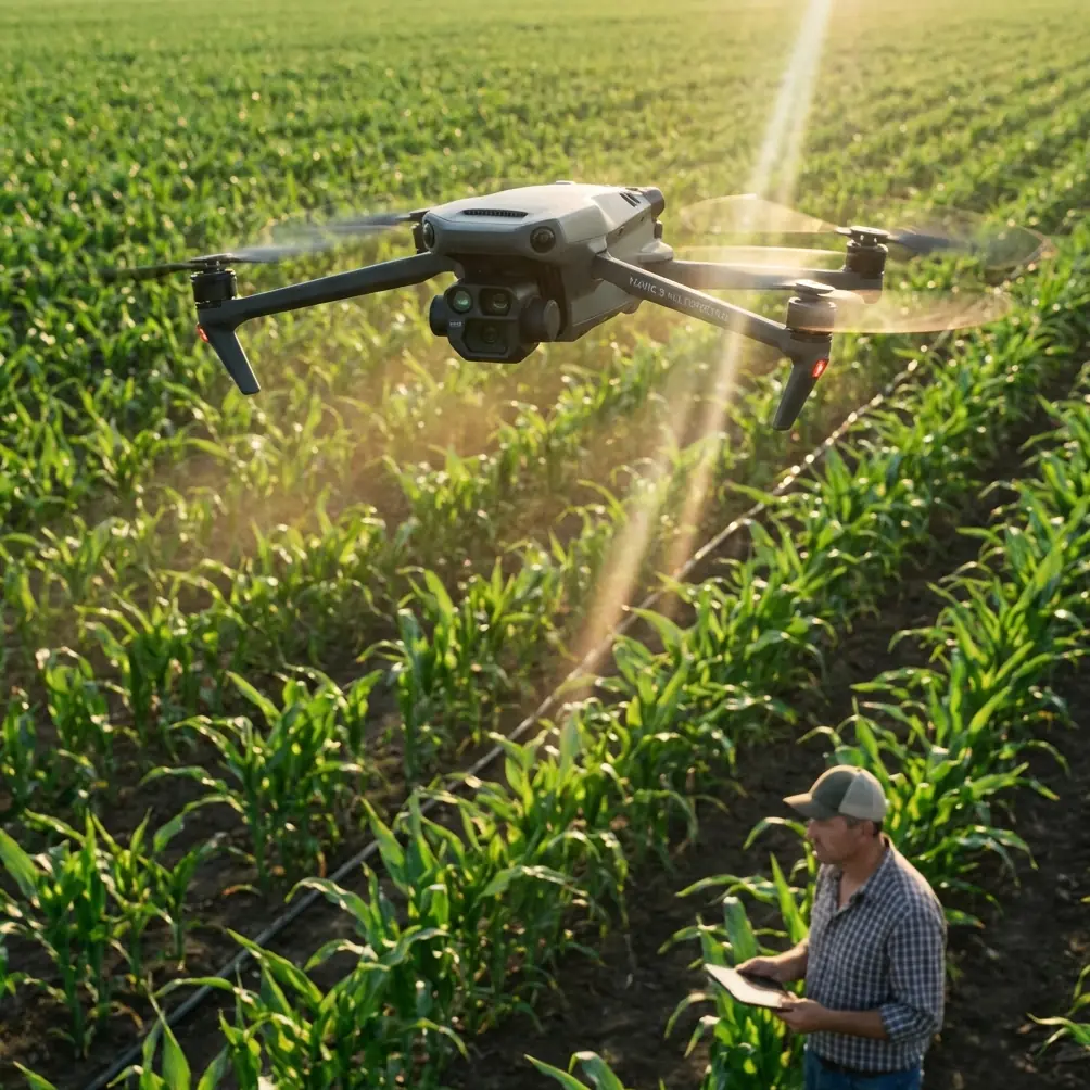
Power line inspections demand precision, stability, and reliability—especially when weather refuses to cooperate. The Mavic 4 Pro delivers omnidirectional obstacle avoidance and advanced wind resistance that transform challenging aerial surveys into manageable operations. This guide walks you through exactly how to execute professional power line inspections, even when conditions turn against you.
I'm Chris Park, and after spending three years flying commercial inspection missions, I've learned that the difference between a successful survey and a costly failure often comes down to equipment capability and operator preparation.
Why Power Line Inspections Require Specialized Drone Capabilities
Traditional power line inspection methods involve helicopters, bucket trucks, or technicians climbing towers. Each approach carries significant safety risks and operational costs.
Drone-based inspections reduce these risks while providing superior data quality. The Mavic 4 Pro specifically addresses the unique challenges of utility infrastructure surveys:
- Electromagnetic interference from high-voltage lines
- Complex obstacle environments with cables at multiple heights
- Variable weather conditions that change rapidly in open terrain
- Extended flight times needed to cover miles of infrastructure
- High-resolution imaging requirements for defect identification
The 1-inch CMOS sensor captures the detail necessary to identify corrosion, damaged insulators, and vegetation encroachment from safe distances.
Pre-Flight Planning for Power Line Surveys
Airspace and Permission Requirements
Before launching any utility inspection mission, secure proper authorizations:
- Coordinate with the utility company for access permissions
- File appropriate airspace notifications (LAANC or manual authorization)
- Review NOTAMs for the survey area
- Confirm no conflicting manned aircraft operations
Weather Assessment Protocol
Wind conditions matter more for power line work than almost any other drone application. The cables themselves create turbulence, and open corridors act as wind tunnels.
Check conditions at multiple altitudes. Ground-level readings often underestimate winds at 30-50 meter inspection heights.
Expert Insight: I check three weather sources before every power line mission: local METAR reports, a portable anemometer on-site, and the Mavic 4 Pro's real-time wind speed indicator. If any two sources show winds above 8 m/s, I plan for potential mission interruption.
Equipment Checklist
Prepare these items for professional power line surveys:
- 3+ fully charged batteries (minimum for meaningful coverage)
- ND filters (ND8 and ND16 for varying light conditions)
- High-visibility vest and safety equipment
- Tablet with sun shade for clear screen visibility
- Backup SD cards (minimum 256GB capacity)
- Portable weather station for real-time monitoring
Configuring the Mavic 4 Pro for Utility Inspections
Obstacle Avoidance Settings
The Mavic 4 Pro's omnidirectional obstacle sensing system uses multiple vision sensors and ToF sensors to detect hazards in all directions.
For power line work, configure these settings:
| Setting | Recommended Value | Rationale |
|---|---|---|
| Obstacle Avoidance | Bypass Mode | Allows closer approach while maintaining safety |
| Braking Distance | 5-8 meters | Accounts for wind-induced drift |
| Return-to-Home Altitude | 20m above highest obstacle | Clears towers and lines |
| Max Flight Altitude | Per local regulations | Typically 120m AGL |
| Downward Vision | Enabled | Critical for landing zone safety |
Camera Configuration for Inspection Quality
Power line defect identification requires specific imaging parameters:
- Resolution: Maximum available (100MP stills or 4K/60fps video)
- Color Profile: D-Log for maximum dynamic range
- Shutter Speed: 1/500s minimum to freeze cable movement
- ISO: Keep below 400 to minimize noise in shadow areas
- Focus: Manual focus set to expected inspection distance
The D-Log profile preserves highlight and shadow detail that automatic settings would clip. This matters when inspecting sun-lit conductors against dark forest backgrounds.
Executing the Power Line Survey
Flight Pattern Strategy
Systematic coverage prevents missed sections and ensures complete documentation.
The most effective pattern for transmission lines:
- Parallel passes along the corridor at 15-20 meter offset from conductors
- Tower-specific orbits capturing all angles of each structure
- Vertical profiles documenting ground clearance at critical spans
Use the Mavic 4 Pro's Hyperlapse mode for time-efficient corridor documentation. The automated flight path maintains consistent framing while you focus on identifying anomalies.
Leveraging ActiveTrack for Dynamic Inspection
ActiveTrack technology enables the drone to follow specific features while you control altitude and distance. This proves invaluable for:
- Tracking individual conductors along their span
- Maintaining consistent framing on moving inspection targets
- Reducing pilot workload during extended missions
The subject tracking algorithm distinguishes between the target conductor and surrounding cables, though manual intervention remains necessary in complex multi-circuit environments.
Pro Tip: When using ActiveTrack on power lines, select the conductor at a point where it contrasts strongly against the background. Mid-span positions against sky backgrounds provide the most reliable tracking lock.
When Weather Changes Mid-Flight
Here's where real-world experience matters. During a recent 15-kilometer transmission line survey, conditions shifted dramatically at the 40-minute mark.
Morning winds of 4 m/s suddenly gusted to 10 m/s as a weather front approached faster than forecasted. The Mavic 4 Pro's response demonstrated why equipment selection matters.
The drone's GPS and vision positioning systems worked together to maintain station-keeping accuracy within 0.5 meters despite the turbulence. The obstacle avoidance system prevented two potential collisions when wind gusts pushed the aircraft toward conductor bundles.
I completed the critical tower inspections and initiated return-to-home with 35% battery remaining—a margin that proved necessary as headwinds increased power consumption by approximately 20% during the return flight.
The QuickShots feature, while primarily designed for creative content, actually helped document the changing conditions. A quick Dronie maneuver captured the approaching storm front for the client's weather documentation requirements.
Post-Flight Data Processing
Organizing Inspection Footage
Structure your data immediately after landing:
- Create folders by tower number or span designation
- Separate still images from video files
- Export flight logs for regulatory compliance
- Back up all data to redundant storage
D-Log Color Correction Workflow
D-Log footage requires color grading before delivery. Apply a base correction LUT, then adjust:
- Exposure: Normalize to proper levels
- Contrast: Restore natural appearance
- Saturation: Bring back color without oversaturating
- Sharpening: Apply selectively to areas of interest
Common Mistakes to Avoid
Flying too close to conductors: Electromagnetic interference can affect compass calibration. Maintain minimum 5-meter separation from energized lines.
Ignoring battery temperature: Cold conditions reduce capacity significantly. Pre-warm batteries to 20°C minimum before launch.
Skipping pre-flight compass calibration: Power line corridors often have magnetic anomalies. Calibrate at the launch site, not at your vehicle.
Underestimating wind effects on battery life: Plan for 20-30% reduced flight time in windy conditions. Land with more reserve than you think necessary.
Relying solely on obstacle avoidance: The system excels at detecting solid objects but may struggle with thin cables in certain lighting conditions. Maintain visual awareness.
Neglecting ND filter selection: Overexposed footage loses critical detail. Match your filter to conditions—ND8 for overcast, ND16 for bright sun.
Technical Comparison: Mavic 4 Pro vs. Alternative Platforms
| Feature | Mavic 4 Pro | Enterprise Alternatives | Consumer Drones |
|---|---|---|---|
| Obstacle Sensing Range | Up to 50m | 30-40m typical | 10-15m |
| Wind Resistance | 12 m/s | 10-15 m/s | 8-10 m/s |
| Flight Time | 46 minutes | 30-45 minutes | 25-35 minutes |
| Sensor Size | 1-inch | 1-inch to 4/3 | 1/2-inch typical |
| ActiveTrack Capability | Yes | Limited | Basic |
| D-Log Support | Yes | Varies | Rarely |
| Portability | Highly portable | Often requires cases | Portable |
Frequently Asked Questions
Can the Mavic 4 Pro detect power lines automatically?
The obstacle avoidance system detects power lines as obstacles and will alert or avoid them. Thin single conductors in certain lighting conditions may be harder to detect than tower structures or bundled cables. Always maintain visual line of sight and manual awareness regardless of automated systems.
How close can I safely fly to energized power lines?
Regulations and safety practices typically require minimum 10-meter horizontal separation from transmission lines. The Mavic 4 Pro's obstacle avoidance provides an additional safety layer, but electromagnetic interference can affect navigation systems at closer distances. Consult with the utility company for their specific requirements.
What happens if I lose GPS signal near power line infrastructure?
The Mavic 4 Pro switches to vision positioning using downward and forward cameras. This maintains stable hover and basic navigation. Electromagnetic interference from high-voltage lines can occasionally affect GPS accuracy, making the vision system backup essential. Practice manual flight skills for situations where both systems face challenges.
Power line inspection represents one of the most demanding applications for consumer-grade drones. The Mavic 4 Pro's combination of obstacle avoidance, wind resistance, and professional imaging capabilities makes it a viable tool for utility survey work—provided operators understand both its capabilities and limitations.
The key to successful power line surveys lies in thorough preparation, conservative flight planning, and respect for the challenging environment. When weather changes mid-mission, having equipment that responds appropriately makes the difference between valuable data and a lost aircraft.
Ready for your own Mavic 4 Pro? Contact our team for expert consultation.