Mavic 4 Pro Best Practices for Highway Surveying in Complex
Mavic 4 Pro Best Practices for Highway Surveying in Complex Terrain
META: Practical tutorial for using the Mavic 4 Pro on highway survey missions in difficult terrain, with tips on obstacle avoidance, ActiveTrack, D-Log capture, EMI handling, and safer data collection workflows.
Highway surveying sounds straightforward until the road stops behaving like a flat line on a map.
The reality is cut slopes, retaining walls, bridges, drainage channels, tree lines, power infrastructure, moving vehicles, and long sightlines that suddenly vanish around bends. In that environment, a drone is not just a camera in the air. It becomes a mobile observation platform that has to balance image quality, route discipline, signal stability, and safety at the same time.
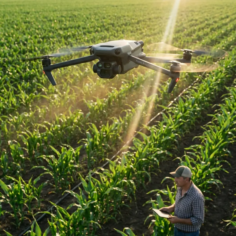
That is where the Mavic 4 Pro earns attention. Not because it is a magic solution, but because its core feature set aligns well with the daily problems survey teams run into on road corridors. If your job involves documenting pavement condition, slope stability, shoulder erosion, roadside assets, or progress on a linear construction site, the difference between a clean mission and a frustrating one usually comes down to preparation and a few field habits that are easy to overlook.
This tutorial is built for that specific scenario: surveying highways in complex terrain with the Mavic 4 Pro, with a particular focus on obstacle avoidance, subject tracking tools like ActiveTrack, image workflow choices such as D-Log, and one issue that deserves more discussion than it gets—electromagnetic interference, and how antenna adjustment can help you manage it.
Start with the mission geometry, not the drone menu
Many operators begin by thinking about camera settings or flight modes. On a highway survey, that is backwards.
The first question is how the corridor behaves. Does it run through a valley? Does it climb across switchbacks? Are there overpasses, signs, transmission lines, or concrete barriers that could block signal or confuse visual judgment? Is traffic moving close enough to create pressure on launch location selection?
Once you understand the corridor, divide it into smaller flight segments. Long highway runs are where pilots get lazy because the road creates a false sense of simplicity. But a corridor that stretches for several kilometers can shift from open sky to a cluttered, reflective environment in seconds. Breaking the route into controlled sections gives you better overlap, cleaner battery planning, and fewer rushed decisions.
This is also where the Mavic 4 Pro’s obstacle avoidance matters operationally. In complex terrain, obstacle sensing is not just there to save the aircraft from a tree branch. It helps create a margin when your attention is split between alignment, camera framing, traffic awareness, and terrain changes. Along highways, that margin can be the difference between a recoverable warning and a mission-ending incident near a sign gantry or bridge edge.
Obstacle avoidance should not be treated as permission to fly carelessly. Treat it as a secondary layer. Build a route that already avoids obvious conflict points. Then let the sensing system act as backup when visibility, angle, or depth perception become imperfect.
Choose launch points for signal health, not convenience
A good launch site is not simply the nearest shoulder with enough space to unfold the aircraft.
For highway work, your takeoff point needs three things: clear line of sight, minimal local interference, and a workable view of the route ahead. That often means walking a bit farther than you expected. A small rise, open pull-off, or service area can outperform a launch point that is technically closer to the target but boxed in by barriers, poles, parked equipment, or overhead lines.
This matters because electromagnetic interference tends to show up in exactly the sort of roadside environments survey teams use every day. Power corridors, cellular equipment, traffic systems, reinforced concrete structures, and even dense clusters of metal can all complicate signal behavior. When operators describe a link as “suddenly unstable,” the cause is often not one single dramatic interference source. It is the accumulation of bad geometry, reflections, and poor controller orientation.
That is why antenna adjustment deserves to be part of your standard operating routine.
How to handle electromagnetic interference with antenna adjustment
If signal quality starts dropping during a highway survey, many pilots stare at the screen and hope it resolves itself. A better response is to think physically.
Your controller antennas need to be oriented to present the strongest effective alignment toward the aircraft, not pointed like arrows directly at it. Small changes in controller angle can improve link stability, especially when the drone is skimming along a corridor that curves, descends behind roadside terrain, or moves near reflective infrastructure.
Here is the practical method:
Pause and evaluate position.
If you see signal degradation, avoid making aggressive directional changes. Hold or gently reposition into clearer air if safe.Adjust your body position before overcorrecting the aircraft.
Turn to maintain a cleaner frontal orientation to the drone. On a winding roadway, operators often keep their feet planted while the aircraft moves off-axis. That can quietly weaken the link.Refine antenna angle in small increments.
Do not snap the controller around. Subtle adjustments are easier to assess. Watch how the signal responds over a few seconds.Increase vertical separation from clutter if needed.
If the aircraft is flying near barriers, bridge rails, sign structures, or roadside vegetation, a modest altitude increase can reduce multipath effects and improve line of sight.Relocate for the next segment if the environment remains noisy.
Persistent interference is often a site problem, not a pilot skill problem. Move the operation rather than forcing the issue.
Operationally, this matters because highway survey work often relies on consistency more than speed. A stable link supports smoother track lines, more even image spacing, and fewer aborted passes. It also reduces the temptation to rush low-altitude runs in bad signal conditions.
If your team wants a second opinion on field setup or controller positioning, you can message the flight desk here between survey days.
Use ActiveTrack carefully in corridor documentation
ActiveTrack is often discussed as a cinematic tool, but it has a place in infrastructure observation when used with discipline.
On a highway site, there are moments when tracking a slow inspection vehicle, maintenance convoy, or designated moving reference along a corridor can help standardize visual documentation. It can be useful for repeatable progress checks or following a support vehicle through an accessible segment while maintaining framing on adjacent assets.
The key is restraint.
Highway environments are full of objects that can confuse tracking logic: adjacent traffic, lane merges, shadows from overpasses, reflective surfaces, and repetitive markings. That means ActiveTrack should support your documentation plan, not replace active piloting. Before relying on it, test how the system behaves in a lower-risk segment with predictable movement and fewer competing objects.
The Mavic 4 Pro’s obstacle avoidance works well as a safety layer here, but the operational significance is this: tracking features reduce pilot workload only when the scene is legible. In a cluttered roadside environment, they can increase workload if the pilot has to keep correcting or reassigning the subject. For survey-grade consistency, manual route control still wins in many cases. Use ActiveTrack where it improves repeatability, then disengage it where traffic density or terrain complexity begins to erode confidence.
QuickShots and Hyperlapse are not just for marketing teams
Survey professionals tend to dismiss automated creative modes. That is a mistake.
QuickShots and Hyperlapse can serve practical communication purposes on road projects, especially when you need to brief engineers, contractors, or stakeholders who do not interpret orthomosaics or raw inspection stills easily.
A short automated reveal of a landslide-prone slope, drainage bottleneck, bridge approach, or earthworks zone can quickly establish context before the technical imagery is reviewed. Hyperlapse can be useful for showing construction progression, lane staging changes, or traffic management patterns over time, provided the operation is planned safely and flown within site rules.
The significance is not artistic. It is explanatory. A corridor survey often produces huge volumes of useful but fragmented visual data. These modes can create orientation assets that help teams understand where the detailed measurements fit within the larger site picture.
That said, do not let these tools contaminate your core survey workflow. Run the primary data capture first. Use QuickShots or Hyperlapse only after the essential mapping or inspection passes are complete, battery reserves are healthy, and airspace conditions remain suitable.
Why D-Log matters on highway surveys
D-Log is easy to ignore if you are focused only on immediate field review. But for highways in complex terrain, it is often worth the extra post-processing step.
Road corridors produce extreme tonal variation. Dark asphalt, pale concrete, reflective guardrails, shadowed cut faces, bright sky, and vegetation can all exist in the same frame. Standard color profiles may clip highlights or bury detail in shadows, especially around overpasses or steep embankments.
D-Log gives you more flexibility in preserving these tonal transitions. That matters when your footage is being used to inspect drainage staining, shoulder degradation, surface cracking visibility, slope moisture patterns, or structural edges that become less obvious when contrast is crushed.
The operational value is simple: better retained detail gives engineers and project managers more usable visual evidence. It also improves consistency if you are documenting the same route repeatedly across changing weather conditions.
A sensible workflow is to capture critical video passes in D-Log, then maintain a clear file management structure so those clips do not get mixed with standard profile material. If your team needs same-day review, generate quick reference exports later rather than compromising the source footage in the field.
Terrain changes demand altitude discipline
Highways in complex terrain create one of the most common drone errors: pilots hold a visual relationship to the road surface and forget the surrounding landform is changing faster than they think.
A route that looks comfortably clear from your launch point may tighten quickly near a rock cut, tree line, or elevated signage. The Mavic 4 Pro’s obstacle avoidance is helpful, but terrain management still begins with deliberate altitude planning.
A few habits help:
- Maintain a mission altitude strategy tied to the highest relevant obstruction in each segment, not the average road elevation.
- Reassess height after every major bend, grade change, or structure crossing.
- Avoid long low runs near embankments when the corridor narrows visually.
- Use overlapping passes rather than trying to capture too much in one risky low trajectory.
For highway work, consistency often beats dramatic proximity. Survey data suffers less from being slightly higher than planned than from being interrupted by repeated avoidance warnings, abrupt braking, or route deviations.
Build repeatability into each sortie
The most useful road survey flights are the ones you can replicate next week.
That means noting more than battery count and file names. Record takeoff point, wind behavior, local interference observations, antenna orientation that worked well, problem zones, sun angle, and any sections where ActiveTrack or obstacle sensing behaved differently than expected. Those notes become operational memory.
On recurring projects, this is where the Mavic 4 Pro can become genuinely efficient. Features like obstacle avoidance, ActiveTrack, D-Log, QuickShots, and Hyperlapse are valuable individually, but their real strength appears when you know exactly when to use each one and when to leave it off. Mature workflows are selective. They do not deploy every capability on every flight.
A field-ready workflow for the Mavic 4 Pro on highway surveys
If you want a practical sequence, use this as a baseline:
Before arrival
- Review corridor hazards, terrain breaks, and likely interference sources.
- Segment the route by topography and line-of-sight constraints.
- Decide which outputs are essential: stills, video, context footage, progression visuals.
On site
- Choose a launch point based on signal geometry and visibility, not just proximity.
- Check for overhead lines, metallic clutter, and structures that may affect the link.
- Confirm home point and emergency procedures.
First sortie
- Fly a conservative reconnaissance pass.
- Assess obstacle warning behavior near structures and terrain transitions.
- Watch link quality and refine controller antenna position early, before pushing farther.
Primary data capture
- Run your repeatable survey lines.
- Use D-Log for high-contrast video documentation where detail retention matters.
- Keep obstacle avoidance active as a safety layer, but do not let it substitute for route planning.
Secondary capture
- Use ActiveTrack only where movement is predictable and the environment is visually clean enough.
- Capture QuickShots or Hyperlapse for stakeholder context after core survey outputs are complete.
After landing
- Log interference zones, signal issues, and successful antenna orientations.
- Tag the segments that should be reflown from a better launch position next time.
That workflow will not make every site easy. Highway corridors rarely are. But it gives the Mavic 4 Pro a structured role instead of treating it like a flying camera expected to solve planning mistakes.
The best results come from operators who respect the complexity of the corridor, use automation selectively, and stay physically aware of the signal environment. On these missions, small habits matter: standing in the right place, adjusting antennas before panic sets in, choosing D-Log when contrast is harsh, and letting obstacle avoidance protect a disciplined plan rather than rescue a careless one.
That is how you turn a capable aircraft into a reliable survey tool.
Ready for your own Mavic 4 Pro? Contact our team for expert consultation.