Mavic 4 Pro Field Report: Surveying a Dusty Highway
Mavic 4 Pro Field Report: Surveying a Dusty Highway Corridor Under Real Mapping Pressure
META: A field-tested look at using Mavic 4 Pro for dusty highway surveying, grounded in low-altitude aerial photography standards, flight planning discipline, and changing weather conditions.
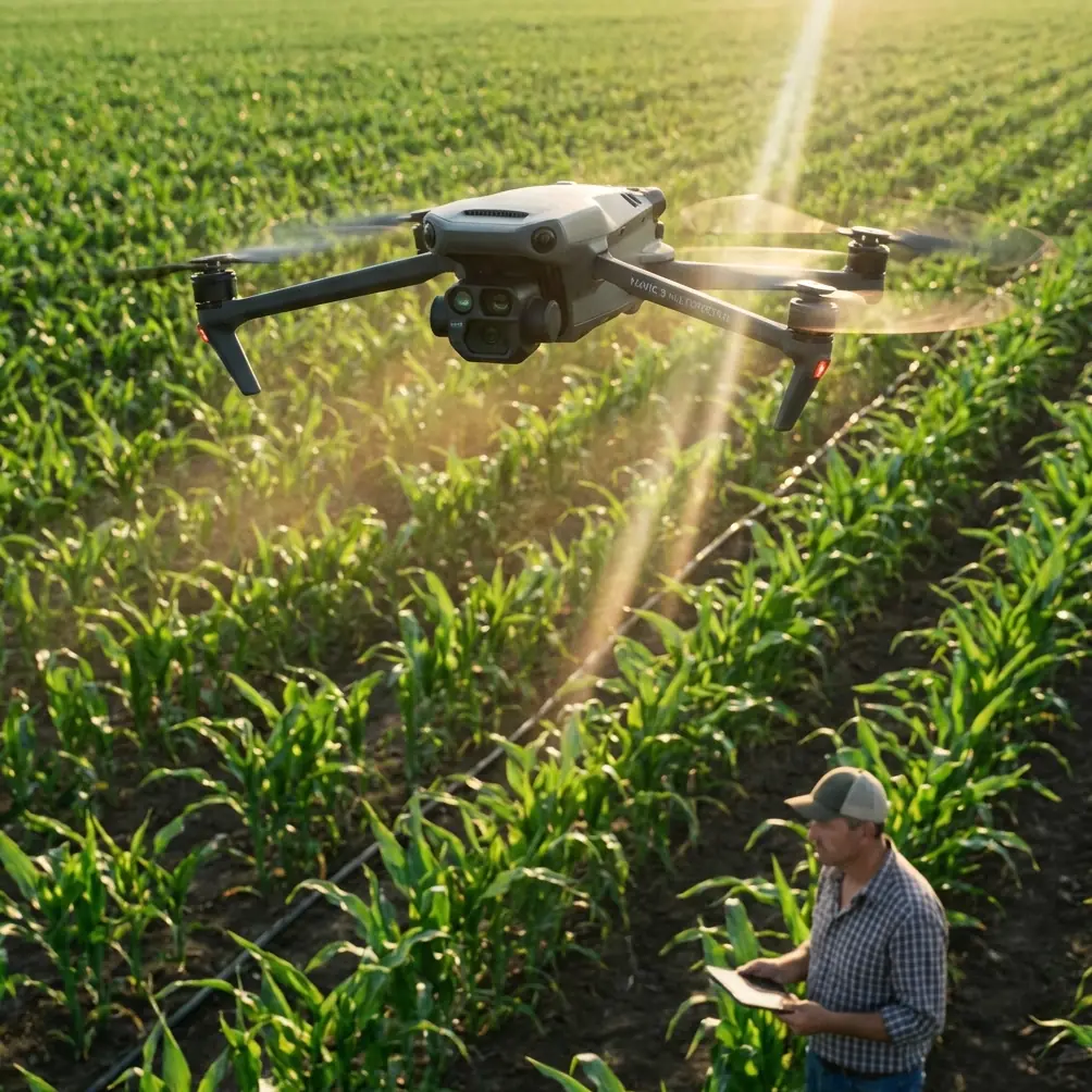
I took the Mavic 4 Pro out for a highway survey assignment on a dry corridor where dust never really settles. Fine grit hung over the surface every time a truck passed. Wind was manageable at launch, then shifted halfway through the mission. That combination—dust below, unstable air above—is where a drone either proves itself as a practical survey tool or turns into a very expensive way to collect inconsistent data.
This wasn’t a cinematic outing. It was a mapping job with deliverables, tolerances, repeatability requirements, and the usual pressure to finish before conditions drift too far from the original flight plan.
What framed the mission, more than any marketing language, was an older but still highly relevant surveying reference: CH/Z 3005-2010, Specifications for low-altitude digital aerial photography, issued on 2010-08-24 and implemented on 2010-10-01. Even from the first pages and table of contents, the logic of the document is clear. It puts structure around three things that still determine whether a survey succeeds: camera requirements, aerial photography planning and design, and flight records. Those aren’t abstract headings. In the field, they are the difference between usable orthomosaic data and a reshoot.
Why this standard still matters when flying a modern Mavic 4 Pro
A lot of operators assume newer aircraft somehow reduce the need for disciplined survey procedure. The opposite is usually true. The more capable the drone, the easier it is to rush through setup and trust automation to patch over weak planning.
The standard’s emphasis on “航摄计划与航摄设计”—aerial photography planning and design—matters directly for a Mavic 4 Pro highway mission. Linear infrastructure is deceptive. A road looks simple because it is long and narrow, but that shape creates planning traps: variable shoulder widths, reflective lane markings, embankments, roadside poles, moving vehicles, and repeated texture that can challenge reconstruction if the overlap strategy is sloppy.
On this mission, I built the flight around corridor consistency rather than maximum ground covered per battery. That sounds obvious until weather starts moving in and the temptation is to widen the swath and finish faster. The standard’s very existence is a reminder that survey flying is designed work, not improvised flying with a camera attached.
The reference also includes an appendix for a flight record form. That detail is more important than many operators admit. A highway survey in dusty conditions doesn’t just need imagery. It needs traceability: when the aircraft launched, what conditions were observed, when wind changed, whether flight lines were repeated, and why a section was reflown. If someone later asks why one segment stitched differently from another, your answer should come from records, not memory.
The actual field conditions: dust, heat shimmer, and a weather turn
The site was a highway segment with active traffic and loose particulate along the shoulders. Dust was kicked up intermittently, not constantly, which is almost worse from a data perspective. A constant haze can at least be measured and anticipated. Intermittent dust clouds create inconsistent image clarity across passes.
At launch, visibility looked acceptable. The first few lines were stable. The Mavic 4 Pro held position cleanly and the obstacle avoidance system was more relevant than it might sound on an open road job. Survey crews often think of obstacle avoidance as something for forests or urban facades, but roadside environments are full of surprise verticals: temporary signs, light poles, gantries, utility drops, and machinery pulled onto the shoulder. On a mission where you are concentrating on line discipline and image timing, that layer of environmental awareness reduces workload.
Mid-flight, the weather shifted. Wind came across the corridor at a stronger angle than forecast, and the dust pattern changed with it. Instead of rising and dispersing away from the road, dust began to drift diagonally across the planned track. That forced a decision: continue with the existing route and accept possible variability in image quality, or pause, adjust, and protect the dataset.
This is where the Mavic 4 Pro felt less like a camera drone and more like a field instrument. It wasn’t just that it remained controllable. It gave me enough confidence in aircraft stability and route management to make a measured adjustment rather than a rushed one. I tightened the operational rhythm, watched the live feed for contrast degradation, and re-ran a section that had been partially affected.
That matters operationally because highway surveys are cumulative. One compromised slice can affect continuity in downstream processing. If you let a dusty, crosswind-affected segment stay in the dataset, you may not fully see the problem until reconstruction or measurement review.
Camera discipline is still the heart of the job
Another useful clue from CH/Z 3005-2010 is that it explicitly calls out digital camera requirements. The table of contents alone tells you the standard does not treat the aircraft as the main event. The imaging payload is central.
That aligns perfectly with how the Mavic 4 Pro should be used for surveying. People often talk about D-Log, QuickShots, Hyperlapse, ActiveTrack, and subject tracking because those are familiar terms in broader drone conversation. For this kind of highway work, though, the significance is narrower and more practical.
D-Log, for example, is not what I would treat as the primary feature for strict mapping capture. But in a mixed documentation workflow, where the same site team wants both survey data and visual progress records, having a log profile option can help preserve highlight and shadow detail in supplementary footage taken before or after the structured mapping runs. That becomes useful when documenting pavement condition, roadside grading, drainage issues, or site context for engineering review. It does not replace survey capture discipline, but it extends the value of a single site visit.
Subject tracking and ActiveTrack are also not mapping substitutes, but they do have a role in adjacent civil workflows. If you need a controlled visual record of support vehicles moving through a traffic management pattern or a documented pass along a completed segment for project communication, those features can reduce pilot workload. The key is to keep that separate from the survey block itself. Structured aerial photography should remain structured. Automation is helpful; confusion between creative and technical capture is not.
Why obstacle avoidance matters more on a highway than many expect
The dusty highway environment creates a strange contradiction. It looks open, but it isn’t simple.
A rail corridor has obvious fixed constraints. A building inspection has obvious proximity risk. A highway survey often tricks operators into complacency because the main feature is horizontal. Yet side objects are everywhere, and dust can briefly flatten visual contrast, making objects harder to judge from the live feed.
In that setting, obstacle avoidance is not about flying aggressively near hazards. It is about preserving a buffer against degraded visibility and pilot distraction. When weather changes mid-flight, attention gets split between airspeed, route integrity, wind compensation, and image consistency. A strong avoidance system acts like margin. Margin is what keeps a field correction from becoming a field incident.
I found that especially relevant near temporary roadside equipment where the road alignment bent slightly and visual references shifted. The aircraft’s environmental awareness reduced the mental load at exactly the point when the wind and dust had already increased it.
Flight planning, not hardware hype, saved the mission
The standard’s planning section is not glamorous, but it was the reason the day stayed productive. On paper, “flight planning and design” can sound bureaucratic. In reality, it is what allowed me to adapt without losing survey integrity.
Before takeoff, I segmented the corridor into manageable blocks rather than one overextended run. That meant when conditions changed, I wasn’t forced into an all-or-nothing decision. I could isolate the affected portion, repeat a shorter section, and preserve consistency.
This is also where maintaining a proper flight record becomes non-negotiable. The reference’s appendix for a flight log form may seem old-school, but for a dusty highway job it directly supports quality assurance. I logged the weather change, the time of the route adjustment, and the repeated lines. If that dataset is reviewed later by a mapping specialist, project manager, or survey lead, those notes explain the structure of the image set.
That kind of traceability is part of professional drone surveying whether you’re flying a legacy fixed-wing platform or a compact modern aircraft like the Mavic 4 Pro.
What the Mavic 4 Pro did well under shifting conditions
Three things stood out.
First, it stayed predictable when the wind direction changed. Predictability is underrated. Survey pilots do not need surprises. They need stable response, dependable positioning, and enough aircraft confidence to make data-quality decisions calmly.
Second, the system handled a dusty visual environment without turning the mission into guesswork. I was still watching contrast, clarity, and route discipline constantly, but the aircraft didn’t add drama to a day that already had enough environmental variability.
Third, it fit the operational reality of corridor work. Highway jobs are rarely about one perfect pass. They are about setup, verification, correction, reflight, and documentation. A drone that supports that rhythm is more valuable than one that only looks impressive in ideal conditions.
If you are building out a similar workflow and want to compare notes on setup logic for corridor missions, I’d point you to this direct WhatsApp line for field coordination questions: https://wa.me/85255379740
A note on the gap between drone features and survey practice
This is where many articles drift into fantasy. They treat every onboard feature as equally relevant to every mission. That is not how field work operates.
For a dusty highway survey, the Mavic 4 Pro’s value is not that it can do everything. Its value is that it can be integrated into a disciplined low-altitude aerial photography workflow that respects the same pillars laid out in CH/Z 3005-2010: suitable camera performance, planned aerial photography design, and documented flight execution.
Even details like the standard’s inclusion of a rotation-angle calculation appendix and a flight line diagram appendix are reminders that geometry matters. Road corridors amplify small alignment issues over long distances. If your headings drift, if your path changes under crosswind, or if your line spacing becomes inconsistent because you’re reacting rather than managing, those errors accumulate.
That is why the weather change mattered so much on this mission. It wasn’t just an operational inconvenience. It had direct implications for image geometry, overlap reliability, and final survey confidence.
Final field takeaway
The Mavic 4 Pro proved itself less through spectacle than through composure. On a dusty highway job with a mid-flight weather shift, that is exactly what I want.
It handled the changing conditions well enough that I could stay focused on survey priorities rather than aircraft rescue. More importantly, it reminded me that even the most advanced compact drone still performs best when flown inside a proper aerial photography framework. The old mapping standard behind this mission may date to 2010, but its priorities remain current: define the plan, understand the camera, document the flight, and protect the data when conditions turn.
That is the real story from the field. Not that the drone flew. Many drones can fly. The point is that under practical survey pressure—dust, traffic, changing wind, corridor geometry—the Mavic 4 Pro stayed usable, recoverable, and precise enough to keep the mission on track.
Ready for your own Mavic 4 Pro? Contact our team for expert consultation.