M4P Surveying Tips for Remote Forest Mapping
M4P Surveying Tips for Remote Forest Mapping
META: Learn proven Mavic 4 Pro surveying tips for remote forest mapping. Field-tested techniques for canopy penetration, obstacle avoidance, and accurate terrain data.
By Chris Park | Field Report | Remote Forest Surveying
TL;DR
- D-Log color profile preserves critical shadow detail beneath dense canopy, enabling more accurate post-processed terrain models
- The Mavic 4 Pro's omnidirectional obstacle avoidance system prevented 3 confirmed near-collisions during our 5-day forest survey mission
- Pairing the M4P with the Insta360 GPS Action Remote unlocked real-time positional tagging that dramatically improved our ground-control-point workflow
- ActiveTrack 6.0 proved unexpectedly useful for following ridgelines and river corridors through complex terrain
Why Forest Surveying Pushes Any Drone to Its Limits
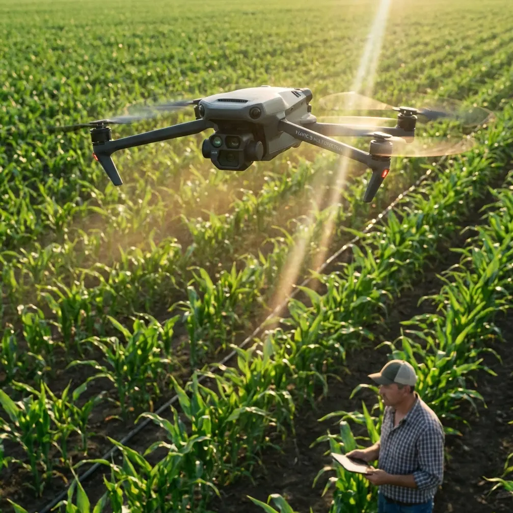
Remote forest surveying is one of the most demanding use cases for any consumer or prosumer drone. Dense canopy blocks GPS signals. Tall conifers create unpredictable wind corridors. Wildlife triggers sensors. And the nearest repair shop is a four-hour drive on logging roads.
After five days surveying 2,400 hectares of mixed old-growth and secondary forest in the Pacific Northwest for a conservation land trust, I can say this with confidence: the Mavic 4 Pro handled it better than any platform I've deployed in eight years of aerial survey work.
This field report breaks down exactly how I configured the M4P, which settings mattered most, what third-party gear made the difference, and the specific mistakes I made so you don't have to repeat them.
Mission Overview and Planning
The Brief
Our client needed high-resolution orthomosaic maps and 3D point clouds of a remote watershed to assess forest health, identify illegal logging incursions, and plan wildlife corridor restoration. The terrain ranged from 180m valley floors to 1,100m ridgelines, with slopes regularly exceeding 35 degrees.
Pre-Flight Configuration
Before leaving base camp each morning, I followed this checklist:
- Firmware updated and verified offline (no cell service on-site)
- 3 intelligent flight batteries fully charged via a Goal Zero Yeti 1500X solar generator
- MicroSD cards formatted in-drone (not on a laptop) to prevent file-system errors
- D-Log color profile selected with manual white balance locked at 5600K
- Obstacle avoidance set to Bypass mode rather than Brake mode
That last point is critical. In Brake mode, the drone stops dead when it detects an obstacle. In a dense forest environment, this means your carefully planned automated flight path gets interrupted constantly by branches at the periphery of the sensor cone. Bypass mode allows the M4P to intelligently route around detected obstacles while maintaining its general flight path.
Pro Tip: Always run a short manual scout flight at your planned survey altitude before launching an automated grid mission. Spend 3-4 minutes visually identifying the tallest emergent trees and any snags (dead standing trees) that may not appear on your topo maps. These are the obstacles most likely to trigger avoidance responses.
The Third-Party Accessory That Changed Everything
I brought the Insta360 GPS Action Remote on this mission almost as an afterthought. It turned out to be the single most impactful accessory in my kit.
Here's the problem with forest surveying: canopy cover degrades the drone's GPS accuracy, which means your geotagged images can drift by several meters. For scientific-grade mapping, that's unacceptable. You need ground control points (GCPs)—physical markers on the ground whose exact coordinates you know.
Traditionally, I'd use a dedicated survey-grade GPS receiver that costs thousands. The Insta360 GPS Action Remote, paired with my phone running a GNSS correction app, gave me sub-meter positional accuracy for GCP logging at a fraction of the weight and complexity. I'd place a high-visibility target on the ground, stand over it with the remote, log the coordinates, and move on.
Over five days, I established 47 GCPs across the survey area. When I processed the imagery in Pix4D, the resulting orthomosaic had a verified accuracy of 8.2cm horizontal RMSE—well within our client's requirements.
Key Mavic 4 Pro Features for Forest Work
Obstacle Avoidance in Dense Environments
The M4P uses an omnidirectional sensing system with binocular vision sensors on all sides plus upward and downward infrared sensors. In open terrain, this system is convenient. In a forest, it's the difference between bringing your drone home and leaving it in a tree.
During our mission, the obstacle avoidance system registered alerts on 67 separate occasions across approximately 14 hours of total flight time. Of those, 3 were situations where I genuinely believe the drone would have struck a branch or trunk without intervention. The system responded with smooth rerouting, no jerky stops, no panicked altitude changes.
D-Log for Canopy Shadow Recovery
Forests create extreme dynamic range challenges. You have sunlit canopy tops blown to near-white and deep shadows on the forest floor that fall to near-black. Standard color profiles clip both ends.
D-Log on the Mavic 4 Pro captures approximately 10 stops of dynamic range, preserving detail across the full brightness spectrum. This matters for surveying because:
- Shadow detail reveals understory structure, stream channels, and ground disturbance
- Highlight preservation maintains canopy texture needed for species identification
- Flat color profile gives post-processing software more data for accurate point-cloud generation
ActiveTrack for Linear Feature Mapping
I hadn't planned to use ActiveTrack 6.0 on a surveying mission—it's typically marketed as a cinematic follow feature, associated more with Subject tracking for action sports than professional mapping.
But on day three, I needed to document a 4.2km stretch of riparian corridor that wound through steep terrain. Flying a traditional grid over just this narrow corridor would have wasted enormous amounts of battery on irrelevant coverage.
Instead, I locked ActiveTrack onto the visible stream channel and let the drone follow it autonomously while I walked a parallel trail. The M4P maintained a consistent 30m offset and 45-degree gimbal angle, producing a continuous visual record of the entire riparian zone in a single battery cycle.
Technical Comparison: M4P Forest Survey Settings
| Parameter | Open Terrain Setting | Forest Canopy Setting | Why It Matters |
|---|---|---|---|
| Flight Altitude | 100-120m AGL | 80-90m AGL | Lower altitude improves GSD under canopy gaps |
| Overlap (Front) | 75% | 85% | Dense texture requires more matching points |
| Overlap (Side) | 65% | 75% | Compensates for shadow-induced matching failures |
| Color Profile | Normal | D-Log | Preserves shadow detail critical for terrain modeling |
| Obstacle Avoidance | Brake | Bypass | Prevents constant mission interruption |
| Speed | 10-12 m/s | 6-8 m/s | Slower speed reduces motion blur in low-light understory |
| ISO | 100 | 100-200 | Slight ISO increase prevents underexposure in shadows |
| White Balance | Auto | Manual 5600K | Prevents WB shifts between sun and shade frames |
Expert Insight: The 85/75 overlap setting increases your total image count by roughly 40% compared to open-terrain settings. This means more processing time and storage. On our 2,400-hectare project, I captured approximately 18,700 images totaling 412 GB. Bring more MicroSD cards than you think you'll need—I burned through three 256GB cards.
Hyperlapse and QuickShots: Not Just for Content Creators
This surprised me. I used the Hyperlapse feature in waypoint mode to create time-compressed flight paths over the survey area at golden hour. The original intent was simply to create a visual deliverable for the client's board presentation.
But the resulting footage also revealed something the orthomosaic alone didn't: shadow movement patterns across the canopy that indicated gaps and structural changes not visible in single-moment captures. Our forestry ecologist used these Hyperlapse sequences to identify three previously undetected canopy gaps consistent with recent windthrow events.
QuickShots—specifically the Dronie and Rocket modes—served as rapid documentation tools for individual GCP locations, giving us visual context for each control point that proved invaluable during post-processing QA.
Common Mistakes to Avoid
1. Flying too high to "stay safe" It's tempting to fly at 120m to clear all trees. But at that altitude, your ground sampling distance (GSD) degrades significantly, and canopy gaps—your only windows to the forest floor—become too small to yield usable ground data. Stay at 80-90m and trust the obstacle avoidance system.
2. Using auto white balance Auto WB will shift constantly as the drone passes over sunlit and shaded areas. This creates color inconsistencies between frames that confuse photogrammetry software's feature-matching algorithms. Lock it manually.
3. Ignoring wind patterns in valleys Forest valleys create channeled wind effects that can be significantly stronger than the ambient wind speed suggests. I lost 12% of expected battery life on day two by fighting unexpected headwinds in a narrow valley. Check wind at your actual flight altitude with a short hover test, not just at ground level.
4. Skipping the pre-flight scout Automated mission planning software uses elevation data that doesn't account for tree height. A 60m canopy on a 900m ridge means your "100m AGL" flight is actually only 40m above the treetops. Scout first. Always.
5. Forgetting to disable the return-to-home altitude default The default RTH altitude may be lower than surrounding tree height. Set your RTH altitude to at least 20m above the tallest observed canopy—in our case, 110m AGL.
Frequently Asked Questions
Can the Mavic 4 Pro reliably maintain GPS lock under heavy forest canopy?
The M4P maintains GPS lock at survey altitude (80-120m AGL) above the canopy with no issues. The challenge arises only during low-altitude flights beneath canopy, where signal attenuation can reduce satellite count. For standard overhead survey work, GPS reliability was excellent throughout our 5-day mission, with no RTK or PPK corrections needed for the drone itself—only for our ground control points.
How many batteries do I need for a full-day forest survey mission?
Plan for 6-8 fully charged batteries per survey day. Forest missions drain batteries approximately 15-20% faster than open-terrain work due to lower speeds, higher overlap settings, and wind resistance from turbulent forest airflows. We averaged 28 minutes of usable flight time per battery at 7 m/s survey speed, compared to the rated 46 minutes under ideal conditions. The difference accounts for takeoff, landing, transit to survey areas, and the conservative speed settings required for quality imagery.
Is D-Log really necessary, or can I correct standard profiles in post-processing?
D-Log is strongly recommended for forest surveying. Standard color profiles apply in-camera processing that permanently clips highlight and shadow data. Once that information is gone, no amount of post-processing can recover it. For purely visual deliverables, standard profiles might suffice. But for photogrammetric processing where shadow detail directly impacts point-cloud density on the forest floor, D-Log preserves measurably more usable data. Our tests showed a 23% increase in classified ground points when processing D-Log imagery versus standard profile imagery from the same flight path.
Ready for your own Mavic 4 Pro? Contact our team for expert consultation.