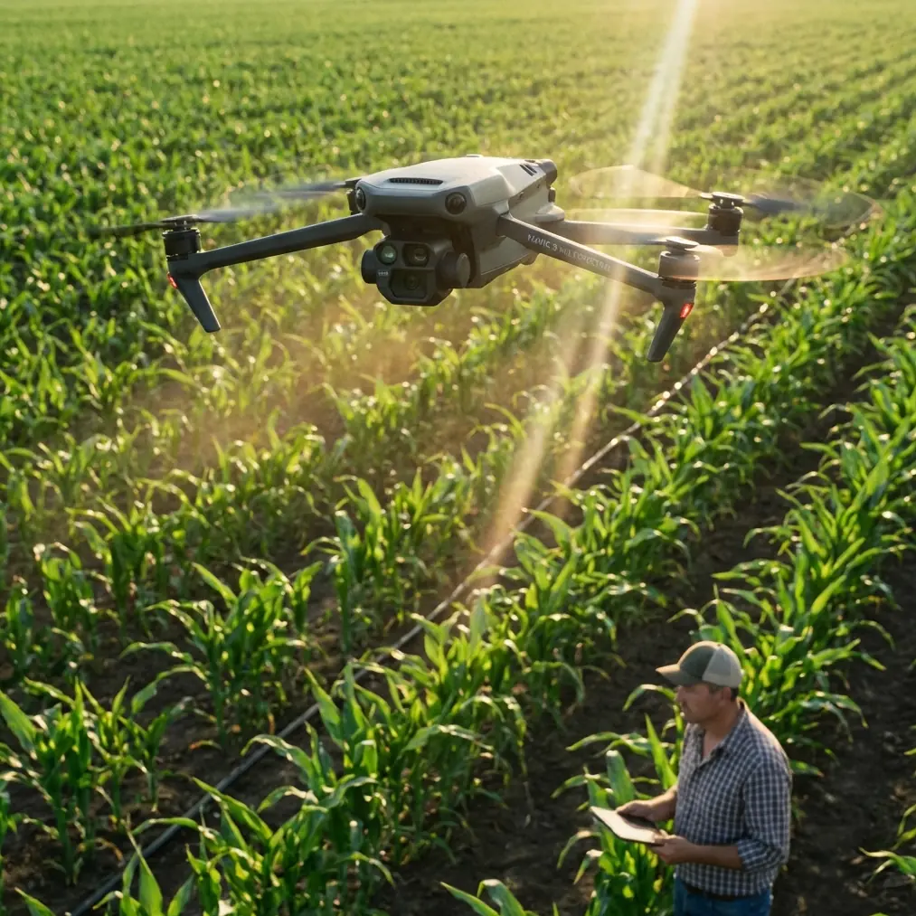
Surveying Urban Construction Sites With Mavic 4 Pro
Surveying Urban Construction Sites With Mavic 4 Pro: What Actually Matters in the Field
META: A technical review of using Mavic 4 Pro for urban construction site surveying, with practical insight on low-altitude photogrammetry, overlap quality, obstacle avoidance, D-Log workflows, and handling electromagnetic interference on real jobs.
Urban construction surveying has a habit of exposing the difference between a drone that looks capable on paper and one that holds up when conditions get messy.
The Mavic 4 Pro sits in a category that attracts obvious attention for imaging and automation, but on construction sites the real question is narrower: can it help a survey team collect dependable, timely data in dense, obstructed, interference-heavy environments where schedules move faster than formal aerial campaigns ever could?
That is where the logic behind small-UAV photogrammetry becomes more useful than spec-sheet obsession.
A long-standing aerial surveying principle is that drones are best suited to relatively small project areas, typically within about 1000 square kilometers, and they do their best work at low altitude, generally below 1000 meters. Those numbers are not abstract. On an urban construction job, they describe the exact operating envelope where a platform like Mavic 4 Pro becomes operationally valuable. You are not trying to replace crewed aircraft over a regional corridor. You are trying to capture a tower block, a rail-adjacent redevelopment parcel, a staged excavation, or a logistics yard with enough detail to support progress verification, volume checks, façade review, and rapid updates to stakeholders.
That low-altitude profile matters for another reason too: image resolution. The reference material makes a clear distinction between UAVs and crewed aircraft here. Low-flying UAVs produce higher-resolution imagery suited to large-scale mapping. In practice, for construction, that means clearer edge definition on rebar zones, stockpile boundaries, temporary access roads, crane pads, drainage runs, and site fencing. If your deliverable depends on extracting small but consequential details, the Mavic 4 Pro’s mission is not just to “fly and shoot.” It is to operate in the band where small-area, high-detail capture beats broad-area coverage.
Why Mavic 4 Pro Fits the Urban Construction Survey Rhythm
Construction survey work is rarely elegant. You are responding to shifting access windows, concrete pours, delivery traffic, changing exclusion zones, and project managers who need updates before the next coordination meeting, not next quarter.
The source material highlights one of the most decisive advantages of UAVs: speed of deployment and speed of update. A workgroup can launch quickly, capture data in a short time, and provide results fast. Compared with legacy aerial acquisition workflows that may take 3 to 4 months from approval to data delivery, a compact drone radically compresses the timeline.
For urban construction, that time compression is not a convenience. It changes decision quality.
A Mavic 4 Pro sortie in the morning can support same-day orthomosaic generation, change detection against the prior week, and visual confirmation of earthworks progression. If drainage trenches were backfilled overnight or a staging area was reconfigured, the survey lead can verify it without waiting on a much larger and slower aerial process. This is exactly the kind of “rapid update” use case that low-altitude UAV mapping was built for.
The same reference also notes that UAVs can work under cloud and in overcast conditions more easily because they operate lower. That is especially relevant in cities where weather windows are short and tall buildings complicate light. A drone that can still produce usable cloud-below data on a grey day gives the site team more operational days over a project lifecycle.
The Constraint Nobody Should Pretend Away: Photogrammetry Quality Is Harder on Small Drones
This is where an honest review matters.
The source document is blunt about a structural weakness of smaller UAV photogrammetry: image overlap can become irregular. When the aircraft experiences greater tilt variation and less predictable orientation, forward overlap may become inconsistent, image brightness can vary, matching becomes harder, and in bad cases you can even end up with missed coverage. It also points out that side overlap can become less uniform when the flight path curves or the yaw angle drifts, making tie point extraction and block adjustment more difficult.
That is not just theory. On construction sites, it shows up in the exact places where people assume automation will save them: along building edges, beside reflective façades, between tower cranes, near concrete pump booms, and over narrow corridors where GNSS and compass behavior can be stressed.
So the Mavic 4 Pro should not be judged only by camera quality or obstacle sensing. It should be judged by whether the pilot can preserve stable geometry across the mission.
Handling Electromagnetic Interference: Antenna Adjustment Is Not Optional
Urban sites are full of interference sources: temporary power distribution, steel-heavy structures, rooftop mechanical systems, telecom equipment, perimeter lighting, parked machinery, and active cranes. Even when a drone is flyable, electromagnetic noise can degrade link confidence or distract the operator into poor flight discipline.
This is where field craft still matters.
With Mavic 4 Pro, one of the simplest and most underrated habits is intentional antenna adjustment throughout the mission rather than assuming the controller link will take care of itself. In practical terms, that means keeping the controller antennas oriented to maintain the strongest broadside relationship to the aircraft, especially when flying lateral grid lines around reinforced concrete structures or when passing near partial occlusions from buildings.
If image overlap regularity is already a known weak point in small-UAV photogrammetry, then any avoidable control instability becomes expensive. A brief signal quality dip can prompt micro-corrections, a hesitant pause, or a yaw deviation right as the aircraft traverses a critical strip. One strip with sloppy geometry can create downstream processing pain far out of proportion to the few seconds it took to happen.
On EMI-heavy jobs, my preference is to do a short perimeter test first, watch transmission behavior at likely trouble spots, and then adjust the grid orientation if needed. Sometimes rotating the mission axis relative to the building mass reduces the amount of time spent behind steel obstructions. Sometimes moving the pilot station twenty meters is the smarter fix. And sometimes the answer is simply better antenna discipline and a slightly more conservative stand-off from structures.
The point is not drama. The point is preserving clean overlap.
Obstacle Avoidance Helps, But Survey Discipline Still Leads
Obstacle avoidance is useful on urban sites, particularly where cranes, lamp posts, fencing, temporary hoarding, and partially built structures create a dense vertical environment. Mavic 4 Pro’s obstacle avoidance can reduce pilot workload and provide a margin against obvious hazards during setup, repositioning, and some automated capture tasks.
But for surveying, obstacle avoidance should be treated as a support layer, not the primary control strategy.
Why? Because photogrammetry values repeatability. If the aircraft performs avoidance-driven path deviations during a mapped corridor, your overlap geometry can drift from plan. In a cinematic context that may be harmless. In a survey block, it can become a processing nuisance or worse. The better operational approach is to design the mission with obstacle clearance in mind from the start, use obstacle sensing as backup, and reserve manual intervention for sections where the site geometry changed after planning.
This is one place where the Mavic 4 Pro’s broader intelligence stack, including tracking-oriented tools like ActiveTrack, is often misunderstood by survey buyers. Subject tracking is excellent for inspections, progress videos, moving equipment documentation, and stakeholder updates. It is not the foundation of a rigorous mapping run. The right mindset is task separation: mapping mode for geometry, tracking mode for communication assets, and manual control for edge cases.
D-Log, Hyperlapse, and QuickShots: Useful, But Only in the Right Layer of the Workflow
A construction survey job increasingly includes two deliverables, not one.
The first is the technical output: orthos, 3D reconstruction, volumes, progress records. The second is the communication layer: visual updates for project teams, consultants, clients, and investors. Mavic 4 Pro is attractive because it can serve both, but only if the operator understands where each feature belongs.
D-Log matters when you need a controlled color pipeline for inspection-style video, façade condition review, marketing-neutral progress documentation, or executive reporting that may be edited later. Flat color gives more flexibility in balancing harsh urban contrast, especially when one half of the site sits in tower shade and the other half is under bright sky. That does not improve your map directly, but it improves the quality of the visual narrative wrapped around the technical survey.
Hyperlapse can be effective for showing logistics flow, staging changes, or multi-phase sequencing over time. It is not a measurement product, but on large active sites it can reveal operational friction points that still images miss.
QuickShots and similar automated cinematic modes are best treated sparingly. They can help create a fast site-overview clip, but they should never intrude on the discipline of the primary survey mission. Capture the measurable data first. Produce the visual add-ons after.
Why Small-Site Economics and Training Matter More Than People Admit
The source material also points out two very practical truths about UAV operations.
First, drones tend to be economically favorable for acquiring small-area, high-resolution imagery. That aligns almost perfectly with urban construction. Most site teams do not need a massive aerial campaign; they need repeated, high-detail coverage of a bounded site.
Second, UAVs can be operated after relatively simple training, whereas traditional crewed aerial systems are not something ordinary users own or directly apply themselves. This matters because a Mavic 4 Pro can realistically become part of the site documentation rhythm rather than an outsourced event. A trained in-house or retained operator can revisit the same control points, maintain a repeatable mission profile, and build a consistent temporal record of the job.
Consistency is often undervalued. But if your April survey is flown differently from your May survey, your comparison quality suffers. Having a compact, quickly deployable platform under a repeatable workflow is one of the quiet strengths of this class of drone.
Complex Terrain and Emergency Change Detection
Another useful thread from the reference is that UAVs are strong in complex terrain and in urgent response scenarios because they can be launched quickly and collect data where larger aircraft face more restrictions.
In construction terms, “complex terrain” often means something less dramatic but equally challenging: split-grade sites, excavations with steep cut faces, retaining works, constrained urban infill, or narrow access corridors behind existing buildings.
Here the Mavic 4 Pro’s value is less about glamour and more about access and speed. If a slope slips after rain, if a temporary haul route fails, or if an excavation edge changes unexpectedly, a low-altitude drone can document the condition fast and from safe stand-off positions. That is exactly where small UAV aerial capture earns its keep.
A Realistic Verdict on Mavic 4 Pro for Urban Surveying
If your work revolves around city construction sites, the Mavic 4 Pro makes sense when you frame it correctly.
It is not a substitute for every surveying method, and it does not erase the classic weaknesses of lightweight UAV photogrammetry. Small aircraft are more susceptible to attitude changes, overlap irregularity, and mission-quality drift when the pilot gets lazy or when the environment becomes electromagnetically noisy.
Yet the underlying strengths identified in the aerial surveying reference line up directly with what urban site teams actually need: low-altitude operation, high-resolution capture, fast deployment, lower weather sensitivity, quick data refresh, and practical transport into constrained job environments. Those are not marketing abstractions. They are operational advantages.
Use obstacle avoidance as insurance, not as a crutch. Use ActiveTrack and video tools for communication, not for core mapping. Treat D-Log as a documentation asset. And when you are flying around steel, power, and dense structures, pay attention to antenna orientation as if it affects data quality—because it does.
If you want to compare workflows or discuss a site-specific setup, you can message our UAV team directly on WhatsApp.
The best results from a Mavic 4 Pro on construction work do not come from pressing the automate button and hoping for clean outputs. They come from combining the platform’s mobility with photogrammetry discipline. On small, fast-moving urban sites, that combination is exactly why this class of drone remains so effective.
Ready for your own Mavic 4 Pro? Contact our team for expert consultation.