Mavic 4 Pro for Remote Wildlife Work: What a Rural Mapping
Mavic 4 Pro for Remote Wildlife Work: What a Rural Mapping Case Reveals About Real-World Planning
META: A field-tested look at how lessons from a 2 km² UAV photogrammetry mission translate to smarter Mavic 4 Pro operations for remote wildlife documentation, terrain awareness, and precise aerial workflows.
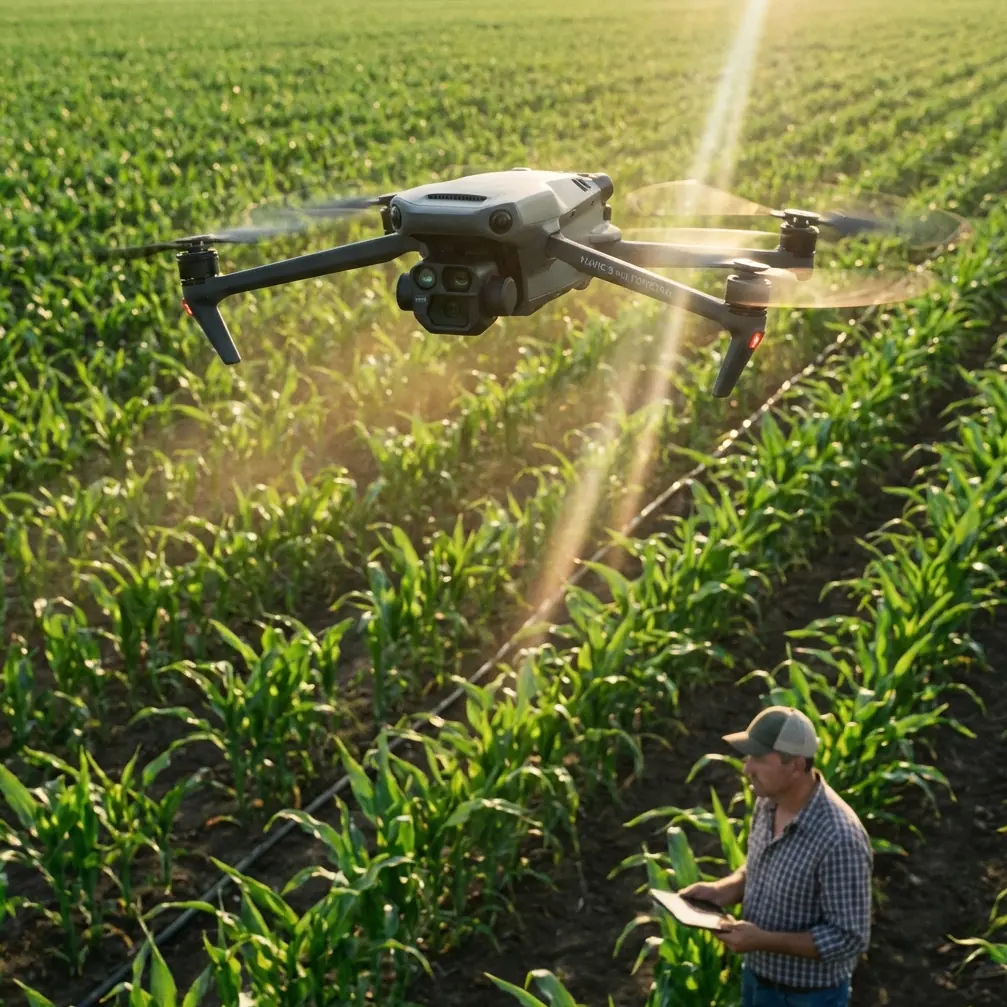
I spend a lot of time around people who talk about drones as if the aircraft is the whole story. It never is. In remote wildlife work, the aircraft matters, but the result comes from planning, route logic, image discipline, terrain awareness, and the way you adapt when the environment pushes back.
That is why an older rural UAV photogrammetry case is still surprisingly useful when thinking about the Mavic 4 Pro.
The reference project was not built around wildlife filming. It was a rural land-rights mapping task. Yet the operational mechanics are exactly the kind of mechanics that separate clean field results from wasted battery cycles and unusable imagery. In that trial, a quadcopter-based aerial survey system was used over a 2 km² test area to produce 1:1,000 scale aerial outputs, including a digital orthophoto and a digital elevation model. The team flew 14 north-south routes, collected 643 images, and used 13 image control points plus 17 check points to validate final accuracy.
Those numbers deserve attention, especially if you are evaluating how a Mavic 4 Pro should be deployed in remote wildlife habitat work, environmental surveys, rehabilitation-area monitoring, or non-invasive aerial observation over sensitive land.
The real lesson is not the airframe
The reference team selected a quadcopter instead of a fixed-wing aircraft because the survey area was relatively small and the terrain was complex. That choice tells you something immediately. In confined, irregular, or logistically awkward spaces, controllability often beats theoretical endurance.
That matters for the Mavic 4 Pro.
A remote wildlife assignment rarely unfolds as a neat, rectangular mapping job. You may be documenting a wetland edge, tracking habitat change along a ridge, checking vegetation recovery near release zones, or recording animal movement corridors without physically entering fragile ground. In these situations, a highly maneuverable platform is usually more practical than a system optimized only for long linear coverage.
The rural case also described how launch and landing locations were chosen based on the actual site, not just the flight plan. The operators selected open roadside areas to the southwest and northeast of the survey zone, and they deliberately avoided midday operations. That is not just procedural trivia. It is fieldcraft.
With the Mavic 4 Pro, the same mindset applies. Wildlife work in remote areas is often constrained by sun angle, thermal shimmer, localized wind, access roads, tree lines, and communication reliability. If you only think in terms of camera specs and flight time, you miss the factors that actually decide whether the sortie succeeds.
Why route design still matters, even with advanced automation
One of the strongest details in the source material is the use of a planned route structure: 14 north-south flight lines across a survey block roughly 1.4 km east-west by 1.5 km north-south. The orientation was not random. It was shaped by road access and site reconnaissance.
For Mavic 4 Pro operators, this is a reminder that intelligent route orientation is part of image quality control.
In wildlife documentation, route direction affects more than coverage. It influences glare, shadow behavior, terrain-relative altitude consistency, and the reliability of subject reacquisition when using automation such as ActiveTrack or other subject-tracking modes. If you are working over scrubland, marsh, or broken topography, changing the direction of your passes can mean the difference between readable ground detail and visually muddy footage.
This is also where obstacle avoidance becomes more than a marketing phrase. In remote habitat zones, route geometry often interacts with isolated trees, utility corridors, ridgelines, or rock outcrops. The Mavic 4 Pro’s obstacle sensing and avoidance tools are most useful when they are supporting a route that was intelligently designed in the first place. They are not a substitute for route design; they are a safety and continuity layer on top of it.
The significance of 643 images
The source mission produced 643 photographs over a 2 km² area. That should immediately reframe expectations for anyone thinking a remote field job can be improvised.
A serious aerial workflow creates volume. Volume is not waste. It is coverage, overlap, redundancy, and decision-making room in post.
For wildlife and environmental users of the Mavic 4 Pro, that has two direct implications.
First, storage and media management have to be part of the mission plan before takeoff. If you are capturing high-detail habitat imagery, D-Log footage for grading, stills for orthomosaic reference, and perhaps QuickShots or Hyperlapse sequences for public-facing reporting, your data load grows very quickly. A clean workflow means naming flights properly, separating observational footage from mapping-style captures, and maintaining location notes while still in the field.
Second, image count reflects overlap strategy. Even if your end product is not a formal orthomosaic, overlap gives you options. It lets you compare passes, check animal disturbance indirectly through terrain marks, examine canopy gaps, and build time-separated visual records of the same site. That is where a Mavic 4 Pro starts to become more than a camera in the sky. It becomes a repeatable observation system.
Ground control, check points, and why wildlife teams should care
The reference project did something very smart. Instead of using a conventional, more labor-intensive control layout, the team distributed 13 image control points across relatively flat areas and added 17 check points to verify the mathematical accuracy of the final outputs.
Even if your wildlife mission is not a formal cadastral survey, the operational principle is gold: separate the points you use to support the model from the points you use to test it.
For Mavic 4 Pro users in habitat restoration, reserve management, or environmental compliance reporting, this means you should think carefully about how you validate what the drone sees. If you are comparing seasonal water spread, nesting-ground disturbance, vegetation regrowth, or perimeter encroachment, then repeatability matters. A beautifully exposed shot is not enough. You need evidence that your comparisons are spatially trustworthy.
That is where field markers, GNSS observations, or repeatable natural reference features become operationally significant. The mapping case demonstrates that thoughtful control placement reduces unnecessary field labor while still preserving confidence in the output. For teams working in remote wildlife areas, that can reduce time spent on foot in sensitive ecosystems.
What this says about camera discipline on the Mavic 4 Pro
The survey system in the source project used a 35 mm fixed-focus lens and flew at a relative altitude of 210 m, with a target ground resolution of 0.1 m. Those details are not there to celebrate equipment. They show that the team matched lens, altitude, and output requirement before flying.
That same discipline should guide Mavic 4 Pro use.
If your job is wildlife spraying in remote regions, I would strongly advise reframing the mission around habitat management documentation rather than treating the drone as a loose aerial accessory. You need to define what the imagery must prove. Is it documenting treatment boundaries? Verifying vegetation response? Recording access conditions before and after field activity? Observing animal-safe buffer areas from the air? Each objective changes your altitude, framing, speed, and capture interval.
D-Log becomes particularly useful here. Not because flat profiles are fashionable, but because remote habitats often produce harsh contrast: bright water, pale soil, deep canopy, reflective rock. A flexible recording profile preserves grading latitude so subtle ecological details are not crushed into black or clipped into white. If the footage will support reporting, training, or stakeholder review, that extra tonal control is practical, not cosmetic.
Handling electromagnetic interference in the field
The context prompt mentions a narrative spark around managing electromagnetic interference with antenna adjustment. That is a very real issue in remote operations, and people often misunderstand it. Interference is not only an urban problem. Remote areas can produce unstable signal behavior through terrain masking, relay towers, utility infrastructure, field equipment, and poor antenna alignment by the pilot.
On a Mavic 4 Pro mission, especially when operating from a roadside launch point like the survey team did, antenna positioning is not a trivial preflight gesture. It is part of link management.
If telemetry begins to fluctuate or video feed quality drops, the first response should not be panic or aggressive stick input. Reassess aircraft orientation, line of sight, and controller antenna angle relative to the aircraft’s actual position. In hilly wildlife terrain, the drone may still be visually unobstructed while the RF path is being compromised by slope geometry or nearby conductive structures. Small antenna adjustments can materially improve link consistency. So can shifting the pilot position a short distance to clear a masking obstacle.
This is another reason the source project’s launch-site selection matters. Open takeoff and recovery zones are not only safer for the aircraft; they improve communications reliability and reduce rushed decision-making during critical phases.
If your team is trying to build a cleaner field workflow around these issues, I’d suggest sharing mission details before deployment through this direct WhatsApp planning line so route structure, signal considerations, and terrain constraints can be reviewed in advance.
Automation is useful, but only inside a disciplined mission
The Mavic 4 Pro’s automation tools can be genuinely helpful in civilian wildlife-related work when used carefully. ActiveTrack can support non-invasive observation of predictable movement patterns from a legal and ethical standoff distance. QuickShots can help produce consistent stakeholder visuals. Hyperlapse can document cloud movement, water change, or activity rhythms over a restoration site.
But the mapping reference gives us an essential correction: structure comes first.
The team did not begin with creative modes. They began with output requirements, terrain analysis, route design, control strategy, and quality verification. That sequence still makes sense for modern Mavic 4 Pro users. If you reverse it, you get attractive footage with weak operational value.
In remote wildlife projects, the smartest workflow often looks like this:
- reconnaissance and access review
- route orientation based on terrain and light
- launch-site selection for safety and signal quality
- primary documentation passes
- secondary observational passes using tracking or cinematic modes
- post-flight validation against field notes or reference points
That order protects both the data and the habitat.
Why this old survey case still matters now
What stands out in the source material is how methodical the mission was despite modest scale. The weather was favorable, with wind below force 4, and image inspection confirmed the selected photos were clear, with tilt and rotation staying within acceptable limits. That is the sort of quiet operational success that tends to be ignored because it lacks drama. Yet it is exactly what professionals try to reproduce.
For a Mavic 4 Pro operator, that means the benchmark is not whether the drone flies. The benchmark is whether the flight produces stable, usable, defensible material under field constraints.
The rural survey case proves that small-area operations can still demand serious rigor. It also shows that reducing field workload does not have to mean lowering standards. The team used a lighter control strategy, but they backed it with check points. They used a quadcopter because it fit the site. They chose launch zones based on terrain realities. They avoided midday timing. They inspected image quality rather than assuming success.
That is the mindset worth carrying into modern wildlife and habitat work with the Mavic 4 Pro.
Not hype. Method.
If you are operating in remote environments, documenting wildlife-sensitive areas, or supporting habitat management tasks, the aircraft becomes far more effective when you think like a surveyor for a moment: define the output, shape the route, control the variables, validate the result.
The Mavic 4 Pro is capable. The bigger question is whether the mission around it is.
Ready for your own Mavic 4 Pro? Contact our team for expert consultation.