Mavic 4 Pro in Windy Field Work: Why Post
Mavic 4 Pro in Windy Field Work: Why Post-Processing Matters More Than People Think
META: A practical expert guide to using Mavic 4 Pro around windy agricultural jobs, with a sharp focus on pre-flight sensor cleaning, safer capture habits, and how Pixel-Mosaic-style processing turns messy aerial data into usable mapping outputs.
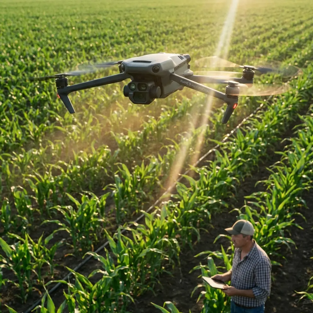
When people talk about the Mavic 4 Pro, the conversation usually drifts toward flight performance, camera quality, obstacle avoidance, ActiveTrack, or cinematic tools like QuickShots and Hyperlapse. That makes sense for content creators. It misses something critical for real field operations.
If your day involves windy agricultural sites, crop assessment, perimeter checks, drainage review, or documenting conditions before and after spraying, the aircraft is only half the workflow. The other half begins after landing, when raw imagery has to become something useful: a stitched map, a surface model, a point cloud, or a 3D scene that can actually support decisions.
That is where the reference material behind Pixel-Mosaic becomes relevant to a Mavic 4 Pro operator.
The source describes a drone data post-processing stack built by Zhongwei Kongjian Technology, a company with more than 10 years of technical accumulation in UAV data post-processing. The key operational point is not the company biography. It is what the software is built to produce from aerial captures: mosaics, aerial triangulation, dense point clouds, DOM/DSM outputs, and 3D models. For anyone flying a Mavic 4 Pro over farm blocks in wind, those outputs are the difference between “I flew the mission” and “I learned something from the mission.”
Wind changes everything in field capture
Let’s start with the actual problem.
A windy agricultural environment is hostile to clean image acquisition. Not always dramatically hostile. Often just enough to create subtle defects that show up later. The drone may hold position well, but gusts can still introduce small attitude changes, inconsistent overlap, motion blur on edge frames, and variable viewing angles over long passes. If you are documenting field conditions around a spraying operation, those small errors can distort the data story.
That matters because a field operator is rarely collecting footage for entertainment. The mission may be intended to verify coverage patterns, inspect standing water, identify stress zones, examine wheel tracks, assess drift-affected edges, or create a visual record of conditions before machinery enters. Each of those tasks benefits from accurate stitched imagery and reliable terrain interpretation.
The Mavic 4 Pro can be a strong platform for this kind of work, but only if you treat the flight as one stage in a larger data chain.
The first safety habit is not glamorous: clean the sensors before takeoff
This deserves more attention than it gets.
In windy field environments, dust, dried spray residue, pollen, and fine debris collect faster than many operators realize. If you are working near treated rows, dirt access roads, or recently disturbed soil, the aircraft’s vision and sensing surfaces can lose clarity before you even launch. That directly affects obstacle avoidance reliability and can also interfere with tracking tools such as ActiveTrack or subject tracking if you are using them to document moving equipment from a safe distance.
A pre-flight cleaning step is not cosmetic. It is a safety step.
Before each sortie, inspect and gently clean the vision sensors, camera glass, and any exposed surfaces tied to navigation or obstacle detection. In agricultural work, this is especially important when the previous flight ended in a dusty landing zone or when wind has been carrying fine particles across the site. If the Mavic 4 Pro’s obstacle avoidance system is expected to help around tree lines, irrigation structures, utility runs, or uneven field margins, those sensors need a clear view.
This is also where many “mysterious” capture inconsistencies begin. Operators sometimes blame the aircraft for uneven results when the issue was basic contamination on the optical path or reduced sensing confidence in difficult light and dusty air.
Clean aircraft. Clean glass. Clean sensors. In windy field work, that is not optional.
Why cinematic features still matter in commercial agricultural documentation
On paper, terms like QuickShots, Hyperlapse, D-Log, and ActiveTrack sound more like creative features than field tools. But the right operator knows these features are not strictly artistic. They are control options.
ActiveTrack or subject tracking, for example, can help maintain consistent framing on moving support vehicles or field equipment during documentation passes, provided you use it conservatively and only in safe open space. Obstacle avoidance adds a layer of confidence when operating near edges, shelterbelts, poles, or farm infrastructure, though it should never replace route planning or pilot judgment.
D-Log matters because windy agricultural scenes often contain harsh contrast: bright sky, reflective wet patches, dark crop rows, and shaded field boundaries. A wider grading latitude can preserve detail for later analysis and reporting, especially when the mission includes visual interpretation rather than social-media-ready output.
Even Hyperlapse has a place. If you need to show changing cloud movement, dust drift behavior, or the progression of field activity over time, a time-compressed sequence can communicate conditions far better than a single still image. The point is not style. The point is evidence.
Still, none of these features fix bad data management after the flight. They only improve what you bring back.
The real bottleneck is turning captures into deliverables
This is where the Pixel-Mosaic references become useful for a Mavic 4 Pro audience.
The source material states that the Pixel-Mosaic aerial image processing system supports UAV survey data processing and can quickly generate several classes of output: stitched mosaics, aerial triangulation, dense point clouds, DOM/DSM products, and 3D models.
Those are not abstract GIS buzzwords. They each solve a practical problem for windy agricultural operations.
1. Mosaics make scattered frames readable
A windy flight often leaves you with a folder full of images that are individually clear enough but hard to interpret as a whole. A mosaic turns those separate captures into a continuous visual surface. For field managers, that means easier inspection of crop blocks, access routes, edge effects, and wet zones without mentally reconstructing the scene image by image.
If you are flying the Mavic 4 Pro to document field conditions around spraying activity, a clean mosaic is often the first usable output. It lets agronomy teams or property managers see spatial relationships instead of isolated snapshots.
2. Aerial triangulation stabilizes the geometry
The source specifically mentions air triangulation, often called aerial triangulation or bundle adjustment in broader photogrammetry workflows. This is operationally significant because windy missions can introduce slight positional and angular variations across the image set. Good triangulation helps reconcile those differences and create a consistent spatial framework.
In plain terms: when the wind nudges the aircraft and your image geometry gets less tidy, the processing stage becomes more important, not less.
3. Dense point clouds and DSM outputs reveal shape, not just color
The reference also highlights dense point clouds and DOM/DSM deliverables.
A dense point cloud can capture the structure of terrain and surface features in far more detail than a flat image. For agriculture-adjacent tasks, that may help with drainage analysis, berm visibility, stockpile estimation, erosion review, or examining uneven ground before machines enter a block.
A DSM, or digital surface model, goes a step further by representing elevation across the visible surface. In a windy field-use scenario, this can help operators and managers understand whether water accumulation, terrain undulation, or crop height variation is contributing to the conditions they are seeing from the air.
The DOM gives you a rectified orthographic image product, while the DSM adds the vertical story. Together, they create a much stronger operational record than a casual visual flyover.
Why 3D matters in field management
The source also describes a 3D management platform called 3D-Exhibition, which combines remote sensing imagery, digital elevation data, and 2D/3D datasets to build a realistic virtual 3D environment for geographic information management.
That sounds enterprise-heavy, but the significance is straightforward.
As agricultural operations become more data-driven, imagery is no longer only for “checking on the field.” It becomes part of a layered spatial record. Once Mavic 4 Pro captures can feed a workflow that supports 3D visualization, managers can compare terrain, imagery, and contextual data in one environment instead of switching among screenshots, paper notes, and disconnected maps.
For windy-site documentation, that matters because weather-related issues are spatial issues. Drift concerns happen at boundaries. Water issues happen in depressions. Obstructions affect route safety. Surface changes influence where equipment can travel. A realistic 3D scene helps teams see those relationships quickly.
Single-machine versus network-scale processing
Another detail in the source is easy to overlook: Pixel-Mosaic is described in both single-machine and network versions, with the network architecture supporting parallel production, automatic networking, distributed modeling, and large-scale 3D model generation.
This matters for Mavic 4 Pro users who are moving from occasional jobs to repeat operations.
If you only fly one short mission now and then, a single workstation workflow may be enough. But windy agricultural work is often repetitive and seasonal. Operators may capture multiple blocks, repeated time-series missions, or large estates over several windows of acceptable weather. Once that volume grows, processing speed and scalability start to shape the business just as much as flight skill does.
A drone like the Mavic 4 Pro may be compact, but the downstream data burden can become substantial very quickly. Knowing that scalable processing frameworks exist is useful because it reframes the aircraft as a front-end sensor in a larger geospatial system.
A practical workflow for windy agricultural jobs with Mavic 4 Pro
Here is the version I would recommend to serious operators.
First, define the purpose of the mission before you charge batteries. Are you documenting pre-spray conditions, checking drainage, reviewing crop stress edges, recording vehicle access paths, or building baseline mapping products? The answer affects altitude, overlap strategy, and whether stills matter more than video.
Second, before takeoff, perform the unglamorous but vital cleaning pass. Wipe the camera glass. Check and clean obstacle sensing surfaces. Inspect the airframe for dust or sticky residue. In windy field work, this should be routine.
Third, fly conservatively. Wind pushes operators toward rushed decisions. Resist that. Increase overlap margins if you expect gust variation. Avoid relying too heavily on automated tracking features near obstructions even if ActiveTrack is available. Use obstacle avoidance as a support layer, not as permission to get casual.
Fourth, capture with post-processing in mind. If the final objective is a mosaic, DOM, DSM, or 3D model, image consistency matters more than flashy flight moves. QuickShots have their place for presentation, but structured acquisition wins when the output needs to inform field decisions.
Fifth, process the imagery in a system designed for aerial datasets. This is the core lesson from the Pixel-Mosaic references. A capable post-processing environment can transform Mavic 4 Pro imagery into mosaics, dense point clouds, terrain-linked products, and 3D outputs that are actually useful in agricultural workflows.
If you are planning a field workflow and want to compare capture approaches before your next mission, you can message a drone workflow specialist here.
What this means for the Mavic 4 Pro buyer or operator
The biggest mistake in evaluating a drone like the Mavic 4 Pro is stopping at the aircraft spec sheet.
Yes, obstacle avoidance matters. Yes, image quality matters. Yes, D-Log, ActiveTrack, and subject tracking can all contribute to a more capable field workflow. But for windy agricultural scenarios, especially where documentation around spraying activity is involved, the quality of your end product depends just as much on what happens after the aircraft lands.
The reference material from Zhongwei Kongjian Technology points squarely at that neglected half of the operation. Their processing ecosystem is built around generating mosaics, aerial triangulation outputs, dense point clouds, DOM/DSM results, and 3D models from UAV imagery. That is exactly the kind of post-flight value chain that gives a Mavic 4 Pro real utility beyond simple aerial observation.
So if your interest in the Mavic 4 Pro is tied to field work, do not ask only, “How well does it fly in wind?” Ask a better question:
Can my workflow turn imperfect real-world captures into dependable field intelligence?
That is the threshold between hobby-grade results and professional outcomes.
Ready for your own Mavic 4 Pro? Contact our team for expert consultation.