How I’d Configure a Mavic 4 Pro Mapping Flight for Coastal W
How I’d Configure a Mavic 4 Pro Mapping Flight for Coastal Work in Low Light
META: Practical Mavic 4 Pro setup advice for low-light coastal mapping missions, including flight orientation, overlap, interval shooting, altitude, and antenna positioning for safer, cleaner orthomosaic capture.
Coastal work has a way of exposing weak planning.
Light drops faster near the water than many pilots expect. Wind is rarely consistent. The edge of the survey area is often irregular, not a neat rectangle. And when you are trying to collect usable imagery before conditions turn, every inefficient flight behavior starts to matter.
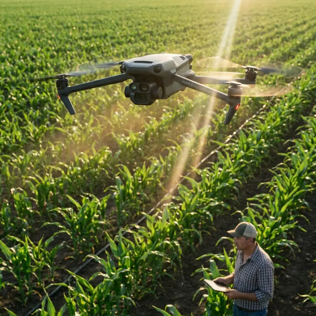
If I were preparing a Mavic 4 Pro for a coastline mission in low light, I would not start by thinking about flashy camera modes. I would start with mission geometry, image capture logic, return behavior, and signal discipline. Those choices decide whether you come home with a clean orthomosaic dataset or a folder full of gaps, blur, and unnecessary battery stress.
The most useful reference point here comes from a GS Pro orthophoto workflow that highlights a few settings many operators overlook. Those details translate surprisingly well to Mavic 4 Pro field practice, especially when the mission area follows an uneven shoreline rather than a tidy inland parcel.
Start with the map shape, not the aircraft
On coastal jobs, the survey area is almost never regular. You may need to follow a dune line, tidal barrier, drainage cut, embankment, vegetation edge, or erosion zone. That matters because forcing a rectangular mission over an irregular site wastes time over water or nonessential land and burns battery where you gain nothing.
The better approach is to define the task area as a polygon and drag its vertices until the boundary reflects the real shoreline target. The underlying reference specifically notes that the mission area can be set as an irregular polygon. Operationally, that is more than a convenience. It is one of the simplest ways to improve coastal efficiency:
- less dead mileage
- shorter total flight time
- fewer turns outside the area of interest
- better battery reserve for return and contingencies
For a Mavic 4 Pro crew working at dawn or under heavy cloud cover, this matters even more. Low-light flights reduce your margin for repeated passes. You want the aircraft spending its best visibility window over the actual survey strip, not tracing empty geometry.
Camera orientation affects more than image composition
A small line in the reference is worth serious attention: setting the camera orientation parallel to the main flight line instead of using the default perpendicular orientation.
That recommendation came with a comparison to other airframes, where crosswise flight in stronger side wind could bring landing gear into frame. A Mavic platform is less vulnerable to that exact issue, but the deeper lesson still applies. Aircraft attitude and orientation relative to wind can affect image consistency, energy use, and track smoothness.
For coastal jobs, where crosswind is common, I prefer the most stable, predictable alignment possible. If the route planner wants to orient the aircraft in a way that encourages more lateral exposure to wind, I reconsider it. The point is not just avoiding unwanted aircraft structure in the image. The point is reducing unnecessary aerodynamic drama during data capture.
On a Mavic 4 Pro, that helps in three ways:
Cleaner frame-to-frame consistency
Orthomosaic software likes predictable image geometry. Sudden corrections from gusts make matching harder.Lower battery waste
Constant compensating movement costs energy, and coastal missions already fight wind.Better low-light sharpness
In weak light, any extra motion becomes more visible. Stable track behavior supports sharper captures.
This is one area where people get distracted by advanced features like ActiveTrack, QuickShots, or Hyperlapse. Those are useful tools in the right context, especially for documentation or presentation work. But for actual orthophoto collection, disciplined flight orientation beats cinematic automation every time.
Interval shooting is the setting that changes the mission
The reference strongly recommends time-interval shooting over waypoint hover capture, and I agree with that logic for coastal mapping.
Why? Because stopping at every capture point is a terrible trade when you need efficient coverage. Hover-based capture forces a repetitive cycle of decelerate, stop, shoot, and accelerate. That destroys rhythm, wastes energy, lengthens flight time, and introduces extra mechanical workload into the mission.
The field result cited in the source is especially relevant: even under overcast conditions, with the aircraft flying a steady 15 m/s at above 120 meters, the photos remained clear and usable while in motion. That is not a minor detail. It tells you that a properly configured moving capture workflow can still produce survey-grade imagery without forcing the aircraft to pause at each frame.
For Mavic 4 Pro operators working coastlines in low light, the significance is huge:
- You preserve battery for area coverage rather than stop-start movement.
- You reduce mission duration during narrow weather windows.
- You avoid repeated hover exposure in gusty air over water.
- You maintain smoother momentum, which supports image consistency.
There is a caveat, of course. Motion capture only works if the shutter behavior, altitude, overlap planning, and speed are all aligned. If your exposure gets too slow in dim conditions, blur can creep in. That is why low-light coastal work should be planned conservatively: use the earliest workable light, avoid pushing into near-dark conditions, and monitor whether the camera is maintaining sufficient shutter speed for mapping rather than cinematic footage.
D-Log can be helpful for visual documentation segments before or after the mapping run, especially when you want to preserve tonal flexibility in a flat dawn scene. But for the mapping pass itself, the priority is not grading latitude. It is consistent, sharp, repeatable image capture.
Altitude is a resolution decision with practical consequences
The source makes another point many crews treat too casually: as flight altitude increases, the ground resolution value grows as well. In plain language, higher altitude means less detail on the ground.
That sounds obvious, but on coastline projects it often gets ignored because pilots are trying to finish quickly. The result is imagery that covers the whole site but lacks the detail needed for edge analysis, drainage interpretation, vegetation boundary review, or erosion measurement.
The source also mentions a flight altitude ceiling of 200 meters in the app environment it describes. Whether your local rules and platform configuration differ, the operational principle stays the same: altitude should be chosen based on the required output, not convenience alone.
For a Mavic 4 Pro coastline mission, I would balance altitude around four pressures:
- required ground detail
- wind stability
- battery endurance
- available light
Low light tempts some crews to climb, hoping broader coverage means fewer passes. But higher altitude can leave you with coarser data and more atmospheric softness over water-adjacent terrain. If the job requires accurate surface interpretation, cutting corners on altitude usually creates more work later in processing.
Overlap is where low-light coastal missions are won
The reference suggests 80% forward overlap on the main flight line and 66% side overlap between lines, noting that 60% may be sufficient in general, but higher overlap was used to get better results.
That is a practical recommendation, not academic theory.
Coastal surfaces can be awkward for photogrammetry. You may have repeating textures in sand, vegetation patterns that shift in the wind, reflective wet areas, and feature-poor strips near the tide line. In low light, shadows flatten detail while some damp surfaces become visually ambiguous. Extra overlap gives the software more chances to find robust matching points.
For Mavic 4 Pro missions along a coast, high overlap does three useful things:
Improves stitching reliability
Repetitive or low-contrast terrain is easier to reconstruct when more image relationships exist.Adds resilience against a few weak frames
If several images suffer from minor motion softness, the dataset may still process well.Helps around irregular edges
Shorelines are messy. Extra overlap reduces the chance of coverage gaps where the mission boundary bends.
The tradeoff is time. More overlap means more passes and more images. But if your objective is a dependable orthomosaic rather than just a quick visual check, generous overlap is usually worth the battery cost.
Don’t leave the aircraft hanging at the edge of the mission
One of the strongest warnings in the reference concerns the default “hover” behavior at mission completion. It calls that setting risky because the pilot may need to manually retrieve the aircraft from the survey boundary. If the mission ends while the connection is weak or absent, the aircraft may have to rely on failsafe return behavior instead.
That is exactly the kind of edge-case problem coastal crews should avoid.
Signal conditions near water can be deceptive. You may have a clear line of sight and still experience an inconsistent link because of terrain shape, staging position, or body-blocking of the controller antennas. Add low light, wind, and a long outbound leg, and there is no reason to finish the mission with a recovery plan that depends on perfect connectivity.
For Mavic 4 Pro operations, I want the end-of-mission behavior to be deliberate and conservative. A predictable automatic return is generally preferable to a passive hover at the far edge of the job. Hovering sounds harmless until it happens just beyond a ridge, behind vegetation, or at the moment your tablet and aircraft stop talking cleanly.
Antenna positioning: a simple habit that protects range
Since coastal operators often work stretched linear corridors, range discipline matters. Here is the field habit I recommend to every pilot: keep the broad face of the controller antennas oriented toward the aircraft, not the antenna tips pointed at it. The strongest part of the radiation pattern is usually off the flat sides, not straight out of the ends.
That means you should adjust your body position as the Mavic 4 Pro moves down the shoreline. Do not stand twisted awkwardly while the controller remains aimed the wrong way. Re-center yourself, maintain line of sight where possible, and keep your own torso from blocking the link.
A few additional practical habits help:
- launch from the highest reasonable point near the work area
- avoid standing behind a vehicle or metal fence
- keep the controller above waist level
- do not crowd the tablet with cables or accessories that make the antenna angle awkward
- if the route bends, reposition early instead of waiting for signal degradation
This is one of those unglamorous topics that saves missions. If your team wants a second opinion on route setup or field signal discipline, I’d suggest sending the site sketch through this direct WhatsApp line for mission planning feedback.
Where obstacle avoidance and subject tools fit
Mavic 4 Pro buyers often want to know whether obstacle avoidance, ActiveTrack, and other intelligent features help on technical shoreline work.
They help, but not in the way marketing usually frames it.
For mapping, obstacle avoidance is most valuable during takeoff, landing, repositioning, and low-altitude inspection segments around rocks, poles, sparse trees, or built shoreline structures. It is not a replacement for route planning. During the core orthomosaic pass, the mission should already be designed to avoid terrain conflicts.
Subject tracking tools like ActiveTrack have more value in adjacent documentation tasks than in map capture itself. If you are producing an inspection narrative of a coastal restoration team, drainage outfall, or shoreline maintenance vehicle before or after the mapping run, those tools can save time. Same with QuickShots and Hyperlapse for presentation assets. Useful? Yes. Central to orthophoto success? No.
For the mapping block, the fundamentals stay boring and effective: stable route, correct overlap, efficient shooting mode, safe mission finish, and solid signal posture.
My practical Mavic 4 Pro coastline setup checklist
If I were building this mission from the reference workflow outward, my priority stack would look like this:
- define the coastline target as an irregular polygon, not a rectangle
- verify the camera model and mission parameters before launch
- align aircraft orientation parallel to the main route when that supports steadier wind behavior
- use time-interval image capture rather than hover-at-each-point shooting
- choose altitude based on final resolution needs, not just speed
- keep forward overlap near 80% and side overlap near 66% when the output quality matters
- avoid mission-end hover if an automatic return behavior is safer
- maintain correct antenna orientation throughout the run
- use low-light judgment conservatively; if shutter behavior becomes questionable, stop and reassess
That is the difference between using a Mavic 4 Pro as a camera in the sky and using it as a serious data-collection platform.
Coastal work rewards disciplined setup. The aircraft may be highly capable, but the mission succeeds or fails on the planning decisions that happen before the first propeller spin.
Ready for your own Mavic 4 Pro? Contact our team for expert consultation.