Mavic 4 Pro in the Mountains: a Wildlife Scouting Case
Mavic 4 Pro in the Mountains: a Wildlife Scouting Case Study Built Around Safer Flights
META: A practical mountain wildlife scouting case study with the Mavic 4 Pro, focused on obstacle avoidance, ActiveTrack, D-Log, Hyperlapse, QuickShots, and one pre-flight cleaning step that protects flight safety.
By Chris Park
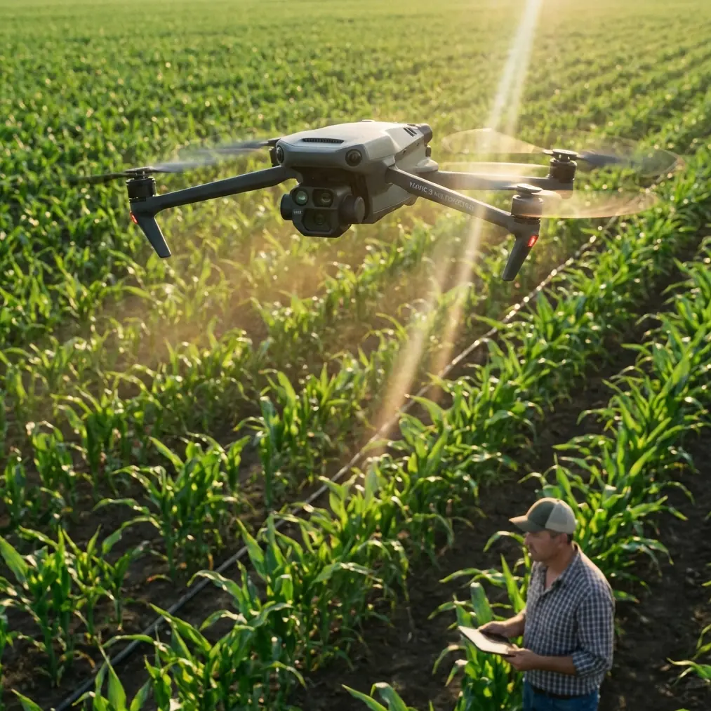
Mountain wildlife scouting exposes every weakness in a drone workflow. Thin air changes handling. Slopes compress depth perception. Tree lines, rock faces, and shifting light can fool even experienced pilots into trusting a scene that is less open than it looks from the ground. That is exactly why the Mavic 4 Pro conversation should not start with cinematic buzzwords. It should start with reliability.
On one scouting session in upland terrain, the most useful lesson had nothing to do with flight modes at all. It was a pre-flight cleaning habit.
Before powering up, I wiped the forward, rear, and downward sensing areas and checked the camera glass for dust, moisture spots, and pollen residue. That sounds basic. In mountain environments, it is not. Obstacle avoidance and subject tracking are only as good as the sensors’ ability to read contrast and distance cleanly. A smudge from a previous landing or a bit of condensation after moving from a warm vehicle into cold morning air can reduce the clarity those systems rely on. When you are flying near ridgelines or above broken canopy, that small oversight can be the difference between a smooth assisted flight and a system that behaves more cautiously, or worse, less predictably.
That one step shaped the whole day.
Why mountain scouting is a different test
Scouting wildlife in the mountains is not the same as filming open farmland or coastal water. The terrain itself moves the mission from simple visual capture to active route management. A deer trail that looks clear from your takeoff point may disappear behind a cluster of firs. A gliding bird can cross from bright snow-lit air into a dark valley backdrop in seconds. The Mavic 4 Pro matters here because its feature set supports adaptation, not just image capture.
Obstacle avoidance is the obvious headliner, but in this setting its operational value is narrower and more practical than most people assume. It is not a license to fly casually near branches or cliffs. It is a support layer that can help when depth cues become unreliable due to uneven terrain, changing sunlight, or the pilot repositioning to maintain line of sight. In mountain scouting, that support matters most during lateral movement along a slope, where the background can flatten visually and make a stand of trees feel farther away than it is.
The same goes for subject tracking. ActiveTrack is useful in wildlife observation, but only if you understand what “useful” means. It does not replace fieldcraft. It helps maintain framing on moving animals or a guide moving through terrain while you stay focused on route safety and altitude decisions. In practice, that means you are using the system to reduce workload, not surrendering judgment.
The pre-flight step that protects your safety features
Let’s stay with the cleaning point, because it deserves more attention than it gets.
Before takeoff, I now do a deliberate 60-second sensor and lens check whenever I am operating in mountain conditions:
- wipe the obstacle sensing surfaces with a clean microfiber cloth
- inspect for fine dust, water spots, sap mist, or fingerprints
- check the main camera lens for haze or edge smears
- confirm no debris is trapped around vents or moving parts
- power on and visually verify the live feed is crisp before launch
Why is this so important on the Mavic 4 Pro? Because the features pilots lean on in difficult terrain, obstacle avoidance and ActiveTrack in particular, depend on accurate visual and spatial input. If the sensing surfaces are dirty, the aircraft may become more hesitant, less consistent, or simply less trustworthy at the exact moment you need clean system behavior. That operational significance is real. A dirty lens can ruin footage. Dirty sensing surfaces can affect decision support.
This is even more relevant when wildlife scouting requires low-disturbance flight paths. You want fewer re-takes, fewer repositioning moves, and fewer abrupt corrections. Clean sensors help the aircraft interpret the environment better, which supports smoother, less intrusive passes.
A real mountain workflow with the Mavic 4 Pro
The mission was simple on paper: scout a mountain meadow system at first light to identify animal movement routes without pushing too close and disturbing activity. The actual terrain was layered and awkward. The launch site sat on uneven ground below the observation area, with a ridge to the west and a line of conifers boxing in the northern edge.
I used three flight phases.
1. High reconnaissance pass
The first leg was a conservative climb and broad orbit to understand wind behavior and visual obstacles. This is where obstacle avoidance gives confidence, not permission. I still planned a wide buffer from treetops and rock faces, but knowing the system was active let me concentrate on terrain reading rather than staring only at the distance between the drone and every isolated branch.
For wildlife scouting, that first pass is also where the Mavic 4 Pro becomes a field tool rather than a content machine. You are gathering patterns: where shadows hold longest, which gullies channel movement, where exposed ground creates thermal shimmer later in the morning.
2. Controlled tracking of movement
Once movement appeared at the meadow edge, ActiveTrack became useful. Not because it was dramatic, but because it stabilized my workflow. Instead of repeatedly re-centering the subject manually while adjusting for slope and wind drift, I could monitor the route and maintain a more respectful distance.
That matters. Wildlife scouting should prioritize minimal pressure on the animals. Smooth tracking from farther out is often better than aggressive repositioning for a tighter angle. The operational significance of ActiveTrack in this case is reduced pilot workload. Reduced workload means more attention available for altitude, wind, and escape paths.
3. Environmental storytelling shots
After the scouting objective was met, I switched to QuickShots and Hyperlapse for environmental context. These modes are often treated like social-media tricks. In a mountain case study, they are more valuable than that.
QuickShots can create repeatable, structured establishing clips that show how the meadow sits within the ridge system. That helps when you are documenting a site over time or sharing flight observations with a conservation team, land manager, or production crew preparing a follow-up visit. Consistency matters more than flair.
Hyperlapse has a different role. In mountain terrain, weather and light can transform the same area in minutes. A Hyperlapse sequence can reveal fog movement, shifting sun bands across tree lines, or activity windows tied to dawn conditions. That is useful scouting information, not just a visual extra.
Why D-Log matters in the mountains
The visual problem in mountain wildlife work is dynamic range. Bright sky. Dark timber. Reflective rock. Deep shadow. You can expose for one and lose texture in another if you are not careful.
This is where D-Log becomes a practical choice.
When I know a scene will contain strong contrast, I capture with D-Log to preserve more grading flexibility later. That is not only for filmmakers. It is also valuable if your footage has to serve as observational documentation. In mountain environments, details in shaded tree cover or along ridgelines can matter. D-Log gives you more room to balance those extremes in post without the image falling apart too quickly.
Operationally, that means fewer regrets when you get back to the screen and realize the meadow looked perfect in person but the ungraded file leaned too bright in the sky or too blocked up in the forest edge. You do not always get a second chance with wildlife timing. Better file flexibility is practical insurance.
What the Mavic 4 Pro does well in this use case
A lot of drone articles flatten every mission into the same talking points. Mountain scouting is a better filter because it exposes whether a feature has field value.
Here is what stood out.
Obstacle avoidance helped manage stress in compressed terrain. Again, not as a substitute for planning, but as a safety layer when visual depth became deceptive.
ActiveTrack reduced workload during moving-subject observation. That let me fly smoother and stay less intrusive.
QuickShots created fast, repeatable context shots that were actually useful for documenting the site layout.
Hyperlapse turned changing mountain weather into readable information.
D-Log preserved image flexibility in a scene with harsh contrast between valley shade and open sky.
None of those features should be isolated from the others. Their value compounds when the pilot has a disciplined workflow. That starts on the ground, with a clean aircraft and a realistic plan.
The mistake mountain pilots make with “smart” features
The common error is assuming smart functions remove risk. In mountain operations, they mostly redistribute attention.
If your sensors are clean, your route is conservative, and your expectations are grounded, the Mavic 4 Pro’s assisted systems can reduce pilot strain and improve consistency. If you rush the pre-flight, launch from a poor position, and expect automated tracking to solve every terrain problem, those same features can create false confidence.
That is why I keep coming back to the cleaning step. It sounds almost too ordinary to mention in a case study. Yet that small habit directly affects the two features mountain pilots most often depend on: obstacle avoidance and subject tracking. If those systems matter to your flight, maintaining the surfaces they rely on is not housekeeping. It is risk management.
A better mountain scouting checklist
For readers planning similar wildlife work, this is the checklist I now consider non-negotiable with the Mavic 4 Pro:
- Clean the sensing surfaces and camera lens before every launch
- Watch for condensation when moving from warm storage into cold air
- Start with a high reconnaissance pass before trying to track anything
- Use ActiveTrack to reduce workload, not to excuse poor route discipline
- Reserve generous distance from trees, ridges, and rising terrain even with obstacle avoidance active
- Use D-Log in high-contrast scenes when post-processing flexibility matters
- Capture one or two repeatable QuickShots for site context, not just dramatic effect
- Run a short Hyperlapse if weather movement is part of the scouting objective
If you are building a mountain workflow and want a second opinion on setup choices, field habits, or camera configuration, I’ve found it useful to message an experienced drone team directly before committing to a demanding shoot.
The bigger lesson
The Mavic 4 Pro earns its place in mountain wildlife scouting when you treat it like a precision field instrument, not a flying shortcut. The aircraft’s intelligent features are valuable, but they become truly useful only when paired with disciplined preparation.
That is the heart of this case study. Not the spectacle of alpine footage. Not a list of modes. A workflow decision that improves both safety and results: clean the aircraft before takeoff, especially the surfaces that feed obstacle avoidance and tracking.
From there, everything else starts working the way it should. The drone reads the scene more cleanly. You trust your support systems more appropriately. Your movements become smoother. Your footage gains context instead of just drama. And your wildlife scouting stays what it should be: observant, controlled, and minimally disruptive.
That is how the Mavic 4 Pro makes sense in the mountains.
Ready for your own Mavic 4 Pro? Contact our team for expert consultation.