Mavic 4 Pro in Complex Terrain: A Field Report
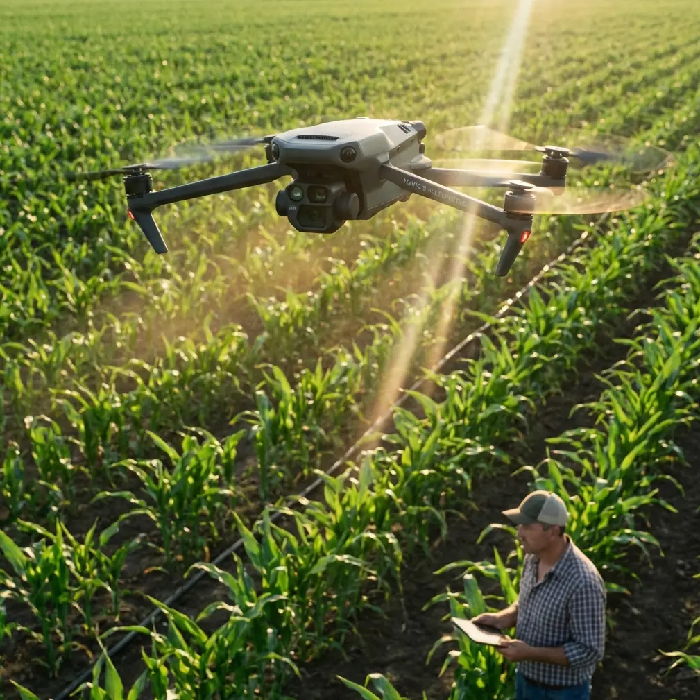
Mavic 4 Pro in Complex Terrain: A Field Report From Wildlife Recon
META: Field-tested look at how the Mavic 4 Pro handles wildlife scouting in steep, cluttered terrain, with practical insight on obstacle avoidance, ActiveTrack, D-Log, Hyperlapse, and real-world flight decisions.
I took the Mavic 4 Pro into broken country for the kind of job that exposes a drone quickly: scouting wildlife movement where the landscape refuses to cooperate.
This was not a broad, open valley with easy sightlines. It was a layered ridge system cut by ravines, scrub oak, loose rock, and scattered conifers, the sort of terrain that produces blind angles every few seconds. For a photographer, it is rich ground. For a pilot, it is where the quality of sensing, tracking, and camera control stops being a spec-sheet discussion and becomes operational.
The assignment was simple on paper. Locate and observe animal movement near first light without pushing too close, without disturbing behavior, and without wasting battery on repeated repositioning. In practice, that means the aircraft has to do three things well. It needs to read cluttered airspace, hold a subject when the background is visually chaotic, and give enough image flexibility to handle hard contrast between sky, stone, and shadow.
That is exactly where the Mavic 4 Pro starts to make sense.
The wildlife encounter that tested it
The most telling moment came during an early pass along a sloped drainage line. A small group of deer had moved out from the tree edge and started crossing a shelf below the ridge. They were not in an open meadow. They were weaving through uneven terrain, disappearing behind brush and reappearing against pale rock. Above them, a dead branch line projected from one side of the drainage. On the opposite side, the terrain rose steeply enough to compress the flight corridor.
That combination matters. Wildlife doesn’t move on cue, and complex terrain narrows your safe options very quickly. I needed to hold visual awareness of the animals while keeping the aircraft clear of protruding limbs and changing elevation. This is where obstacle avoidance is not a comfort feature. It is the difference between collecting a usable sequence and aborting a pass.
The Mavic 4 Pro’s sensing behavior in that situation felt less like brute caution and more like controlled negotiation with the landscape. Rather than forcing me into a jerky stop-start pattern, it helped maintain a cleaner line while I adjusted speed and angle. In dense scouting work, that smoothness matters for two reasons. First, it reduces pilot overload. Second, it keeps the aircraft movement less abrupt, which is valuable when you are trying not to pressure wildlife into changing direction.
Why obstacle avoidance matters more in wildlife scouting than people admit
A lot of drone coverage treats obstacle avoidance as a generic safety item. In wildlife recon, its real value is subtler.
Animals rarely move in the most photogenic direction. They drift into gullies, under overhangs, past deadfall, and along tree edges where depth perception from the pilot’s viewpoint can be deceptive. If you are flying near a slope, even a modest lateral move can also become an altitude problem because the ground is rising beneath the aircraft faster than your eye reads it on a flat display.
Obstacle sensing gives you margin, but the real operational gain is decision speed. You spend less mental energy second-guessing every branch tip and can put more attention on behavior, spacing, and camera timing. When scouting wildlife, that means you are better able to anticipate where the subject will emerge next instead of merely reacting after it happens.
In my field notes from that morning, I wrote one line that still sums it up: “The drone bought me bandwidth.” That is what good sensing does in the real world.
ActiveTrack when the subject does not cooperate
The second major test was subject tracking. The terrain was visually messy, and the deer were moving in and out of partial cover. That is the kind of scene where a tracking system can either become genuinely useful or reveal its limits fast.
ActiveTrack on the Mavic 4 Pro was most effective when used as a controlled assistant rather than an excuse to stop piloting. That distinction matters. In wildlife work, you are not following a cyclist on a clear road. Your subject can turn unexpectedly, overlap with shrubs, or vanish behind terrain contours. A pilot who expects full automation to solve that is asking for lost framing or a broken shot.
Used properly, ActiveTrack helped maintain compositional consistency while I concentrated on route refinement. That let me preserve better standoff distance and avoid the constant micro-corrections that often create noisy, distracted footage. Operationally, this matters because every aggressive correction is both visible in the image and more likely to alter animal behavior.
One lesson stood out. Tracking became more reliable when I resisted the urge to fly too tight. Giving the system a cleaner subject silhouette and allowing more environmental context around the animals improved continuity. That is a useful principle for anyone scouting in brushy or mountainous country: the best wildlife drone footage often comes from disciplined restraint, not proximity.
The camera side: why D-Log earns its place in difficult light
Complex terrain does not only challenge flight. It punishes exposure.
On this ridge, sunrise produced a familiar but difficult split: bright sky on the upper frame, dark vegetation in the lower third, and reflective stone surfaces catching stray light in between. Standard color can look fine in gentle conditions, but in this kind of mixed contrast, D-Log becomes valuable for a practical reason. It preserves room to recover the scene later without forcing ugly compromises in the field.
That flexibility mattered on a sequence where the deer crossed from cool shadow into a sunlit patch of grass for only a few seconds. With D-Log, I had a more workable file for balancing detail in the darker brush against the highlights on the exposed slope. For wildlife scouting, that is not a purely aesthetic bonus. If your objective includes identifying movement patterns, habitat use, or behavior at the edge of cover, image detail in both shadow and highlight areas can affect what you are actually able to interpret after the flight.
Photographers coming from stills sometimes underestimate how useful this is in a drone workflow. In a fixed moment on the ground, you can wait, reposition, or bracket. In the air, especially with moving animals, the scene changes before you can negotiate with it. D-Log gives you a wider margin for those non-repeatable moments.
QuickShots and Hyperlapse are not just for style
There is a tendency to treat QuickShots and Hyperlapse as accessories for social clips. In wildlife fieldwork, they can serve a more thoughtful purpose when used sparingly.
QuickShots are most useful during location familiarization. Before committing to a low, careful pass near animal movement corridors, a short automated motion can help reveal how ridges, tree bands, and water channels relate spatially. That broader read supports safer planning. You are effectively building a visual map of the site while preserving battery and reducing unnecessary repositioning.
Hyperlapse has its own place, especially for habitat storytelling. In one section of the morning, fog was lifting through the cut between two ridges while the lower brushline began to warm in sunlight. A Hyperlapse sequence captured how visibility, shadow, and terrain interacted over time. That is useful not only for a final edit, but for understanding when a site becomes visually open or concealed. For wildlife photographers, those transitions shape the best scouting windows.
Neither feature replaces precise manual flying. But both can contribute something more practical than decoration when they are tied to site analysis and environmental reading.
Flight behavior in uneven country
The biggest mistake I see in wildlife drone work is flying as if the map and the terrain are telling the same story. They often are not.
A slope that seems manageable from a launch point can become far more complex once you move laterally. Drainages funnel wind. Tree crowns conceal elevation change. Rock faces create hard visual contrasts that can distort depth judgment on screen. In these conditions, the Mavic 4 Pro feels most useful when flown with a layered plan:
- establish a high, conservative reconnaissance pass
- identify likely wildlife movement lines
- note obstacle clusters and rising ground
- set a flight path that leaves retreat options
- then drop only as much as the scene requires
That approach worked well during the deer encounter because the drone had already built a spatial picture of the area before the key sequence began. When the animals changed angle, I was adapting inside a known environment rather than improvising blind in a cluttered corridor.
For pilots who scout in mountains, marsh edges, woodland breaks, or canyon country, that workflow matters more than chasing any single feature. The aircraft’s systems help, but they help most when the pilot has already done the terrain reading.
What surprised me most
Not image quality. Not tracking. It was how much the aircraft reduced friction between observation and execution.
That sounds abstract until you fly in truly awkward ground. Some drones can produce excellent files but demand so much constant management that you start making conservative choices too early. You back off. You skip a line. You abandon a sequence because the workload spikes. The Mavic 4 Pro gave me more confidence to work deliberately in an environment where every branch, slope, and shadow competes for attention.
That does not mean it removes the need for judgment. Wildlife scouting still requires distance discipline, legal compliance, weather awareness, and a genuine respect for the animals’ space. But good equipment should widen the gap between careful operation and avoidable compromise. On this outing, that is what happened.
A photographer’s take on who this is really for
If your wildlife work is mostly over open beach, flat grassland, or large clearings, you may appreciate the Mavic 4 Pro without fully challenging it. Its strengths become more obvious when the environment is messy.
It suits photographers and field operators who need to work around ridgelines, tree interruptions, uneven light, and subjects that appear and vanish on their own schedule. Obstacle avoidance matters there. ActiveTrack matters there. D-Log matters there. Even QuickShots and Hyperlapse matter there when they are used to understand landscape behavior rather than just produce flashy edits.
That is the key point. The drone is not interesting because it has recognizable feature names. It is interesting because those features, used together, reduce the number of weak decisions a pilot has to make under pressure.
If you are still comparing setups for terrain-heavy wildlife scouting, I’d rather have a practical conversation than offer a generic recommendation. You can reach out here for a field-oriented discussion: message me directly on WhatsApp.
Final field note
That morning ended with the deer clearing the drainage and disappearing into denser cover. The best clip was not dramatic in the usual sense. No sprint, no dust, no cinematic reveal. Just a clean tracking sequence across difficult terrain, with enough environmental context to show how the animals were using the landscape.
That is what made it valuable.
The Mavic 4 Pro did not turn a rough site into an easy one. It did something better. It made a difficult site readable, flyable, and documentable without forcing the operation into either recklessness or timidity. For wildlife scouting, especially in country full of visual traps and tight airspace, that balance is the whole story.
Ready for your own Mavic 4 Pro? Contact our team for expert consultation.