Mavic 4 Pro Scouting Tips for Vineyards in Extreme Temperatu
Mavic 4 Pro Scouting Tips for Vineyards in Extreme Temperatures
META: Practical Mavic 4 Pro vineyard scouting advice for extreme heat and cold, with mapping-grade workflow insights drawn from real aerial surveying methods.
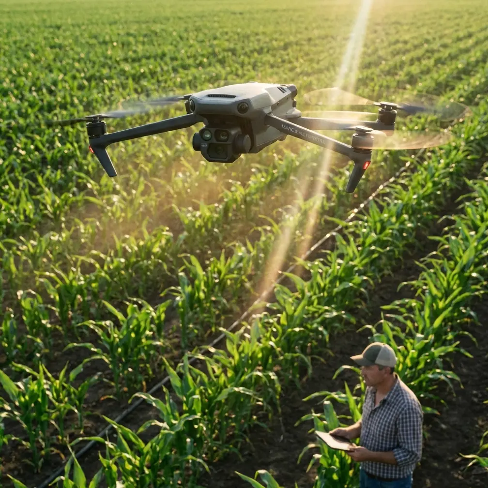
I’ve spent enough time around vineyards to know that “beautiful light” and “easy operating conditions” rarely show up on the same day. Harvest windows don’t care if the afternoon is baking hot. Frost risk doesn’t wait for a pleasant sunrise. If you’re using a Mavic 4 Pro to scout vine rows in extreme temperatures, the aircraft itself is only part of the story. The real differentiator is how you fly, how you validate what you see, and how you turn images into something operationally useful rather than just visually impressive.
That’s where a surveying mindset helps.
A technical mapping workflow from a rural cadastral aerial survey offers a surprisingly relevant lesson for vineyard operators: image capture is only valuable when it connects cleanly with reliable reconstruction, field verification, and a consistent visual standard. That survey design used Smart3DCapture with POS-supported exterior orientation data, then applied a coarse-to-fine pyramid matching strategy for automatic tie-point extraction and free-network bundle adjustment. On paper, that sounds far removed from viticulture. In practice, it addresses the same problem growers face when scouting with drones in difficult conditions: how do you trust what the aircraft saw?
The vineyard problem: extreme weather exposes weak workflows
In vineyard scouting, extreme temperatures create two kinds of failure.
The first is obvious: aircraft performance changes. Battery behavior shifts. Wind often builds with temperature gradients. Sensors can be stressed by glare, haze, frost, or hard contrast between sunlit slopes and shaded rows.
The second failure is more subtle and more expensive. People collect footage, inspect a few obvious sections, and assume the mission was useful. Then they discover gaps: a blocked row edge wasn’t visible, a drainage issue was misread because of shadowing, or a suspected canopy inconsistency turned out to be a perspective artifact.
That’s why a Mavic 4 Pro should not be treated as a flying camera alone. For vineyard scouting, especially in punishing weather, it should be treated as a lightweight reconnaissance and documentation platform that benefits from mapping discipline.
Why the survey reference matters to a Mavic 4 Pro user
One detail from the reference material deserves special attention: the project relied on software that simulated the ground projection range of all images, including oblique imagery, using exterior orientation data from a POS system. Operationally, that matters because vineyards are not flat picture books. Trellis lines, slope breaks, service roads, tree belts, retaining edges, and utility features all create viewing limitations. If you only rely on straight-down imagery, you will miss context along row sides and boundary transitions.
That is exactly where the Mavic 4 Pro’s obstacle avoidance and controlled oblique capture strategy become useful. Even when your goal is scouting rather than formal cadastral delivery, oblique viewing helps reveal canopy density variation, edge encroachment, trellis irregularities, erosion scars, blocked access lanes, and changes around infrastructure. In extreme temperatures, those details matter more because stress often expresses itself unevenly across terrain and exposure.
The second critical detail from the reference is its tolerance threshold for reconstruction quality: reprojection error was controlled to around 0.5 pixels, with a hard limit at 0.55 pixels, and flights exceeding that standard had to be redone. Vineyard managers may never quote pixel residuals in the field, but the principle is essential. If your data quality is suspect, do not force an interpretation. Re-fly the block.
That one habit can save far more time than trying to salvage bad scouting data from a compromised mission.
A practical problem-solution workflow for vineyard scouting
Problem 1: Heat and cold distort decision-making before they distort imagery
In very hot conditions, operators tend to rush because the aircraft, batteries, and pilot all feel the pressure. In cold conditions, they delay and shorten missions because they expect reduced endurance. Both reactions often lead to incomplete passes and inconsistent angles.
Solution: standardize your capture pattern before takeoff
Use the Mavic 4 Pro the way a survey team would structure a mission: define a repeatable route, fixed observation goals, and clear re-fly criteria. For vineyard scouting, that means:
- one high overview pass for block-wide pattern recognition
- one lower oblique pass along selected rows or edges
- one targeted pass on known problem zones such as low points, irrigation heads, or wind-exposed margins
The reference document emphasized a unified map expression when merging old and new content. The vineyard equivalent is consistency between scouting sessions. If each flight uses a different altitude, angle, and route, comparing heat stress, vigor variation, or access changes over time becomes guesswork. A repeatable flight profile lets you compare one week to the next with confidence.
Why oblique imagery beats a top-down-only habit
The source material specifically addressed multi-view joint adjustment for oblique photogrammetry. That’s not just a mapping issue. In vineyards, oblique imagery can expose what nadir imagery hides.
Top-down imagery is useful for spotting broad canopy anomalies and route planning. But when temperatures swing hard, symptoms often start in ways that are easiest to read from the side:
- uneven leaf posture along a row
- gaps in training structure visibility
- side-shadow clues around washout or soil movement
- access obstruction near poles, boxes, or service points
The Mavic 4 Pro’s ActiveTrack and subject tracking features are often discussed in creative filming contexts, but they can also help with repeatable visual inspection of moving field vehicles or workers coordinating irrigation and maintenance logistics, provided the operation remains safe and within standard civilian use. More commonly, though, the value in vineyards is controlled directional flight with obstacle avoidance active, especially near row ends, treelines, or utility corridors where line-of-sight complexity increases.
Obstacle avoidance matters here not because vineyards are inherently dense urban spaces, but because scouting flights in harsh light can hide branches, wires, and uneven terrain cues that are easier for the aircraft to detect than the pilot in glare-heavy conditions.
The hidden lesson from field verification
One of the most grounded parts of the reference workflow had nothing to do with software. It stated that when field objects, surveyed positions, or attributes could not be confirmed on site, the issue had to be reported promptly with field photos so the quality team could respond uniformly.
That is a strong lesson for vineyard scouting.
Drone imagery is not a substitute for agronomic truth. If the Mavic 4 Pro shows an irregular patch at the end of a row during a cold morning pass, don’t force a conclusion from the screen alone. Flag it. Capture reference photos on the ground. Build a small review habit with your team so recurring uncertainties are classified consistently.
This matters even more in extreme temperatures because visual signatures can mislead:
- cold shadows can exaggerate canopy gaps
- intense afternoon glare can flatten detail
- dust and dry reflectance can mimic plant stress
- wet soil can appear structurally worse than it is
A simple field-photo protocol turns drone scouting into a decision tool rather than a collection of educated guesses.
Making the Mavic 4 Pro footage useful, not just attractive
Jessica Brown, the photographer lens here, would likely appreciate the visual side of vineyard flying. The Mavic 4 Pro is naturally suited to cinematic row reveals, Hyperlapse sequences over changing light, and polished color work in D-Log. Those are valid strengths. But in extreme-weather scouting, visual polish should serve interpretation.
D-Log is especially helpful in vineyards with harsh midday contrast or frost-lit dawn scenes because it preserves more flexibility when balancing bright sky, reflective leaves, and dark under-canopy spaces. That does not magically improve agronomic insight, but it can preserve subtle tonal information that gets crushed in baked-in contrast profiles.
QuickShots and Hyperlapse have a role too, though not for routine inspection. Hyperlapse is useful when documenting broader environmental movement across a block—fog burn-off, cloud shadow sweep, or changing worker and vehicle logistics during a weather-sensitive operation. QuickShots are less critical for technical scouting but can help create consistent visual communication for owners, agronomists, or remote stakeholders who need a fast understanding of terrain layout.
The key is discipline: every automated feature should answer a real question.
A third-party accessory that genuinely helps
One accessory I’d add for vineyard scouting in extreme temperatures is a high-quality third-party landing pad with weighted corners and a heat-resistant, dust-shedding surface. It sounds minor until you’re operating on dry soil in summer or damp, uneven ground in winter.
Why does it matter? Because takeoff and landing are often when preventable contamination enters the workflow. Dust kicked into the gimbal area, debris on the aircraft, and moisture contact around field edges all increase mission friction. In a vineyard, where you may relocate frequently between blocks, a reliable landing surface improves turnaround speed and reduces the chance that a rushed hand-catch or improvised launch compromises the next sortie.
If you’re comparing field setups or trying to source practical accessories for this kind of operation, this vineyard drone support chat is a sensible starting point.
Borrowing survey logic for better vineyard reconstructions
Another technical detail from the reference deserves attention: during 3D reconstruction, Smart3DCapture automatically selected the best stereo image pairs from opposing views, then generated a dense point cloud, converted it into a TIN surface, removed and repaired bad triangles caused by image matching errors, and optimized the geometry before texturing.
Why does that matter to a Mavic 4 Pro user scouting vines?
Because vineyard terrain is full of repetitive textures. Row after row can confuse weak reconstruction workflows. Add extreme-temperature visual noise—hard shadows, dry glare, frost sheen—and image matching becomes less forgiving. If you intend to build even a lightweight 3D understanding of slope behavior, drainage, terrace edges, or infrastructure context, you need multi-angle inputs and enough overlap for software to identify good matching relationships.
The practical takeaway is simple:
- don’t rely on one altitude and one viewing angle
- capture enough overlap to support later interpretation
- use opposing or cross-row perspectives on complex ground
- inspect results critically before trusting the model
The reference’s “coarse to fine” matching strategy points to a bigger truth: reliable outputs are built through progressive refinement, not by expecting one pass to do everything.
When to choose RTK-style precision thinking, and when not to
The reference also separated field methods by visibility conditions: RTK in open areas, total station methods in heavily obstructed zones, and intersection methods for features like poles or utility points with angle constraints between 30° and 150°.
A vineyard operator does not need to replicate that exact survey methodology, but the decision logic is valuable. Open, unobstructed blocks are ideal for broad drone scouting. Tight areas near new buildings, dense shelterbelts, or infrastructure corridors may need supplementary ground checks because imagery alone becomes less reliable.
That is a mature way to use the Mavic 4 Pro: know where aerial efficiency ends and ground verification begins.
A better mindset for extreme-temperature scouting
The Mavic 4 Pro can absolutely be a strong vineyard scouting tool in difficult weather. But the aircraft’s real value appears when you pair its flight intelligence with a reconstruction-aware workflow.
Use obstacle avoidance to reduce risk near complex boundaries. Use oblique passes to reveal side conditions top-down imagery misses. Use D-Log when contrast would otherwise erase subtle detail. Use repeatable routes so temporal comparisons mean something. And most of all, adopt the survey habit of rejecting uncertain data rather than explaining it away.
That’s the strongest lesson hidden inside the mapping reference. Precision is not just about software sophistication. It’s about operational honesty. If a mission doesn’t meet your quality threshold, you do it again. If a visible anomaly can’t be confirmed, you escalate it with field photos. If new observations need to be merged with older records, you keep the visual standard consistent so the whole picture remains usable.
That approach turns a Mavic 4 Pro from a capable flying camera into a dependable vineyard scouting system.
Ready for your own Mavic 4 Pro? Contact our team for expert consultation.