Mavic 4 Pro Guide for Scouting High-Altitude Vineyards
Mavic 4 Pro Guide for Scouting High-Altitude Vineyards
META: A practical, field-focused Mavic 4 Pro guide for scouting vineyards at altitude, with mapping logic, obstacle awareness, image workflow, and why drone orthomosaic methods matter for terrain-heavy sites.
I still remember a mountain vineyard recce where the old workflow broke down before the real work even started.
The access road ended early. The slope beyond it was wet, uneven, and lined with terraces that looked manageable from a distance but turned awkward the moment boots hit the ground. Walking rows by hand took too long. Driving between blocks was unrealistic. Satellite imagery helped with broad orientation, but not with the kind of detail you need when row spacing, erosion marks, access paths, and drainage behavior all matter. Hiring a crewed aircraft for a small scouting window made no operational sense.
That problem is not unique to vineyards. A 2016 Chinese drone surveying solution from Tianjin Tengyun Zhihang described the same pain points in plain terms: manual surveying creates heavy workloads, low efficiency, and long data acquisition cycles; difficult terrain raises risk; satellite revisit cycles are too slow and resolution can be too low; crewed aircraft bring higher operating complexity and cost. Those points were written for the surveying world, but they translate almost perfectly to steep vineyard scouting.
That is where a Mavic 4 Pro-style workflow becomes useful. Not because it turns viticulture into push-button automation. It doesn’t. What it does is compress the time between arrival on site and a usable visual understanding of the terrain.
For high-altitude vineyards, that matters.
Why vineyard scouting at altitude is really a mapping problem
A vineyard in the mountains is not just a pretty landscape. It is a layered operational surface. You are trying to understand slope transitions, row geometry, canopy consistency, access constraints, runoff pathways, terrace edges, nearby tree lines, and obstacles that may affect future flights or field work.
The reference document highlights a core output of drone surveying: high-resolution orthophoto generation, also called DOM, or Digital Orthophoto Map. That sounds technical, but the significance is simple. An orthophoto is not just a nice aerial image. It is corrected so the scene can function as reliable geographic information rather than a perspective-heavy photograph.
For a vineyard scout, that means the difference between “this looks steep” and “this block edge actually shifts here, this track bends there, and this drainage cut runs along the lower terrace.”
The source also notes that orthophotos can be used to update mapping data faster and serve directly as a background layer inside geographic information systems. In practical vineyard terms, a Mavic 4 Pro flight can help create current visual basemaps for planning irrigation checks, access routes, replanting zones, erosion mitigation, or seasonal documentation. The value is not the image alone. The value is that the image becomes workable.
Step 1: Start with a terrain-first flight plan, not a camera-first mindset
Photographers often begin with the shot. Survey people begin with the area. In high-altitude vineyards, the second approach wins.
Before launching the Mavic 4 Pro, walk enough of the site to understand three things:
- Elevation change across the blocks
- Wind behavior near ridgelines and terrace edges
- Obstacle density, especially poles, wires, isolated trees, and netting structures
The source document specifically mentions that drone survey work begins with a terrain inspection of the target area before route planning. That detail is operationally important. At altitude, vineyard flights can go wrong when pilots assume the site is visually simple. It rarely is. A hillside that looks open from one angle may contain abrupt rises that challenge obstacle sensing or break line of sight more quickly than expected.
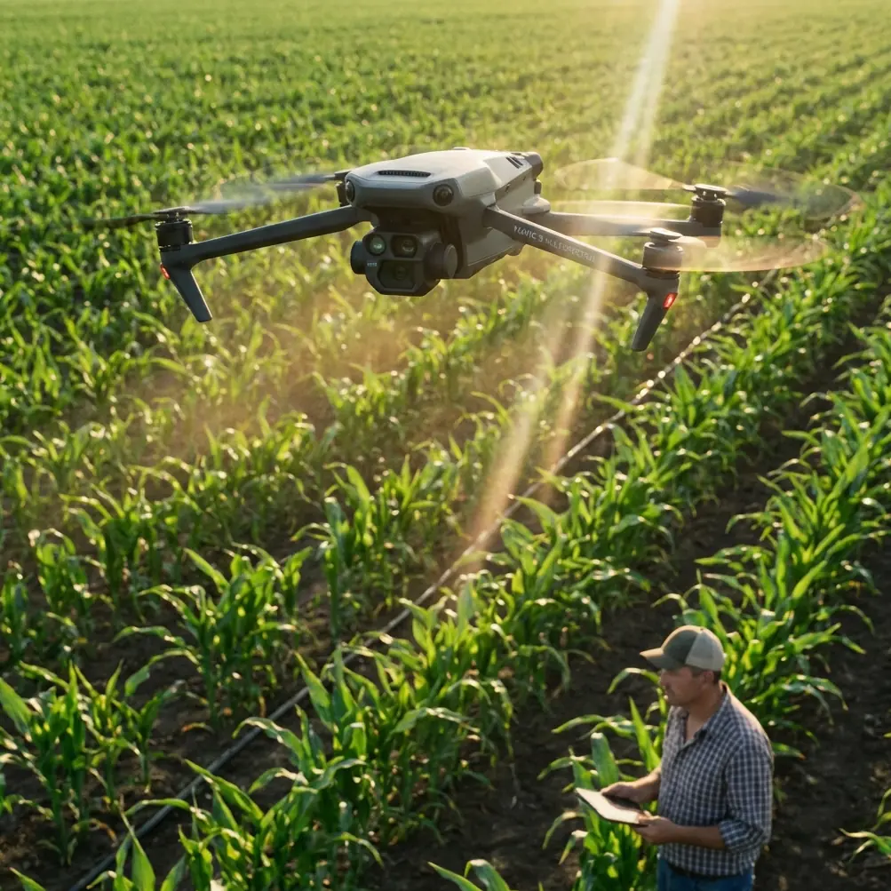
This is where obstacle avoidance on the Mavic 4 Pro matters less as a marketing feature and more as a risk buffer. In vineyards, obstacle systems help when flying close to terrain transitions, near end-of-row trees, or above service roads that curve behind embankments. You should not rely on them blindly, but they can reduce workload when attention is split between composition, route monitoring, and terrain.
My own habit is to define two missions mentally before takeoff: one flight for orientation, one for precision. The orientation pass is higher, slower, and focused on understanding the property. The precision pass comes later, once I know where the trouble spots are.
Step 2: Use wide coverage first to build your orthophoto logic
Even if your end goal is visual scouting rather than formal surveying, borrow the surveying sequence.
The original solution document references a workflow that includes flight route planning, sensor payload use, aerial image capture, POS data, and post-processing software. You do not need to recreate a full enterprise stack to benefit from that logic. The key lesson is this: useful vineyard intelligence comes from a repeatable capture pattern, not from random cinematic passes.
Start with a grid or parallel-row coverage pattern over the vineyard blocks you need to assess. Keep overlap consistent. Maintain stable altitude relative to terrain as much as conditions allow. If the site includes significant elevation swings, break the area into smaller segments rather than trying to force one perfect flight across the whole property.
Why does this matter? Because high-altitude vineyards often deceive the eye. The rows appear orderly, but small perspective distortions hide low spots, terrace breaks, and service tracks. A coverage pattern designed for orthomosaic-style reconstruction gives you cleaner material for later review, even if you are simply examining images manually.
This is where the old source document feels surprisingly current. It emphasized that orthophoto products improve the timeliness of mapping updates. For vineyards, that means you can revisit a site after weather events, after pruning stages, or before harvest logistics and compare against earlier captures with much better clarity than casual handheld shooting.
Step 3: Switch from survey mode to scouting mode
Once broad coverage is complete, the Mavic 4 Pro becomes more than a mapping tool. It becomes a field notebook with wings.
Now you can fly targeted routes to inspect:
- runoff channels after snowmelt or heavy rain
- gaps in canopy structure along steep rows
- access roads that may be unsafe for equipment
- shade patterns from bordering hills or tree belts
- terrace edges that need a closer look before workers or vehicles move through them
This is where subject tracking and ActiveTrack can be genuinely helpful, though probably not in the way many creators think. In a vineyard setting, I am less interested in tracking a person for dramatic footage and more interested in keeping the aircraft’s framing stable while following a utility vehicle, worker path, or access route through the site. That makes route documentation easier and reduces the chance of jerky corrections when terrain changes quickly.
QuickShots and Hyperlapse also have a place, but only when used with purpose. A Hyperlapse sequence from dawn through late morning can reveal how shadow retreats across a terraced slope. A controlled orbit can show how one block relates spatially to another. These are not gimmicks if the output helps a grower or site manager understand the property faster.
Step 4: Use D-Log when visual interpretation matters later
For pure mapping, consistency matters more than cinematic flexibility. But scouting often sits between documentation and interpretation. That is where D-Log earns its place.
Mountain vineyards regularly produce harsh contrast: bright sky, reflective leaves, dark gullies, pale soil, deep shadow under terrace walls. If you capture in D-Log, you preserve more flexibility when reviewing footage later, especially if your goal is to inspect subtle differences in texture, washout marks, or canopy tonality without clipped highlights.
As a photographer, I learned this the hard way. On one site, standard profile footage looked punchy in the field but hid too much information in the bright side of the slope. After that, I started treating scouting flights more like evidence gathering than social content. Pretty footage is nice. Recoverable footage is better.
The point is not to overgrade everything. It is to keep your options open when conditions are visually unforgiving.
Step 5: Respect weather and altitude as data problems, not just flight problems
The reference material mentions ice, flooding, earthquakes, and landslides as conditions that disrupt traditional surveying. Vineyards at altitude may not face all of those at once, but they do share the broader issue: adverse conditions slow human inspection and increase uncertainty.
After snow, freeze-thaw cycles, or storm runoff, ground access can become patchy and risky. A drone lets you inspect first and walk second. That order matters. You should know where the washouts are before committing a crew to the slope.
This is one of the strongest overlaps between the old surveying solution and present-day vineyard scouting. The drone is not simply replacing a camera angle. It is changing the sequence of decision-making. You gather visual intelligence before exposing people and vehicles to difficult terrain.
If you are planning repeated site reviews or want help tailoring a vineyard workflow, I’d suggest sending your route questions here and comparing notes before the next field day.
Step 6: Build a repeatable deliverable, not a pile of clips
A common mistake with vineyard drone work is coming home with beautiful fragments and no coherent record.
The source document’s emphasis on orthophoto products and GIS background use points toward a better habit: organize your capture so each mission produces something comparable over time. Even if you are not delivering formal survey files, you should still aim for a repeatable package:
- a high-level site overview
- block-by-block top-down coverage
- selected oblique passes for terrain reading
- route documentation for access roads
- fixed reference shots from the same points on each visit
This turns the Mavic 4 Pro into a continuity tool. Over a season, or across multiple seasons, you can compare change rather than relying on memory. For remote vineyards, especially those where walking every row is unrealistic, this can save major time.
And time is really the central theme here. The 2016 surveying document repeatedly framed the old problem as one of slow acquisition cycles, difficult access, and inefficient fieldwork. Those same constraints still define many vineyard sites today. A modern compact drone helps because it shortens the loop between observation and action.
Step 7: Know what the Mavic 4 Pro is best at in this scenario
For high-altitude vineyard scouting, the Mavic 4 Pro is most useful when you need to combine three tasks in one visit:
- establish a current visual map of the site
- inspect specific terrain or canopy concerns
- create usable review material for later planning
Its strength is not that it replaces dedicated large-format survey platforms in every circumstance. It does not. Its strength is that it makes high-value reconnaissance practical for smaller teams, shorter site visits, and terrain that punishes inefficient workflows.
That makes it especially relevant for vineyard owners, consultants, farm managers, agronomy teams, and visual documentation specialists working in steep regions. If your challenge is not “how do I get dramatic aerial footage,” but “how do I understand this site thoroughly before the day disappears,” then the aircraft earns its keep.
The real shift: from seeing the vineyard to reading it
That is the biggest lesson I took from combining photographic fieldwork with the logic inside older drone surveying methods.
A vineyard scout does not need random aerial beauty. A scout needs readable space.
The reference material from Tianjin Tengyun Zhihang may come from a different era and a more formal surveying context, but its core argument still holds up: manual methods are slow, terrain creates risk, satellite data can be too delayed or too coarse, and high-resolution drone imagery can update geographic understanding far faster. Add modern flight intelligence, obstacle awareness, tracking tools, and flexible color capture, and the Mavic 4 Pro becomes a smart fit for the specific reality of high-altitude vineyard work.
That is why I no longer start these assignments thinking about footage. I start by asking what the site is hiding from ground level.
Then I launch.
Ready for your own Mavic 4 Pro? Contact our team for expert consultation.