Mavic 4 Pro Field Report: What a Heritage Mapping Case
Mavic 4 Pro Field Report: What a Heritage Mapping Case Teaches Us About Remote Vineyard Scouting
META: A field report on Mavic 4 Pro for remote vineyard scouting, using a real heritage mapping case to explain why aerial efficiency, terrain handling, and smart imaging workflows matter.
I’ve spent enough time around flight operations to know that the most useful drone stories rarely start with a spec sheet. They start with a constraint.
In this case, the constraint came from a mapping project near Jerusalem: an 80,000-square-meter historic site, 121 old structures, a 90-day deadline, and a requirement to produce deliverables that weren’t decorative but operationally necessary—terrain mapping for restoration work, along with 3D building models, 2D façade drawings, and 2D roof plans. The team initially considered traditional methods like total station surveying and 3D laser scanning. They walked away from both. Too slow. Too expensive.
Instead, they used a DJI flight platform with Datumate’s Datugram3D software. The result mattered for reasons that go far beyond archaeology. The project was completed on time, and the cost came in at roughly one-seventh of total station surveying and one-fifth of laser scanning.
If you’re scouting vineyards in remote terrain with a Mavic 4 Pro, that case is more than an interesting footnote. It’s a practical blueprint for how modern aerial workflows outperform older ground-heavy methods when the land is uneven, access is awkward, and decisions need to be made fast.
Why this heritage case is relevant to vineyard scouting
At first glance, an ancient hillside village and a remote vineyard don’t look like the same job. Operationally, they overlap more than most people realize.
Both environments are shaped by terrain. Both often include fragmented layouts, elevation changes, partial obstructions, and features that are hard to assess cleanly from the ground. In both cases, the value of the mission is tied to what happens after the flight: planning restoration, scheduling field crews, identifying access routes, checking roof or trellis conditions, documenting slope behavior, or building a visual record for future comparison.
The Jerusalem-area survey had one particularly instructive detail: the site was sloped. That matters. Sloping ground complicates line of sight, changes how distances feel from the pilot’s perspective, and makes conventional field surveying more labor-intensive than many desktop planners expect. A drone-centered workflow turns that problem into a manageable capture task.
For vineyard operators, consultants, and estate managers working in remote regions, this is exactly where the Mavic 4 Pro becomes interesting—not as a toy for pretty vineyard reveal shots, but as an aerial platform that can compress scouting time while giving decision-makers a more coherent view of the property.
What the old methods got wrong
The survey company in the heritage case didn’t reject traditional methods because they were inaccurate. They rejected them because they were inefficient under the project conditions.
That distinction is critical.
Ground-based techniques still have their place. But when a site covers 80,000 square meters and includes 121 separate structures, every additional setup point, every line-of-sight issue, and every crew movement starts to add friction. The original work plan referenced five survey teams establishing ground control for 10 buildings per week, while a UAV pilot captured imagery for each structure. That hybrid logic—limited ground control plus broad aerial capture—is exactly the kind of workflow that makes sense in large agricultural properties too.
A remote vineyard can easily create the same kind of friction:
- access roads may be rough or narrow
- blocks may be spread across hillsides
- service buildings, irrigation assets, and retaining structures may be scattered
- visual assessment from a utility vehicle often misses roof, drainage, and canopy pattern issues
You can send people everywhere. You just may not want to if a drone can shorten the path to a useful answer.
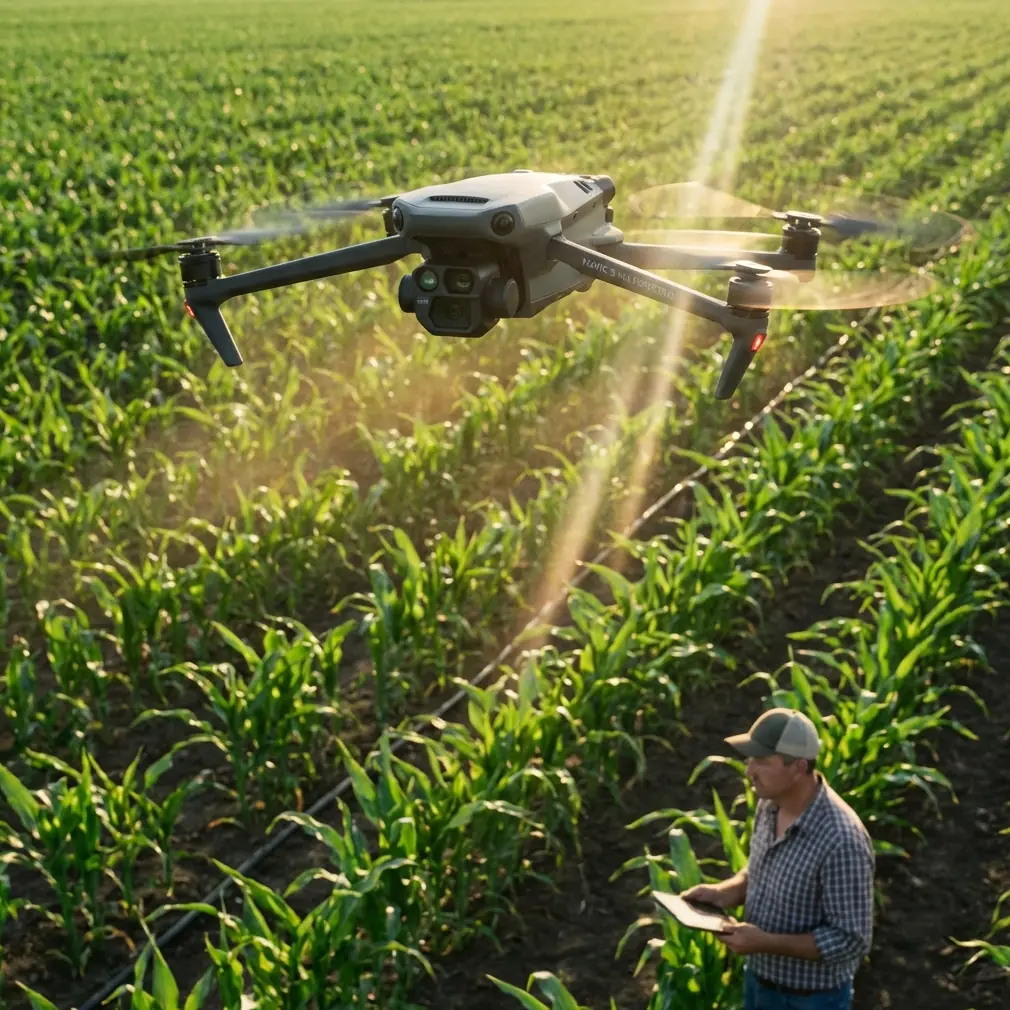
Where the Mavic 4 Pro fits in
The Mavic 4 Pro is not the same aircraft used in that historical mapping case, but the lesson transfers cleanly: when aerial collection is paired with an intelligent workflow, the drone stops being an image-gathering accessory and becomes a field instrument.
For remote vineyard scouting, the Mavic 4 Pro’s value is tied to four practical capabilities.
1. Terrain-aware visual coverage
On sloped vineyard land, obstacle-rich flying is normal rather than exceptional. Tree lines, utility poles, farm buildings, netting systems, windbreaks, and elevation shifts all work against smooth capture. That’s where obstacle avoidance becomes more than a convenience. It reduces pilot workload during route adjustments and low-altitude visual passes, especially when you’re inspecting the transition zones between planted rows, access paths, and structures.
A lot of drone failures in agriculture don’t come from dramatic mistakes. They come from fatigue and divided attention. Anything that helps preserve pilot focus during repeated passes has operational value.
2. Repeatable movement for scouting comparisons
If you’re monitoring a remote property over time, consistency matters as much as image quality. ActiveTrack and subject tracking features may sound creator-oriented on paper, but in field practice they can be useful for maintaining smooth attention on moving vehicles, following an operator through infrastructure zones, or capturing repeatable path-based footage that makes later comparison easier.
The real point is not cinematic polish. It’s continuity. A vineyard manager reviewing footage from different weeks benefits when camera movement is stable and intentional instead of erratic and improvised.
3. Fast overview capture when the site is hard to reach
Some scouting days are about diagnosis. Others are simply about situational awareness. QuickShots and Hyperlapse are often dismissed as social-media tools, but they can be surprisingly useful in professional communication when used correctly. A short orbit of a hillside block, a reveal showing drainage flow from ridge to lower rows, or a compressed time-based view of fog movement across a site can help non-pilots understand the landscape immediately.
That matters when the decision-maker isn’t on location.
Remote vineyards often involve absentee owners, outside agronomists, infrastructure contractors, or export-side stakeholders who need a fast visual briefing. The drone doesn’t just capture evidence; it shortens explanation time.
4. Flexible image grading for difficult light
Vineyard scouting is rarely scheduled around perfect sun angles. You fly when crews are available, when weather breaks, or when a suspected issue needs checking. That means mixed lighting, bright sky, dark rows, reflective surfaces, and scene contrast that can flatten detail if you aren’t careful.
That’s where D-Log enters the conversation. Not because every vineyard scout wants a color grading session, but because a flatter capture profile preserves more room to recover detail in bright and dark areas. When you’re documenting canopy stress patterns, roof conditions on service buildings, erosion marks, or row-end damage near tree cover, that extra post-production flexibility can be the difference between “looks fine” and “there’s the problem.”
The hidden lesson from the Jerusalem project: deliverables matter more than flights
The strongest part of the heritage mapping case wasn’t the aircraft. It was the outcome structure.
The client didn’t just want pictures. They needed a usable package: a terrain map for the whole area, plus building-specific outputs. That’s a mature way to think about drone work. Flights are not the product. Decisions are.
Vineyard operators should approach the Mavic 4 Pro the same way.
Before launch, define what the sortie is supposed to produce:
- a block access review after weather
- a drainage and erosion visual record
- a roof and outbuilding condition check
- a planting layout overview for consultants
- a slope and row relationship briefing for visiting contractors
- a repeatable visual archive for seasonal comparison
Once the output is defined, the flight path, altitude, timing, and camera mode become easier to choose. The scouting mission stops being “let’s see what the drone finds” and becomes “let’s gather exactly what the next decision requires.”
That is the professional mindset behind the heritage case, and it is still the right mindset for the Mavic 4 Pro.
A field-ready accessory can change the aircraft’s usefulness
One thing that often separates casual use from dependable field use is the accessory setup. In remote vineyard work, power and visibility are usually the first two bottlenecks.
A third-party high-bright monitor hood or tablet sunshade can make a larger difference than many pilots expect. In open agricultural terrain, glare is relentless. A shaded viewing setup reduces misreads during framing, improves confidence when checking obstacle spacing near rows or sheds, and cuts the temptation to fly higher than necessary just because the screen is hard to interpret. It’s not glamorous, but it’s one of the simplest ways to improve capture discipline.
I’ve also seen serious productivity gains from a multi-battery charging solution designed for vehicle use between blocks. In remote properties, that can turn a fragmented scouting day into a continuous one. The right accessory doesn’t make the Mavic 4 Pro more advanced. It makes it more usable over a full field shift.
If you’re configuring a vineyard scouting kit and want a practical recommendation rather than a generic checklist, you can message our field team directly on WhatsApp: https://wa.me/85255379740
Why cost efficiency still deserves attention
Some operators avoid cost discussions because they sound too commercial. That’s a mistake. The heritage case puts cost in its proper place: not as a sales talking point, but as an operational enabler.
A workflow that delivered the job at one-seventh the cost of total station surveying and one-fifth the cost of laser scanning changed what was feasible under a public project deadline. That’s the real significance.
For vineyards, the parallel is straightforward. Lower-friction aerial scouting means inspections can happen more often, more consistently, and with less disruption. It becomes easier to justify re-flying after heavy weather, documenting a problem area before contractor visits, or building a seasonal visual record instead of relying on memory and scattered phone photos.
The value isn’t merely saving effort on one mission. It’s creating a workflow that people will actually repeat.
How I’d use a Mavic 4 Pro on a remote vineyard day
If I were setting up a field report workflow with the Mavic 4 Pro, I’d break the day into layers.
First, a high-level pass to understand site conditions: access roads, slope relationships, standing water, visible canopy irregularities, roof conditions, and any obvious obstruction hazards.
Second, targeted lower-altitude passes over the areas that deserve closer review. This is where obstacle avoidance, stable tracking behavior, and careful framing matter most.
Third, a short set of communication-friendly clips for the people who aren’t there. That might include a controlled reveal of the most difficult hillside block, a simple orbit around a utility building, or a Hyperlapse showing changing light or fog over the site. Not for vanity. For clarity.
Fourth, an organized archive. Date everything. Keep file naming consistent. Separate overview sorties from problem-area inspections. If your footage can’t be retrieved and compared later, half its value disappears.
That’s another lesson buried inside the Jerusalem mapping case. Their work had to support future restoration. Vineyard scouting often supports future intervention too—drainage work, access improvements, canopy adjustment, structural maintenance, contractor coordination. The footage earns its keep when it feeds the next step.
The bigger takeaway
The most persuasive argument for the Mavic 4 Pro in remote vineyard scouting is not that it flies well or captures attractive footage. Plenty of drones can claim that.
The stronger argument is that aerial workflows have already proven themselves in tougher documentation environments. An 80,000-square-meter heritage site with 121 buildings, a 90-day completion window, and strict deliverable requirements is not an easy assignment. Yet a DJI-based aerial workflow paired with specialized software beat slower, more expensive ground-led alternatives.
That should get the attention of anyone responsible for remote agricultural land.
Because the same logic applies: when the property is large, terrain is uneven, access is time-consuming, and stakeholders need visual certainty, the right drone workflow isn’t just convenient. It changes how quickly the site can be understood.
For remote vineyards, that’s the real promise of the Mavic 4 Pro. Better scouting, yes. But more importantly, better decisions made earlier, with less wasted movement across the land.
Ready for your own Mavic 4 Pro? Contact our team for expert consultation.