Scouting Windy Vineyards With the Mavic 4 Pro
Scouting Windy Vineyards With the Mavic 4 Pro: A Field Case Study
META: A practical case study on using the Mavic 4 Pro to scout vineyards in windy conditions, with real workflow tips on obstacle avoidance, ActiveTrack, D-Log, Hyperlapse, and accessory setup.
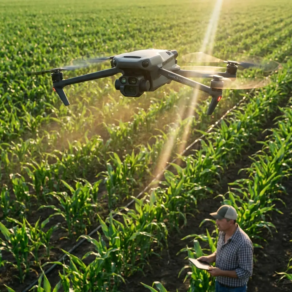
I took the Mavic 4 Pro into a vineyard on a day when the wind never really settled. Not dangerous, but restless enough to expose weak workflows fast. Gusts pushed across the rows, the terrain rolled just enough to complicate line of sight, and the late-afternoon light kept shifting between bright gaps and deep shadow. That combination is exactly where a premium drone either proves its value or becomes a very expensive way to collect shaky footage and incomplete field notes.
This wasn’t a cinematic joyride. The assignment was practical: scout vine health patterns, check row consistency, review canopy gaps, document access conditions, and capture material the vineyard team could use for planning. The aircraft was the Mavic 4 Pro, and the point of the exercise was not simply to get airborne. It was to see how well the platform handled real agricultural observation when the environment refused to cooperate.
Why windy vineyard scouting is harder than it looks
Vineyards create their own kind of flight challenge. From above, they look orderly. In the field, they are full of small complications. Repeating rows can make visual orientation sloppy if you don’t manage your route discipline. Trellis systems, poles, netting, and occasional tree lines demand reliable obstacle avoidance, especially if you’re flying lower to inspect canopy structure. Wind moves differently across the property too. One section might feel manageable, then a gap between slopes channels air into a crosswind that hits the aircraft sideways.
That matters because scouting is not the same thing as shooting a highlight reel. A vineyard manager wants useful data and clear visuals. You need stable passes over representative blocks, repeatable angles, and enough image latitude to compare one area with another. If the drone drifts, overcorrects, or forces you to keep aborting low runs, the mission becomes fragmented. You end up with footage that looks attractive but answers very few operational questions.
The Mavic 4 Pro fits this kind of job because it combines features that matter in the real world: obstacle avoidance for flying near structured rows, subject tracking for moving vehicle follow shots, QuickShots for fast overview assets, Hyperlapse for time-based terrain context, and D-Log for preserving tonal detail when you need to evaluate conditions across difficult light. On paper, that’s familiar language. In the vineyard, each one solves a specific problem.
Pre-flight: building a workflow for unstable air
Before launch, I mapped out three categories of capture.
First, high-altitude overview passes to understand the shape of the property and identify exposure differences between blocks.
Second, medium-altitude row runs to inspect canopy uniformity and spot visible irregularities in growth, irrigation expression, and access paths.
Third, low, carefully controlled passes for marketing-grade visuals that still carried operational value. These are the shots owners often want for internal presentations, investor updates, and agritourism content, but they also help reveal row spacing consistency and ground condition.
I also added one accessory that made a bigger difference than many pilots expect: a third-party landing pad with weighted edges. That sounds minor until you’re operating in a vineyard with loose dust, dry leaves, and gusts. A stable launch and recovery surface reduces rotor wash contamination on takeoff and keeps debris away from the gimbal during landing. In agricultural environments, that’s not cosmetic. Fine dust and organic particles have a way of finding exactly the wrong moving parts.
I also mounted a third-party sun hood for the controller display. Again, simple accessory, meaningful result. In bright vineyard light, especially when you’re evaluating row detail rather than just aircraft position, screen visibility matters. Better monitoring leads to better decisions on framing, route adjustment, and obstacle spacing.
The first test: holding composition in moving air
The first passes were broad orbits and lateral drifts over several blocks to establish a visual baseline. This is where windy conditions usually reveal whether your plan is realistic. The Mavic 4 Pro stayed composed enough to maintain usable framing without constant pilot fight. That doesn’t mean wind disappears. It means the aircraft lets you focus on the mission instead of spending the entire flight correcting for every gust.
That distinction matters for vineyard scouting because consistency is everything. If you’re trying to compare one block to another, your footage needs a repeatable visual language. Similar altitude. Similar angle. Similar speed. Similar camera movement. Stable flight gives you that repeatability.
The obstacle avoidance system became relevant sooner than expected. One edge of the property had taller vegetation and service structures near the rows. On a calmer day, I might have flown a tighter manual path with less margin. In active wind, I prefer extra caution. The drone’s obstacle sensing allowed me to preserve a lower, more informative route while maintaining a healthier buffer around vertical hazards. In agricultural work, that is not just about avoiding impact. It also helps you keep the camera where it needs to be rather than climbing too high and losing detail every time the environment gets tighter.
ActiveTrack in a vineyard is not just for flashy footage
One of the more useful sequences involved following a utility vehicle moving slowly along a service track between vine blocks. This is where ActiveTrack earns its keep in a commercial setting. Most people hear “tracking” and think social media footage. In a vineyard, tracked follow shots can document access conditions, road quality, turnaround constraints, and relative spacing between vehicle lanes and planted rows.
I used ActiveTrack to maintain a clean follow while keeping enough altitude to preserve context. In gusty conditions, that removed some of the burden of manually balancing aircraft position, subject framing, and route awareness at the same time. You still supervise the system closely, especially around poles and edge vegetation, but the automation reduces workload.
Operationally, this is significant for two reasons. First, it helps produce footage that managers can actually use to evaluate movement through the site. Second, it frees attention for environmental monitoring. In other words, instead of hand-flying every micro-adjustment, you can spend more bandwidth watching wind behavior, checking margins around obstacles, and deciding whether to continue or reposition.
D-Log was the difference between pretty footage and useful footage
The light changed all afternoon. Sun would break through, then a cloud shadow would flatten one section while another stayed bright. Vineyard rows exaggerate these shifts because repetitive geometry creates alternating bands of highlight and shadow. If you shoot without enough tonal flexibility, you can lose subtle canopy differences fast.
This is where D-Log mattered. I wasn’t using it to chase a dramatic grade. I used it because scouting footage often has to do more than look polished. It has to preserve information. D-Log gave me more room to hold detail in bright sky, reflective leaf surfaces, and darker row interiors at the same time. That made later review far more useful when comparing areas with different exposure.
For teams that combine operational scouting with content production, this is one of the strongest reasons to treat camera settings as part of mission design. A flatter profile takes a bit more care in post, but it can save a flight from becoming visually misleading. If one block appears healthier or denser simply because the highlights clipped or shadows crushed, your footage becomes less trustworthy.
QuickShots and Hyperlapse have a place in serious field work
There is a tendency to separate “creative modes” from “professional use.” That’s too simplistic. QuickShots can be valuable when you need fast, repeatable establishing visuals without burning battery on manual experimentation. A short automated reveal at the start of a reporting package helps orient stakeholders immediately. They see slope, row direction, adjacent access roads, and neighboring vegetation in a few seconds.
Hyperlapse was even more interesting. I used it to show cloud shadow movement across part of the vineyard over time. For a vineyard team, that kind of sequence can add context to discussions about light exposure, block variation, and the difference between a single still image and an evolving field condition. It won’t replace agronomic analysis, but it can sharpen conversations around site behavior.
That is the larger point with these modes. They are not frivolous if used with intent. They compress context. In industries like agriculture, context is often what turns an isolated image into a decision-making tool.
Wind changes your flight priorities
The biggest lesson from the day was not about any single feature. It was about priority order.
In calm weather, pilots often chase the best-looking route first and safety buffer second. In wind, that order reverses. You build a route that tolerates drift, leaves room for corrections, and respects the fact that vineyard edges can hide surprises. The Mavic 4 Pro supported that style of flying well because it gave me enough confidence in obstacle awareness and tracking behavior to stay productive without forcing overly conservative altitude all day.
I also adjusted battery planning more aggressively than I would on a calm survey run. Windy flights are deceptive. Even when the drone appears to be handling conditions well, energy use can climb when it is constantly compensating, especially on return legs. My rule on this job was simple: finish useful work early in each battery cycle and leave recovery margin untouched. That matters more in vineyards with rolling terrain, where a shift in wind direction can make the trip back less efficient than the outbound segment.
What the vineyard team actually cared about
After the flight, the most appreciated material was not the most dramatic clip. It was a set of stable, medium-altitude passes that clearly showed variation between rows and highlighted a few sections worth ground inspection. The tracked utility-vehicle sequence also proved useful because it illustrated access limitations better than a verbal description would have.
That’s worth underlining. Drone work for vineyards succeeds when it reduces uncertainty. The Mavic 4 Pro helped do that by combining stable flight, intelligent assistance, and flexible capture modes in a package that could adapt to changing wind and light without turning the mission into a technical struggle.
The output also had a second life. Because the footage was captured with enough discipline, some of it could be repurposed for communications without compromising the operational mission. That blend matters to vineyards. One flight can support field planning, stakeholder reporting, and brand storytelling if the pilot understands how to structure the capture from the start.
A practical setup I’d use again
If I were repeating this exact vineyard mission, I’d keep the same basic package:
- Mavic 4 Pro as the primary aircraft
- Weighted third-party landing pad for cleaner takeoff and recovery
- Third-party screen hood for better controller visibility in bright light
- D-Log for high-contrast periods
- ActiveTrack for controlled follow sequences on internal tracks
- Obstacle avoidance enabled for lower row-adjacent work
- QuickShots and Hyperlapse used selectively for orientation and environmental context
That combination created a workflow that felt deliberate rather than improvised. In windy agricultural scouting, that’s half the battle.
If you’re planning a similar vineyard operation and want to compare field setups or accessories, you can message us directly on WhatsApp.
Final assessment
The Mavic 4 Pro handled the vineyard the way a serious field drone should: not by erasing the challenges, but by making them manageable enough that the operator could keep thinking about the mission. Obstacle avoidance reduced the stress of flying near structured rows and edge hazards. ActiveTrack turned a follow sequence into something operationally useful rather than merely stylish. D-Log preserved the visual integrity of scenes that would have fallen apart under shifting sun and shadow. QuickShots and Hyperlapse added context without wasting flight time.
For windy vineyard scouting, that combination has real value. You get a drone that can document the landscape, follow movement through the property, protect image quality in mixed light, and maintain control discipline when the air is unsettled. That is what matters in the field. Not the spec sheet by itself. The outcome.
Ready for your own Mavic 4 Pro? Contact our team for expert consultation.