Mavic 4 Pro for Low-Light Solar Farm Scouting
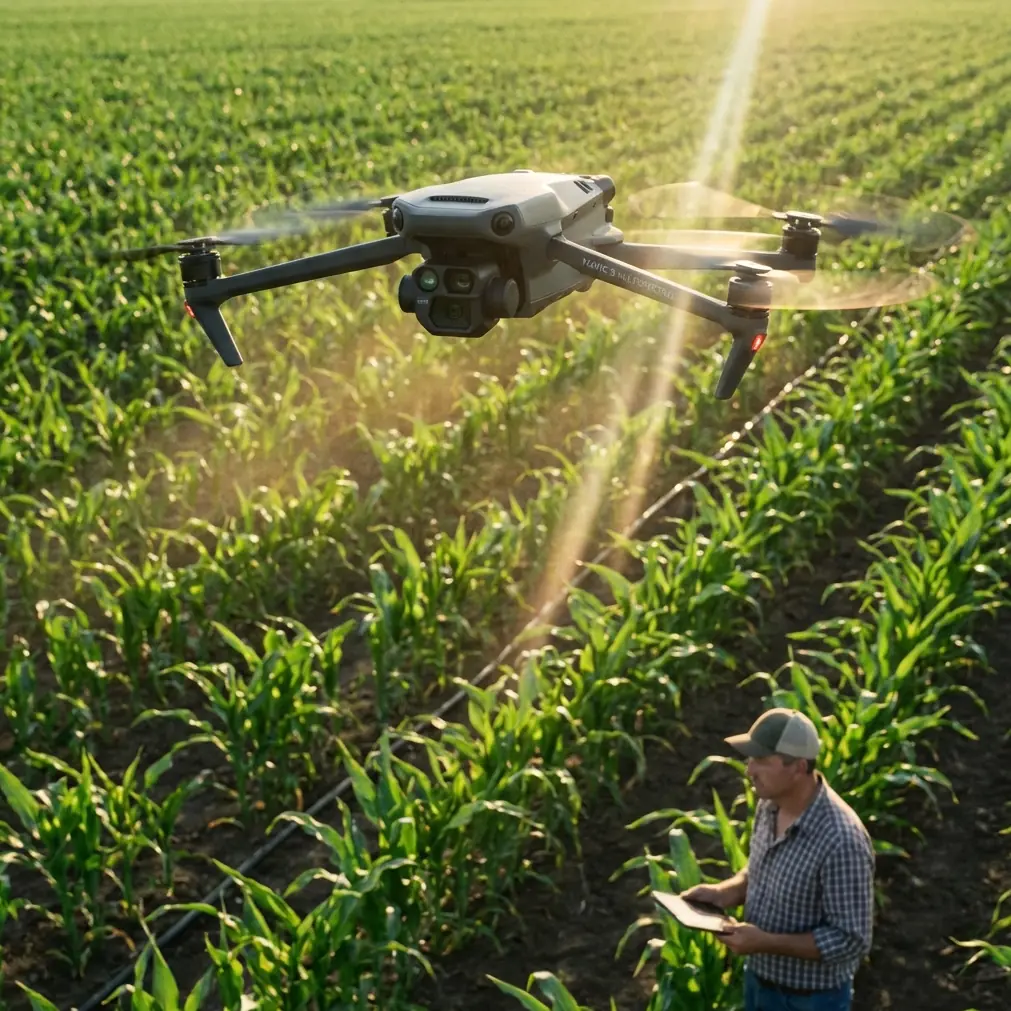
Mavic 4 Pro for Low-Light Solar Farm Scouting: A Field Method That Holds Up When Weather Turns
META: Practical expert guide to using Mavic 4 Pro for low-light solar farm scouting, with workflow tips on obstacle avoidance, ActiveTrack, D-Log, Hyperlapse, and handling sudden weather changes.
I’ve spent enough dawn and dusk flights around utility-scale sites to know that solar farms can look simple from the road and become surprisingly demanding once you’re in the air. Long rows repeat into the distance. Access roads cut hard lines through the site. Tracker systems create subtle visual shifts that matter. And when you’re scouting in low light, the margin for error narrows fast.
That’s where the Mavic 4 Pro becomes interesting—not as a spec-sheet trophy, but as a practical aircraft for identifying layout issues, access constraints, drainage concerns, row consistency, shading encroachment, and maintenance planning before the light fully comes up or after it starts to fall away.
This guide is built around one real operational scenario: scouting solar farms in dim conditions while the weather shifts mid-flight. That combination is exactly where good camera craft and disciplined flight planning matter more than marketing language.
Why low-light solar scouting is different
A solar farm at midday gives you obvious contrast, harsh reflections, and easy line definition. At dawn, dusk, or under a weather front, the site behaves differently. Contrast softens. Perimeter fencing blends into the ground. Service vehicles can disappear into muted backgrounds. Panel rows become harder to separate visually, especially across a very large footprint.
For a photographer’s eye, low light can be useful. You get fewer blown highlights and often better surface texture. For an operator, though, it raises three questions immediately:
- Can the drone maintain stable situational awareness?
- Can the camera preserve enough detail for later review?
- Can the link and flight plan survive changing conditions?
Those are the right questions to ask with a Mavic 4 Pro workflow.
Start with the site logic, not the drone menu
Before takeoff, define the purpose of the scout. On a solar farm, low-light missions usually fall into one of these buckets:
- Pre-maintenance visual overview
- Construction progress documentation
- Access-road and drainage assessment
- Perimeter and vegetation encroachment review
- Panel row consistency and staging observations
- Marketing or stakeholder imagery captured during operational scouting
The Mavic 4 Pro can support all of these, but the flight pattern changes depending on the goal. If you treat every job like a cinematic free-flight, you’ll miss operational details.
My preferred structure is simple:
- One high, slow establishing pass
- One medium-altitude row alignment pass
- One perimeter sweep
- One low-altitude detail sequence where safe and legal
- One short reserve window for anything the first passes reveal
That reserve window matters. On a large site, the thing you need often appears only after you review the geometry from above.
A note from industrial UAV practice that still matters here
The reference material behind this article comes from a drone solution for oil pipeline inspection, and while the platform class is different, the operational discipline transfers well to solar work.
Two details stand out.
First, the source describes endurance around 4 hours, cruise speed of 80–140 km/h, and payload support in the 6–8 kg range. A Mavic 4 Pro is obviously not that kind of heavy industrial aircraft, but those numbers highlight how infrastructure inspection has traditionally been built around range, persistence, and mission continuity. For solar farm scouting with a compact platform, the lesson is not to imitate those numbers—it’s to design your mission so each battery segment has a clear purpose. In other words, fly like an inspection professional, not like someone looking for pretty angles.
Second, the source specifies communication relay approaches, including ground-fixed relay and multi-point relay, plus transmission parameters reaching up to 40 km directional and 8 km omnidirectional under that system. Again, the Mavic 4 Pro is a different tool, but the operational significance is huge: link reliability is part of mission quality. On sprawling energy sites, line-of-sight management, antenna orientation, and takeoff position can make the difference between a clean survey and a disrupted one. Even with a prosumer airframe, don’t underestimate site topology, inverter blocks, containers, or tree lines that interfere with signal behavior.
That industrial mindset is what makes a small drone workflow genuinely useful on large civilian assets.
Camera setup for low-light solar farm scouting
Low-light aerial work over reflective surfaces is a balancing act. Solar panels can swallow detail in shadow and still throw highlights when the angle shifts. I usually start with the following priorities:
1. Record for review, not just for immediate punch
If I expect stakeholders to inspect the footage later, I shoot in D-Log. That gives more room to balance the scene in post, especially when the sky is still brighter than the panel field. In these conditions, a flatter profile is less about “cinematic look” and more about preserving information across the frame.
2. Keep movement deliberate
A solar farm benefits from smooth, readable camera motion. Quick yaw changes make row analysis harder. Slow forward passes, measured lateral slides, and controlled ascents tell the story better. If I need social-ready cutaways later, that’s when QuickShots can help—briefly and selectively. But the scouting mission comes first.
3. Use Hyperlapse only when it answers a real question
Hyperlapse is useful on solar sites when you want to show cloud movement, shifting ambient light, crew movement, or progress rhythm across a broad footprint. It is not a substitute for inspection-style coverage. I use it as a finishing layer, not as the core deliverable.
Obstacle avoidance matters more than people assume on solar sites
When people hear “solar farm,” they think open terrain. That’s partially true. It’s also misleading.
You may have:
- Tracker rows at varying angles
- Perimeter fencing
- Monitoring masts
- Weather stations
- Poles and utility runs
- Storage containers
- Temporary construction equipment
- Uneven terrain near drainage channels
In low light, visual separation can flatten. That’s why obstacle avoidance is not just a convenience feature here. It’s a fatigue reducer. It helps when you’re threading a careful route near edge infrastructure or adjusting your angle while concentrating on row continuity.
Still, no one should fly a site like this assuming sensors make risk disappear. Low light compresses confidence. The safer approach is to use avoidance as backup while maintaining conservative spacing from all structures.
ActiveTrack and subject tracking on a solar farm
A lot of pilots think ActiveTrack or subject tracking only belongs in lifestyle shooting. That misses one of its best practical uses on industrial property: keeping a moving maintenance vehicle, utility cart, or site lead centered while you document route access, road condition, or work progression.
Let’s say a technician is driving from one inverter station to another before sunrise. If you use ActiveTrack intelligently, you can maintain a consistent visual relationship between the vehicle and surrounding infrastructure. That tells a far clearer story than random follow shots. You’re documenting site usability, not just motion.
The key is restraint. Don’t run subject tracking through cluttered zones or in marginal visibility where manual control gives you cleaner oversight. Use it where it improves continuity, then disengage when the site geometry gets tight.
What happened when the weather changed mid-flight
One recent low-light scout started under calm conditions with a thin layer of early haze. Ten minutes in, the light dipped harder than expected as a weather band moved across the site. The panel rows lost separation, and the horizon went flat. Then the wind picked up—not violent, but enough to change the tone of the mission.
This is the exact moment where amateurs chase the shot and professionals reassess.
I shortened the outer perimeter leg and shifted from an ambitious low, lateral run to a slightly higher, more conservative route. The Mavic 4 Pro stayed composed, and that matters. Stability in changing conditions isn’t only about aircraft confidence; it protects image readability. Small oscillations become very obvious when you’re filming repetitive row structures.
I also leaned more heavily on obstacle awareness during the return side of the route because the darker background was swallowing site-edge detail. The drone’s ability to maintain controlled flight while the weather turned gave me enough margin to finish the key passes without pushing the mission into avoidable risk.
The lesson wasn’t that technology solved everything. It was that the aircraft gave me the room to make better decisions after conditions changed.
Build a smarter flight path for low light
If you’re scouting a solar farm with the Mavic 4 Pro, this sequence works well:
High establishing pass
Climb to a safe altitude and map the site visually. This is where you identify:
- Row orientation
- Access-road condition
- Standing water or drainage patterns
- Perimeter interruptions
- Construction staging zones
Mid-level row analysis
Descend to an altitude where row geometry becomes legible without getting too close to fixed site infrastructure. Fly parallel passes. Keep speed consistent. This is the most useful segment for operations teams reviewing site coherence.
Perimeter review
Trace the outer edges where vegetation, erosion, fencing, and access points often tell the real story. Low light can hide these details, so avoid rushing.
Targeted detail captures
Now use the flexible features. If a service truck is moving through muddy access lanes, subject tracking can help. If stakeholder reporting needs a short visual summary, capture a restrained QuickShot or brief Hyperlapse at the end.
Reserve for weather or rediscovery
Always leave enough battery and focus to revisit something. Large sites reward second looks.
Image transmission and why positioning still matters
The source material mentions a video transmission system using COFDM and 16QAM, adjustable channel bandwidth from 2M to 8M, and support for HD1080 60P input. Those are industrial transmission details, but they point to a principle many small-drone operators forget: image quality is only useful if the live view remains dependable enough for confident decision-making.
On a solar farm, your launch point affects more than convenience. A poor position can create weak visibility over long row corridors or around site-edge elevation changes. If the property is large, choose a takeoff area that preserves clean sightlines into the longest and most critical leg of the mission.
That’s a direct carryover from larger inspection systems. Good communication architecture starts before takeoff, even when you’re flying a compact drone.
If your team is planning repeat site scouting workflows and wants a practical setup discussion, I’d suggest sending your mission outline through this direct WhatsApp channel so the route, terrain, and reporting needs can be reviewed against the aircraft’s actual role.
Post-flight: what to check before you leave the site
Do not pack up after a quick glance at the screen.
Review for:
- Row legibility across the full field
- Shadow detail in problem areas
- Perimeter completeness
- Access-road visibility
- Any missed transition zones between arrays and infrastructure
- Tracking shot stability if ActiveTrack was used
- Color headroom if you captured in D-Log
This is where the difference between “nice footage” and “useful scouting data” becomes obvious.
The bigger takeaway
The Mavic 4 Pro makes sense for low-light solar farm scouting when you treat it as a disciplined documentation tool. The camera features help, yes. D-Log preserves room for analysis. ActiveTrack can improve continuity when documenting vehicle movement. Obstacle avoidance reduces workload when the site gets visually muddy. QuickShots and Hyperlapse add presentation value when used sparingly.
But the real advantage comes from borrowing the mindset of larger infrastructure inspection programs. The reference material behind this discussion comes from pipeline operations that emphasize endurance, relay-based communications, and standards-led execution. Even though a compact drone lives in a different category, those same habits elevate the mission: plan the link, define each flight segment, preserve margin, and adapt quickly when weather changes.
That’s what turned my last dim-light solar scout from a potentially compromised session into a usable one. The weather shifted. The light collapsed earlier than expected. The route tightened. And the aircraft still gave me enough control and clarity to come back with material the client could actually use.
Ready for your own Mavic 4 Pro? Contact our team for expert consultation.