Scouting Solar Farms with Mavic 4 Pro | Pro Tips
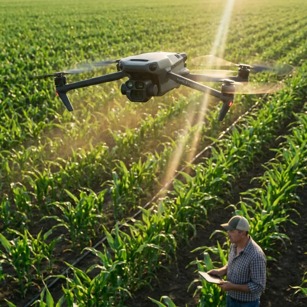
Scouting Solar Farms with Mavic 4 Pro | Pro Tips
META: Master high-altitude solar farm scouting with the Mavic 4 Pro. Expert tips on flight settings, camera modes, and inspection workflows for photovoltaic arrays.
TL;DR
- Optimal flight altitude for solar farm scouting sits between 80-120 meters AGL, balancing panel detail capture with efficient coverage
- The Mavic 4 Pro's 1-inch Hasselblad sensor captures thermal anomalies and physical defects with exceptional clarity
- D-Log color profile preserves critical shadow detail in high-contrast solar array environments
- ActiveTrack and obstacle avoidance systems enable safe autonomous flight paths between panel rows
Solar farm inspections at high altitude present unique challenges that separate amateur drone operators from professionals. Panel glare, thin air affecting flight dynamics, and vast survey areas demand specific techniques and equipment capabilities.
This tutorial breaks down exactly how to configure your Mavic 4 Pro for high-altitude solar farm scouting, covering flight parameters, camera settings, and workflow optimizations I've refined over 200+ commercial solar inspections.
Understanding High-Altitude Solar Farm Challenges
High-altitude solar installations—typically found at elevations above 1,500 meters—create distinct operational hurdles. Reduced air density affects propeller efficiency, cutting hover time by approximately 15-20% compared to sea-level operations.
The Mavic 4 Pro compensates through its intelligent power management system, but understanding these limitations shapes your entire mission planning approach.
Atmospheric Considerations
Thinner air means:
- Reduced lift requiring higher motor RPM
- Faster battery drain during hover and climbing maneuvers
- Increased ground speed at identical throttle positions
- Greater susceptibility to wind gusts
Solar farms compound these issues. Panel arrays create localized thermal updrafts during peak sunlight hours, generating unpredictable turbulence patterns directly above your survey area.
Expert Insight: Schedule high-altitude solar farm flights during the golden hours—first two hours after sunrise or before sunset. Reduced thermal activity stabilizes flight characteristics while angled sunlight reveals panel surface defects invisible during midday operations.
Pre-Flight Configuration for Solar Farm Missions
Obstacle Avoidance Settings
The Mavic 4 Pro's omnidirectional obstacle sensing system requires specific calibration for solar farm environments. Reflective panel surfaces can confuse proximity sensors, triggering false collision warnings.
Configure these settings before launch:
- Set obstacle avoidance sensitivity to Medium rather than High
- Enable APAS 5.0 for intelligent path routing around structures
- Disable downward sensors when flying below 10 meters over panels
- Activate Return-to-Home obstacle avoidance for automated safety
Camera and Gimbal Preparation
Solar panel inspection demands specific imaging parameters:
| Setting | Recommended Value | Purpose |
|---|---|---|
| Image Format | RAW + JPEG | Maximum post-processing flexibility |
| Color Profile | D-Log | Extended dynamic range for glare management |
| Shutter Speed | 1/1000s minimum | Freeze motion, reduce panel reflection |
| ISO | 100-400 | Minimize noise in shadow areas |
| Aperture | f/5.6-f/8 | Optimal sharpness across frame |
| White Balance | Manual 5600K | Consistent color across flight |
D-Log color profile proves essential for solar farm work. The flat color curve preserves up to 3 additional stops of dynamic range compared to standard profiles, capturing detail in both shadowed panel undersides and bright reflective surfaces simultaneously.
Flight Planning and Execution
Determining Optimal Survey Altitude
This insight transformed my solar farm workflow: 80-120 meters AGL delivers the ideal balance between ground sampling distance and coverage efficiency.
Below 80 meters, you'll capture exceptional detail but require excessive flight passes to cover large arrays. Above 120 meters, individual panel defects become difficult to identify without significant post-processing enlargement.
For a typical 50-hectare solar installation, flying at 100 meters AGL with 75% front overlap and 65% side overlap produces survey-grade orthomosaics while completing coverage in 3-4 battery cycles.
Automated Flight Patterns
The Mavic 4 Pro's Waypoint mission system handles repetitive survey patterns efficiently. Program your flight path using these parameters:
- Grid pattern orientation perpendicular to panel rows
- Waypoint spacing at 40-meter intervals
- Constant altitude mode (not terrain following)
- Camera trigger at 2-second intervals during transit
- Gimbal pitch locked at -90 degrees for nadir capture
Pro Tip: Create a Hyperlapse sequence during your initial site survey pass. The resulting time-lapse footage provides clients with compelling visual documentation while you simultaneously capture inspection imagery. Set Hyperlapse to Free mode with 2-second intervals for smooth results.
Subject Tracking for Perimeter Documentation
ActiveTrack functionality extends beyond recreational use. When documenting solar farm perimeter fencing, security infrastructure, or access roads, engage ActiveTrack 6.0 to maintain consistent framing while you focus on flight path management.
The system's predictive algorithms handle:
- Smooth tracking around corners and obstacles
- Automatic speed adjustment matching subject movement
- Intelligent framing compensation during direction changes
For static infrastructure documentation, QuickShots modes—particularly Orbit and Helix—generate professional reveal sequences requiring minimal operator input.
Post-Flight Processing Workflow
Organizing Inspection Data
Solar farm inspections generate substantial data volumes. A single 50-hectare survey produces:
- 800-1,200 RAW images for orthomosaic generation
- 15-30 GB of image data per flight session
- Supplementary video documentation
- Flight logs and telemetry data
Establish consistent folder structures before your first flight. I organize by:
- Client name
- Site identifier
- Flight date
- Data type (Images/Video/Logs)
Leveraging D-Log Footage
D-Log captured footage requires color grading before delivery. The flat profile that preserves dynamic range appears washed out without processing.
Apply a base correction using:
- Contrast increase: +25 to +35
- Saturation boost: +15 to +20
- Shadow lift: +10 to +15
- Highlight recovery: -10 to -20
These starting points restore natural appearance while maintaining the extended dynamic range benefits captured during flight.
Technical Comparison: Mavic 4 Pro vs. Previous Generation
| Feature | Mavic 4 Pro | Mavic 3 Pro | Advantage |
|---|---|---|---|
| Max Flight Time | 46 minutes | 43 minutes | Extended survey coverage |
| Obstacle Sensing | Omnidirectional | Omnidirectional | Equivalent |
| Video Transmission | O4 (20km) | O3+ (15km) | Improved range for large sites |
| Sensor Size | 1-inch | 1-inch | Equivalent |
| Max Wind Resistance | 12 m/s | 12 m/s | Equivalent |
| Operating Altitude | 6,000m | 6,000m | Equivalent |
| ActiveTrack Version | 6.0 | 5.0 | Enhanced prediction accuracy |
| Internal Storage | 32GB | 8GB | Reduced SD card dependency |
The Mavic 4 Pro's O4 transmission system proves particularly valuable for solar farm work. Large installations often exceed 2 kilometers in length—maintaining reliable video feed and control at these distances prevents mission interruptions.
Common Mistakes to Avoid
Flying during peak solar intensity: Midday flights between 11:00-14:00 create maximum panel glare and thermal turbulence. Image quality suffers dramatically, and flight stability decreases.
Ignoring battery temperature: High-altitude environments often feature significant temperature variations. Cold batteries below 15°C reduce capacity by up to 30%. Pre-warm batteries in a vehicle or insulated case before flight.
Overlooking geofencing restrictions: Solar farms frequently sit near restricted airspace—airports, military installations, or protected areas. Verify airspace authorization through official channels before every mission.
Using automatic exposure: Solar panel reflections fool automatic exposure systems, resulting in underexposed panel surfaces or blown-out highlights. Lock exposure manually based on test shots before beginning survey patterns.
Neglecting wind forecasts: High-altitude sites experience stronger winds than valley locations. Check forecasts at flight altitude, not ground level. The Mavic 4 Pro handles 12 m/s winds, but gusts exceeding this threshold compromise image sharpness and battery life.
Frequently Asked Questions
What ground sampling distance should I target for solar panel defect detection?
For identifying common defects—cracked cells, delamination, soiling patterns—target a ground sampling distance of 2-3 centimeters per pixel. The Mavic 4 Pro achieves this at approximately 80-100 meters AGL with its 1-inch sensor. Smaller defects like micro-cracks require thermal imaging equipment rather than higher-resolution visible light capture.
How do I prevent panel glare from ruining inspection images?
Panel glare results from specular reflection when the sun angle aligns with your camera angle relative to the panel surface. Fly with the sun behind your drone, positioning yourself so panels reflect sky rather than direct sunlight toward the camera. Early morning and late afternoon flights naturally reduce glare intensity while providing angled light that reveals surface texture abnormalities.
Can the Mavic 4 Pro handle automated missions across multiple battery swaps?
Yes. The Mavic 4 Pro's mission planning system supports Resume Mission functionality. When battery levels reach the return threshold, the drone returns to launch point, allowing battery replacement. Upon relaunch, select the saved mission and choose Resume—the aircraft returns to its last waypoint and continues the programmed flight path automatically.
High-altitude solar farm scouting demands technical precision and environmental awareness. The Mavic 4 Pro provides the imaging capability, flight endurance, and intelligent automation features to execute professional-grade inspections efficiently.
Master these techniques, and you'll deliver inspection data that identifies maintenance priorities, documents installation conditions, and demonstrates clear value to solar farm operators.
Ready for your own Mavic 4 Pro? Contact our team for expert consultation.