Scouting Guide: Mavic 4 Pro for High-Altitude Solar Farms
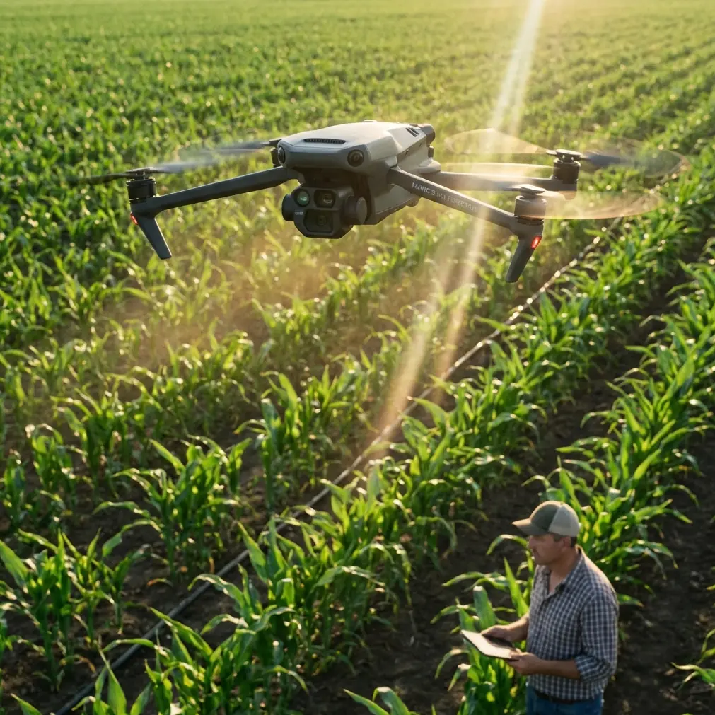
Scouting Guide: Mavic 4 Pro for High-Altitude Solar Farms
META: Master high-altitude solar farm scouting with the Mavic 4 Pro. Expert tips on obstacle avoidance, D-Log settings, and pre-flight protocols for reliable inspections.
TL;DR
- Pre-flight sensor cleaning is non-negotiable at high-altitude solar installations where dust accumulation compromises obstacle avoidance systems
- The Mavic 4 Pro's omnidirectional sensing system handles the complex geometry of solar panel arrays with remarkable precision
- D-Log color profile captures critical detail in high-contrast environments where reflective panels meet shadowed infrastructure
- ActiveTrack and subject tracking features enable single-operator scouting missions across expansive solar installations
The Pre-Flight Step That Saves Missions
Before any high-altitude solar farm scout, I spend exactly three minutes on a step most pilots skip: cleaning every obstacle avoidance sensor on the Mavic 4 Pro.
At elevation, fine particulate matter accumulates faster than you'd expect. Solar installations compound this problem—panels create micro-weather patterns that lift dust into concentrated pockets around infrastructure. A single smudged sensor can trigger false obstacle warnings or, worse, fail to detect guy wires and support structures.
My cleaning protocol uses a microfiber lens cloth and compressed air canister rated for electronics. I address all sensing surfaces: forward, backward, lateral, upward, and downward. This three-minute investment has prevented countless aborted missions and potential collisions with the thin cables that crisscross solar farm perimeters.
Expert Insight: At altitudes above 7,000 feet, air density drops enough to affect both drone performance and sensor accuracy. The Mavic 4 Pro compensates well, but clean sensors give the obstacle avoidance system the best possible data to work with.
Why High-Altitude Solar Farms Demand Specialized Approach
Solar installations at elevation present a unique combination of challenges that stress both pilot skills and equipment capabilities.
Thin air reduces lift efficiency. The Mavic 4 Pro's motors work harder to maintain altitude, which affects battery consumption and flight time. At 8,500 feet—a common elevation for mountain solar installations—expect roughly 15-20% reduction in total flight time compared to sea-level operations.
Temperature swings are extreme. Morning scouting missions might start at 45°F and end at 75°F within a two-hour window. These rapid changes affect battery chemistry and can cause condensation on optical systems if you're not careful about equipment storage.
Reflective surfaces create navigation complexity. Solar panels bounce sunlight in unpredictable patterns, occasionally confusing visual positioning systems. The Mavic 4 Pro handles this better than previous generations, but understanding the limitation helps you plan flight paths that minimize exposure to direct panel reflections.
The Geometry Problem
Solar farms aren't flat. Panel arrays tilt at precise angles, support structures create vertical obstacles at irregular intervals, and maintenance roads cut through installations in patterns that don't match satellite imagery.
Subject tracking becomes essential for efficient scouting. Rather than manually piloting every meter of inspection route, I program waypoints and let the Mavic 4 Pro's tracking systems handle smooth transitions between areas of interest.
Equipment Configuration for Solar Farm Scouting
The Mavic 4 Pro arrives ready for consumer use, but professional solar farm scouting requires specific configuration adjustments.
Camera Settings That Capture Usable Data
D-Log is mandatory for solar installations. The dynamic range challenge is severe—you're capturing detail in shadowed inverter housings while simultaneously exposing for sun-blasted panel surfaces. D-Log preserves approximately 2.5 additional stops of highlight and shadow information compared to standard color profiles.
My base configuration:
- ISO 100 (native sensitivity, minimal noise)
- Shutter speed 1/500 minimum (eliminates motion blur during tracking shots)
- Aperture f/4-f/5.6 (balances sharpness with depth of field)
- White balance 5600K (matches typical high-altitude daylight)
Obstacle Avoidance Configuration
For solar farm work, I modify the default obstacle avoidance behavior:
| Setting | Default | Solar Farm Config | Rationale |
|---|---|---|---|
| Avoidance Mode | Brake | Bypass | Allows continued mission progress around minor obstacles |
| Detection Range | 15m | 25m | Earlier warning for thin cables and guy wires |
| Downward Sensing | Standard | Enhanced | Critical for low-altitude panel inspection passes |
| Return-to-Home Altitude | 30m | 50m | Clears all infrastructure during emergency returns |
Pro Tip: Disable obstacle avoidance entirely only when you have direct visual contact and are performing precision maneuvers around known structures. The three seconds it takes to toggle the setting is worth the safety margin.
Flight Planning for Comprehensive Coverage
Efficient solar farm scouting requires systematic coverage patterns that capture all infrastructure while minimizing battery swaps.
The Grid-Plus-Perimeter Method
I've developed a hybrid approach that combines automated grid coverage with manual perimeter inspection:
Phase 1: Automated Grid (60% of flight time)
- Program parallel flight lines at 80-foot altitude
- Set 70% front overlap and 65% side overlap for photogrammetry compatibility
- Enable Hyperlapse capture at 2-second intervals for time-compressed documentation
Phase 2: Perimeter Sweep (25% of flight time)
- Manual flight along fence lines and access roads
- 40-foot altitude for detail capture
- ActiveTrack engaged on infrastructure elements requiring close inspection
Phase 3: Point-of-Interest Documentation (15% of flight time)
- QuickShots orbital captures around inverter stations
- Static hover documentation of junction boxes and monitoring equipment
- Low-altitude passes over any anomalies identified during grid coverage
Battery Management at Altitude
High-altitude operations demand conservative battery protocols:
- Land at 30% remaining (not the typical 20%)
- Warm batteries to 70°F minimum before flight
- Rotate through three battery sets to allow adequate cooling between uses
- Never charge immediately after flight—wait 15 minutes for cell temperature stabilization
ActiveTrack and Subject Tracking for Solo Operations
Most solar farm scouting happens with a single operator. The Mavic 4 Pro's tracking capabilities make this practical for installations that would otherwise require a two-person team.
Tracking Infrastructure Elements
ActiveTrack locks onto high-contrast subjects reliably. For solar farm work, this means:
- Inverter housings (excellent tracking due to distinct shape and color)
- Perimeter fencing (good tracking along linear features)
- Access vehicles (useful for documenting road conditions during drive-throughs)
- Maintenance personnel (when coordinating with ground crews)
Tracking Limitations to Understand
The system struggles with:
- Individual solar panels (too similar to adjacent panels, tracking jumps between subjects)
- Thin cables and wires (insufficient visual contrast for reliable lock)
- Moving shadows (can confuse the tracking algorithm in late afternoon light)
When tracking fails, the Mavic 4 Pro defaults to hover rather than continuing on an errant path. This fail-safe behavior prevents most tracking-related incidents, but you should always maintain visual contact and manual override readiness.
Common Mistakes to Avoid
Ignoring wind patterns around panel arrays. Solar installations create localized turbulence as air flows over and around tilted panels. The Mavic 4 Pro handles gusty conditions well, but sudden altitude drops near panel edges can surprise pilots who aren't anticipating them.
Flying during peak reflection hours. Between 10 AM and 2 PM, panel reflections are most intense and most likely to interfere with visual positioning. Schedule scouting missions for early morning or late afternoon when sun angles reduce direct reflection into camera and sensor systems.
Underestimating mission duration. High-altitude battery drain, combined with the extensive coverage requirements of solar installations, means missions take 40-50% longer than equivalent sea-level operations. Plan accordingly and bring more batteries than you think you'll need.
Skipping the sensor cleaning protocol. I've watched experienced pilots lose entire mission days to obstacle avoidance malfunctions that a simple pre-flight cleaning would have prevented. The dust at solar installations is fine, persistent, and accumulates faster than at almost any other inspection environment.
Relying entirely on automated flight modes. QuickShots and Hyperlapse produce impressive footage, but they don't replace the judgment of a pilot who understands what infrastructure elements require detailed documentation. Use automation for efficiency, not as a substitute for professional assessment.
Frequently Asked Questions
How does the Mavic 4 Pro perform at altitudes above 10,000 feet?
The Mavic 4 Pro maintains stable flight characteristics up to approximately 13,000 feet, though performance degrades progressively above 9,000 feet. Expect 25-30% reduction in flight time at extreme altitudes, along with slightly reduced maximum speed and climb rate. The obstacle avoidance system continues functioning normally, but reduced air density means the drone requires more aggressive motor input to execute avoidance maneuvers.
What's the best approach for documenting panel damage during scouting flights?
Combine automated grid coverage with manual follow-up on identified anomalies. During the initial grid pass, capture 4K video with D-Log enabled to preserve maximum detail. Review footage between battery swaps to identify areas requiring closer inspection. For confirmed damage documentation, descend to 15-20 feet and capture static images with the camera oriented perpendicular to the panel surface. This approach provides both comprehensive coverage and detailed damage records.
Can a single operator effectively scout a large solar installation?
Yes, with proper planning. The Mavic 4 Pro's subject tracking and automated flight modes enable single-operator coverage of installations up to approximately 50 acres in a single day. Larger installations require multi-day operations or multiple drone systems. The key is systematic flight planning that minimizes redundant coverage while ensuring no infrastructure elements are missed. I typically allocate one battery per 8-10 acres of coverage, which provides adequate margin for re-flights and detailed documentation of problem areas.
Moving Forward with Confidence
High-altitude solar farm scouting demands respect for both the environment and the equipment. The Mavic 4 Pro delivers the sensor capabilities, obstacle avoidance reliability, and flight performance that professional scouting requires—but only when configured and operated with understanding of the unique challenges these installations present.
The pre-flight cleaning protocol, conservative battery management, and systematic coverage planning I've outlined here represent thousands of hours of field experience compressed into actionable guidance. Apply these principles consistently, and your solar farm scouting operations will produce reliable, comprehensive documentation regardless of altitude or installation complexity.
Ready for your own Mavic 4 Pro? Contact our team for expert consultation.