Mavic 4 Pro in the Mountains: A Highway Scouting Case Study
Mavic 4 Pro in the Mountains: A Highway Scouting Case Study from the Field
META: A field-tested Mavic 4 Pro case study for mountain highway scouting, covering obstacle avoidance, ActiveTrack, D-Log workflow, Hyperlapse planning, and practical accessory choices.
When you scout a highway corridor in the mountains, the drone matters less than the decisions you make with it. Terrain changes fast. Wind does not behave the way it does in flat country. Light bounces off rock, snow, guardrails, wet pavement, and tree cover in the same pass. You are not just trying to get dramatic footage. You are trying to return with usable information.
That is where the Mavic 4 Pro earns its place.
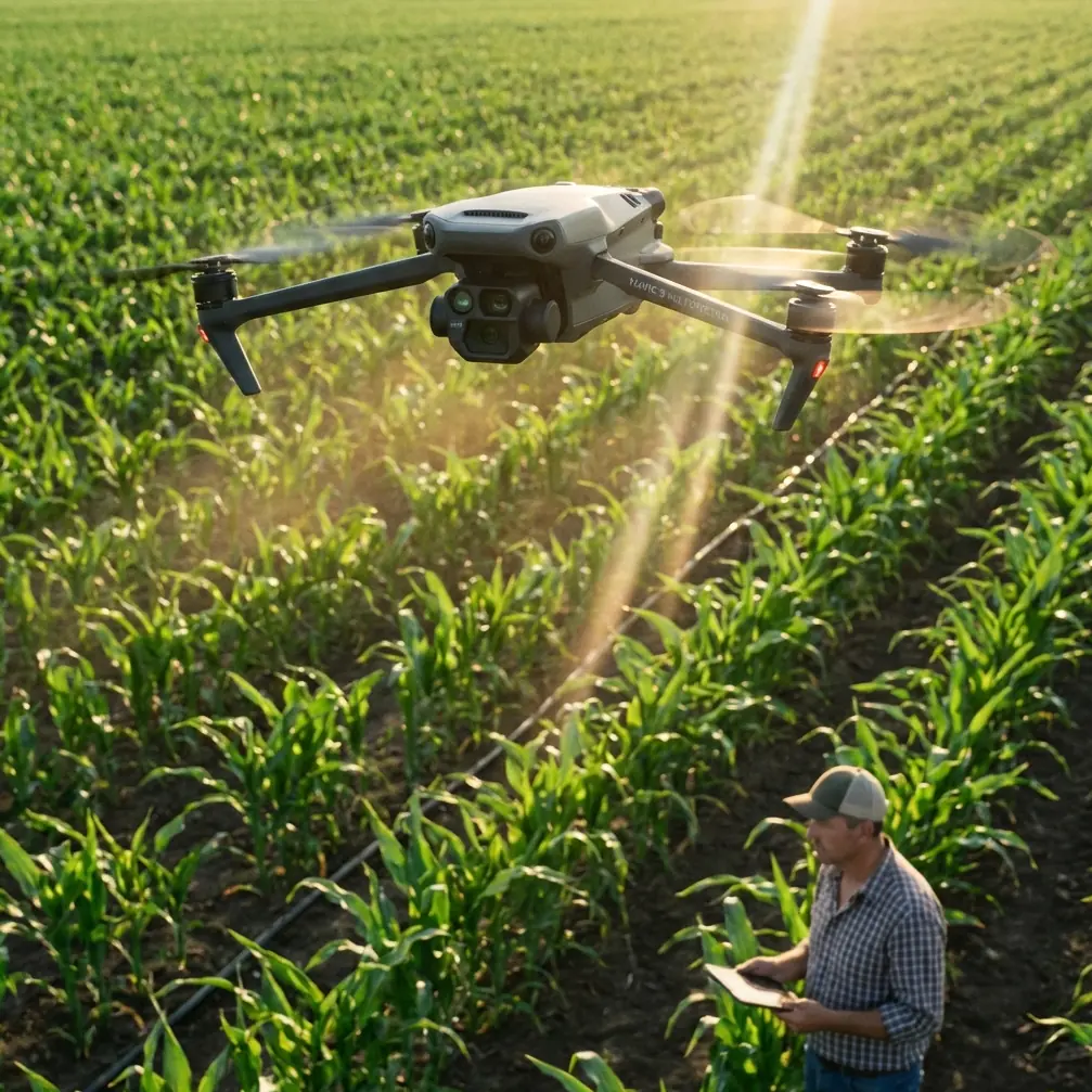
I approached this assignment as a photographer first and a drone operator second. The goal was to evaluate a winding mountain highway for visual documentation, traffic flow context, pull-off visibility, and several sections where elevation changes made ground scouting inefficient. The aircraft was the tool, but the real question was simple: could it help me read the road clearly without turning each flight into a risk management exercise.
This case study is built around that exact scenario.
Why mountain highway scouting exposes the truth about a drone
A drone can look impressive in a spec sheet and still become frustrating once you put it over a mountain road. Highway scouting is demanding because it combines several difficult variables at once.
You are often flying along narrow corridors with steep drop-offs on one side and rising slopes on the other. That means obstacle sensing is not theoretical. It affects whether you can safely reposition while maintaining line of sight. The same applies to tracking. Following a moving vehicle or maintaining framing over a curving road sounds straightforward until the road disappears beneath trees, cuts behind rock, or bends sharply around terrain.
This is why the Mavic 4 Pro discussion should not center only on image quality. For scouting work, the more meaningful conversation is about stability of operation and repeatability of results.
If I need three passes over the same section of road at different altitudes, I need confidence that the aircraft can hold a clean line, detect hazards, and let me focus on composition and observation rather than constant correction. In mountain environments, that workload reduction is operationally significant.
The mission profile
The scouting route covered a mountain highway with alternating open overlooks, dense pine sections, short bridge spans, and several blind curves. Ground access existed, but only in fragments. A drive-through tells you very little about vertical context. You can see a bend. You cannot easily understand how it relates to the next cut, shoulder width, drainage line, or surrounding slope.
The Mavic 4 Pro changed that by making it possible to build a layered record of the route in one session:
- high establishing passes to understand terrain relationships
- lower lateral passes to inspect shoulder conditions and pull-out visibility
- tracking passes to study how moving vehicles behaved through curves
- static elevated holds for light, shadow, and surface reading
That combination mattered more than any single hero shot.
Obstacle avoidance is not just a safety feature here
In mountain highway work, obstacle avoidance becomes part of the data collection process. Roads carve through trees, utility lines appear where you do not expect them, and ridgelines distort your sense of clearance. Even experienced pilots can misread distance when the terrain is moving beneath the aircraft in multiple planes.
The practical value of advanced obstacle avoidance in the Mavic 4 Pro setup is that it reduces hesitation during route-following work. When I shifted from a higher survey pass to a lower angled move along a bend, I was not asking the aircraft to save me from careless flying. I was using sensing as a second layer of awareness.
That distinction matters.
A mountain road often creates moments where you need to drift laterally to preserve sightlines around a curve while keeping the camera trained on the pavement and shoulder edge. If your drone’s obstacle handling is weak, you back off early and lose the exact perspective that makes the flight useful. If it is reliable, you can work with more discipline and more precision.
For highway scouting, that means cleaner edge mapping of the road corridor and better interpretation of how the route interacts with surrounding topography.
ActiveTrack and subject tracking over winding roads
A lot of drone marketing makes subject tracking sound effortless. Mountain highways are where that idea gets tested. Vehicles do not move in straight, open spaces. They pass into shadow, under partial canopy, and around curves that can break line continuity in seconds.
Using ActiveTrack on the Mavic 4 Pro was most effective when treated as a support tool, not a substitute for piloting. On long visible stretches, it helped maintain framing on a lead vehicle so I could pay more attention to altitude discipline and road geometry. On tighter curves, I used it selectively and was ready to retake manual control before the terrain forced a bad angle.
Operationally, this matters because tracking is not just about making cinematic car footage. It can reveal how a vehicle visually enters and exits hazardous curves, how quickly sightlines collapse, and how lane positioning changes in mountain sections with uneven shoulders.
That is valuable scouting information.
If you are documenting a road for planning, inspection support, location recce, or even editorial storytelling, subject tracking gives you continuity. But in this environment, the win is not automation by itself. The win is reduced workload at the exact moments when terrain complexity is highest.
The accessory that made the biggest difference
The third-party addition that genuinely improved this mission was a high-quality variable ND filter set. In my case, it was not about chasing a stylized look. It was about controlling shutter behavior in harsh midday mountain light while keeping motion readable on moving traffic and tree-lined flybys.
That accessory changed the usefulness of the footage.
Mountain highways produce strong brightness swings. One moment you are over dark asphalt bordered by evergreens; the next you are looking at pale rock faces or reflective barriers. Without controlled exposure, footage can feel jumpy and analytical review becomes harder. A good ND setup let me hold more consistent motion rendering and cleaner exposure discipline across multiple passes.
This had a direct effect on two parts of the workflow:
First, tracking shots became easier to evaluate because motion looked natural rather than brittle. Second, Hyperlapse sequences taken from fixed overlooks held together better in shifting light, making them more useful for showing traffic rhythm and weather movement across the corridor.
Accessories are often discussed as optional extras. In this case, the filter set improved the mission outcome enough that I would consider it standard equipment for mountain scouting.
D-Log was the right choice for mixed mountain light
Color profiles are sometimes treated like a post-production luxury. For this assignment, D-Log was practical.
Highway scouting in the mountains means dealing with contrast that can get ugly fast: bright sky, dark tree shadow, reflective road paint, rock texture, and occasional patches of snow or haze depending on elevation. Shooting in D-Log gave me more room to balance those extremes later without sacrificing the subtle information that helps you read the scene.
That was particularly useful in two recurring conditions:
- late-angle sunlight hitting one side of the road while the opposite shoulder remained in deep shade
- ridge-backed compositions where the sky threatened to overpower pavement and terrain detail
The operational significance is simple. If your footage clips highlights too early or crushes shadow detail, your scouting material becomes less informative. You stop seeing edge conditions and start seeing contrast problems. D-Log preserved enough latitude to make those sections readable in post while still delivering a natural final image.
For anyone documenting roads rather than just filming them, that flexibility is not cosmetic. It protects information.
QuickShots and Hyperlapse were more useful than expected
I did not go into the session expecting QuickShots to matter much. For detailed scouting, manual control usually wins. But a few pre-planned automated moves turned out to be efficient for establishing context at overlooks where the road’s relationship to the valley was the real story.
A controlled reveal from a turnout quickly communicated elevation change and route direction in a way that would have taken longer to build manually. Used sparingly, QuickShots helped create orientation references for the broader scouting package.
Hyperlapse had a different value. It helped show traffic cadence, cloud shadow movement, and the way the road visually disappeared into temperature shifts and terrain haze through the afternoon. That is not just visually appealing. It helps explain why one section of highway feels open and legible while another becomes visually compressed and fatiguing for drivers.
For teams that need to brief others quickly, that kind of time-based perspective can be more persuasive than a stack of still frames.
Flight planning in this terrain
The biggest mistake in mountain highway scouting is trying to cover too much in one uninterrupted flight path. The better approach is to divide the corridor into visual problems.
That is how I structured the work:
Section one focused on broad alignment and elevation transitions. Section two targeted blind curves and shoulder visibility. Section three concentrated on bridge approach and exit lines. Section four documented the way trees and slope walls changed driver sightlines.
The Mavic 4 Pro fit this segmented method well because it allowed me to shift between survey-style passes and more cinematic diagnostic passes without changing platforms. That flexibility matters in the field. You save time, keep batteries focused on useful tasks, and avoid the temptation to force one flight style onto every problem.
If you are preparing for a similar mission and want to compare route-planning ideas or camera setups, I shared a brief field note through this direct chat link: message me here.
What stood out most after the flights
Three things stayed with me after reviewing the material.
First, obstacle awareness and tracking support were not separate benefits. Together, they made the drone more dependable in a corridor where terrain and motion constantly compete for your attention. That reduced pilot workload showed up directly in the quality of the scouting passes.
Second, D-Log was not optional if the goal was to preserve interpretive value in mixed light. The mountain environment creates contrast traps that standard profiles can make harder to manage later.
Third, the third-party ND filter set had an outsized effect relative to its simplicity. It improved consistency across tracking shots, static holds, and Hyperlapse captures in a way that made the entire package feel more coherent and more useful.
Those are not abstract advantages. They affect whether the footage helps someone understand the road.
Who this setup actually suits
The Mavic 4 Pro makes the most sense for operators who need one aircraft to handle documentation, motion work, and terrain-heavy reconnaissance without constant compromise. That includes photographers scouting routes, production teams building shot lists, infrastructure observers capturing corridor context, and creators documenting travel or overland routes with a more analytical eye.
For mountain highway use specifically, I would prioritize it for pilots who value:
- reliable obstacle support around complex terrain
- controlled moving shots over winding pavement
- flexible grading latitude from D-Log footage
- fast transitions between establishing views and detail passes
- support for tools like QuickShots and Hyperlapse when context matters
That is the real takeaway from this field case. The Mavic 4 Pro is not interesting because it promises everything. It is interesting because in a difficult environment, it helps you come back with footage that answers real questions.
And when you are scouting a highway in the mountains, that is the whole point.
Ready for your own Mavic 4 Pro? Contact our team for expert consultation.