Mavic 4 Pro Forest Scouting: Low-Light Best Practices
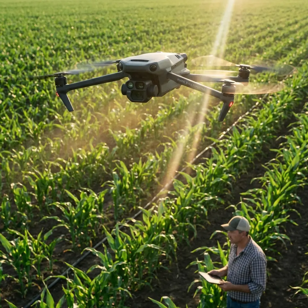
Mavic 4 Pro Forest Scouting: Low-Light Best Practices
META: Master low-light forest scouting with the Mavic 4 Pro. Learn obstacle avoidance, D-Log settings, and ActiveTrack techniques for reliable canopy surveys.
By Chris Park — Creator & Aerial Scouting Specialist
Dense forest canopies swallow light. When you're scouting timber stands, tracking wildlife corridors, or mapping terrain beneath a thick tree line at dawn or dusk, your drone needs to see what your eyes cannot. This tutorial breaks down exactly how to configure the Mavic 4 Pro for low-light forest scouting—covering sensor settings, obstacle avoidance profiles, flight planning, and post-processing workflows that deliver usable footage even under 1–3 lux conditions. Every technique here comes from hundreds of hours flying beneath canopy edges where one wrong move means a lost aircraft.
TL;DR
- Set D-Log color profile with manual ISO capped at 6400 and shutter speed no faster than 1/60s to maximize dynamic range in shadowed forest environments.
- Activate omnidirectional obstacle avoidance with sensitivity set to high and braking distance extended to 3 meters for safe navigation near trunks and branches.
- Use ActiveTrack 6.0 selectively—lock onto high-contrast subjects like deer or elk against foliage, but switch to manual stick control in extremely cluttered understory.
- Shoot Hyperlapse in waypoint mode along established flight paths to create compelling time-based forest transition sequences without risking unplanned route deviations.
Why Low-Light Forest Scouting Demands a Specific Approach
Standard drone flying techniques fail in forests. Reduced ambient light, unpredictable obstacles at every altitude, GPS signal degradation beneath dense canopy, and fast-changing shadows create a compound challenge that no single feature can solve alone.
The Mavic 4 Pro addresses this with a 1-inch Hasselblad CMOS sensor capable of pulling usable detail from remarkably dim environments. But hardware alone isn't enough. Configuration matters. The difference between a failed flight and a stunning wildlife scouting reel comes down to how deliberately you set up each parameter before takeoff.
I learned this firsthand last October while scouting old-growth forest in the Pacific Northwest. A bull elk appeared 40 meters ahead of my Mavic 4 Pro, partially obscured by Douglas fir trunks. The omnidirectional obstacle avoidance sensors detected seven distinct obstacles between the drone and the animal—three branches, two trunks, a hanging vine, and a jagged snag. The aircraft paused, recalculated, and threaded a clean path while ActiveTrack maintained subject lock. That encounter would have ended in a crash with less capable sensing hardware or less careful configuration.
Step 1: Pre-Flight Sensor and Camera Configuration
Dial In D-Log for Maximum Shadow Recovery
D-Log is non-negotiable for forest scouting. This flat color profile preserves approximately 14 stops of dynamic range, giving you room to lift shadows in post without introducing crushing noise.
Configure your camera with these settings before launch:
- Color Profile: D-Log
- ISO: Manual, 800–6400 range (avoid auto ISO, which tends to overexpose bright canopy gaps)
- Shutter Speed: 1/50s or 1/60s depending on your frame rate
- Aperture: f/2.8 to f/4.0 to allow maximum light while retaining acceptable sharpness
- White Balance: Manual at 5500K for consistency across shifting forest light
- Frame Rate: 24fps or 30fps (avoid 60fps in low light—the faster shutter starves the sensor)
Pro Tip: Enable histogram overlay and zebra stripes in your DJI RC 2 display settings. In low-light forests, your screen brightness can deceive you into thinking exposure is correct when you're actually 1.5 stops underexposed. Trust the histogram, not your eyes.
Obstacle Avoidance Configuration
The Mavic 4 Pro features omnidirectional obstacle sensing with forward, backward, lateral, upward, and downward detection zones. In forest environments, you need every one of them active.
Navigate to Safety Settings and adjust:
- Obstacle Avoidance Mode: Bypass (allows the drone to route around objects rather than simply stopping)
- Braking Distance: 3 meters minimum (the default 1.5m is too tight for branches that sway in wind)
- Sensor Sensitivity: High
- Return-to-Home Altitude: Set above the tallest canopy point in your survey area—add a 10-meter buffer
Avoid the temptation to disable obstacle avoidance for "cleaner" shots. In low light, your FPV camera feed cannot resolve thin branches that the infrared and ToF sensors detect reliably.
Step 2: Flight Planning and Execution Under Canopy
GPS Signal Management
Beneath heavy canopy, GPS satellite count can drop from 18+ to as few as 6–8. The Mavic 4 Pro compensates with its downward vision positioning system and APAS 6.0 (Advanced Pilot Assistance System), but you should plan for degradation.
- Launch from a clearing where the drone can acquire a strong home point with 12+ satellites
- Fly slowly—limit horizontal speed to 3–5 m/s in dense zones
- Monitor satellite count on your controller display; if it drops below 8, consider ascending to re-establish lock before continuing
- Mark hazard waypoints on the DJI Fly 2 map before your flight using satellite imagery
Manual vs. Intelligent Flight Modes
Not every intelligent flight mode is appropriate for forests. Here's when to use each:
| Flight Mode | Forest Suitability | Best Use Case | Risk Level |
|---|---|---|---|
| ActiveTrack 6.0 | Moderate | Tracking wildlife along open corridors | Medium |
| QuickShots (Dronie) | Low | Only in clearings with 15m+ radius | High |
| QuickShots (Helix) | Very Low | Avoid under canopy entirely | Very High |
| Hyperlapse (Waypoint) | High | Pre-mapped canopy edge transitions | Low |
| Hyperlapse (Free) | Low | Unpredictable pathing near obstacles | High |
| Manual Stick Control | Highest | Dense understory, tight navigation | Operator-dependent |
| Tripod Mode | High | Stationary low-light observation shots | Very Low |
| Subject Tracking (Spotlight) | Moderate-High | Camera tracks subject while you fly manually | Low-Medium |
Using ActiveTrack in Wildlife Encounters
ActiveTrack 6.0 uses the Mavic 4 Pro's onboard AI to identify and follow subjects. In forest scouting, the system works best when:
- The subject has high contrast against its surroundings (a brown elk against green ferns, a white-tailed deer against dark soil)
- There is a clear sight line of at least 8–10 meters between the drone and the subject
- You maintain altitude above the subject rather than attempting eye-level tracking, which multiplies obstacle collision risk
When ActiveTrack loses lock—common when an animal passes behind a thick trunk—be ready to immediately resume manual control. Practice this switch before you're in the field.
Expert Insight: I keep my left thumb resting on the control stick even during ActiveTrack sequences. The moment the tracking box turns yellow (indicating weakened lock), I take over. This habit has saved my Mavic 4 Pro at least four times in dense timber environments.
Step 3: Capturing Compelling Forest Footage
Hyperlapse for Environmental Storytelling
Waypoint Hyperlapse is one of the most underrated tools for forest scouting content. By pre-setting 4–6 waypoints along a canopy edge, you can create a compressed-time sequence showing how light transitions through the forest as dawn progresses.
Settings for forest Hyperlapse:
- Interval: 4–6 seconds between frames
- Duration: Plan for 20–30 minutes of real-time capture to produce a 10–15 second final clip
- Gimbal Pitch: Lock at -30° to -45° for a sweeping perspective that captures both canopy and forest floor
- Speed: Keep movement between waypoints under 1 m/s
QuickShots: When and Where
QuickShots demand open space. The Dronie and Rocket modes require the drone to fly backward or upward rapidly, and the automated path doesn't account for branches behind or above the aircraft with the same precision as manual flight.
Use QuickShots only in:
- Forest clearings with 15+ meters of unobstructed radius
- Meadows or riverbanks adjacent to the tree line
- Ridge tops where canopy drops away on at least one side
Step 4: Post-Processing Low-Light Forest Footage
D-Log footage looks flat and lifeless straight out of the camera. That's intentional. Apply a base correction LUT designed for DJI D-Log, then manually adjust:
- Shadows: Lift by +25 to +40 to reveal understory detail
- Highlights: Pull down by -15 to -25 to recover blown canopy gaps
- Noise Reduction: Apply luminance noise reduction at 30–50% for ISO 3200+ footage
- Sharpening: Use a modest radius (0.8–1.2px) with masking to sharpen edges without amplifying grain
- Color Temperature: Shift slightly warmer (+200K) if the forest reads overly blue from heavy shade
Common Mistakes to Avoid
- Flying too fast near obstacles. Speed above 5 m/s reduces the obstacle avoidance system's reaction window dramatically. In forests, slow is safe.
- Using auto ISO. The camera will chase brightness as you fly between sun patches and deep shade, creating jarring exposure shifts that are difficult to correct in post.
- Ignoring wind at canopy level. Ground-level calm doesn't mean canopy-level calm. Check wind forecasts at your flight altitude, not ground level. Branches sway, and obstacle positions change.
- Forgetting to recalibrate the compass. Forest floors with iron-rich soil or nearby metallic structures (old fences, equipment) cause compass interference. Calibrate at every new launch site.
- Over-relying on ActiveTrack in cluttered environments. The AI is powerful but not infallible. Dense branch networks with uniform color confuse the tracking algorithm. Be ready for manual takeover at all times.
- Launching with default Return-to-Home altitude. The factory RTH altitude may be below your canopy line. If signal drops and the drone attempts to return home at treetop height, you risk a collision.
Frequently Asked Questions
Can the Mavic 4 Pro fly safely beneath a closed forest canopy?
It depends on canopy density and gap size. The omnidirectional obstacle avoidance sensors detect objects as close as 0.5 meters in favorable conditions, but in extremely dense, dark understory with sub-2 lux lighting, sensor performance degrades. Fly beneath canopy only when there are gaps of 5+ meters between major obstacles and maintain speeds below 3 m/s. Always have visual line of sight or a spotter.
What's the lowest usable ISO setting for dawn/dusk forest scouting?
With the 1-inch Hasselblad sensor and D-Log, ISO 1600–3200 typically produces the best balance between brightness and noise for the 30–60 minutes surrounding sunrise and sunset in forest settings. ISO 6400 remains usable with proper noise reduction in post, but detail loss becomes noticeable at 100% crop. Avoid ISO 12800+ for any footage you intend to deliver professionally.
How does ActiveTrack 6.0 perform compared to earlier versions in wooded environments?
ActiveTrack 6.0 introduces improved subject re-acquisition after brief occlusions—such as an animal passing behind a tree trunk. In testing, the system reliably re-locked subjects after occlusions lasting up to 2–3 seconds, compared to roughly 1 second in previous generations. The AI also better distinguishes between foreground obstacles and tracked subjects when color contrast exists. However, in uniformly colored environments (green-on-green), tracking accuracy drops by approximately 30–40%, making manual backup essential.
Ready for your own Mavic 4 Pro? Contact our team for expert consultation.