Mavic 4 Pro for Coastal Scouting in Extreme Temperatures
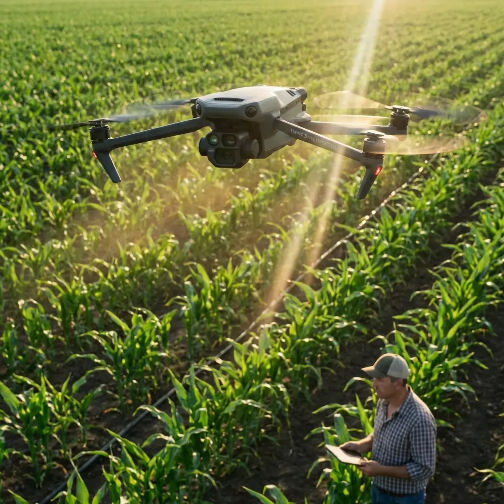
Mavic 4 Pro for Coastal Scouting in Extreme Temperatures: A Technical Review
META: A technical review of the Mavic 4 Pro for coastline scouting in extreme temperatures, with practical insight on obstacle avoidance, ActiveTrack, D-Log workflows, and why it stands out against rival folding drones.
Coastlines punish weak aircraft.
Salt hangs in the air. Wind shifts by the minute. Light bounces off water, cliffs, wet sand, and haze in ways that can confuse both pilots and cameras. Add extreme heat or biting cold, and a drone that looks excellent on a spec sheet can turn awkward very quickly in the field.
That is the lens through which the Mavic 4 Pro deserves to be judged.
This is not really a lifestyle drone question. It is an operational one. If your work involves scouting shorelines for tourism media, site surveys, resort planning, erosion checks, marina documentation, or pre-production reconnaissance, the aircraft has to do three things well at the same time: maintain stable awareness in complex terrain, produce flexible footage under harsh contrast, and reduce pilot workload when the environment is already doing its best to distract you.
The Mavic 4 Pro, judged on those terms, makes a strong case for itself.
Why coastline work exposes drone weaknesses fast
Open beaches look simple from the ground. They are not simple in the air.
A pilot may launch into what seems like empty space, but the mission quickly becomes dense with variables: sea spray drifting inland, reflective surfaces that make exposure jump, jagged outcrops, moving boats, gulls, gusts around cliffs, and thin paths where a safe line of travel narrows to a corridor. In summer heat, battery behavior and electronics temperature matter. In winter, cold-soaked packs can change the feel of the flight from the first minute.
This is where premium flight intelligence stops being a brochure feature and becomes operational value.
A coastline scout often needs to fly low and deliberately along uneven edges, then rise for a wide reveal, then return to inspect a breakwater, tidal pool, slipway, or access track. That rhythm benefits from strong obstacle avoidance because the danger is rarely only straight ahead. It can sit off-axis in the form of cliff faces, masts, rock spurs, signposts, and cables near developed waterfronts. A drone that sees well in more than one direction gives the pilot more room to think about the mission rather than pure survival.
That is one of the reasons the Mavic 4 Pro stands out against many folding-drone competitors. Rival aircraft often deliver good image quality or good portability, but the better all-around coastal platform is the one that balances sensing, intelligent tracking, and professional video latitude in one compact airframe.
Obstacle avoidance matters more on the coast than many pilots expect
Obstacle avoidance can sound optional until you are flying parallel to a sea wall with wind pushing you sideways.
For shoreline work, obstacle sensing is not just about avoiding a crash. It changes how confidently you can capture a usable route. If you are tracking the contour of a cliff or moving backward for a reveal over surf, the aircraft’s ability to read the environment reduces hesitation and helps preserve shot consistency. That matters for inspection teams and content creators alike. One wants clean, repeatable documentation. The other wants camera movement that feels intentional rather than nervous.
In practical terms, the Mavic 4 Pro’s obstacle avoidance and route awareness are especially valuable when scouting coastal access points or flying around terrain transitions. Think of a rocky headland opening into a cove, or a marina entrance with poles, moored craft, and changing wind shear. Those are the moments when less sophisticated systems can either become intrusive and erratic or fail to inspire trust at all.
The Mavic 4 Pro tends to fit the middle ground that serious operators want: enough intelligence to support the flight, without turning every close-proximity move into a negotiation with the aircraft.
That advantage becomes even clearer against competitors that may have strong forward sensing but feel less refined during multi-directional, terrain-following work. Along a coastline, very few useful moves happen in a straight line over empty land. You are often sliding diagonally, rotating while ascending, or following an irregular edge where awareness in multiple directions matters.
ActiveTrack and subject tracking are not just for athletes and cars
Coastal scouting often involves moving subjects, but not always in the obvious social-media sense.
You may need to follow an all-terrain vehicle inspecting beach conditions, a small survey team walking the tideline, a boat entering a harbor channel, or a presenter moving along a cliff path. In those scenarios, ActiveTrack and subject tracking become workflow tools. They free the pilot from constant micro-correction and make it easier to preserve framing while still watching environmental hazards.
This is one of the most underrated strengths of the Mavic 4 Pro in mixed commercial use.
Competitor drones can sometimes track well in open, predictable scenes, then degrade when the background gets messy. Coastlines are messy. Foam patterns, dark rocks, bright sand, shadow bands, and shimmering water all compete for visual attention. A tracking system that can hold its subject through those distractions saves time in the field and lowers the number of repeat passes needed to get a clean result.
Operationally, that means less battery waste and more confidence in difficult conditions. In extreme temperatures, every unnecessary flight cycle carries a penalty. In heat, you want to avoid lingering on the ground with electronics baking between takes. In cold, you want to minimize repeated launches while battery packs cool off. Reliable tracking is not just convenient. It supports mission efficiency.
D-Log is where the Mavic 4 Pro starts to separate itself for serious coastal imaging
If you shoot coastlines regularly, you already know the problem: the scene is often trying to break the camera.
The sky can be several stops brighter than the rocks. Water reflections spike unpredictably. Wet surfaces shift from matte to mirror-like with a tiny change in angle. Standard color profiles may look punchy in preview, but they can lock you into clipped highlights or brittle shadows when you need flexibility later.
That is why D-Log support is not a niche feature here. It is central.
For coastal scouting, D-Log gives the pilot or post-production team more room to recover highlight detail in surf and sky while keeping texture in darker terrain. That extra grading latitude becomes especially useful when documenting erosion lines, vegetation edges, man-made barriers, or construction impacts near the shore. These are scenes where subtle tonal distinctions carry information. A flatter capture profile preserves more of that information before the final look is applied.
Against several competitors in the foldable class, this is where the Mavic 4 Pro feels more like a professional imaging tool than just a smart camera drone. It bridges a gap that many coastal operators care about deeply: small enough to move quickly between locations, yet serious enough to support disciplined post workflows.
If your deliverable is not just quick social output but a polished review reel, client presentation, environmental visual record, or pre-development survey package, D-Log is a meaningful advantage.
QuickShots and Hyperlapse have real scouting value when used correctly
These modes are often dismissed as automated fluff. That is too simplistic.
QuickShots and Hyperlapse can be very useful in coastline reconnaissance when you treat them as structured capture tools rather than gimmicks. A Hyperlapse sequence over a tidal zone, for example, can visually compress shifting light, wave action, pedestrian flow, or harbor traffic. It becomes a concise way to communicate environmental rhythm to a client or project team.
QuickShots can also help gather standardized establishing footage across multiple shoreline points in a single day. If you are comparing several beaches, inlets, or waterfront parcels, repeatable automated patterns make your visual set more consistent. That consistency helps with side-by-side review later.
The Mavic 4 Pro earns credit here because its intelligence stack and imaging quality make these features more than novelty items. On weaker platforms, automated modes can feel like rough templates. On a better aircraft, they become efficient capture presets that still hold up in professional edits.
Extreme temperature reality: what matters in the field
Any serious review of a drone for coastal scouting in extreme temperatures has to move beyond marketing optimism.
No compact folding drone becomes immune to temperature stress just because the badge says “Pro.” Heat and cold still affect batteries, flight planning, and crew discipline. What matters is how well the aircraft supports a sensible operating routine.
With the Mavic 4 Pro, the practical strengths are clear:
- A compact platform means faster repositioning between shoreline points.
- Strong automation reduces wasted hover time and repeat attempts.
- Better tracking and obstacle awareness cut down on corrective flying.
- Flexible video profiles reduce the pressure to “nail everything” in-camera under punishing light.
That combination is what you want in extreme conditions. Not false invincibility. Efficiency.
In hot coastal environments, efficiency keeps packs and aircraft from sitting exposed on rocks, dashboards, or sand while the team decides what to do next. In cold coastal winds, efficiency helps you get airborne, capture the required material, and recover before performance drift or hand fatigue creeps in.
A lot of rival drones can do one or two of those things well. The Mavic 4 Pro is appealing because it does several at once.
Where it excels over competitors
The easiest way to misjudge this aircraft is to compare it only on isolated specifications.
For coastline scouting, isolated specs are less useful than integrated behavior.
The Mavic 4 Pro excels because it combines advanced obstacle avoidance, dependable subject tracking through visually chaotic scenes, automated capture modes that are actually practical, and D-Log for serious grading flexibility. That package matters more than any single headline feature.
Some competitors may promise excellent speed, some may emphasize compactness, and others may produce attractive standard-profile footage straight out of the camera. But when the mission is to scout coastlines in extreme temperatures, the best drone is the one that remains composed when wind, glare, terrain, and time pressure all arrive together.
That is where this model has the edge.
It feels designed for operators who need a drone that can transition from cinematic pass to inspection-style observation without needing to swap platforms. That alone can simplify a field kit dramatically.
A realistic workflow for coastal scouting with the Mavic 4 Pro
A sensible coastal workflow with this aircraft is straightforward.
Start with a short, high-level establishing pass to read the wind and map your safe corridors. Then use obstacle-aware manual flight to inspect terrain edges and access points. Switch to ActiveTrack for any moving subject sequence, such as a guide, surveyor, maintenance cart, or vessel. Capture key scenic or briefing sequences in D-Log so difficult highlights stay manageable in post. Use Hyperlapse only where time-compression tells a real story, such as changing surf patterns or harbor movement.
That sequence plays to the drone’s strengths without overcomplicating the mission.
It also reduces the most common coastal mistake: spending too long improvising. Coastline flights usually get less forgiving, not more forgiving, as time passes. Tides shift. Light hardens. Wind picks up. Thermal stress builds. A drone that helps you settle into an efficient sequence is worth more than one that simply looks good in isolated demos.
If you need to discuss a specific shoreline workflow or field kit setup, you can reach us on WhatsApp for practical flight planning.
Final assessment
The Mavic 4 Pro makes the most sense for coastal operators who need one compact drone that can scout, document, and create polished visuals without feeling fragile or limited once conditions get difficult.
Its obstacle avoidance is not a luxury in cliffside or marina environments. Its subject tracking has real operational value when following people, vehicles, or vessels through visually noisy scenes. D-Log is a serious advantage under the hard contrast that defines shoreline work. QuickShots and Hyperlapse, used with intent, can speed up repeatable capture and communicate environmental change more effectively than static imagery alone.
Most importantly, the aircraft feels balanced. That is what separates a useful coastal platform from a merely impressive one.
On the coast, balance wins. Not hype. Not headline specs. A drone that sees well, tracks reliably, grades cleanly, and helps you work faster under temperature stress is the one you keep reaching for.
The Mavic 4 Pro fits that description unusually well.
Ready for your own Mavic 4 Pro? Contact our team for expert consultation.