Mavic 4 Pro Best Practices for Vineyard Monitoring in Comple
Mavic 4 Pro Best Practices for Vineyard Monitoring in Complex Terrain
META: Practical Mavic 4 Pro guidance for vineyard monitoring on steep terrain, with lessons drawn from a real UAV mapping heritage project that covered 80,000 square meters under a 90-day deadline.
Steep vineyards punish weak workflow design.
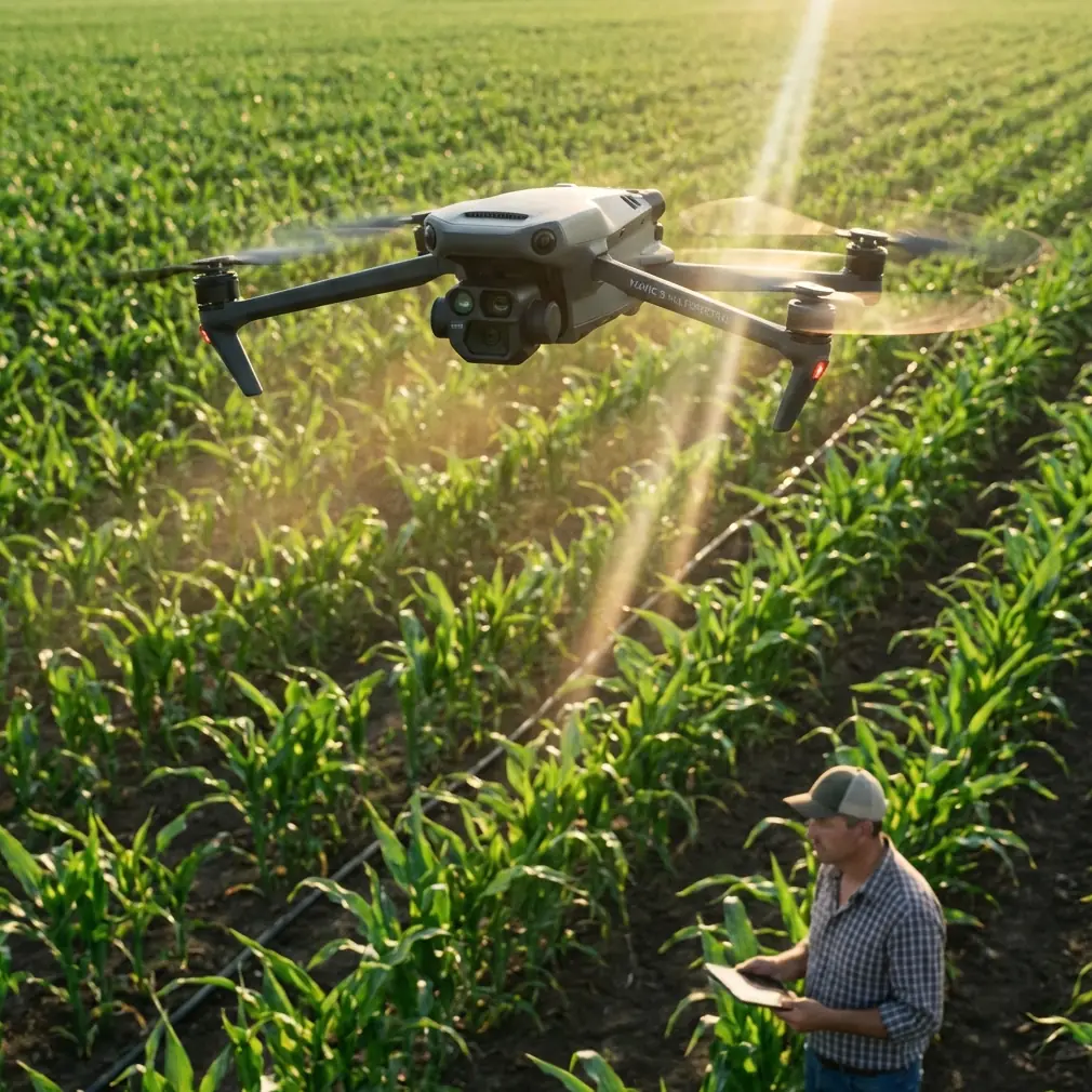
Anyone who has monitored vines on sloped ground knows the problem is not simply “getting aerial footage.” It is maintaining repeatable coverage across rows that bend with terrain, preserving enough image consistency to spot canopy changes, and doing it without burning through labor, batteries, or daylight. That becomes even harder when the site has irregular elevations, narrow access paths, and visual clutter from terraces, walls, sheds, and perimeter trees.
This is where the Mavic 4 Pro becomes interesting—not as a flashy camera drone, but as a practical field tool when you borrow discipline from serious mapping operations.
A useful reference comes from a heritage survey project near Jerusalem, where a UAV-based workflow was chosen to map a historically significant site measuring 80,000 square meters. The terrain was sloped. The site included 121 old buildings. The team had to deliver within 90 days, and the job called for outputs far beyond pretty overheads: terrain mapping, building models, facade drawings, and roof plans. Traditional approaches such as total stations and 3D laser scanning were considered, then rejected because they were too slow and too expensive for the timeline. The drone-plus-mapping-software method completed the work on time, with costs reported at only one-seventh of total-station surveying and one-fifth of laser scanning.
That case was not about vineyards. But the operational lesson is directly relevant to vineyards in complex terrain: when the landscape is uneven and the area is large, the winning workflow is the one that captures enough accurate visual data without repeatedly dragging crews back onto the slope.
The Vineyard Problem: Slopes Create Blind Spots and Inefficiency
A flat vineyard is simple by comparison. Launch, run your route, maintain line of sight, land, review. On complex terrain, small mistakes compound fast.
One block may sit on a shoulder with a clean sky view, while another drops into a fold where signal confidence and visual orientation feel different. South-facing rows may reflect harsh light at midday, while lower sections hold shadow much longer than expected. Obstacles also behave differently on steep land. A tree line that looks harmless from the takeoff point may sit directly in the path of a lateral pass once the aircraft follows the slope contour.
If your goal is monitoring rather than one-off cinematography, the challenge is consistency. You need flights that can be repeated at similar angles, with similar exposure logic and similar timing, so imagery from one week actually compares well with the next.
The old Jerusalem heritage project makes that point in a surprisingly clear way. The real achievement was not only that a drone was used. It was that the method produced structured deliverables under time pressure across a complicated site. That same mindset matters in vineyard operations. The aircraft is only one piece; the value comes from a repeatable capture system.
Why the Mavic 4 Pro Fits This Type of Work
For vineyard monitoring, the Mavic 4 Pro is most useful when you take advantage of flight intelligence without surrendering judgment.
Obstacle avoidance matters more on sloped vineyards than many pilots admit. The hazard is not usually a single dramatic obstacle. It is the accumulation of smaller ones: utility lines near pump areas, cypress windbreaks, poles, netting structures, and trellis edge irregularities. On rolling ground, your visual read of clearance can be distorted. Reliable obstacle sensing gives you a buffer, especially when repositioning between rows or following terrain-adjacent paths.
ActiveTrack and subject tracking also have value here, though perhaps not in the way lifestyle content suggests. In vineyard work, you might use tracking less for people and more for controlled vehicle follow shots during inspections, irrigation checks, or documentation of access routes after heavy rain. When a utility vehicle or field worker is moving through steep blocks, stable tracking can produce useful visual records without forcing the pilot to divide all attention between framing and collision risk.
Then there is image flexibility. D-Log is not just for creators chasing cinematic color. In mixed light—bright ridgelines and shaded lower rows—having a flatter recording profile can preserve highlight and shadow information that helps when reviewing vine vigor visually or creating management reports with cleaner tonal control. If one section of a vineyard regularly clips highlights in standard profiles, your ability to compare row condition over time suffers.
QuickShots and Hyperlapse are less central to agronomic monitoring, but they are not pointless. They can be useful for progress documentation—seasonal canopy development, access road changes, erosion movement around terraces, or before-and-after records following pruning or replanting. Used sparingly, these automated modes reduce the chance that you improvise a poor manual flight just to create a visual summary for owners or managers.
What the Heritage Mapping Case Teaches Vineyard Operators
The Jerusalem project highlights two details that matter operationally.
First, the site was sloped and complex, yet UAV capture still won over slower ground-heavy methods. That matters because many vineyard managers assume steep land automatically favors boots-on-the-ground inspection only. Ground checks remain essential, but the case shows that difficult terrain is exactly where an aerial-first workflow can save time. Walking every row on every inspection cycle is rarely the most efficient use of labor.
Second, the mission had a 90-day completion window across 80,000 square meters and 121 structures. That is a reminder that drone value scales with organization. The technology helps most when you define repeatable capture blocks, image review habits, and deliverable standards. Vineyards may not need CAD terrain maps every week, but they do benefit from similar discipline: fixed launch points, standard route naming, recurring altitude choices, and consistent battery rotation.
Without that structure, even an advanced aircraft becomes a flying notebook with messy pages.
A Better Monitoring Workflow for Vineyards on Difficult Ground
The best approach is a problem-solution model.
Problem 1: Uneven terrain makes altitude feel deceptive
A pilot standing on a high edge can accidentally fly too low over descending rows, or too high over rising sections, reducing image usefulness.
Solution
Break the vineyard into terrain-based segments rather than trying to cover the whole property in a single visual logic. Fly upper terraces separately from lower basins. Keep route labels simple and permanent: North Ridge AM, Mid Slope West, Lower Block East, and so on. This is the same thinking that large mapping jobs depend on. The old heritage site did not succeed by treating 80,000 square meters as one vague space. It succeeded because the work was organized into clear outputs.
For the Mavic 4 Pro, segmenting also improves obstacle avoidance performance in practice because each route has a more predictable hazard profile.
Problem 2: Inconsistent lighting ruins comparison over time
One of the easiest mistakes in vineyard monitoring is flying whenever there is a spare moment. You end up comparing morning shade from one week with hard afternoon sun from the next.
Solution
Choose narrower time windows for repeat inspections. If possible, keep similar weather conditions and sun angle. Use D-Log when the dynamic range is difficult, especially in steep areas where row shadows persist. This gives you more room to normalize footage and still preserve visible differences in canopy density, irrigation stress signals, and ground moisture patterns.
Problem 3: Batteries disappear faster on slopes than your plan suggests
This is the field lesson I wish more pilots learned early.
On paper, battery estimates look generous. In real vineyard work, they shrink because climbing transitions, hover checks over suspect rows, re-positioning around obstacles, and repeated re-framing consume more power than a straightforward open-field pass.
Solution: My field battery rule
I never plan a steep-site monitoring session around the manufacturer’s best-case battery expectation. I plan around the return climb.
That means if I am inspecting lower blocks from a launch point above them, I mentally reserve battery not for the current view, but for the least efficient path home. Wind shifts and slope changes can make that return more expensive than it looks. A simple habit helps: assign one battery to one terrain segment, even if the aircraft could technically stretch further. It sounds conservative. It is also why you avoid rushed climbs and low-margin returns over trellis and trees.
Another practical tip: rotate your freshest batteries to the segments requiring the hardest uphill return or the longest lateral path back to home. Save older or warmer batteries for upper blocks closer to the launch area. That one decision smooths out risk more than most pilots expect.
Obstacle Avoidance Is Not Permission to Get Lazy
The Mavic 4 Pro’s obstacle avoidance is a safety layer, not a substitute for route judgment.
In vineyards, the danger often appears during transitions rather than the main pass. You finish documenting one block, glance at your screen, and slide laterally toward the next while the hillside hides depth perception. That is where avoidance earns its keep. But if you rely on it carelessly around fine branches, wires, or irregular trellis hardware, you are asking software to solve a planning problem.
Use it as insurance. Still build routes as if you had to fly them manually.
When Subject Tracking and ActiveTrack Actually Help
Some vineyard teams dismiss tracking features as content-creator fluff. That is too simplistic.
If a manager wants recurring visual records of staff access routes, terrain damage after storms, or vehicle movement through difficult rows, ActiveTrack can help capture smooth, usable documentation while preserving pilot focus. In training scenarios, it is also useful for showing how ground crews move through blocks during inspection or harvest prep.
The key is control. Use tracking where movement is predictable and the environment is readable. Do not force it into cramped tree edges or cluttered utility zones just because the feature exists.
Hyperlapse and QuickShots for Operational Storytelling
A vineyard is a business, but it is also a landscape that changes visibly over a season. Hyperlapse can document that change in a way managers, owners, and hospitality partners understand instantly. Bud break, canopy expansion, terrace repairs, drainage interventions, and harvest preparation all become easier to communicate when you have structured visual sequences.
QuickShots can help when you need a fast, standardized overview clip of a block or facility area without spending time on manual setup. The trick is to treat those modes as documentation shortcuts, not as the core of your monitoring practice.
The Real Value: Better Decisions With Less Field Drag
What made the Jerusalem heritage project compelling was not novelty. It was efficiency under constraints. A sloped, sensitive site. A fixed deadline. A need for reliable outputs. The drone-centered workflow delivered the required documentation while radically lowering cost compared with conventional methods.
That is exactly why the Mavic 4 Pro makes sense for vineyard monitoring in difficult terrain. Not because it turns every manager into a surveyor, and not because every flight needs to become a map. It makes sense because the same principles apply: cover more ground, preserve repeatability, reduce unnecessary labor on foot, and capture imagery that supports action.
If you are building a practical vineyard routine, start there:
- segment by terrain,
- standardize timing,
- reserve battery for the return climb,
- use obstacle avoidance intelligently,
- and treat every flight as part of a repeatable record.
That is how a drone stops being a gadget and starts becoming part of farm operations.
If you want to compare flight setups or field routines with someone who understands this kind of workflow, you can message a UAV specialist here.
Ready for your own Mavic 4 Pro? Contact our team for expert consultation.