Expert Monitoring With Mavic 4 Pro for Urban Vineyards
Expert Monitoring With Mavic 4 Pro for Urban Vineyards
META: A practical, expert-led look at how the Mavic 4 Pro can monitor urban vineyards using obstacle avoidance, ActiveTrack, D-Log, Hyperlapse, and smart workflow upgrades.
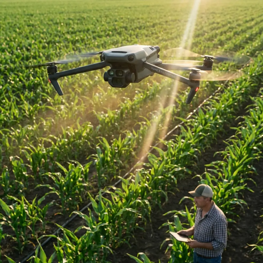
Urban vineyards ask unusual things from a drone.
You are not just flying over neat agricultural rows in open countryside. You are working around walls, access roads, power lines, neighboring buildings, pedestrians, parked vehicles, and the visual clutter that comes with city-adjacent land. The mission is also more layered than simple aerial photography. A vineyard manager may want canopy consistency checks in the morning, progress documentation for investors in the afternoon, and polished visual content for public outreach by the end of the week.
That mix is where the Mavic 4 Pro makes sense.
I approach this as a photographer first, but also as someone who has spent enough time around drones to know that image quality alone does not solve field problems. In an urban vineyard, the real question is whether the aircraft can collect useful information repeatedly, safely, and without slowing the workday. The Mavic 4 Pro stands out when those needs overlap: stable image capture, reliable obstacle awareness, smooth subject tracking, and enough codec flexibility to support both analytical review and finished media.
The urban vineyard problem is not distance. It is complexity.
A rural vineyard survey usually gives you room to breathe. Urban plots do not. You may have narrow margins between vines and property edges. Trees can interrupt sightlines. Structures create odd wind behavior. Workers move through rows while irrigation lines, fencing, and trellis systems create a busy low-altitude environment.
That setting punishes sloppy flying.
Obstacle avoidance matters here not as a marketing bullet, but as an operational filter. In tight agricultural spaces, sensing and route correction reduce the mental load on the pilot during repeated passes. When you are trying to maintain consistent framing across multiple flight days, you do not want every mission to feel improvised. A drone that can help detect obstacles around vineyard edges lets the operator spend more attention on crop observation and shot discipline rather than pure collision prevention.
This is especially useful when monitoring vine vigor visually over time. The best comparison footage is boring in the best sense: same angle, similar altitude, similar path, minimal drift. If the aircraft can confidently navigate a constrained environment, that consistency becomes easier to achieve.
Why subject tracking is more useful in vineyards than many pilots expect
A lot of people hear “subject tracking” and think only about action footage. In practice, ActiveTrack and related subject-following features can be surprisingly helpful in vineyard work, especially in urban sites where movement through the property needs to be documented clearly.
Think about a vineyard manager walking an inspection route between rows. Tracking tools can hold framing on that person while preserving environmental context around them. That creates footage with real operational value. You can review how accessible certain row sections are, where ground conditions have changed, whether pruning or canopy management work was completed, and how different blocks look under the same pass.
The significance is simple: tracking reduces the need for a second operator or stop-start manual repositioning. On a busy site, fewer interruptions mean cleaner records and less battery wasted on setup corrections.
There is another benefit. Urban vineyards often serve dual roles as productive agricultural spaces and public-facing destinations. If you need a visual update showing staff walking through the plot, checking growth, or explaining seasonal changes to stakeholders, ActiveTrack makes that footage feel deliberate rather than shaky and reactive.
Good monitoring depends on repeatable visuals, not just sharp ones
Everyone notices resolution first. Vineyard operators usually should not.
What matters more is whether the footage can tell the same story every week. Are shadows manageable? Can highlights survive reflective surfaces nearby? Does color hold enough information to compare foliage tone across changing conditions? Is there enough control in post-production to balance footage captured at different times of day?
This is where D-Log becomes practical instead of theoretical.
In a monitoring workflow, a flatter color profile gives you more room to standardize your archive. That matters if one flight happens under hard midday light and the next under thin cloud with reflected brightness from surrounding urban surfaces. D-Log helps retain detail that can otherwise clip away in contrasty scenes. The operational significance is not “cinematic quality” by itself. It is consistency. You can grade sequences into a more comparable visual baseline, which makes week-to-week vineyard changes easier to read.
For vineyard owners who also need public-facing content, that same file flexibility means one flight can serve two outputs: a factual archive for operations and a polished visual piece for marketing or education. The drone is doing more than collecting pretty overheads. It is supporting a documentation system.
Hyperlapse is not just for style. It reveals pattern.
Hyperlapse gets underestimated in agricultural environments because it is often framed as a creative mode. In an urban vineyard, it can become a pattern-recognition tool.
A well-planned Hyperlapse sequence across a plot can show how shadows move over vines during the day, how activity concentrates around access points, or how the surrounding built environment affects the feel and readability of the site. If your vineyard sits near roads or structures, that changing relationship between sunlight, shade, and nearby infrastructure can influence both plant observation and visitor experience.
The practical advantage is that time compression exposes rhythms that static flights miss.
If I were building a monitoring routine around the Mavic 4 Pro, I would not use Hyperlapse on every mission. I would use it selectively: once after a major canopy change, after infrastructure work, or during a season when light exposure patterns are under review. In those moments, it gives decision-makers a compressed but legible view of what the site is doing over time.
QuickShots have a place, but only when used with discipline
QuickShots can sound like a feature for social content only, yet they can be effective in urban vineyard reporting when the objective is communication rather than analysis.
For example, when a property manager needs a short, consistent opening sequence for monthly updates, an automated movement around a defined edge or central access point can create a recognizable visual marker. The key is restraint. A vineyard monitoring program should not become a collection of dramatic camera moves. It should remain structured, readable, and safe around obstacles.
That is another reason obstacle avoidance and automated capture modes belong in the same conversation. In urban environments, automation without environmental awareness is risky. Automation with reliable sensing is far more useful because it creates repeatable visuals without demanding constant manual correction.
The accessory that made the biggest difference was not glamorous
The most helpful third-party upgrade I have seen for this kind of work was a landing pad.
Not a flashy add-on. A simple, portable third-party landing pad.
Urban vineyards rarely offer perfect launch surfaces. You may be taking off from gravel, dust, uneven soil, trimmed grass, or a service path near the vines. A good landing pad creates a cleaner and more predictable home point area, which reduces debris near the aircraft during takeoff and landing. That matters more than people think, especially when you are flying repeated short missions during seasonal checks.
It also speeds up the routine. Pilots stop hunting for suitable ground every time they move between blocks. They unfold the pad, confirm the area, launch, and get on with the task. In practical field operations, those small friction reductions add up.
I would put a third-party sun hood for the controller screen in second place, particularly in bright vineyard conditions where reflection can make exposure judgment harder. But if I had to name one accessory that consistently improved the workflow, it would be the landing pad because it solved a repeat problem every single flight day.
A smart workflow for urban vineyard monitoring with the Mavic 4 Pro
The strongest Mavic 4 Pro workflow is not complicated. It is disciplined.
Start with one baseline route flown at a fixed altitude over the same rows each time. Capture wide overhead footage for structural comparison. Then add one lower-altitude pass along a row edge to evaluate canopy density, gaps, irrigation visibility, or physical access. If staff movement or inspection activity needs to be documented, use ActiveTrack for a controlled walking sequence. If lighting conditions are challenging, record in D-Log to preserve grading flexibility later.
Once every few weeks, add a Hyperlapse from a consistent edge position to reveal temporal patterns around the site. Use QuickShots sparingly for stakeholder updates or public-facing summaries. The main archive should stay plain, stable, and comparable.
That balance is what separates useful drone monitoring from occasional drone enthusiasm.
Why the Mavic 4 Pro fits this specific reader scenario
For someone monitoring vineyards in an urban setting, the aircraft needs to handle two kinds of pressure at once: environmental pressure from a confined site and communication pressure from multiple audiences.
The Mavic 4 Pro fits because it supports cautious navigation, controlled tracking, and adaptable image processing in one platform. Obstacle avoidance is operationally significant because urban edges leave less room for pilot error. ActiveTrack is significant because it helps document real vineyard activity without requiring a camera crew. D-Log matters because urban lighting is inconsistent, and comparative review depends on preserving detail. Hyperlapse and QuickShots become useful when the same dataset also has to communicate progress to owners, partners, or visitors.
That combination gives the drone range beyond a simple aerial camera.
Where pilots still need judgment
No aircraft feature replaces planning.
Urban vineyard flying still requires careful timing, clear launch and recovery zones, awareness of nearby people, and restrained mission design. The most effective operators are not the ones trying every intelligent flight mode on every battery. They are the ones who know when a straightforward top-down pass will reveal more than an elaborate orbit.
The Mavic 4 Pro gives you tools. The value comes from deciding which tool belongs to which task.
If your goal is crop observation, prioritize repeatability. If your goal is team documentation, use tracking carefully and keep framing readable. If your goal is a seasonal visual record that can also support outreach, capture in D-Log and build a grading template for consistency. And if your site presents rough launch conditions, bring a proper landing pad before you buy anything more exotic.
The real advantage is fewer compromises
What I like most about using a drone in this category for urban vineyard monitoring is not one isolated feature. It is the reduction in tradeoffs.
You do not have to choose between safe navigation and polished footage. You do not have to choose between practical inspection passes and presentable visuals. You do not have to choose between fast deployment and enough image flexibility for serious post-production.
That is why the Mavic 4 Pro deserves attention in this niche. It handles the mixed reality of urban vineyard work, where one sortie may need to satisfy a grower, a property manager, and a communications team at the same time.
If you are mapping out a workflow for that kind of environment and want to compare setup ideas, flight routines, or accessories that actually help in the field, you can message the team here.
The best drone for a vineyard is not the one with the loudest spec sheet. It is the one that keeps producing usable information in a site that keeps throwing variables at you. In urban vineyards, that standard is higher than most people realize. The Mavic 4 Pro is compelling because it meets that standard where it counts: control, consistency, and a workflow that respects the complexity of the place being flown.
Ready for your own Mavic 4 Pro? Contact our team for expert consultation.