Mavic 4 Pro Field Report: Monitoring High
Mavic 4 Pro Field Report: Monitoring High-Altitude Vineyards Without Losing Detail
META: A field-based look at using the Mavic 4 Pro for high-altitude vineyard monitoring, with practical insight on obstacle avoidance, ActiveTrack, D-Log workflows, and accessory setup.
High-altitude vineyards ask more from a drone than postcard scenery ever will. Steep rows, irregular wind, thin mountain light, and compressed working windows turn every flight into a test of judgment. That is where the Mavic 4 Pro starts to make sense—not as a luxury camera platform, but as a working tool for growers and agronomy teams who need fast, repeatable visual intelligence without dragging a larger aircraft into difficult terrain.
I have spent enough time around vineyard operations to know that “good footage” is not the goal. The real requirement is usable information: canopy consistency, row gaps, drainage patterns after weather swings, stress pockets on exposed slopes, and a clear visual record that can be compared week to week. In high-altitude sites, the challenge compounds because access is slower, weather changes faster, and terrain punishes sloppy planning. The Mavic 4 Pro fits this environment well when it is flown with discipline and paired with the right workflow.
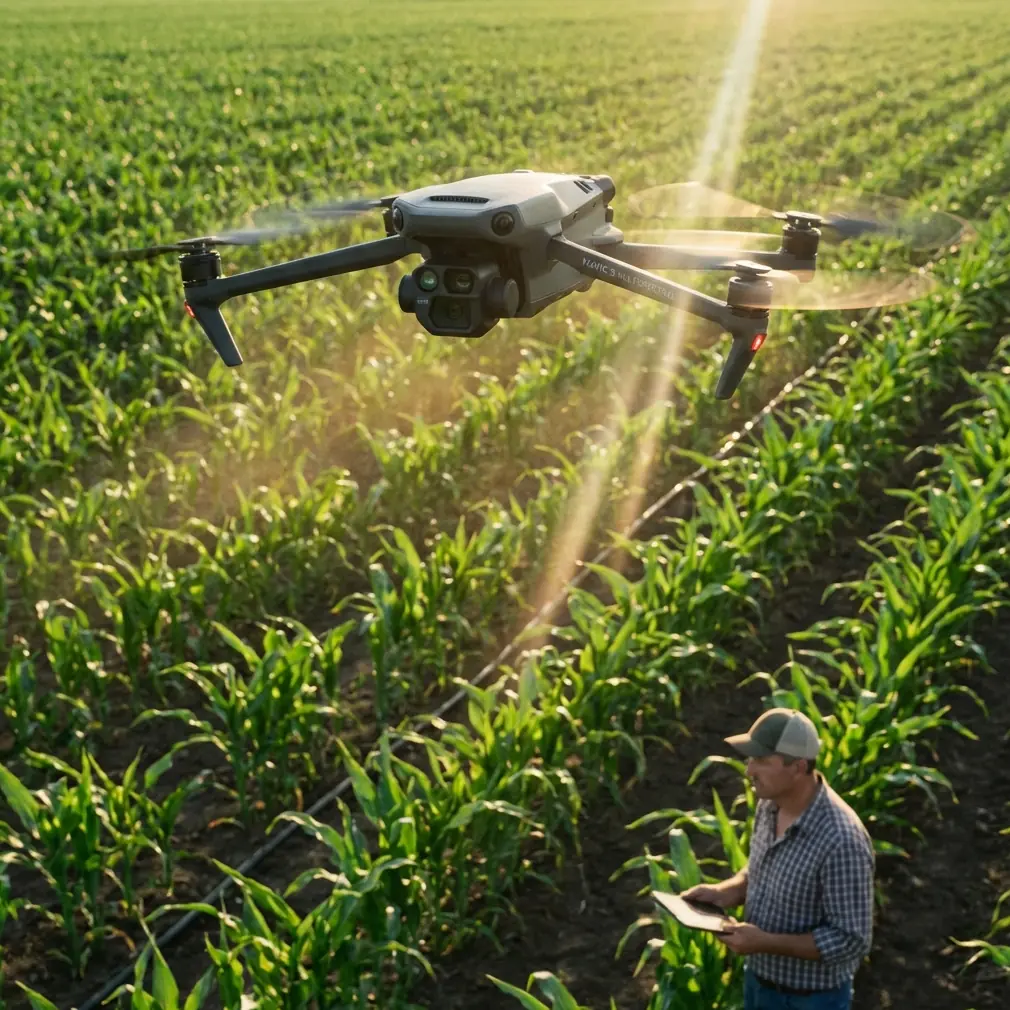
The first thing that matters in mountain vineyards is not headline image quality. It is confidence near terrain. Obstacle avoidance earns its keep here because vineyard monitoring is rarely performed over an open, forgiving field. You are often moving beside trellis lines, climbing over terraces, crossing access roads, and working near isolated trees, utility features, or ridgeline contours that do not show their depth clearly from the pilot’s position. A drone that can perceive and react to obstacles reduces the mental load, which lets the operator pay closer attention to the crop itself. That difference is operational, not cosmetic. If a pilot spends the whole flight protecting the aircraft from the terrain, less attention goes to canopy density, irrigation irregularities, or erosion signatures between rows.
This is also where subject tracking and ActiveTrack become more useful than many growers expect. In a vineyard context, those features are not just for following vehicles in a flashy promo clip. They help when you need consistent motion along a service path, a utility vehicle route, or a walking inspection team moving through a block. Used carefully, tracking can create repeatable passes that preserve framing and speed, which is valuable when comparing clips across different dates. It also reduces the micro-corrections that often creep into manual flights on windy slopes. That steadier flight path makes it easier to review footage later and actually notice subtle changes in vigor or row uniformity.
Light is another problem that high-altitude operators meet early. Vineyards on elevated ground can swing from flat morning haze to harsh midday contrast very quickly. Rows on one side of a slope can blow out while the opposite side drops into shadow. This is why D-Log matters in a field workflow. It captures a flatter image profile designed to preserve more highlight and shadow information for later grading. In practical terms, that gives you more room to recover detail in bright soil patches, reflective irrigation hardware, or dark leaf zones under a dense canopy. If your purpose is tracking plant condition over time, preserving tonal nuance is not a filmmaking indulgence. It is part of making the imagery trustworthy.
I would push that a step further. In vineyard monitoring, a technically modest shot captured consistently is often more valuable than a dramatic one-off clip. The Mavic 4 Pro is strongest when it becomes part of a repeatable observation system. Fly the same block at roughly the same time of day. Keep your altitude, angle, and line of travel close to the previous mission. Use D-Log when the contrast is difficult. Then build a simple archive by parcel or row section. That process reveals patterns. It is how you notice that one exposed shoulder of the vineyard dries earlier than the rest, or that a drainage line is slowly affecting vigor at the lower end of a terrace.
One accessory changed the usefulness of this setup for me in steep vineyard work: a high-quality third-party landing pad. That sounds almost too simple to mention, yet on dusty mountain roads and uneven rocky pullouts, it solves a real problem. Takeoff and landing are when cameras, gimbals, and sensors are most vulnerable to loose grit. A foldable pad gives the aircraft a clean surface when the nearest “flat area” is actually a mix of gravel, dry grass, and windblown dust. In one hillside block, that single accessory cut down the amount of debris kicked into the air during launch enough to make quick multi-stop flights far less stressful. It also made it easier for crews to establish a consistent launch point during repeated inspections. People underestimate how much smoother the day runs when the basic ground handling is under control.
The Mavic 4 Pro also suits vineyard teams because it can switch roles in the same visit. One moment it is capturing broad overview passes for managers who want to understand the entire block relationship. The next, it is creating closer perspective shots around trouble areas that a field supervisor flagged earlier in the week. QuickShots and Hyperlapse have a place here too, though not in the way many people assume. QuickShots are useful for producing short, standardized visual summaries for internal communication. If a vineyard manager needs to brief remote partners or investors on slope condition, road access, or post-weather recovery, a concise automated movement can communicate terrain structure fast. Hyperlapse is even more practical when used to document changing light, fog lift, worker access patterns, or cloud build-up over exposed parcels. That is not decorative content. It can help explain why one block dried late or why a harvest team’s access window narrowed on a particular morning.
Another reason this aircraft makes sense for vineyards is the way it supports layered decision-making. Not every flight is about finding a problem. Sometimes the mission is to confirm that a concern is not spreading. Other times it is to give context before boots-on-ground crews commit time to steep sections that are expensive to inspect manually. A drone flight can identify where the field team should focus first. That matters in high-altitude vineyards because labor and vehicle movement are not trivial. Walking every row on a steep site costs time and energy. If the drone narrows the search area, the savings show up in crew efficiency, not just in nicer imagery.
There is also a strong training angle. Newer pilots often struggle in mountain vineyards because the environment compresses the margin for error. Signal awareness, battery discipline, and route planning become more serious when the launch point sits below the work area or when ridges create awkward visual references. The Mavic 4 Pro’s obstacle avoidance features and intelligent flight modes can support training, but only if they are framed correctly. They are aids, not substitutes for planning. I like to train operators to map out three simple things before launch: where the wind is likely to shear near terrain, where the emergency hover zone exists, and where they will lose visual contrast against background ridges. If those three points are clear, the aircraft’s smart features become genuinely helpful rather than falsely reassuring.
Storage and workflow after the flight are just as important. A vineyard manager does not need a memory card full of unnamed clips. They need footage that can be sorted by block, date, and issue type. This is where the Mavic 4 Pro’s imaging capabilities pair well with a disciplined naming convention and a lightweight review process. Tag clips by slope section, row orientation, and observed issue. Export both a natural look version for quick discussion and a D-Log-graded version when tonal detail matters. That simple two-track approach keeps the footage accessible to non-technical stakeholders while preserving analytical value for deeper review.
For readers working in elevated wine regions, one question always comes up: can a compact platform really handle demanding terrain day after day? The answer depends less on the drone than on the operator’s habits. The Mavic 4 Pro is capable, but the real advantage appears when you stop treating it like a gadget and start using it like a field instrument. Build repeatable routes. Respect the weather. Use obstacle avoidance as a layer of protection, not permission to fly carelessly. Use ActiveTrack where it improves consistency. Use D-Log when contrast would otherwise bury useful detail. Bring a proper landing pad. Those details sound small until you stack them together. Then the operation becomes calmer, faster, and more informative.
I have seen vineyard teams get the most value from the aircraft when they define a tight mission before every takeoff. One flight might answer a drainage question after overnight rain. Another might document canopy development across a steep upper parcel. Another might produce a stable visual reference for a consultant who cannot be onsite. The Mavic 4 Pro handles all three jobs well because it sits in the middle ground that many agricultural users need: portable enough to deploy quickly, advanced enough to produce footage worth acting on, and smart enough to help in places where terrain can distract even experienced pilots.
If you are building a vineyard monitoring workflow around this aircraft, keep your ambitions practical. Start with one or two blocks. Establish a repeatable route. Record under similar lighting conditions whenever possible. Compare clips over time instead of chasing dramatic single-flight moments. If you need help refining a field setup or accessory list for mountain vineyards, you can reach out through this practical support channel: https://wa.me/85255379740. The best drone operations in agriculture are rarely the flashiest ones. They are the ones that make the next field decision easier.
That is the lens through which the Mavic 4 Pro should be judged in high-altitude vineyards. Not by isolated specifications, and not by cinematic hype. Judge it by whether it helps you see the vineyard more clearly, with less friction, in the narrow windows when the mountain allows you to fly. On that standard, it earns its place.
Ready for your own Mavic 4 Pro? Contact our team for expert consultation.