Mavic 4 Pro for Solar Farm Monitoring in Extreme Temperature
Mavic 4 Pro for Solar Farm Monitoring in Extreme Temperatures: A Technical Review
META: Expert review of the Mavic 4 Pro for solar farm inspections in extreme heat and cold, with practical altitude, imaging, tracking, and safety guidance.
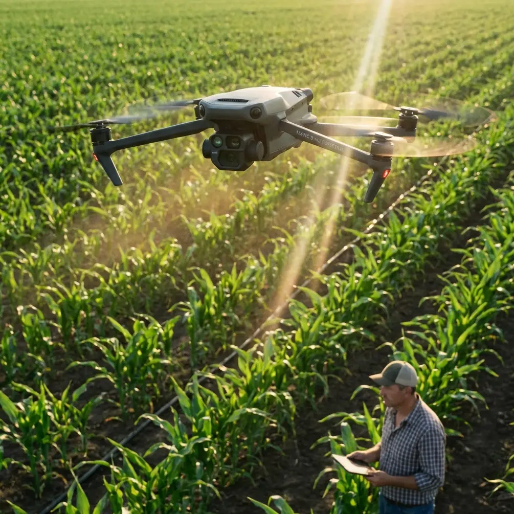
Solar farm inspection is unforgiving work for any drone. Heat shimmer distorts imagery. Wind accelerates across open fields. Cold mornings can suppress battery performance, while scorching afternoon temperatures raise the thermal load on both aircraft and operator. In that environment, the Mavic 4 Pro stands out not because of hype, but because its core flight and imaging systems align unusually well with the real demands of utility-scale PV monitoring.
This review looks at the Mavic 4 Pro through a narrow lens: how well it serves operators inspecting solar farms in extreme temperatures. That means less attention on lifestyle flying and more on operational realities such as obstacle avoidance around tracker rows, repeatable subject tracking for moving maintenance crews, D-Log capture for mixed-light analysis, and the right flight altitude for identifying panel defects without wasting time or battery.
Why the Mavic 4 Pro fits solar work
A solar farm presents a deceptively simple airspace. From above, it can look like endless geometric repetition. In practice, that repetition is exactly what stresses a drone system. Long rows demand stable navigation, accurate framing, and clean route discipline. A pilot needs to scan for cracked modules, hotspot patterns, vegetation encroachment, soiling differences, inverter-area anomalies, and structural shifts. If the platform drifts, hunts for focus, or struggles with contrast under harsh sunlight, the mission slows down fast.
The Mavic 4 Pro has a useful balance for this kind of work. It remains portable enough to redeploy quickly between sections of a site, but it also brings the sensing and image control expected in serious technical fieldwork. That matters when the job is not a cinematic pass for marketing footage, but repeatable documentation under conditions that can swing from near-freezing dawns to punishing midday heat.
Its obstacle avoidance system is particularly relevant here. Many people think of obstacle sensing as something for forest trails or urban shoots. On solar assets, the threat profile is different but no less real. Tracker mechanisms, perimeter fencing, weather stations, substation hardware, and maintenance vehicles all create collision risks, especially when glare reduces visual contrast. A robust obstacle avoidance stack helps preserve aircraft safety during low-altitude passes and lateral transitions across equipment zones. Operationally, that reduces the cognitive load on the pilot, which is critical when the real task is interpreting site conditions rather than fighting to keep the drone clear of hazards.
Extreme temperatures change everything
The biggest mistake in solar farm drone operations is treating heat or cold as a side note. Temperature is not background context. It shapes the entire mission.
In extreme heat, the air over dark panel surfaces becomes unstable. That shimmer can soften image detail and complicate defect verification. Batteries and onboard processors also carry a heavier thermal burden. In the cold, the challenge flips. Air density may help lift efficiency slightly, but battery chemistry becomes less forgiving, and the aircraft can feel sluggish until the system reaches a healthier operating state.
For the Mavic 4 Pro, the practical takeaway is simple: mission timing matters as much as camera settings. If the objective is visible-spectrum documentation of panel condition, structural alignment, or vegetation spread, early morning flights usually produce the cleanest imagery. If you are trying to correlate visible defects with site conditions under strong irradiance, a later window may be useful, but only if you manage the effects of heat haze and battery temperature carefully.
This is also where flight cadence matters. Shorter, well-planned sorties are better than trying to brute-force an entire site in one long session. On large solar farms, operators should think in blocks: inspect one segment, review data quality, land, check battery state and aircraft temperature, then relaunch. The Mavic 4 Pro’s portability supports that workflow well. It encourages disciplined field practice instead of overextending a single flight.
The optimal altitude for solar farm inspections
For this scenario, the best working altitude with the Mavic 4 Pro is usually 20 to 35 meters above ground level for detailed row inspections, with 50 to 70 meters reserved for broader condition mapping and progress documentation.
That range is not arbitrary. Below roughly 20 meters, you gain detail, but coverage efficiency drops sharply, and you increase the risk of distortion from changing angles across module rows. You also reduce your margin around poles, tracker hardware, and service vehicles. Above 35 meters, you cover more ground, but small anomalies become easier to miss in standard visual imagery, especially under heat shimmer.
At 25 to 30 meters, the Mavic 4 Pro tends to hit the sweet spot for visible-light inspection of PV arrays in difficult weather. You keep enough pixel density to assess cracked glass, major contamination zones, pooling patterns near edges, and mechanical irregularities in row alignment, while maintaining a field of view wide enough for efficient lane-by-lane progress. That altitude also gives obstacle avoidance systems enough reaction space to work effectively during cross-row repositioning.
For pilots documenting maintenance operations rather than panel condition alone, a slightly higher envelope can be smarter. Around 40 to 50 meters, the aircraft can monitor vehicle movement, crew distribution, access paths, and work sequencing without constantly needing aggressive repositioning. In extreme heat, this higher altitude can also reduce the worst effects of thermal shimmer rising directly off module surfaces.
The main point is that altitude should reflect the inspection question. If the question is “Which rows need a closer look?” fly higher. If the question is “What exactly happened to this section?” come down into that 20-to-35-meter band.
Imaging discipline matters more than headline specs
Solar sites create punishing contrast. Bright reflective surfaces can sit next to shadowed understructures, dusty access roads, and dark electrical housings in the same frame. That is where D-Log becomes genuinely useful on the Mavic 4 Pro.
Recording in D-Log gives more room to preserve highlight information while retaining usable shadow detail. On a solar farm, that has real analytical value. You may need to inspect panel surfaces without blowing out reflective hotspots, while still keeping enough visibility in support structures or cable runs to understand the scene. A flatter profile is not just for color grading aesthetics. It is a practical tool for extracting more interpretable visual data from difficult light.
That said, D-Log only pays off if the operator has a consistent post-workflow. If your team needs quick same-day reporting, standard profiles may be preferable for routine condition checks. But for sites where evidence quality matters, especially in warranty, compliance, or damage documentation contexts, D-Log is the better capture path.
Hyperlapse and QuickShots are often dismissed in technical operations, but that misses the point. They are not inspection tools by themselves. They are communication tools. A carefully executed Hyperlapse can show cloud shadow movement across an array block, maintenance vehicle activity over time, or the progression of weather over a site visit. QuickShots, used sparingly, can create useful context clips for stakeholders who need to understand terrain layout, access constraints, or the spatial relationship between arrays and balance-of-system equipment. The Mavic 4 Pro gives field teams the ability to produce both raw technical records and high-clarity executive summaries from one platform.
ActiveTrack and subject tracking in a utility environment
Most solar inspections are not only about fixed assets. They also involve people and machines moving through the site. This is where ActiveTrack and subject tracking become more relevant than many enterprise operators assume.
A maintenance crew diagnosing repeated faults across multiple rows can be followed from a safe offset, allowing the Mavic 4 Pro to capture process documentation without demanding continuous manual reframing from the pilot. That is useful for training, QA review, and contractor verification. If a technician is moving between inverter stations or a utility vehicle is covering a long perimeter route, subject tracking reduces workload and helps maintain consistent visual context.
Operationally, this becomes even more valuable in extreme temperatures. In hot conditions, pilot fatigue arrives earlier than many teams admit. In cold conditions, dexterity can degrade. A reliable tracking mode does not replace pilot judgment, but it can reduce repetitive control input and make data capture more consistent across long inspection days.
Of course, solar sites are not idealized tracking environments. Repetitive geometry can confuse any vision system, and reflective surfaces can produce unpredictable visual cues. That means ActiveTrack should be treated as an assistive feature, not an autonomous answer. The Mavic 4 Pro is at its best when tracking supports a defined inspection plan rather than substituting for one.
Obstacle avoidance is more useful here than many expect
Obstacle avoidance tends to be undervalued on open industrial sites because the area looks clear from a distance. Get lower, and that illusion disappears. Tracker posts, combiner boxes, perimeter barriers, service lifts, temporary equipment, and even birds can complicate low-level flight.
On a solar farm, one of the highest-risk moments is not the inspection pass itself. It is the transition between passes, especially when the pilot yaws, climbs, and slides laterally while trying to realign for the next row. In bright sun or strong glare, depth judgment is less reliable. A capable obstacle avoidance system gives the Mavic 4 Pro a real operational edge in these moments. It helps avoid the kind of minor contact event that ends a productive day and introduces reporting obligations no operator wants.
This feature also matters when monitoring around substations or weather instrumentation, where pilots may need wider situational awareness than a single forward view provides. The drone’s ability to sense and respond to nearby structures makes it more suitable for mixed-asset energy sites, not just clean array fields.
Practical field workflow for extreme-temperature inspections
If I were deploying the Mavic 4 Pro on a solar site facing severe seasonal swings, I would structure the mission like this:
Start with a high pass at 60 meters to build a quick situational map. This reveals standing water, major soiling zones, vegetation issues, access obstructions, and any obvious row misalignment. Then drop into the 25-to-30-meter range for targeted visual inspection of flagged sections. If maintenance crews are active, use ActiveTrack selectively to document interventions from a safe lateral position rather than hovering directly overhead. Capture critical imagery in D-Log when the contrast is severe or when downstream review quality matters.
In hot weather, avoid the temptation to fly long low passes above the darkest panels in the hottest part of the day. Climb slightly, shorten the segment, and rotate batteries more often. In cold weather, monitor aircraft responsiveness closely on the first mission of the day and keep early sorties conservative until the system is operating comfortably.
This kind of workflow is where the Mavic 4 Pro makes sense. It is not just about having advanced features. It is about having features that can be arranged into a repeatable inspection method.
If your team is refining that method for a utility-scale site, a direct field planning discussion often saves more time than another week of trial and error. You can reach out here for a practical ops conversation: message our drone team on WhatsApp.
Where the Mavic 4 Pro genuinely helps solar operators
The Mavic 4 Pro is strongest when the mission demands three things at once: fast deployment, dependable flight assistance, and image flexibility under ugly light. Solar farms in extreme temperatures create exactly that combination.
Its obstacle avoidance contributes directly to safer low- and mid-altitude inspection patterns. ActiveTrack and subject tracking help document maintenance actions without forcing the pilot into constant manual framing. D-Log improves image retention when glare and hard shadow share the same frame. QuickShots and Hyperlapse add communication value that can support reporting beyond the technical team.
Just as important, the aircraft’s size and speed of setup make it practical for repeat visits. That matters because solar monitoring is not a one-off event. The real value comes from comparable flights over time. A drone that is fast to deploy is more likely to be used consistently, and consistency is what turns footage into operational intelligence.
Final assessment
For solar farm monitoring in extreme temperatures, the Mavic 4 Pro is not simply a capable camera drone. It is a strong field platform when flown with inspection logic rather than marketing logic. Keep the aircraft around 25 to 30 meters for detailed row work, move higher for site-wide context, use D-Log when contrast is punishing, and treat ActiveTrack as a smart assistant for documenting crews and vehicles. Most importantly, respect the temperature. The drone can handle serious work, but the best results still come from operators who adapt the mission to the environment instead of forcing the environment to fit the mission.
That is the real value of the Mavic 4 Pro on solar assets. It gives experienced teams enough sensing, control, and imaging headroom to work methodically in conditions that usually expose weaknesses fast.
Ready for your own Mavic 4 Pro? Contact our team for expert consultation.