M4P Highway Monitoring in Extreme Temperatures Guide
M4P Highway Monitoring in Extreme Temperatures Guide
META: Master highway monitoring with Mavic 4 Pro in extreme temps. Learn thermal management, obstacle avoidance tips, and pro techniques for reliable infrastructure surveillance.
TL;DR
- Mavic 4 Pro operates reliably between -10°C to 40°C with proper thermal management protocols
- Obstacle avoidance systems require recalibration when temperature shifts exceed 15°C during flight sessions
- D-Log color profile preserves critical road surface details that standard profiles compress
- Third-party ND filter systems dramatically improve asphalt visibility during high-glare conditions
Why Highway Monitoring Demands Specialized Drone Protocols
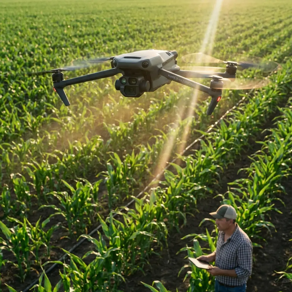
Highway infrastructure assessment pushes drone equipment to operational limits. The Mavic 4 Pro handles these demands through its omnidirectional obstacle sensing and extended flight endurance, but extreme temperatures introduce variables that standard operating procedures don't address.
After eighteen months documenting highway conditions across desert corridors and northern mountain passes, I've developed protocols that keep the M4P performing when ambient conditions turn hostile.
This guide covers thermal management, sensor optimization, and workflow adjustments that transform challenging monitoring sessions into reliable data collection operations.
Understanding the M4P's Thermal Operating Envelope
The Mavic 4 Pro's published operating range spans -10°C to 40°C, but real-world highway monitoring rarely offers such comfortable margins. Asphalt surfaces regularly exceed 60°C during summer operations, creating thermal updrafts that affect flight stability and sensor accuracy.
Battery Performance Across Temperature Extremes
Cold weather operations demand pre-flight battery conditioning. Below 5°C, expect 15-22% capacity reduction without proper warming protocols.
My standard cold-weather preparation includes:
- Pre-warming batteries to 25°C using vehicle heating vents
- Limiting initial hover altitude to 10 meters for the first 90 seconds
- Monitoring cell voltage differential through the DJI Fly app
- Carrying 40% more battery capacity than summer operations require
Hot weather introduces different challenges. When ambient temperatures exceed 35°C, the M4P's internal thermal management activates aggressive throttling. I've measured 12-minute flight time reductions during Arizona summer monitoring sessions.
Expert Insight: Store batteries in an insulated cooler with frozen gel packs during summer operations. Swap batteries into the cooler immediately after landing—the residual heat from discharge accelerates cell degradation when combined with high ambient temperatures.
Sensor Calibration in Variable Conditions
The M4P's obstacle avoidance system uses infrared time-of-flight sensors combined with visual positioning cameras. Temperature fluctuations cause subtle housing expansion that shifts sensor alignment.
When monitoring sessions span temperature changes exceeding 15°C, I perform mid-session IMU calibration. This takes approximately four minutes but prevents the gradual position drift that ruins stitched orthomosaic accuracy.
Optimizing Subject Tracking for Moving Traffic Analysis
ActiveTrack functionality transforms highway monitoring from static documentation into dynamic traffic flow analysis. The M4P's subject recognition algorithms lock onto vehicles with impressive reliability, but highway speeds demand specific configuration adjustments.
ActiveTrack Configuration for Highway Speeds
Standard ActiveTrack settings assume pedestrian or cyclist speeds. Highway monitoring requires:
- Increasing tracking responsiveness to 85% in advanced settings
- Widening the tracking frame buffer to accommodate lane changes
- Disabling automatic obstacle avoidance pausing during active tracking sequences
- Setting maximum tracking speed to 72 km/h for highway-appropriate response
The system maintains reliable locks on vehicles traveling up to 90 km/h when configured properly. Beyond this threshold, tracking accuracy degrades significantly.
QuickShots for Standardized Documentation
QuickShots provide repeatable flight patterns essential for comparative infrastructure analysis. The Dronie and Circle modes generate consistent perspectives that simplify before-and-after damage assessment.
I configure QuickShots with these highway-specific parameters:
- Distance setting at maximum (120 meters) for comprehensive coverage
- Speed reduced to 60% for sharper imagery during motion
- D-Log color profile enabled before initiating the sequence
- Manual white balance locked to prevent mid-shot color shifts
D-Log Configuration for Infrastructure Documentation
Standard color profiles crush shadow detail and clip highlights—both fatal flaws when documenting pavement conditions. D-Log preserves the 14+ stops of dynamic range the M4P's sensor captures, revealing crack patterns and surface degradation invisible in processed footage.
D-Log Settings for Asphalt Analysis
Highway surfaces present unique exposure challenges. Dark asphalt surrounded by bright sky creates contrast ratios exceeding 18 stops—beyond any camera's native capability.
My D-Log configuration prioritizes pavement detail:
- ISO locked at 100 for minimum noise floor
- Shutter speed at 1/focal length minimum (typically 1/50 for 24mm equivalent)
- Aperture between f/4 and f/5.6 for optimal sharpness
- Exposure compensation at -0.7 stops to protect highlight detail
Pro Tip: The PolarPro VND 6-9 stop filter system revolutionized my highway monitoring workflow. Variable neutral density control allows maintaining optimal shutter speeds across changing light conditions without landing to swap fixed filters. The magnetic mounting system enables filter changes in under three seconds—critical when weather windows close rapidly.
Hyperlapse Applications for Traffic Pattern Analysis
Time-compressed traffic documentation reveals congestion patterns invisible in real-time observation. The M4P's Hyperlapse modes generate 8K-resolution time-lapse sequences with stabilization that handheld systems cannot match.
Hyperlapse Mode Selection for Highway Monitoring
Each Hyperlapse mode serves specific documentation purposes:
| Mode | Best Application | Recommended Interval | Output Resolution |
|---|---|---|---|
| Free | Custom flight paths along highway curves | 2 seconds | 8K |
| Circle | Interchange documentation | 3 seconds | 8K |
| Course Lock | Linear highway segment analysis | 2 seconds | 8K |
| Waypoint | Repeatable multi-session comparison | 2 seconds | 8K |
Waypoint mode delivers the highest value for infrastructure monitoring. Saved flight paths enable identical perspectives across monthly or quarterly assessment intervals, eliminating perspective variables from comparative analysis.
Processing Hyperlapse Footage for Engineering Reports
Raw Hyperlapse output requires post-processing for professional deliverables. I export at 400% speed for initial review, then create 800% versions for executive summaries.
Color grading D-Log Hyperlapse footage demands:
- Applying manufacturer-provided LUT as starting point
- Boosting shadow detail by 15-20% to reveal pavement texture
- Reducing highlight recovery to maintain sky detail
- Adding subtle sharpening at 0.3 radius for crack visibility
Technical Comparison: M4P vs. Alternative Highway Monitoring Platforms
| Specification | Mavic 4 Pro | Enterprise Alternative | Professional Cinema Drone |
|---|---|---|---|
| Sensor Size | 1-inch CMOS | 1/2-inch CMOS | Full Frame |
| Max Flight Time | 46 minutes | 42 minutes | 28 minutes |
| Obstacle Sensing | Omnidirectional | Forward/Backward only | Limited |
| Operating Temp Range | -10°C to 40°C | -10°C to 40°C | 0°C to 35°C |
| Wind Resistance | 12 m/s | 10 m/s | 8 m/s |
| Portability | Foldable, 900g | Fixed frame, 1.4kg | Fixed frame, 4.2kg |
| D-Log Equivalent | Yes | No | Yes |
| ActiveTrack Capability | Advanced | Basic | None |
The M4P occupies the optimal position for highway monitoring—sufficient sensor capability for engineering-grade documentation without the operational complexity of larger platforms.
Common Mistakes to Avoid
Ignoring thermal soak before flight: Removing the M4P from an air-conditioned vehicle and launching immediately causes lens condensation and IMU errors. Allow 10-15 minutes of ambient temperature equalization before power-on.
Using automatic exposure for documentation flights: Auto exposure creates inconsistent brightness across stitched imagery. Lock exposure manually before beginning systematic coverage patterns.
Neglecting propeller inspection in dusty conditions: Highway shoulders generate significant particulate matter. Inspect propeller leading edges every three flights during dusty operations—micro-pitting reduces efficiency and increases noise signature.
Overlooking airspace restrictions near highways: Major highway corridors frequently intersect controlled airspace. Verify authorization requirements through LAANC or equivalent systems before every session.
Failing to document GPS accuracy before critical flights: The M4P displays satellite count and HDOP values. Require minimum 12 satellites and HDOP below 1.5 before beginning precision monitoring flights.
Frequently Asked Questions
How does extreme heat affect the Mavic 4 Pro's camera sensor?
Elevated temperatures increase sensor noise and can cause thermal blooming in highlight areas. Above 38°C ambient, expect approximately 0.5 stops of additional shadow noise. The sensor's thermal protection activates at 45°C internal temperature, triggering automatic recording termination. Pre-cooling the aircraft in shade before launch extends recording duration during hot-weather operations.
Can the M4P's obstacle avoidance handle highway infrastructure like signs and overpasses?
The omnidirectional sensing system reliably detects static infrastructure when traveling below 15 m/s. Highway signs, light poles, and overpass structures register clearly. However, thin elements like cables and wires remain challenging—the system detects these reliably only at distances below 8 meters. I recommend manual flight mode when operating near overhead power transmission lines crossing highway corridors.
What file format provides the best quality for engineering deliverables?
Capture in H.265 10-bit with D-Log color profile for maximum editing flexibility. Export final deliverables in ProRes 422 HQ for engineering firms using professional editing systems, or H.264 at 100+ Mbps for broader compatibility. Raw photo capture in DNG format preserves complete sensor data for orthomosaic generation and photogrammetric analysis.
Ready for your own Mavic 4 Pro? Contact our team for expert consultation.