Mavic 4 Pro for Low-Light Wildlife Mapping: A Field
Mavic 4 Pro for Low-Light Wildlife Mapping: A Field-Focused Technical Review
META: A technical review of the Mavic 4 Pro for low-light wildlife mapping, covering flight altitude, obstacle avoidance, ActiveTrack, D-Log, and practical field setup.
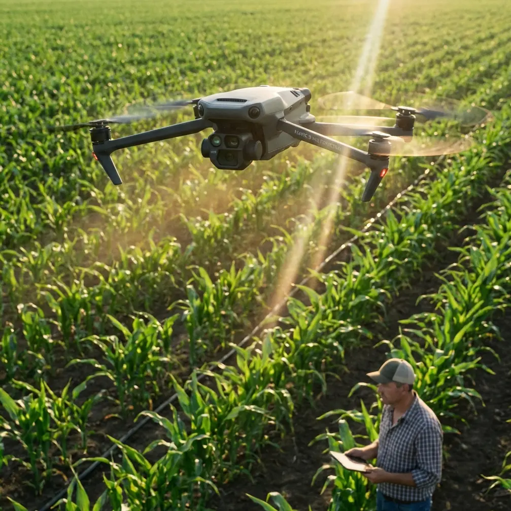
Low-light wildlife mapping is one of those jobs that looks straightforward on paper and becomes unforgiving the moment you launch. The light is thin, animal movement is unpredictable, terrain detail starts disappearing, and every system on the aircraft gets tested at once. In that environment, the Mavic 4 Pro is not just being judged as a camera drone. It has to function as a stable imaging platform, a reliable navigation tool, and a decision-making aid for the operator.
That is the lens I would use to evaluate it.
As a photographer, I care about image quality first. But when the assignment is wildlife mapping rather than scenic flying, image quality only matters if it arrives with clean positioning, repeatable coverage, and enough situational awareness to keep the aircraft out of trees, ridgelines, wires, and uneven ground. The Mavic 4 Pro sits in a class of aircraft that appeals to wildlife researchers, habitat survey teams, conservation groups, and environmental contractors because it blends relatively portable field deployment with features that reduce pilot workload. For low-light work, that balance matters more than headline specs.
What low-light wildlife mapping actually demands
The phrase “wildlife mapping” can mean several different missions. Sometimes you are documenting herd position at dawn. Sometimes you are tracking movement corridors along a riverbank at dusk. In other cases, you are building a visual record of nest sites, wetland boundaries, or grazing patterns without disturbing the animals. The common thread is this: your best flight window often sits near sunrise or sunset, exactly when visibility is least forgiving.
That changes how you should think about the Mavic 4 Pro.
In bright daylight, many drones can produce acceptable map imagery if the weather cooperates. In low light, weak aircraft behavior gets exposed quickly. You need smooth hovering, stable framing, accurate obstacle sensing, and footage that holds shadow detail instead of collapsing into muddy blacks. You also need control over your color profile and motion cadence, because wildlife mapping often feeds into analysis workflows later, not just a quick social media clip from the field.
This is where features such as obstacle avoidance, subject tracking, D-Log, Hyperlapse, QuickShots, and ActiveTrack stop being marketing vocabulary and become operational tools.
The most useful flight altitude for this scenario
If I had to give one practical altitude recommendation for low-light wildlife mapping with the Mavic 4 Pro, I would start most missions at 60 to 90 meters above ground level and adjust from there based on species sensitivity, vegetation height, and terrain complexity.
That range works for a reason.
At around 60 meters, you are often low enough to preserve subject detail in dim conditions without forcing the camera into excessively high ISO behavior. Ground texture remains readable, animal grouping is easier to distinguish, and the drone still has enough stand-off distance to reduce disturbance for many non-fragile species. Move closer than that in low light and you can improve detail, but you also increase rotor-noise influence and narrow your field of view, which makes route context harder to interpret.
At 90 meters, coverage expands and the aircraft can map larger habitat segments in fewer passes. That helps when daylight is fading quickly. The tradeoff is that tiny subjects can blend into dark terrain, especially under tree canopy edges, brush lines, or uneven shadow bands. For larger mammals in open grassland, the upper part of that range is often efficient. For smaller animals, mixed woodland edges, or wetland margins, I would lean lower.
The key point is operational significance: altitude in low light is not just about regulations or safety margin. It directly affects noise footprint, target detectability, image clarity, and how much correction you will need in post.
Why obstacle avoidance matters more at dusk than most pilots admit
Obstacle avoidance is easy to undervalue when conditions are perfect. In low light, it becomes central to mission design.
Wildlife surveys often happen over terrain that includes tree lines, reeds, power corridors, embankments, or abrupt elevation changes. At dusk, those features flatten visually, and a pilot relying purely on the live feed can misread distance. If the Mavic 4 Pro’s obstacle avoidance system is working well, it gives you a second layer of protection when depth perception starts to degrade. That matters especially when you are flying lateral transects or orbiting a habitat feature while trying to maintain camera framing.
Operationally, this changes how confidently you can fly near edges and transitions. A marsh meeting a wooded perimeter is a classic example. The camera may still see the boundary, but judging branch protrusion or uneven canopy shape gets harder as the light falls. Obstacle sensing does not make low-light flying carefree, but it does reduce the probability of a small misjudgment becoming a mission-ending impact.
For wildlife mapping teams, that also affects staffing. A platform with dependable sensing can lower pilot cognitive load, which is useful when a single operator is handling aircraft positioning, visual scanning, and observation logging at the same time.
ActiveTrack and subject tracking are not just for cinematic shots
A lot of drone pilots hear ActiveTrack or subject tracking and think of athletes, vehicles, or polished follow footage. In wildlife mapping, those features can be surprisingly useful when used conservatively.
If you are documenting the movement of a larger animal or a group across open terrain, subject tracking can help maintain framing while you focus on altitude, spacing, and route safety. The value is not that the drone “hunts” the subject for you. The value is that tracking support can smooth out workload during moments when the subject changes direction and the light is too poor for constant manual micro-correction.
That matters because low-light missions already strain the operator’s attention. If the drone can help keep a subject centered while you monitor the edge of a tree line or the topography ahead, your overall situational awareness improves.
There are limits. Dense canopy, overlapping subjects, and cluttered backgrounds can challenge any tracking system. I would not hand over the mission to automation in those environments. But in open grassland, tidal flats, scrubland, or broad riverbanks, ActiveTrack can support documentation in a way that is genuinely practical.
Its significance is simple: when light is weak, reducing unnecessary control inputs often improves footage quality and flight safety at the same time.
D-Log is where this aircraft starts earning its keep for serious field work
If your output is a quick visual check, the standard image profile may be enough. But if you are building records for researchers, NGOs, habitat consultants, or repeat seasonal comparisons, D-Log has real value.
Low-light wildlife mapping usually contains extreme tonal compromises. You may have a bright band of sky, dark vegetation, reflective water, and moving subjects all in one frame. A flatter profile such as D-Log helps preserve highlight and shadow information so you can make better decisions later in grading and analysis. That is especially useful when you need to reveal subtle terrain separation or distinguish dark-coated animals from background cover.
The operational significance here is not aesthetic. It is interpretive reliability.
When shadow detail is crushed, habitat boundaries can look less distinct than they really are. When highlights clip, water edges and open ground can lose texture. D-Log gives you more room to recover those areas, which can make a difference when comparing movement paths or identifying where animals are actually entering and leaving a site.
For field teams, I would pair D-Log capture with disciplined exposure management and short review pauses between flight segments. You do not want to discover after sunset that the entire mission drifted too dark.
Hyperlapse and QuickShots have a place, but not the one people assume
QuickShots and Hyperlapse sound like creative extras, and in many cases they are. For wildlife mapping, though, they can serve specific support roles.
Hyperlapse can help document environmental transition over a short window: fog lifting from a wetland, animal congregation near water, or changing movement around a feeding zone at dawn. This is not a substitute for formal mapping passes, but it can add temporal context that still imagery misses.
QuickShots are less central, yet they can be useful for rapid visual site summaries before or after a structured survey. A concise automated orbit or reveal can document terrain arrangement, access constraints, or habitat structure for stakeholders who were not in the field. Used carefully, these modes can create reference material that helps teams plan later flights.
The mistake would be treating them as the mission itself. In conservation and wildlife assessment work, they are supporting tools, not the core dataset.
Camera handling in low light: what I would actually do
I would approach the Mavic 4 Pro as a platform that needs restraint rather than constant feature use. Low-light mapping rewards discipline.
Start with a measured ascent and hold hover long enough to judge wind and image stability. Build a first pass at 60 to 90 meters AGL, then lower only if subject identification is weak and the species can tolerate the noise profile. Keep speed moderate. Fast flight in poor light reduces your margin for both obstacle reaction and image review.
If I were collecting footage for later analysis, I would favor D-Log and prioritize exposure consistency over dramatic framing. For moving wildlife in open space, I would test ActiveTrack only after confirming that the background is clean enough for reliable lock. In woodland edge work, I would keep tracking off unless performance was clearly stable.
Obstacle avoidance stays on unless the environment creates a specific reason to alter the setting. In low light, that layer of protection is worth preserving.
And I would avoid flying so low that the aircraft becomes a disturbance source. Mapping works best when animal behavior remains natural. A technically sharp image captured after the subject has been pushed off course is a poor result.
Where the Mavic 4 Pro fits best
The Mavic 4 Pro makes the most sense for teams that need a compact field aircraft able to shift between documentation, observation, and repeatable survey support without dragging a heavy deployment burden into remote areas. It is well suited to conservation photography, habitat monitoring, wildlife corridor checks, wetland edge mapping, and dawn or dusk reconnaissance where portability and imaging flexibility matter.
It is less about one spectacular capability than the way several systems work together.
Obstacle avoidance helps when terrain detail fades. ActiveTrack and subject tracking can reduce pilot workload in cleaner scenes. D-Log preserves more usable image information when shadows deepen. Hyperlapse and QuickShots can supplement the mission with contextual visuals. None of those features alone defines the aircraft. Together, they make it practical for the kind of mixed, imperfect field conditions that wildlife work usually involves.
That is what I would want from a drone in this category: not just impressive footage, but a better chance of coming back with usable, repeatable data.
Final field perspective
For mapping wildlife in low light, the Mavic 4 Pro should be judged by one standard: does it help you gather cleaner visual evidence while keeping the aircraft predictable in difficult conditions? On that question, the answer is largely yes, provided the pilot respects the limits of light, background complexity, and animal sensitivity.
My preferred altitude starting point remains 60 to 90 meters above ground level because it balances disturbance, area coverage, and image readability better than most lower or higher choices in this scenario. Pair that with obstacle avoidance enabled, careful use of ActiveTrack in open terrain, and D-Log for any footage that may need later interpretation. That combination gives the aircraft real field value.
If you are comparing setups for conservation or habitat survey work and want to talk through mission fit, flight planning, or camera workflow, you can message a drone specialist here.
Ready for your own Mavic 4 Pro? Contact our team for expert consultation.