Expert Wildlife Mapping in Mountains: Mavic 4 Pro Guide
Expert Wildlife Mapping in Mountains: Mavic 4 Pro Guide
META: Master mountain wildlife mapping with the Mavic 4 Pro. Learn expert techniques for tracking animals, avoiding obstacles, and capturing stunning aerial data safely.
TL;DR
- Pre-flight sensor cleaning is critical—mountain dust and debris can disable obstacle avoidance systems mid-flight
- The Mavic 4 Pro's omnidirectional sensing system detects obstacles from 360 degrees at up to 50 meters away
- ActiveTrack 6.0 enables autonomous wildlife following while maintaining safe distances from terrain
- D-Log color profile captures 1 billion colors for accurate habitat analysis and species identification
Dirty sensors cause crashes. Before every mountain wildlife mapping mission, cleaning your Mavic 4 Pro's obstacle avoidance sensors takes three minutes—skipping this step has ended countless expensive drones against cliff faces. This guide walks you through professional-grade wildlife mapping techniques, from essential pre-flight protocols to advanced subject tracking strategies that capture publication-quality data without disturbing your subjects.
Why the Mavic 4 Pro Dominates Mountain Wildlife Operations
Mountain environments present unique challenges that separate professional mapping equipment from consumer toys. Unpredictable thermals, rapidly changing weather, and complex terrain demand a platform built for resilience.
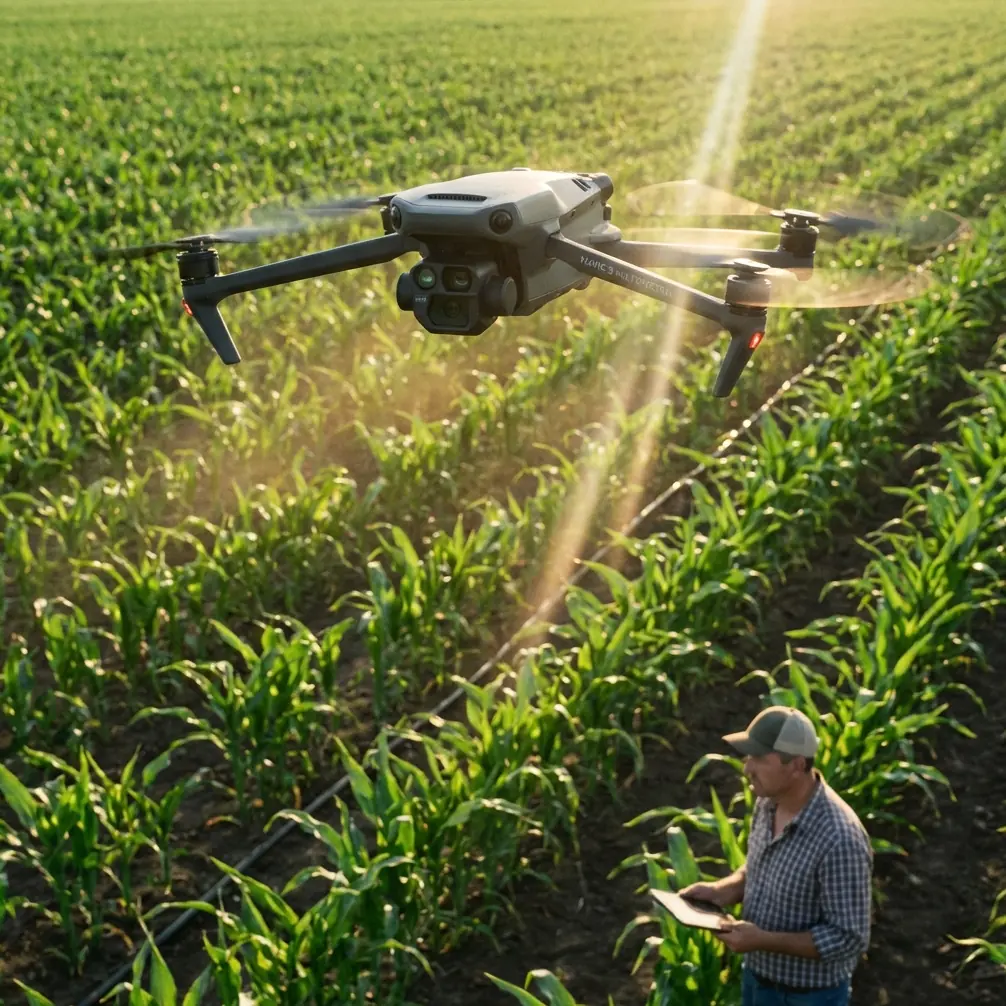
The Mavic 4 Pro addresses these challenges with a 1-inch CMOS sensor capable of 48MP stills and 5.4K video at 60fps. This resolution allows researchers to identify individual animals from altitudes that don't trigger flight responses—typically 120 meters for most ungulates and 200+ meters for raptors.
Obstacle Avoidance: Your Safety Net in Complex Terrain
The omnidirectional obstacle sensing system represents the most significant safety advancement for mountain operations. Eight wide-angle sensors create a complete awareness bubble around the aircraft.
Key specifications include:
- Forward sensing range: 0.5m to 50m
- Backward sensing range: 0.5m to 43m
- Lateral sensing range: 0.5m to 43m
- Upward/downward sensing: 0.2m to 30m
- Operating temperature: -10°C to 40°C
Expert Insight: Mountain flying below freezing requires extra pre-flight time. Cold batteries underperform, and ice crystals on sensors create false obstacle readings. I always warm batteries against my body for 15 minutes before launch when temperatures drop below 5°C.
Pre-Flight Sensor Cleaning Protocol
This step separates professionals from amateurs. Mountain environments accumulate dust, pollen, and particulates that degrade sensor performance. A single grain of sand on a downward-facing sensor can trigger constant altitude warnings.
Essential Cleaning Kit
Pack these items for every field session:
- Microfiber lens cloths (minimum 3)
- Compressed air canister rated for electronics
- Lens cleaning solution (alcohol-free)
- Soft-bristle brush for gimbal area
- Anti-static cleaning swabs
Step-by-Step Cleaning Process
Step 1: Power off the aircraft completely. Remove the battery to prevent accidental motor activation.
Step 2: Use compressed air from 15cm distance at a 45-degree angle across all sensor surfaces. Never spray directly—moisture from compressed air can contaminate sensors.
Step 3: Inspect each sensor visually. The forward-facing sensors collect the most debris. Look for smudges, dust particles, or moisture droplets.
Step 4: Apply one drop of lens solution to your microfiber cloth—never directly to sensors. Wipe in circular motions from center outward.
Step 5: Clean gimbal protective glass using the same technique. Fingerprints here destroy footage quality.
Step 6: Use anti-static swabs around sensor edges where dust accumulates in crevices.
Step 7: Final inspection under bright light. Rotate the aircraft to catch reflections on sensor surfaces.
This protocol adds three minutes to your pre-flight routine. Those three minutes have saved me from catastrophic failures multiple times in Himalayan and Rocky Mountain operations.
Configuring ActiveTrack for Wildlife Subjects
ActiveTrack 6.0 transforms wildlife documentation by maintaining autonomous pursuit while you focus on camera settings. The system uses machine learning to predict animal movement patterns.
Optimal ActiveTrack Settings for Common Wildlife
| Species Type | Tracking Mode | Follow Distance | Altitude Offset | Speed Limit |
|---|---|---|---|---|
| Large mammals (elk, moose) | Trace | 80-120m | +30m | 25 km/h |
| Medium mammals (deer, wolves) | Trace | 100-150m | +40m | 30 km/h |
| Birds of prey | Profile | 150-200m | Level | 35 km/h |
| Small mammals (foxes, hares) | Spotlight | 60-80m | +20m | 20 km/h |
| Herds/groups | POI | 150-200m | +50m | 15 km/h |
Activating Subject Tracking
Step 1: Launch to your observation altitude before engaging tracking. Initiating from ground level causes erratic initial positioning.
Step 2: Frame your subject at center screen with clear boundaries visible. Avoid subjects partially obscured by vegetation.
Step 3: Draw a tracking box using the controller screen. Make the box 20% larger than the subject—this accommodates movement variation.
Step 4: Select your tracking mode. Trace follows directly behind; Profile maintains a lateral angle; Spotlight keeps the aircraft stationary while the gimbal tracks.
Step 5: Set maximum speed limits based on species. Faster isn't better—smooth footage requires gentle acceleration.
Pro Tip: For nervous species, enable "Slow Start" in advanced tracking settings. This ramps acceleration over 3 seconds instead of immediate response, preventing startling movements that can trigger animal flight responses.
Leveraging D-Log for Scientific Documentation
Wildlife researchers increasingly demand raw footage that preserves maximum color information. D-Log gamma curve captures 14+ stops of dynamic range, critical for accurate coat pattern identification and habitat vegetation analysis.
D-Log Configuration for Wildlife Work
Navigate to Camera Settings > Color Profile > D-Log M. Adjust these supporting parameters:
- ISO: Start at 100 for daylight, maximum 400 to minimize noise
- Shutter speed: Minimum 1/120 for moving subjects
- White balance: Manual at 5600K for consistent color matching across clips
- Sharpness: -1 to preserve detail for post-processing
D-Log footage appears flat and desaturated in-camera. This is intentional—the profile prioritizes data capture over display-ready images. Color grading in post-production reveals the full dynamic range.
Hyperlapse Techniques for Habitat Documentation
Beyond individual animal tracking, habitat mapping benefits enormously from Hyperlapse sequences. These compressed time-lapses reveal animal movement patterns, grazing behaviors, and territorial boundaries invisible in real-time footage.
Four Hyperlapse Modes Explained
Free mode allows full manual control during capture. Use this for complex terrain where automated flight paths risk obstacles.
Circle mode orbits a central point—ideal for documenting waterholes, salt licks, or den sites where animals congregate.
Course Lock mode maintains consistent heading while you control lateral movement. Perfect for ridgeline surveys.
Waypoint mode follows pre-programmed GPS coordinates. This creates repeatable transects for longitudinal studies.
For 2-minute final Hyperlapse output, plan 30-40 minute capture sessions with the aircraft moving at 3-5 km/h.
QuickShots for Rapid Species Documentation
When you encounter unexpected wildlife, QuickShots modes capture professional-quality reference footage immediately. No complex setup required.
Most effective modes for wildlife include:
- Dronie: Reveals animal in habitat context
- Circle: 360-degree documentation of subject and surroundings
- Helix: Ascending spiral combines Circle benefits with altitude change
- Rocket: Straight vertical ascent for herd counting
Each mode executes in 10-30 seconds, then returns the aircraft to starting position.
Common Mistakes to Avoid
Skipping pre-flight sensor checks: Mountain particulates accumulate between flights. I've seen professionals lose aircraft because "I just cleaned it yesterday."
Engaging ActiveTrack too close: Starting tracking at minimum distances causes aggressive aircraft movements. Begin tracking from 150% of your intended follow distance, then close gradually.
Ignoring wind shadows: Mountain terrain creates invisible turbulence zones. Ridgelines generate rotor that can overpower flight control. Stay minimum 50 meters above ridgeline crests.
Filming into sun with D-Log: The extended dynamic range doesn't eliminate lens flare. Position yourself with sun at 90-135 degrees to your lens axis.
Trusting obstacle avoidance completely: The system excels at solid obstacles. Thin branches, power lines, and guy wires remain problematic. Maintain visual contact always.
Frequently Asked Questions
How long can the Mavic 4 Pro fly in mountain conditions?
Expect 32-38 minutes at lower elevations under 2000 meters. Above 3000 meters, thin air reduces rotor efficiency—budget for 25-30 minutes maximum. Cold temperatures further reduce this by 15-20%. Always land with minimum 20% battery remaining for safe return-to-home capability.
Does ActiveTrack work on camouflaged animals?
The system uses contrast and movement patterns rather than color recognition. Camouflaged animals tracking successfully when moving against contrasting backgrounds. Stationary camouflaged subjects in matching vegetation will lose tracking. Re-initiate tracking when subjects move to higher-contrast areas.
What regulations govern wildlife drone operations?
Requirements vary by jurisdiction and species protection status. Many national parks and wilderness areas prohibit drone use entirely. Protected species may require special permits. Contact local wildlife management authorities before any operation. Maintain minimum 500 meters from nesting raptors as standard practice, though some jurisdictions mandate greater distances.
Take Your Wildlife Mapping Further
The Mavic 4 Pro has transformed what individual researchers and small teams can accomplish. Capabilities once requiring helicopters and film crews now fit in a backpack.
Success comes from preparation. Master your pre-flight protocols. Understand your tracking modes before you need them. Practice in forgiving environments before committing to remote mountain operations.
The techniques outlined here represent hundreds of hours of field experience across three continents. Adapt them to your specific species and terrain conditions.
Ready for your own Mavic 4 Pro? Contact our team for expert consultation.