Urban Wildlife Mapping with Mavic 4 Pro: Complete Tutorial
Urban Wildlife Mapping with Mavic 4 Pro: Complete Tutorial
META: Master urban wildlife mapping using the Mavic 4 Pro drone. Learn expert techniques for tracking, positioning, and capturing professional wildlife data in city environments.
TL;DR
- Antenna positioning at 45-degree angles maximizes signal strength in urban environments with RF interference
- ActiveTrack 6.0 enables autonomous wildlife following while maintaining safe observation distances
- D-Log color profile captures 14+ stops of dynamic range for accurate species identification in mixed lighting
- Proper obstacle avoidance configuration prevents wildlife disturbance while protecting your investment
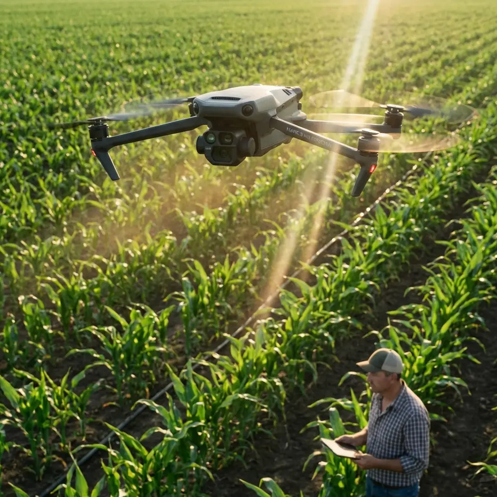
Urban wildlife mapping presents unique challenges that traditional survey methods simply cannot address. The Mavic 4 Pro transforms how researchers, conservationists, and municipal planners document animal populations in city environments—delivering centimeter-accurate positioning and intelligent tracking capabilities that make comprehensive surveys achievable in hours rather than weeks.
This tutorial walks you through every step of configuring, flying, and processing urban wildlife mapping missions with the Mavic 4 Pro.
Understanding Urban Wildlife Mapping Requirements
Urban ecosystems support surprising biodiversity. Cities worldwide host populations of deer, coyotes, foxes, raptors, waterfowl, and countless smaller species that have adapted to human environments.
Traditional ground-based surveys face significant limitations:
- Limited visibility through vegetation and around structures
- Observer presence alters animal behavior
- Time constraints prevent comprehensive coverage
- Safety concerns in certain urban areas
- Inconsistent data collection across different observers
Aerial mapping solves these problems by providing consistent, repeatable observation from distances that minimize wildlife disturbance.
The Mavic 4 Pro specifically addresses urban mapping needs with its omnidirectional obstacle sensing, extended flight time of 46 minutes, and 1-inch CMOS sensor capable of resolving fine details from safe altitudes.
Essential Pre-Flight Configuration
Antenna Positioning for Maximum Urban Range
Urban environments present significant RF challenges. Buildings reflect signals, power lines create interference, and competing wireless networks crowd available frequencies.
Expert Insight: Position your controller antennas at 45-degree angles pointing toward your aircraft rather than straight up. This orientation maximizes signal reception in environments with multipath interference. The Mavic 4 Pro's OcuSync 4.0 system performs best when antennas face the drone directly.
Additional positioning recommendations:
- Maintain line of sight whenever possible
- Avoid standing near metal structures or vehicles
- Keep the controller above waist height
- Face the drone's general direction throughout flight
- Monitor signal strength indicators continuously
Obstacle Avoidance Configuration
The Mavic 4 Pro features omnidirectional obstacle sensing using multiple vision sensors and ToF sensors. For wildlife mapping, configure these settings strategically.
Navigate to Safety Settings and adjust:
- Obstacle Avoidance Behavior: Set to "Bypass" rather than "Brake" for smoother tracking
- Sensing Range: Maximum setting for urban environments
- Return-to-Home Obstacle Avoidance: Always enabled
- Minimum Safe Distance: 5 meters recommended for wildlife work
These settings allow the drone to navigate around unexpected obstacles while maintaining tracking on moving subjects.
Camera Settings for Species Identification
Accurate wildlife mapping requires image quality sufficient for species identification and individual recognition when possible.
Configure your camera with these baseline settings:
- Color Profile: D-Log for maximum dynamic range
- Resolution: 5.1K for video or 100MP stills
- Frame Rate: 60fps minimum for movement analysis
- Shutter Speed: 1/500 or faster to freeze animal movement
- ISO: Auto with maximum limit of 1600
- White Balance: Manual, matched to conditions
D-Log captures approximately 14 stops of dynamic range, preserving detail in shadows under trees and highlights on sunlit pavement simultaneously.
ActiveTrack 6.0 for Wildlife Following
The Mavic 4 Pro's Subject tracking capabilities through ActiveTrack 6.0 enable autonomous wildlife following with minimal pilot intervention.
Initiating Tracking
To begin tracking a wildlife subject:
- Frame the animal in your display
- Tap directly on the subject
- Select "Track" from the popup menu
- Choose tracking mode: Trace, Profile, or Spotlight
- Confirm the tracking box accurately encompasses the subject
Tracking Mode Selection
Different wildlife behaviors require different tracking approaches:
| Mode | Best For | Drone Behavior | Recommended Distance |
|---|---|---|---|
| Trace | Following moving animals | Follows behind subject | 15-25 meters |
| Profile | Lateral movement documentation | Maintains side angle | 20-30 meters |
| Spotlight | Stationary observation | Circles or holds position | 10-20 meters |
Pro Tip: For skittish urban wildlife like deer or coyotes, begin tracking in Spotlight mode from maximum distance. Gradually decrease distance only if the animal shows no stress response. A 30-meter starting distance prevents flight responses in most urban-adapted species.
Tracking Limitations and Workarounds
ActiveTrack performs exceptionally well but has limitations:
- Partial occlusion: Brief obstruction by trees or structures may break tracking
- Similar subjects: Multiple animals of the same species may confuse the system
- Low contrast: Animals matching background colors track less reliably
- Rapid direction changes: Very fast movements may outpace tracking response
Maintain manual control readiness at all times. The Mavic 4 Pro allows instant override of autonomous functions.
QuickShots and Hyperlapse for Documentation
Beyond raw data collection, compelling documentation helps communicate findings to stakeholders and the public.
QuickShots for Habitat Context
QuickShots provide automated cinematic movements that contextualize wildlife within their urban habitat:
- Dronie: Reveals surrounding environment while maintaining subject focus
- Circle: Documents 360-degree habitat context
- Helix: Combines altitude gain with orbital movement
- Rocket: Dramatic vertical reveal of location
Each QuickShot creates 10-15 second clips ideal for presentations and reports.
Hyperlapse for Behavioral Patterns
Hyperlapse condenses extended observation periods into viewable sequences. Configure for wildlife documentation:
- Mode: Free or Circle
- Interval: 2-5 seconds depending on activity level
- Duration: Plan for 30-60 minutes of real-time observation
- Output: 1080p or 4K processed in-camera
Hyperlapse reveals patterns invisible during real-time observation—feeding rhythms, movement corridors, and interaction frequencies become apparent.
Flight Planning for Comprehensive Coverage
Systematic coverage ensures no areas are missed during surveys.
Grid Pattern Mapping
For population density estimates, fly systematic grid patterns:
- Define survey boundaries in DJI Fly app
- Set altitude based on required ground sample distance
- Configure 70% front overlap and 60% side overlap
- Enable waypoint capture for repeatable surveys
- Plan multiple batteries for large areas
The Mavic 4 Pro covers approximately 2 square kilometers per battery at mapping altitudes.
Corridor Surveys
Urban wildlife often follows predictable corridors—waterways, greenbelts, railway margins, and utility easements.
For corridor surveys:
- Fly parallel to the corridor at consistent altitude
- Maintain 30-50 meter lateral offset from expected animal locations
- Use Hyperlapse to document movement patterns over time
- Mark GPS coordinates of sightings for later analysis
Common Mistakes to Avoid
Flying too low initially: Urban wildlife tolerates drones at altitude but flees from close approaches. Start at 40+ meters and descend gradually only if animals remain undisturbed.
Ignoring wind patterns: Urban canyons create unpredictable wind. The Mavic 4 Pro handles 12 m/s winds, but turbulence near buildings can exceed this. Monitor wind warnings continuously.
Neglecting battery reserves: Always land with 25% battery minimum. Urban environments offer fewer emergency landing options than open areas.
Overlooking legal requirements: Many urban areas have specific drone regulations. Verify airspace authorization through LAANC or equivalent systems before every flight.
Single-session surveys: Wildlife activity varies by time of day, season, and weather. Comprehensive mapping requires multiple sessions across different conditions.
Forgetting calibration: Urban magnetic interference affects compass accuracy. Calibrate before each session in an area clear of metal structures.
Data Processing and Analysis
Raw footage requires processing to generate actionable mapping data.
Recommended Workflow
- Import all footage to organized folder structure by date and location
- Review and tag wildlife sightings with timestamps
- Extract GPS coordinates from video metadata
- Process D-Log footage with standardized color correction
- Generate maps using GIS software with sighting overlays
- Analyze patterns across multiple survey sessions
The Mavic 4 Pro embeds precise GPS data in all media files, enabling accurate spatial analysis without additional equipment.
Frequently Asked Questions
What altitude minimizes wildlife disturbance while maintaining identification capability?
Research indicates most urban wildlife ignores drones above 30 meters altitude. The Mavic 4 Pro's 100MP sensor resolves sufficient detail for species identification at this height, with individual recognition possible for larger animals. Start high and descend only when necessary.
How does D-Log improve wildlife mapping compared to standard color profiles?
D-Log preserves detail across the full brightness range of urban scenes. Standard profiles clip highlights on sunlit pavement while crushing shadows under vegetation. D-Log's 14+ stops of dynamic range captures both simultaneously, ensuring no data loss in challenging mixed-lighting conditions common in cities.
Can the Mavic 4 Pro track multiple animals simultaneously?
ActiveTrack 6.0 focuses on single-subject tracking for maximum reliability. For groups, use manual flight with wide framing, or track the group's geometric center. Post-processing software can then identify and track individuals within the footage.
Urban wildlife mapping with the Mavic 4 Pro opens possibilities that were impractical just years ago. The combination of intelligent tracking, exceptional image quality, and reliable obstacle avoidance makes comprehensive urban surveys achievable for researchers, planners, and conservationists at every level.
Ready for your own Mavic 4 Pro? Contact our team for expert consultation.