Mavic 4 Pro in the Vineyard: A Low-Light Mapping Case Study
Mavic 4 Pro in the Vineyard: A Low-Light Mapping Case Study
META: A practical case study on using Mavic 4 Pro for low-light vineyard mapping, covering flight planning, obstacle avoidance, tracking tools, D-Log workflow, and battery management in real field conditions.
The most revealing drone flights rarely happen at noon.
For vineyard operators, consultants, and mapping teams, some of the most useful visual data appears near first light or just before sunset. That is when row structure, canopy gaps, drainage patterns, shadow behavior, and elevation changes often become easier to read than they are under flat overhead sun. It is also when drone work gets harder. Light drops, contrast shifts, obstacles become harder to judge, and battery decisions matter more than people expect.
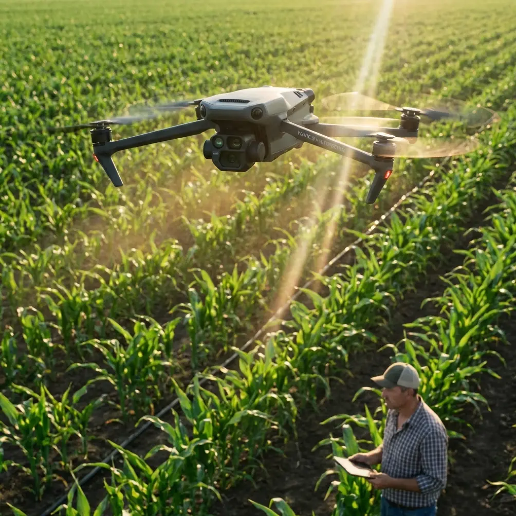
This is where the Mavic 4 Pro becomes interesting, not as a headline object, but as a tool under pressure. I have seen plenty of crews plan vineyard mapping missions as if all conditions were equal. They are not. A low-light mission over vines is a different job than a bright-day flight over open farmland. The terrain is narrower, the hazard profile is tighter, and the margin for sloppy power management shrinks fast.
This case study walks through how I would approach a low-light vineyard mapping session with the Mavic 4 Pro, with a focus on what actually changes in the field: obstacle avoidance behavior, tracking support during setup work, D-Log capture decisions, and one battery habit that has saved more flights than any app setting ever has.
The Scenario: Why Low Light Changes Vineyard Mapping
Picture a hillside vineyard just before sunrise. The goal is not cinematic footage for social media. The objective is to build a clean visual record of row conditions and site layout while the low-angle light helps expose contour and canopy variation. In many vineyards, that shallow light can reveal subtle differences in vigor and spacing that are harder to notice once the sun is high and shadows collapse.
But vineyards are unforgiving drone environments.
You are dealing with repeated row geometry, poles, tension wires, netting in some blocks, access roads, tree lines, and often sloped terrain that can distort your sense of clearance. In low light, those features may still be visible to the pilot while presenting a different challenge to the aircraft’s sensing system. That makes obstacle avoidance more than a convenience feature. It affects whether your route remains efficient or becomes a stop-and-correct exercise every few passes.
The Mavic 4 Pro’s obstacle avoidance matters here because vineyard mapping is rarely a purely vertical mission. Even when the main survey work is systematic, operators still need transitional flights, perimeter checks, lower-angle passes for visual review, and occasional repositioning between blocks. Those are the moments when automated sensing and route awareness can protect both aircraft and data continuity.
Operationally, this means one simple thing: obstacle avoidance is most valuable in the parts of the mission pilots tend to underestimate.
A Better Workflow Than “Just Fly the Grid”
When people say they are mapping a vineyard, they often mean two very different jobs.
The first is structured data capture: repeatable passes, consistent overlap, predictable altitude, and stable exposure. The second is interpretive flying: short exploratory runs to inspect drainage channels, identify stressed sections, document edge rows, or capture visual context for growers and field managers.
The Mavic 4 Pro can support both, but only if the operator stops treating every feature as if it exists for final video. Tools like ActiveTrack, subject tracking, QuickShots, and Hyperlapse are often dismissed in technical workflows. That is a mistake. Not because they replace proper mapping methods, but because they help document the environment around the survey.
For example, ActiveTrack and subject tracking can be useful during pre-mission site movement. If a vineyard manager is walking the block boundary or pointing out problem rows from a service path, a short tracked sequence creates a visual reference tied to on-ground observations. That can become surprisingly useful later when comparing what the aircraft saw from above with what the crew flagged on foot.
QuickShots and Hyperlapse also have a place, but not in the core mapping set. Their value is contextual. A short automated orbit or timed environmental sequence can show fog movement, early sun exposure across a slope, or the transition from shadowed rows to illuminated rows. In vineyard operations, that context helps explain why one section presents differently from another. It is not vanity footage if it answers an agronomic or operational question.
The key is to separate mission-critical capture from supporting capture. The Mavic 4 Pro is capable enough to do both in one site visit, but the disciplined operator does not mix them casually.
Low-Light Capture: Why D-Log Can Help, and When It Slows You Down
Low-light vineyard work tends to expose a split between two types of teams.
One group wants footage that is immediately readable by non-technical stakeholders. The other wants maximum grading flexibility for later analysis and presentation. That is where D-Log enters the conversation.
D-Log can be useful in a vineyard setting because dawn and dusk often create bright sky and dark canopy in the same frame. A flatter capture profile gives you more room to recover highlight and shadow information during post-processing. If you are documenting a property with alternating hill faces, reflective irrigation infrastructure, and dark rows below, that flexibility matters.
But there is a tradeoff, and in field operations people do not talk about it enough. D-Log is not automatically the best choice for every low-light mapping sortie. If the output is primarily for same-day field review, insurance documentation, contractor coordination, or quick agronomy discussion, a simpler profile may save time and reduce ambiguity. Flat footage can look underwhelming or misleading to stakeholders who expect a direct visual read.
My rule is practical. Use D-Log when dynamic range is the problem you need to solve. Do not use it out of habit.
On the Mavic 4 Pro, this becomes an operational decision, not a creative reflex. If the mission includes both formal mapping and interpretive footage, I would segment the workflow. Capture the core survey material with consistency as the priority, then switch profiles only if the supplementary visual pass will benefit from extra grading latitude. That keeps your dataset cleaner and your review process faster.
Obstacle Avoidance in Vineyards: What Actually Matters
Obstacle avoidance is easy to praise in a spec sheet and harder to evaluate in a vineyard.
The question is not whether the system exists. The question is how you use it without letting it dictate the mission in ways that reduce coverage quality or create hesitation in narrow working spaces.
In vineyard environments, the highest-risk objects are not always the largest ones. Wires, trellis structures, row-end posts, net supports, and irregular tree branches can interfere with flight planning in subtle ways. A pilot may visually understand the geometry of a block while the aircraft responds conservatively to partial obstructions or contrast changes. In low light, that gap between human expectation and aircraft behavior can widen.
This has two implications.
First, obstacle avoidance should be tested before the real pass begins. I like to make a short lateral movement at working altitude near the edge of the block, not inside the most constrained section. That gives me a feel for how the aircraft is reading the environment under the actual light conditions, not under assumptions from a previous flight.
Second, route transitions deserve as much planning as the rows themselves. Most near-miss moments happen while shifting position, dropping altitude for visual checks, or backing away after a close inspection. The Mavic 4 Pro’s obstacle awareness is especially valuable there because those moments combine pilot workload, low light, and environmental clutter.
The practical significance is straightforward: obstacle avoidance is not just a safety net for beginners. In vineyard mapping, it protects mission continuity by reducing the chances of an interrupted dataset.
The Battery Tip I Learned the Hard Way
Here is the field lesson I wish more drone operators heard earlier.
Do not launch your final “one quick pass” battery in low-light conditions unless you are willing to land with a larger reserve than usual.
That sounds conservative, but it comes from real work, not caution theater.
In vineyards, especially hilly ones, low-light flights tend to run longer than planned. You pause more often. You verify orientation more carefully. You may reposition to confirm row alignment or repeat a pass because early shadows obscured a section. Add cool morning temperatures or evening air movement, and battery behavior can become less forgiving than it looked during a warm midday test.
My personal habit is simple: I designate one battery as the documentation battery and one as the decision battery. The documentation battery handles the planned mission. The decision battery exists for unfinished work, site changes, or unexpected opportunities. I do not let that second battery become a full mission battery by accident.
More importantly, I avoid storing batteries overnight at full charge if the flight is at dawn but weather is uncertain. If conditions delay the mission, you have stressed the pack for no reason. I would rather top off close to deployment than rely on a charge state that looked convenient the night before.
For low-light vineyard mapping, the operational significance is huge. A battery margin is not just about making it home. It is about preserving enough power for a stable return path over uneven terrain, extra obstacle response, and a clean landing setup when visibility is less forgiving.
The crews who manage batteries well usually look smoother in every other part of the mission too.
Building a Useful Vineyard Deliverable
A good vineyard mapping session with the Mavic 4 Pro should produce more than aerial images.
It should answer practical questions.
Which blocks receive early light first? Where do shadows linger longest? Are there visible inconsistencies in row spacing or canopy density? Do access tracks show drainage issues? Are perimeter obstacles likely to complicate machinery movement or future drone flights?
That is why I like combining structured passes with a short visual narrative package. The map-like capture gives consistency. The supplementary footage gives interpretation. A D-Log sequence from the slope edge might show tonal detail worth grading later. A QuickShot around a problematic block can help a manager understand topographic context. A tracked ground reference clip can connect pilot observations to field comments.
This is also the point where communication matters. If a grower or operations manager needs help evaluating how to set up a vineyard workflow around the aircraft, I prefer direct practical discussion over generic spec talk. A simple field-planning message often solves more than a brochure ever will, and that is exactly why I sometimes point teams to a direct vineyard drone planning chat when they need to compare site conditions before the next flight window.
What the Mavic 4 Pro Does Well in This Role
The Mavic 4 Pro fits low-light vineyard work best when the operator respects the difference between capability and reliability.
Capability is having obstacle avoidance, ActiveTrack, QuickShots, Hyperlapse, and D-Log in one aircraft. Reliability is knowing which of those features belongs in the mission and which belongs around the mission.
For vineyard mapping, the strongest value comes from that flexibility. You can document rows methodically, use obstacle sensing to reduce transition risk, capture supplementary context without changing aircraft, and preserve post-production latitude when changing light creates difficult tonal contrast.
That combination matters in the real world because vineyard teams do not always get multiple ideal weather windows. Sometimes one early-morning session has to produce both technical records and presentation-ready visuals. The aircraft that handles both without forcing unnecessary complexity earns its place.
The Mavic 4 Pro is not valuable here because it promises perfection. It is valuable because it can adapt to a site that changes every 10 minutes as the light moves across the vines.
And if you have done enough agricultural flying, you know that adaptability is what keeps a mission useful.
Ready for your own Mavic 4 Pro? Contact our team for expert consultation.