Mavic 4 Pro for Urban Venue Mapping: A Practical Field
Mavic 4 Pro for Urban Venue Mapping: A Practical Field Guide from a Photographer’s Workflow
META: Learn how to use the Mavic 4 Pro for urban venue mapping with practical flight planning, obstacle avoidance, ActiveTrack, D-Log, Hyperlapse, and battery management tips.
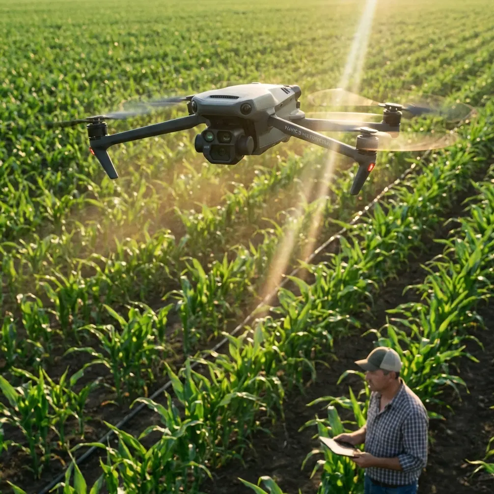
Urban venue mapping looks simple until you are standing between reflective glass, patchy GNSS reception, delivery trucks, lamp posts, and a client who wants clean coverage before the next event load-in. That is where the Mavic 4 Pro becomes less of a camera drone and more of a workflow tool.
I approach this as a photographer first. My priority is not just getting a dramatic hero shot of a venue. It is building a repeatable capture routine that produces usable visual references for planners, marketing teams, operations managers, and production crews. In an urban environment, that means the Mavic 4 Pro has to do three things well: hold a stable position, navigate clutter without hesitation, and give me footage and stills flexible enough for both documentation and polished presentation.
This guide is built for that exact use case: mapping venues in the city with the Mavic 4 Pro, from pre-flight setup to battery discipline in the field.
Why the Mavic 4 Pro fits venue mapping work
Venue mapping is different from scenic aerial shooting. You are not only looking for beauty. You are documenting access roads, service entrances, rooftop obstructions, staging areas, crowd flow paths, nearby towers, lighting poles, parking zones, and the physical relationships between structures.
The Mavic 4 Pro is well suited to this kind of work because its automated flight features reduce workload when you need consistency, while its pro-grade capture tools give you room to deliver assets that do more than mark locations on a map.
A few features matter more than the marketing headlines in this scenario:
- Obstacle avoidance is not a luxury in urban venue work. It is a margin of safety around facades, wires, trees, signage, and temporary event structures.
- ActiveTrack and subject tracking are not only for people or vehicles in cinematic clips. They can help when you need controlled motion around a building edge, access lane, or moving logistics vehicle to explain site operations.
- QuickShots and Hyperlapse are useful when a venue client wants more than survey-style documentation. They can turn a mapping session into a visual briefing tool.
- D-Log matters because urban scenes are contrast-heavy. You often have deep shadow under overhangs and bright sky reflecting off glass in the same frame.
Those are not isolated features. They work best when you treat the flight as a structured capture mission.
Start with the map you actually need
Before I launch, I decide what kind of map the client really needs. Most venue jobs fall into one of three buckets.
The first is orientation mapping. This is the broad overhead and angled coverage that shows the entire site in context: road access, neighboring buildings, entrances, rooflines, and open space.
The second is operational mapping. This focuses on how the venue works. Where do trucks queue? Where are barriers set? Which entrance has the cleanest pedestrian approach? Where is the best temporary broadcast or lighting position?
The third is presentation mapping. This is where the drone material has to be polished enough for stakeholder decks, sponsorship presentations, or planning approvals.
With the Mavic 4 Pro, I try to capture all three in one session by dividing the flight into short blocks rather than improvising in the air.
A simple structure works well:
- A high establishing orbit or wide pass
- A medium-altitude perimeter survey
- Low, slow access-route coverage
- Detail passes on conflict areas
- One polished automated move for presentation use
That sequence keeps the practical material secure before you spend battery on more creative shots.
Flight planning in urban areas: what changes
Urban venue mapping punishes sloppy setup. Tall buildings can interfere with signal quality and distort your sense of space. Wind can also behave unpredictably around corners and roof edges, even when conditions feel manageable from the ground.
My first rule is simple: launch from a space you can recover to comfortably, not just conveniently. A loading bay may be close to the venue, but it is often a poor home point if vans start moving through it 10 minutes later.
I also watch for three specific urban hazards:
- reflective glass that makes judging distance harder
- narrow gaps that look open on screen but are poor choices for actual flight paths
- temporary structures such as banners, truss, cranes, tents, or lift equipment
This is where obstacle avoidance earns its keep. In a venue environment, you are often flying near irregular geometry rather than open landscape. The drone’s sensing system helps reduce the chance of a bad approach, but I never use it as permission to squeeze through tight spaces. Its real value is that it gives you an extra layer of protection while you maintain conservative spacing.
Operationally, that means smoother perimeter work. I can hold a cleaner line around roof edges, façade corners, and landscaped boundaries without constantly sacrificing composition to manual correction.
The most useful capture pattern for venue mapping
If I had to choose one repeatable method for urban venue work, it would be a layered perimeter grid.
Here is the basic idea:
- Start with a high-altitude loop to define the venue in its surrounding city block.
- Drop to a medium altitude and fly a slower, more precise perimeter.
- Add two or three straight cross-site passes that connect key access points.
- Finish with low-angle oblique shots of entrances, loading zones, and pedestrian approaches.
Why this works is simple. The high loop gives context. The medium loop provides clarity. The cross-passes explain movement. The obliques reveal real-world usability.
With the Mavic 4 Pro, that workflow pairs especially well with stable hover behavior and intelligent tracking functions. If I need to show how a service vehicle approaches a rear gate or how pedestrians move toward an event entrance, ActiveTrack can help maintain framing while I focus on clearance and route logic.
That is a subtle but important point. ActiveTrack is not just a cinematic trick in this context. It can communicate operational flow. For venue managers, that can be more valuable than a dramatic reveal shot.
When QuickShots and Hyperlapse are actually useful
A lot of drone operators either overuse automated modes or ignore them entirely. For venue mapping, both mistakes cost you.
QuickShots are helpful when you need a fast, reliable movement pattern that gives the client a readable overview without manually repeating the same move several times. A controlled reveal from behind landscaping, a pullback from the main entrance, or a gentle orbit around the primary structure can add orientation value without much flight time.
Hyperlapse has a more specific role. In urban venue work, it is excellent for showing environmental context. Traffic build-up, pedestrian density, light change across a site, or event prep activity all make more sense when compressed over time.
That means a Hyperlapse is not just decorative. It can show how a venue behaves over a window of time, which is often critical for planning arrivals, security placement, or scheduling setup crews.
If I am capturing one, I usually do it after the essential mapping passes are complete. Hyperlapse eats time and battery discipline. It should not come before the must-have coverage.
D-Log in the city: why it matters more than many pilots expect
Urban venues are contrast traps. Bright sky. Dark service alleys. White roofs. Black asphalt. LED signage. Reflections everywhere.
This is exactly where D-Log helps. If your client needs assets for presentations, marketing recaps, or future planning materials, you want as much tonal flexibility as possible. Shooting in D-Log gives you more room to recover highlight detail from reflective surfaces while keeping shadow information in areas like loading docks or recessed entrances.
That flexibility matters in two ways.
First, it helps you create cleaner final visuals from difficult mixed-light scenes.
Second, it lets the same flight serve multiple departments. Operations may want clear reference frames, while creative teams may want polished edits later. Capturing in D-Log gives you a stronger master file for both.
I would not use it blindly for every operator or every delivery. If the turnaround is immediate and no grading pipeline exists, a standard profile may be more efficient. But when the venue expects reusable professional assets, D-Log is the smarter play.
A field-tested battery management tip that saves flights
Battery management is where many otherwise careful pilots get casual. In venue mapping, that is a mistake because city flights are mentally busy. You are reading airspace, obstacles, foot traffic, RF conditions, and client priorities at once.
My rule is this: never plan the last shot on the first battery.
In practice, I use the first pack to secure the mandatory coverage only. I do not spend it experimenting. I do not chase an optional tracking shot because the light looks nice. I lock the essentials first: the high establishing loop, the medium perimeter, and the critical access routes.
Then I land earlier than many pilots expect.
Why? Urban air can change quickly around structures, and battery percentage can disappear faster when you are fighting small corrections near buildings or working in breezier rooftop flow. The last 20 to 25 percent is not creative time. It is buffer.
A simple system helps:
- Battery one: must-have mapping
- Battery two: detail passes and operational sequences
- Battery three: polished assets like QuickShots, Hyperlapse, or alternate angles
That structure has rescued more jobs for me than any single camera setting.
There is another small habit I recommend. After each battery swap, take 10 seconds and ask one question: what still matters if I have to leave after this flight? That keeps your priorities sharp and prevents the common mistake of returning home with pretty footage but missing the service-road angle the venue manager actually needed.
Subject tracking for movement analysis
Subject tracking is often discussed as if it only exists for athletes, cyclists, or cinematic travel content. In venue mapping, it has a quieter and more practical value.
Suppose you need to document how a shuttle approaches the drop-off area, how staff move from a parking zone to a service entrance, or how visitors naturally funnel toward ticketing. A carefully used tracking mode can preserve that movement path in a way a static overhead cannot.
The significance is operational. Motion explains bottlenecks. It reveals blind spots. It shows where a route narrows or crosses another stream of traffic. When I combine a tracked pass with a higher static overview, clients can understand both the macro layout and the lived route through it.
That is often the difference between footage that looks good and footage that helps someone make a decision.
A simple how-to workflow for your next venue job
If you are heading into an urban mapping session with the Mavic 4 Pro, this is the process I would use.
Arrive early enough to walk the perimeter before launch. Look for obstacles that may not be obvious from satellite maps, especially temporary event structures and reflective surfaces.
Set a safe home point with clear recovery space. Do not choose the closest spot if it may become crowded or blocked.
Capture the site in layers. Start high and wide, then move down to medium-altitude perimeter work, then low and specific passes.
Use obstacle avoidance as a safety buffer, not a license to fly aggressively.
Use ActiveTrack or subject tracking when movement itself is part of the story, such as vehicles, guest flow, or service access.
Reserve QuickShots for readable orientation moves and Hyperlapse for showing how the venue changes over time.
Shoot in D-Log when you need flexibility for grading and polished multi-use deliverables.
Protect your batteries by assigning each pack a purpose. Essentials first, refinements second, presentation assets third.
If you want to compare capture approaches for a particular city venue setup, I usually share field notes and shot logic here: message me directly about your venue workflow.
What separates a useful venue map from impressive drone footage
The Mavic 4 Pro is capable of producing beautiful imagery. That part is not in doubt. The question is whether your flight produces something a venue team can actually use.
Useful venue mapping answers practical questions:
- How do people and vehicles enter and circulate?
- Where are the conflicts and choke points?
- What rooftop or perimeter constraints exist?
- Which views best explain the site to someone who has never been there?
The best drone operators in this space are not the ones who fly closest or fastest. They are the ones who come back with a clear visual record, captured safely, with enough polish that the same material can support planning, coordination, and presentation.
That is why the Mavic 4 Pro stands out for this kind of job. Obstacle avoidance supports safer work near urban clutter. ActiveTrack helps illustrate movement patterns. QuickShots and Hyperlapse add communication value when used with restraint. D-Log protects image quality in difficult city light. And disciplined battery management keeps the mission intact when conditions get messy.
For urban venue mapping, that combination matters far more than headline specs on a product page. It is about whether the drone helps you leave the site with answers.
Ready for your own Mavic 4 Pro? Contact our team for expert consultation.