Mavic 4 Pro Mapping Tips for Dusty Solar Farms
Mavic 4 Pro Mapping Tips for Dusty Solar Farms: Building a Camera Mission That Actually Holds Up in the Field
META: Practical Mavic 4 Pro mapping tips for dusty solar farm work, with camera mission planning, waypoint logic, battery management, and field workflow insights inspired by ArduPilot camera control principles.
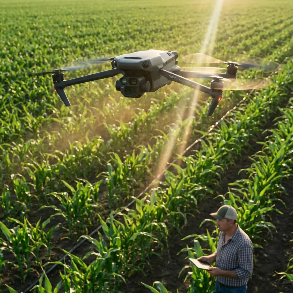
Solar farm mapping looks easy from the access road. Wide rows, repeatable geometry, open sky. Then the rotor wash kicks up dust, panel glare starts fighting your exposure, batteries heat-soak on the tailgate, and a neat flight plan turns into a patchy dataset.
That is where disciplined camera mission design matters more than headline features.
For Mavic 4 Pro pilots working in utility-scale solar environments, the most useful lesson does not come from flashy autonomous marketing. It comes from a more grounded idea found in traditional mission-planning systems such as ArduPilot’s camera control workflow: a photo mission is essentially a waypoint mission with deliberate shutter events built between points, not just at them. That sounds minor. Operationally, it changes how you think about coverage, overlap, consistency, and battery use.
The source material behind this article centers on ArduPilot’s camera and gimbal command structure inside Mission Planner. It highlights several building blocks: camera commands, camera gimbal commands, servo and relay commands, auto-mission types, a Survey Grid example, and composite image creation. Even though Mavic 4 Pro operators may not be flying ArduPilot aircraft, those ideas map neatly onto real-world solar inspection and mapping practice. If you understand that logic, your Mavic 4 Pro flights become more reliable and your stitched outputs become easier to trust.
Start with the mission logic, not the drone
A common mistake in solar farm mapping is starting with aircraft settings before defining the imaging logic. The ArduPilot reference puts the sequence in the right order. First comes camera control, then auto-mission behavior, then survey patterns, then composite image creation. That progression matters.
For Mavic 4 Pro work, think of the job in four layers:
- What image do you need at the end
- What overlap and angle are required to build it
- Where should the aircraft be when each image is captured
- How will battery state and dust conditions affect continuity
That is basically the same philosophy described in the source: the camera task is planned much like an automatic waypoint mission, except the shutter can be triggered between waypoints. On a solar site, this is critical because panel rows are repetitive. If your capture logic is sloppy, the software may still produce a map, but subtle misalignments can hide broken modules, vegetation encroachment, drainage issues, or edge-of-array faults.
With Mavic 4 Pro, your goal should be a flight path that creates consistent image spacing, not just a path that reaches the end of the block.
Why “between-waypoint” capture thinking matters on solar farms
This is one of the most valuable details from the reference material. The article notes that the difference between a regular waypoint mission and a camera mission is the ability to trigger the shutter while traveling between waypoints.
In practice, that means you should avoid treating each waypoint like a photo stop unless your task specifically requires static obliques or asset-detail shots. For mapping a solar farm, stop-and-shoot methods are slower, harder on battery efficiency, and more vulnerable to dust plumes because the drone repeatedly disturbs loose ground while accelerating and braking.
A smoother Mavic 4 Pro route with continuous image capture usually gives you:
- more even overlap
- less motion disruption in the flight profile
- lower time overhead per block
- cleaner battery forecasting
- fewer coverage gaps at row ends
The operational significance is huge. Solar farms often look uniform, but terrain around them is not. Access roads, inverter pads, drainage channels, fencing, and slight elevation changes create small geometry shifts that become obvious during stitching. Consistent capture intervals between route points help preserve a stable reconstruction.
If you are building maps for maintenance planning, vegetation tracking, construction progress, or insurance documentation, this consistency is worth more than any cinematic feature list.
Use gimbal discipline like a surveyor, not a content creator
The source also calls out camera gimbal commands and mentions that, if a gimbal is installed, hotspot tracking tasks become possible. For mapping, that detail has a different meaning: the gimbal is not just for smooth video or subject tracking. It is a geometric control tool.
On a dusty solar farm, your Mavic 4 Pro gimbal angle should stay predictable for the bulk of the mapping mission. Save ActiveTrack, subject tracking, QuickShots, and Hyperlapse for non-survey deliverables. They have their place for project documentation, investor progress updates, and marketing recaps, but not in the primary capture pass if your goal is accurate orthomosaic output.
Here is the field rule I use:
- Main map pass: lock the gimbal to a repeatable survey angle and leave it alone
- Supplemental obliques: fly a separate mission
- Promo footage: treat it as a different deliverable entirely
Why separate them? Because repeatability is the backbone of composite image creation, another reference detail explicitly mentioned in the source. Composite outputs depend on camera geometry that software can interpret consistently. Every unnecessary gimbal change increases the chance of uneven tie points and weak stitch zones, especially over reflective surfaces like photovoltaic panels.
The Mavic 4 Pro may tempt you to do everything in one flight. Resist that temptation on technical jobs.
Dust changes battery strategy more than most pilots expect
The requested narrative spark was a battery management tip from field experience, and this is one that has saved more missions than any app setting.
Do not rotate batteries by charge percentage alone. Rotate them by thermal condition and mission role.
At dusty solar sites, aircraft and batteries often sit in direct sun while crews reposition vehicles, check boundaries, or brief the next block. A pack at 78 percent that has been baking in a hard case can perform worse than a cooler pack at a similar state of charge. You see it in voltage sag during the outbound leg, and on longer lines that can force an early return that cuts a clean survey grid in half.
My habit is simple:
- keep batteries shaded and separated so heat does not build pack-to-pack
- assign the coolest battery to the longest or windiest block
- use partially depleted packs for short edge cleanup flights only
- never start a full mapping lane set with a battery that just came out of a hot aircraft unless it has cooled
This matters because solar farm mapping is all about continuity. If you break a grid midway, you can still recover the area, but you have introduced changing light angles, changing dust conditions, and often slightly different aircraft behavior. That can complicate stitching and color balancing later.
The best battery is not just the fullest one. It is the one most likely to deliver stable output across the entire block.
Mission structure: split the site before you launch
The ArduPilot source references auto-mission types and includes a Survey Grid example. That is the right model for solar work. A solar farm is rarely one mission. It is a collection of repeatable sub-missions.
Before the first takeoff, divide the site into logical blocks:
- large array fields
- perimeter corridors
- substations or inverter clusters requiring separate capture logic
- drainage or access-road zones
- special-interest areas for progress or defect documentation
The reason is not only convenience. It is data quality. When one giant mission meets field reality, things go wrong slowly and expensively. Wind changes. Dust increases. trucks move through the scene. A crew parks where your line should run. Breaking the survey into blocks lets you preserve consistency within each dataset.
This follows the source’s framing of simple manual photo tasks versus more complex automated tasks using Mission Planner tools. For Mavic 4 Pro operators, the lesson is to automate the repetitive geometry, then reserve manual intervention for exceptions. Do not improvise the whole mission manually unless the site is tiny.
For anyone trying to refine this workflow for a specific project type, I usually suggest comparing your planned route structure against your final deliverables before launch. If you need a second opinion on a block layout or camera pass strategy, you can send a quick field sketch here: share the mission outline.
Exposure control over panels: consistency beats drama
Solar panels are visually hostile subjects. They reflect sky, swing between dark and bright across rows, and punish auto exposure decisions. If you let the camera chase the scene, your map may stitch, but it will not look clean and may obscure surface anomalies.
For Mavic 4 Pro mapping passes, stable exposure is usually more valuable than visually dramatic footage. If you are also collecting visual content for a client, use a separate pass in D-Log or another flat profile suited for grading. For the actual map, consistency is the target.
A practical approach:
- lock settings appropriate to current light
- watch histogram behavior over the darkest and brightest row directions
- avoid changing profile or white balance during a block
- re-evaluate settings only when light has materially shifted
This is where photographer discipline matters. I would rather bring home a slightly conservative survey set with uniform tonality than a “better looking” set full of exposure drift. Composite image creation depends on visual continuity just as much as overlap.
Obstacle avoidance is helpful, but route cleanliness still wins
Solar farms are open, though not empty. You may have weather stations, lighting poles, security fencing, combiner boxes, cable bridges, parked utility vehicles, and occasional vegetation. Mavic 4 Pro obstacle avoidance is valuable here, but it should be treated as a safety layer, not a crutch for messy route planning.
A clean route with sensible altitude and turn margins is still the foundation.
Why mention this in a camera mission article? Because unplanned braking or path deviation affects image spacing. If the aircraft slows unexpectedly near an obstacle, shutter timing versus ground position changes. On a casual flight that is no big deal. On a mapping run, it can produce uneven overlap right where the site is already complex.
The fix is not to disable safety. The fix is to pre-plan blocks that reduce unnecessary obstacle interactions and to reserve more complicated geometry for separate flights.
Manual detail passes still have a place
The source notes that, for simple tasks, photos can be taken manually between waypoints, while more complex use cases can be automated. That balance still applies.
After your main Mavic 4 Pro mapping grid is complete, manual passes are often the best tool for:
- documenting damaged panel groups
- showing washout near foundations or roads
- capturing dust accumulation patterns
- checking fence line encroachment
- producing angled context shots for reports
This is where subject tracking or intelligent flight aids may help, especially if you are documenting moving maintenance activity for client communications. Just keep those captures outside the core map dataset.
The biggest professional difference between a hobby flight and a useful site workflow is knowing when not to mix mission types.
A practical repeatable workflow for dusty sites
Here is the tutorial version I give crews:
1. Walk the light and wind first
Do not launch on habit. Check sun angle across panel rows, dust direction, and any moving equipment.
2. Define blocks, not one giant survey
Borrowing from the Survey Grid mindset in the reference, break the solar site into manageable capture zones.
3. Set the map pass for geometric consistency
Fixed gimbal logic. Stable exposure. Continuous capture thinking between route points.
4. Protect battery performance from heat
The coolest battery gets the hardest block. Shade all packs. Let hot batteries recover before assigning them to a long mission.
5. Fly technical data first
Get the orthomosaic dataset before the cinematic content. Dust and light usually worsen as the day goes on.
6. Review coverage at row ends immediately
This is where missions most often fail quietly. Re-fly tiny misses before changing the aircraft setup.
7. Run separate supplemental flights
Obliques, ActiveTrack clips, Hyperlapse sequences, and branded visuals can wait until the survey is secured.
The bigger lesson from the reference material
The ArduPilot page behind these ideas is not really about one brand or one autopilot. It is about mission discipline. It organizes the work into camera commands, gimbal commands, automated survey types, and composite image outcomes. That framework remains valuable even if your aircraft is a Mavic 4 Pro and your software stack looks completely different.
Two source details stand out as especially useful for solar mapping:
- the idea that a camera mission differs from a basic waypoint mission because the shutter can be triggered between waypoints
- the inclusion of a Survey Grid workflow and composite image creation as core mission-planning concepts
Those are not abstract technical notes. They directly affect whether your solar farm deliverable is smooth, complete, and trustworthy.
If you treat the Mavic 4 Pro as a flying camera with smart features, you can get attractive footage. If you treat it as a survey platform whose camera behavior must be planned with the same care as the route itself, you get data you can actually build decisions on.
On dusty solar sites, that distinction shows up fast.
Ready for your own Mavic 4 Pro? Contact our team for expert consultation.