Mavic 4 Pro Field Report: Mapping Solar Farms in Mountain
Mavic 4 Pro Field Report: Mapping Solar Farms in Mountain Terrain
META: A field-tested look at how the Mavic 4 Pro fits mountain solar farm mapping, with practical insight on obstacle avoidance, D-Log, tracking, flight planning, and where it stands against rival prosumer drones.
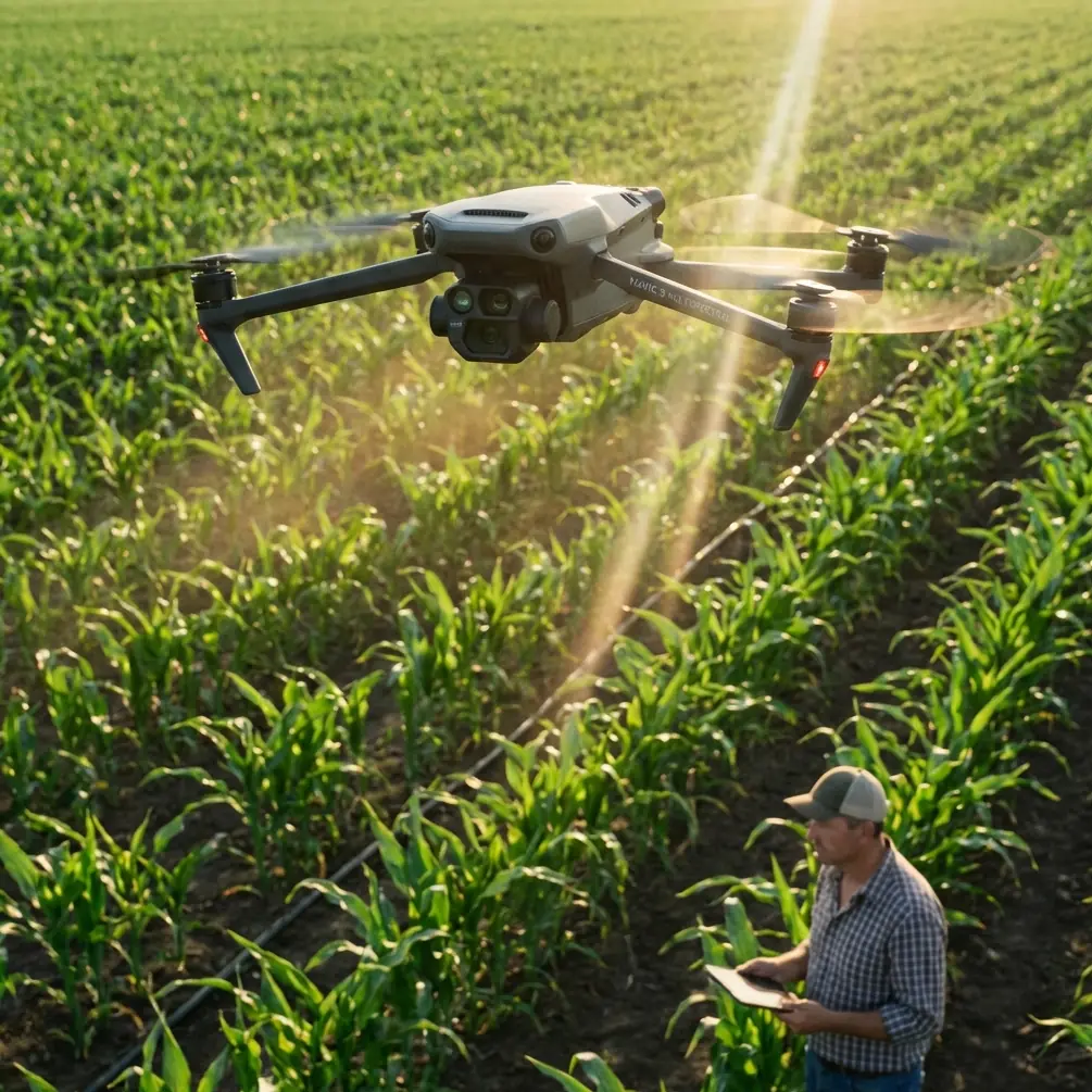
Mountain solar sites punish sloppy workflow. Steep grades distort scale, reflective panel surfaces confuse exposure, wind shifts fast along ridgelines, and access roads are often too narrow or rough for repeated tripod-based survey work. That is exactly where the Mavic 4 Pro becomes interesting—not as a generic camera drone, but as a compact aircraft that can support visual inspection, terrain-aware documentation, and repeatable site coverage when the operator understands its strengths and its limits.
I’ve approached this from the perspective of a field shooter who also needs usable operational data. That distinction matters. A drone can look great on a spec sheet and still become awkward over a real solar array built across uneven mountain shelves. The Mavic 4 Pro stands out because it blends imaging flexibility with the kind of intelligent flight support that reduces friction when the site itself is the problem.
Why mountain solar farms expose weak drones fast
Flat utility-scale sites are one thing. Mountain installations are another. Arrays may be terraced, broken by service lanes, bordered by fencing, and interrupted by drainage cuts, poles, scrub growth, and maintenance vehicles. Add the optical challenge of dark panel rows beside pale gravel roads and bright sky, and a pilot quickly learns whether a drone’s automation actually helps or simply adds more menu taps.
For this kind of mission, the core requirements are straightforward:
- Stable flight in shifting air.
- Reliable obstacle avoidance near terrain and infrastructure.
- Consistent camera output for before-and-after comparisons.
- Efficient repeat runs for documentation.
- Enough intelligence to reduce workload without surrendering control.
That is where the Mavic 4 Pro makes a serious case for itself.
Obstacle avoidance is not a luxury here
On a mountain solar farm, obstacle avoidance is operational, not decorative. Ridge-side arrays often force oblique approaches. You are not always flying clean, high, textbook grid lines over a wide-open plain. You may need to track along a perimeter road, climb with the terrain, clear fencing, and then adjust around inverter pads or utility hardware.
A strong obstacle sensing system matters because vertical relief changes quickly in these environments. One moment you have comfortable separation from the ground; a few seconds later you are moving toward a raised service berm or a slope that rises beneath the aircraft. For inspection imagery, especially when trying to maintain a low and consistent angle across panel rows, that extra awareness reduces the chance of either a safety event or a compromised shot.
Compared with many smaller camera drones that are excellent in open recreational space but less reassuring in tight industrial environments, the Mavic 4 Pro feels more suited to complex work. That does not mean the aircraft can think for you. It means the sensing and flight assistance create a better safety buffer while you concentrate on framing, route discipline, and line-of-sight management.
This is one area where it tends to excel against lighter consumer-oriented competitors. Some rival models can produce attractive footage, but once you ask them to operate near changing topography and man-made structures at a professional pace, they feel less composed. In mountain mapping, that composure becomes productivity.
The camera side matters more than people admit
A solar farm mission is rarely just “map it once.” Teams often need condition baselines, progress documentation, drainage observations, access-road checks, vegetation monitoring, and visual records after wind, snow, or maintenance events. That means image consistency has real value.
The reason D-Log matters in this setting is simple: solar sites generate hard contrast. Dark photovoltaic surfaces, pale aggregate, metallic hardware, bright clouds, and haze over distant ridges can all exist in a single frame. A flatter recording profile gives more room to control highlight retention and shadow separation later, especially if the footage is being used for reporting rather than casual social clips.
That operational significance is easy to overlook. In practice, it means panel rows remain readable without letting the sky blow out into a distracting white slab. It also helps when comparing footage from different times of day or different site visits. If your visual records swing wildly in contrast and color, review becomes slower and less trustworthy.
The Mavic 4 Pro’s imaging toolkit gives it an advantage over drones that are perfectly fine for scenic flying but less satisfying when you need repeatable, editable files from difficult lighting. For a photographer, that translates into cleaner grading. For a site manager, it translates into footage that is easier to interpret and share internally.
ActiveTrack and subject tracking are surprisingly useful on industrial sites
A lot of pilots hear “ActiveTrack” or “subject tracking” and think cyclists, cars, or cinematic reveal shots. On a mountain solar farm, those tools can be more practical than flashy.
Consider a maintenance truck moving along a service road that needs to be documented relative to array sections, drainage paths, or access constraints. Or a technician walking a row where you want contextual footage showing spacing, ground condition, and equipment layout without manually re-framing every few seconds. Used carefully and at safe stand-off distances, tracking modes can reduce pilot workload and help maintain smoother, more legible footage.
The key is not to treat tracking as autonomy. It is an aid. In industrial environments, a pilot still needs to anticipate poles, cables, fencing, abrupt turns, and variable elevation. But compared with competitors whose tracking can feel less confident or less adaptable in visually busy settings, the Mavic 4 Pro is better positioned for practical field use.
That matters because solar documentation often happens under time pressure. You may have a weather window, a narrow maintenance slot, or only a few chances to capture clean movement through a site before personnel shift tasks. Reliable tracking can save minutes, and minutes matter when the wind is climbing.
QuickShots and Hyperlapse are not just for pretty edits
There is a tendency to dismiss QuickShots and Hyperlapse as marketing features. In the wrong hands, they are. In the right workflow, they become communication tools.
QuickShots can help create a fast, standardized visual summary of a site segment. For stakeholders who do not read maps fluently, a short automated reveal around an inverter station or a perimeter transition can make orientation much easier. You are not replacing survey-grade output. You are adding visual clarity.
Hyperlapse has a different value. At a mountain solar site, conditions change visibly over time: moving cloud shadows across panel banks, fog rolling through saddles, snowmelt patterns, equipment movement, even the relationship between access routes and terrain exposure. A controlled Hyperlapse sequence can show how light and weather interact with the site in a way that stills often cannot.
Again, the significance is operational. Better visual communication reduces confusion between field teams, remote managers, and clients. If a competitor drone offers these features but delivers less stable execution or a clumsier setup, the result is simple: fewer usable sequences and more time wasted rebuilding shots.
Where the Mavic 4 Pro really earns its place
For mountain solar work, the strongest argument for the Mavic 4 Pro is not one isolated feature. It is how several systems combine in a compact package.
You have obstacle avoidance helping manage terrain and structures. You have D-Log giving the camera more breathing room in contrast-heavy scenes. You have ActiveTrack and subject tracking supporting vehicle or personnel documentation. You have QuickShots and Hyperlapse contributing to communication, not just aesthetics.
That combination is what separates a practical field platform from a drone that is merely enjoyable to fly.
A heavier enterprise aircraft may still be the right answer for fully specialized inspection workflows, especially where payload flexibility or advanced thermal integration is required. But that is a different category. Against many prosumer competitors, the Mavic 4 Pro hits a balance that is unusually useful: portable enough for remote access, smart enough for complex terrain, and image-focused enough to produce footage people can actually work with.
A field workflow that makes sense
If I were deploying the Mavic 4 Pro on a mountain solar mapping day, I would not start with cinematic ambition. I would start with control.
First, I would split the site into sectors based on terrain breaks rather than just panel count. Mountain installations often look coherent from above but behave like separate micro-sites in the field. Flying them in terrain-aware blocks reduces surprises.
Second, I would capture an establishing pass at safer altitude to understand wind behavior and identify trouble spots—fencing gaps, utility poles, washouts, blind corners, and vehicle movement. Only then would I move into lower, more detailed passes.
Third, I would use D-Log for the key visual record sequences, especially around mixed lighting or glare-prone hours. Midday reflections from panels can make footage brittle. Preserving tonal flexibility pays off later.
Fourth, I would reserve ActiveTrack for clearly defined tasks. A technician inspection walk, a vehicle route check, or a perimeter follow can benefit from tracking. Generalized use around clutter is where pilots get lazy and make mistakes.
Fifth, I would use QuickShots and Hyperlapse selectively to build stakeholder-friendly assets after the mission-critical coverage is secured. Documentation comes first. Presentation follows.
If a team wants to discuss a workflow like this for a live site, I’d point them to a direct field coordination channel here: message the operations desk.
The competitor comparison that actually matters
A lot of drone comparisons get stuck on isolated headline specs. For mountain solar mapping, the better question is this: which aircraft reduces friction across a full day of real work?
Some competitors beat one aspect of the Mavic 4 Pro on paper. A different model may be cheaper to risk. Another may be smaller in a backpack. Another may offer a specific enterprise feature set beyond this class. But in the middle ground—the part where many contractors, visual inspectors, and site documentation teams actually operate—the Mavic 4 Pro tends to feel more complete.
That completeness is why it excels. Not because every feature is unmatched in a vacuum, but because the aircraft supports the job from takeoff to deliverable with fewer compromises. On a mountain solar farm, where terrain, light, and time all work against you, that is a meaningful advantage.
What operators should keep in mind
None of this changes the fundamentals. You still need line-of-sight discipline, weather judgment, route planning, and local compliance. Reflective surfaces can still complicate visual perception. Mountain wind can still build faster than expected. Automation can still tempt pilots into poor decision-making.
But when used correctly, the Mavic 4 Pro is one of the more capable platforms for turning difficult terrain into organized visual information. That is the real story. Not hype. Not spec-sheet theater. Just a drone that fits a demanding job unusually well.
For solar farms in mountain terrain, that fit matters more than any marketing label ever could.
Ready for your own Mavic 4 Pro? Contact our team for expert consultation.