Mavic 4 Pro in Windy Power-Line Mapping: A Field Report
Mavic 4 Pro in Windy Power-Line Mapping: A Field Report Framed by What Older Survey Platforms Got Right
META: A field report for Mavic 4 Pro buyers comparing real mapping needs against legacy survey-drone benchmarks like 40-minute endurance, 5 km control radius, weather resistance, and payload logic for windy power-line inspection.
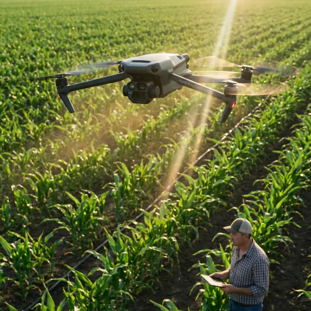
If you spend any real time around utility corridors, you learn quickly that spec sheets only matter when they survive the weather. Power-line mapping in windy terrain is not a studio test. It is long linear mileage, awkward launch spots, shifting gusts, magnetic clutter, and the constant pressure to come home with clean data rather than excuses.
That is the lens I used when thinking about the Mavic 4 Pro.
Not as a lifestyle camera drone. Not as a hype cycle object. As a working aircraft that will be judged by the same standards older dedicated survey platforms were built around: stable hovering, dependable route execution, practical endurance, payload logic, weather tolerance, and clean downstream data processing.
One reference point that helps ground that discussion is the iFly D6 orthophoto system recommendation. It comes from a different class of aircraft, but the details are useful because they reveal what professionals have always cared about in mapping. The D6 was built around precise hover, constant-speed cruise, and route planning, with a quoted 40-minute flight time, 5 km control radius, 6 kg payload capacity, and operation in light rain with wind resistance rated to level 6. It also used a carbon-fiber airframe, had low-voltage and signal-loss protection, and paired with a Sony A7R-class payload and Pix4Dmapper processing.
Why bring up a heavier mapping platform when the topic is Mavic 4 Pro? Because those details expose the job requirements that still matter today. The aircraft may be smaller, smarter, and far more integrated now, but windy power-line mapping still rewards the same fundamentals.
What power-line mapping actually demands
Linear infrastructure is different from broad-acre mapping. A power-line corridor pushes an aircraft into repeated heading changes, lateral offsets, and terrain transitions. The pilot wants consistency more than drama. Stable speed matters because overlap matters. Hover accuracy matters because towers, crossings, and hardware pinch points often need closer documentation passes. Wind handling matters because the line itself usually sits in open, exposed air.
That is exactly why the iFly D6 document spends time on operational control rather than just camera specs. “Precise hovering,” “constant-speed cruise,” and “route planning” are not marketing flourishes. They are mission outcomes. If the Mavic 4 Pro is going to earn a place in this kind of workflow, it has to deliver those same outcomes with less setup friction and more onboard intelligence.
And that is where modern compact platforms become interesting.
A foldable aircraft is not just about portability. On utility work, deployment speed changes the day. The D6 reference lists a 10-minute setup time with foldable arms and quick assembly. In rough field conditions, that was already considered practical. A Mavic-class aircraft compresses that staging window dramatically. That means less time exposed on roadside shoulders, less dust entering equipment during setup, and more flexibility to fly narrow weather gaps.
For crews covering multiple poles, spans, or substations in one day, that matters more than most online reviews admit.
Wind changes everything, especially image quality
The D6’s published resistance to level 6 wind is one of the most revealing numbers in the source material. Not because every operator will fly in those conditions, but because it reflects a design priority: image collection must stay usable when the air stops cooperating.
For Mavic 4 Pro buyers focused on power-line mapping, this is the right question to ask: not “Can it fly in wind?” but “Can it hold mapping geometry in wind without turning your dataset into extra office work?”
That comes down to several things working together:
- positional stability during hover and waypoint legs
- predictable yaw control near structures
- obstacle sensing that helps in clutter but does not constantly interrupt safe corridor flight
- camera performance that preserves detail when shutter speeds need to rise
- battery reserves strong enough to avoid pushing the last third of a mission in deteriorating air
This is also where a lot of buyers misread the value of intelligent features. Obstacle avoidance, ActiveTrack, and subject tracking are often discussed in cinematic terms, but utility teams should think of them differently. The real benefit is confidence in close-proximity situational awareness during non-automated inspection segments. When you break from a corridor grid to document an insulator string, conductor attachment point, or vegetation encroachment hotspot, modern sensing and tracking tools can reduce workload. They are not a replacement for pilot judgment. They are a fatigue reducer.
In wind, fatigue reduction is not a luxury. It is a data-quality feature.
Camera logic: from big-payload mapping to integrated capture
The D6 reference lists Sony A7R as the standard payload and notes an effective pixel count of 36 million. That tells you what the original mission designers valued: high-resolution still capture suitable for professional orthophoto and survey-grade interpretation.
That same mission logic should shape how you evaluate the Mavic 4 Pro camera stack.
For power-line mapping, raw resolution is only part of the story. The real question is whether the aircraft can capture a mix of corridor-wide mapping imagery and targeted asset detail without forcing a second platform into the truck. This is where integrated modern systems tend to outperform older modular rigs operationally, even when the older aircraft can carry far heavier payloads.
With the Mavic 4 Pro, the appeal is not just image sharpness. It is the reduction of workflow friction. One aircraft can move from planned route collection to oblique structure capture to quick contextual video for client reporting. QuickShots and Hyperlapse may sound like features for content creators, but there is a practical utility-side angle too. A controlled Hyperlapse sequence, for example, can create an easy visual record of corridor access conditions or surrounding vegetation change over time. Not every deliverable is a map. Some are communication tools for project managers, landowners, and maintenance planners.
D-Log matters here as well. Not because power utilities need “cinematic color,” but because flatter capture profiles preserve dynamic range when bright sky, reflective hardware, dark vegetation, and shaded ground all appear in the same frame. Anyone who has tried to recover detail from high-contrast line inspections understands the advantage immediately.
The hidden lesson in the D6 battery package
One of the most practical details in the reference is easy to overlook: the D6 package included two 12S 16000 mAh lithium polymer batteries, a charger, a voltage display unit, and a ground monitoring terminal. That equipment list says something important about professional aerial work. The aircraft is only one part of the system. Battery discipline is what keeps the mission predictable.
This is where I’ll add a field tip from experience.
When mapping windy power-line corridors, never plan your battery swaps around nominal flight time. Plan around the point where wind correction starts becoming expensive. On paper, an older platform like the D6 could reach 40 minutes. In the field, line work in gusty conditions means your useful mapping window is always shorter than the brochure number. The same principle applies to Mavic 4 Pro. If you wait for the battery to “tell you” it is time to come back, you are already late for professional work.
My rule is simple: in windy corridor missions, divide each battery into three phases. The first third is transit and mission stabilization. The second third is your main productive mapping segment. The final third is reserve for headwind return, repositioning, and any unexpected hover hold near structures. If the wind is variable across elevation, be even more conservative. Batteries do not drain evenly when the aircraft is fighting lateral gusts and repeated micro-corrections.
Also, let batteries rest between flights rather than hot-swapping them continuously in direct sun. Voltage sag shows up faster on demanding missions, and windy days often hide how hard the power system is actually working. That one habit prevents rushed last-leg decisions.
If you need help building a field-ready battery rotation plan for corridor work, this direct WhatsApp channel is a practical starting point: message a drone workflow specialist.
Why route planning still decides success
The source document’s mention of autonomous takeoff and landing, route planning, and signal-loss protection reflects a very mature operational philosophy. Mapping is won before the aircraft leaves the ground.
That remains true with the Mavic 4 Pro.
Power-line crews should be thinking in layers:
- Primary corridor route for repeatable capture geometry
- Target asset deviations for poles, towers, crossings, and anomalies
- Emergency return logic shaped by terrain and wind direction
- Data handoff plan based on how images will be stitched, inspected, or reported
The old D6 workflow explicitly connected aircraft capture to Pix4Dmapper, which was described as an automated, fast, professional-accuracy aerial image processing system. That matters because it reminds us the aircraft does not create the final product on its own. Your map quality is a chain, not a moment.
For Mavic 4 Pro users, that means every field choice should support the processing stage. Consistent altitude relative to terrain. Controlled speed. Conservative overlap in gusty sections. Structured file organization by segment and battery. Notes on where wind shear forced mission adjustments. These are not glamorous habits, but they produce cleaner reconstructions and fewer painful re-flights.
Weather resistance is not just about surviving rain
The D6 airframe was described as fire-resistant, rain-resistant, and dust-resistant, with operation in light rain and temperatures from -20°C to 60°C. Whether or not a compact modern aircraft matches those exact environmental tolerances, the professional takeaway is the same: weather resilience means mission continuity.
For a Mavic 4 Pro operator, continuity comes from a mix of aircraft capability and crew discipline. If you are mapping power lines in windy conditions, dust and moisture become lens and sensor issues long before they become catastrophic aircraft issues. Fast deployment from a compact case helps, but so does a strict routine:
- inspect props every stop
- wipe optics before every launch, not only when they look dirty
- keep batteries shaded and temperature-aware
- verify home point logic after relocation along the corridor
- avoid “one more pass” thinking when gusts start stacking
The older survey platforms were designed to endure rougher conditions partly because their users expected to work in them. That mindset is worth carrying into Mavic 4 Pro operations. Respect the environment, and the aircraft can be used far more effectively.
Where the Mavic 4 Pro can genuinely shine
Compared with a legacy aircraft like the D6, the Mavic 4 Pro’s biggest potential advantage is not brute payload. It is efficiency.
A 6 kg payload rating, 1.2 m wheelbase, and 12 kg takeoff weight make sense when you are building around interchangeable sensors and larger survey cameras. But many utility teams today do not want a large-flight-case workflow for every corridor job. They want a smaller aircraft that can be deployed fast, flown safely by a lean crew, and still produce material usable for mapping, inspection, reporting, and stakeholder communication.
That is the opening.
In windy power-line mapping, the best compact platform is the one that reduces total project friction without compromising the mission. If Mavic 4 Pro gives you stable route execution, strong image quality, dependable obstacle awareness around structures, and manageable battery logistics, it can cover a surprisingly wide share of utility work that once required a much bulkier system.
Not all of it. But more than many teams assume.
My working view
If I were evaluating Mavic 4 Pro specifically for windy power-line mapping, I would not start by asking whether it can imitate a heavy dedicated survey aircraft. I would ask whether it can deliver the outcomes those aircraft were built to guarantee.
The iFly D6 reference gives us a clear checklist: precise hover, route planning, dependable endurance, weather-minded design, camera credibility, and a processing-ready workflow. It quoted 40 minutes of flight time, 5 km control radius, 10-minute setup, and a 36 MP Sony A7R payload because those numbers represented operational confidence.
That is the standard Mavic 4 Pro should be measured against in the field.
Not hype. Not isolated camera tests. Not one perfect calm-weather sortie.
Real corridor work. Wind on the line. Batteries managed conservatively. Routes planned before launch. Data captured with the processing stage already in mind.
That is how professionals decide whether an aircraft belongs in the kit.
Ready for your own Mavic 4 Pro? Contact our team for expert consultation.