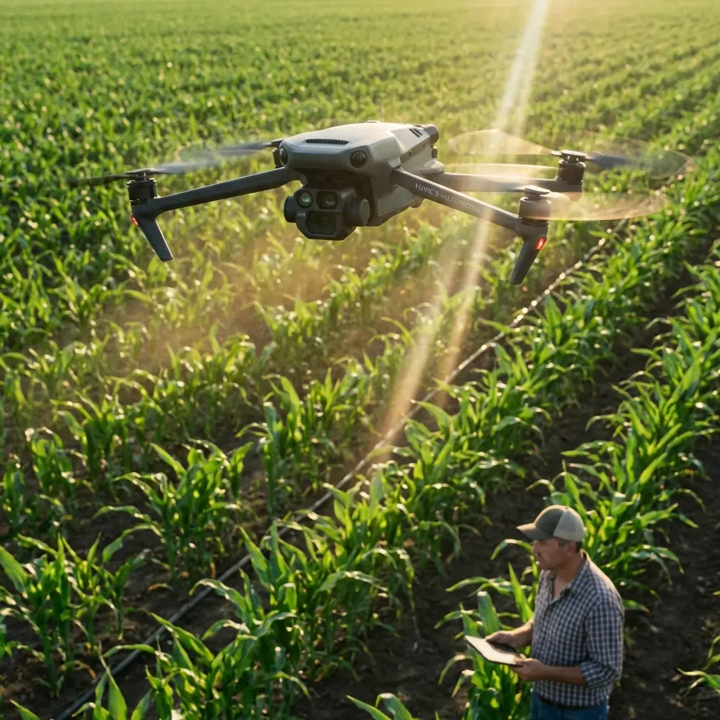
Mavic 4 Pro for Power Line Mapping in Extreme Temperatures
Mavic 4 Pro for Power Line Mapping in Extreme Temperatures: The Altitude Mistake That Skews Your Data
META: Technical review of using Mavic 4 Pro for power line mapping in extreme temperatures, with altitude strategy, sensor error insights, obstacle avoidance considerations, and practical flight planning advice.
Power line mapping is one of those jobs that looks straightforward until weather, terrain, and sensor behavior begin stacking error on top of error. The Mavic 4 Pro is an appealing platform for this kind of work because it sits at the intersection of portability, imaging quality, and intelligent flight automation. But if the mission is mapping lines in extreme heat or cold, the conversation should not start with camera specs. It should start with altitude discipline and sensor trust.
That sounds less glamorous, but it is where usable datasets are won or lost.
The reason is simple. Mapping power lines is not just about seeing conductors, poles, and insulators. It is about keeping a repeatable flight path around narrow linear infrastructure while the aircraft is constantly interpreting its own height, attitude, and motion. In extreme temperatures, the operating environment pushes every estimation layer harder. If you are flying a Mavic 4 Pro along utility corridors, your best results will come from treating altitude as a controlled technical variable, not just a safety setting.
Why altitude matters more than most Mavic operators expect
For corridor work, many pilots focus first on horizontal stand-off distance from the line. That is understandable. The obstacle is long, elevated, and often sits in a visually cluttered background. Yet the more consequential source of mapping inconsistency is often vertical estimation.
A useful clue comes from classical multirotor design work on inertial and barometric sensing. In a tightly coupled system that combines an IMU with a barometric altimeter, the aircraft estimates height from multiple imperfect signals. That matters because the accelerometer bias and the local value of gravity are not trivial details in that stack; they are core variables for stable height estimation. If either drifts, your vertical solution drifts with it.
For power line mapping, the operational significance is immediate. A small vertical error changes conductor framing, viewing angle on attachment hardware, and image overlap from one pass to the next. In a standard land survey block, that may show up as a mild reconstruction issue. Along energized corridor infrastructure, it can turn into missed detail or inconsistent clearance interpretation.
This is especially relevant in extreme temperatures because thermal conditions can amplify sensor behavior that feels invisible during casual flying.
The sensor lesson behind safer, cleaner corridor flights
One of the more practical findings from the reference material is that gravity is often the dominant component in accelerometer signals, and small inclination errors tend to affect computed vertical acceleration less severely than horizontal acceleration under ordinary movement. On paper, that sounds reassuring. In the field, it is only half the story.
The same source points out a second, more important detail for utility missions: when horizontal acceleration becomes large, even a small orientation error can produce a sizable error in vertical acceleration. That is the one power line pilots should care about.
Why? Because corridor missions often tempt pilots into aggressive lateral corrections. Wind shear near spans, turbulence around poles, and rapid obstacle avoidance inputs can all produce the kind of horizontal acceleration that contaminates the vertical estimate. You think you are merely tightening your line. The aircraft is also solving a more difficult motion problem.
Now add temperature extremes. Cold dense air can sharpen control response and tempt overcorrection. Hot unstable air can induce bobbing and lateral wander that leads to repeated stick inputs or constant ActiveTrack intervention. Either way, the more you ask the aircraft to accelerate laterally, the more you risk introducing vertical inconsistency into the capture geometry.
For a Mavic 4 Pro mapping power lines, this leads to a practical recommendation:
Optimal flight altitude insight: stay high enough to reduce correction load, low enough to preserve target detail
For this scenario, the sweet spot is usually not the minimum safe altitude that still lets you see hardware. It is the altitude that reduces abrupt course corrections while maintaining reliable visual separation from conductors, shield wires, and pole-top structures.
A good working principle is to fly slightly above the level of the highest line component you need to inspect, rather than level with the conductors whenever the corridor and regulations allow it. That small altitude advantage changes the mission in three useful ways:
It reduces the frequency of emergency vertical and lateral corrections.
When you are marginally above the lines, your obstacle picture becomes simpler. You are not threading the aircraft through the same elevation band as the conductors. That lowers pilot workload and reduces the kind of strong horizontal acceleration that can corrupt height estimation.It improves obstacle avoidance decision space.
On a Mavic 4 Pro, obstacle avoidance is valuable, but utility corridors are messy environments. Fine wires, intersecting branches, varying terrain, and background clutter are not the same as avoiding a wall or a tree in a cinematic flight. Giving the aircraft a little more vertical margin helps both the pilot and the autonomy stack.It creates more consistent imaging geometry.
Power line mapping is all about repeatability. A stable above-line perspective often yields cleaner pole-top context and more consistent pass-to-pass overlap than a line-level flight that is constantly being corrected.
How much above? There is no universal number because pole height, terrain, conductor sag, and local rules vary. But the insight is strategic: choose an altitude that minimizes control aggression. If your current altitude forces constant side-slipping and repeated climb-drop corrections, it is likely too low for efficient corridor mapping, even if it feels visually precise.
Extreme temperatures make barometric trust more fragile than pilots assume
The reference material also highlights the role of relative barometric height measurement, where pressure change is used to estimate altitude variation. This is standard and effective, but not magical. Pressure-based altitude estimation is useful because it smooths out some of the noise and drift that pure inertial estimation would accumulate. Yet in harsh field conditions, it should always be cross-checked against operational reality.
That matters in hot and cold utility work.
In very hot conditions, rising air and localized thermal activity near rights-of-way can make the aircraft feel less settled than the telemetry suggests. In cold conditions, battery behavior, air density, and wind exposure can make the aircraft respond differently than expected, encouraging extra correction input. In both cases, relying on a single altitude cue is asking too much of the system.
With Mavic 4 Pro, the right mindset is layered confidence:
- Use the aircraft’s altitude readouts.
- Confirm your line-of-sight geometry continuously.
- Build repeatable route spacing from visual references on poles and towers.
- Avoid “chasing” altitude with frequent manual micro-inputs.
That last point is underrated. Pilots who are nervous around lines often end up creating the very instability they are trying to avoid.
Why accelerometer bias is not just an engineering footnote
The source extract mentions an accelerometer bias instability of 1 mg and notes that even that can yield a significant accumulated effect over time. You do not need to derive the equations to understand the field consequence. Tiny bias errors can become non-trivial when a flight depends on stable vertical interpretation over repeated passes.
Operationally, this means two things for Mavic 4 Pro utility mapping:
1. Long corridor legs need reset logic
If you are mapping an extended section of line, do not treat one takeoff as infinitely trustworthy. Break missions into logical segments where you can evaluate consistency, reposition, and verify altitude behavior against known references.
2. Smooth inputs beat heroic corrections
Bias and orientation imperfections become harder to manage when the aircraft is being thrown around. A calm, repeatable flight profile usually delivers better infrastructure data than a more aggressive style, even if the aggressive pilot feels more “in control.”
That is why the best Mavic 4 Pro operators for utility work often look almost boring in the air. Their flights are measured. Their turns are deliberate. Their altitude choices remove drama before it starts.
Where Mavic 4 Pro flight features actually help
A lot of pilots approach flagship drone features through a content-creator lens first. That is understandable, especially with terms like QuickShots, Hyperlapse, and D-Log floating around every launch cycle. For power line mapping in extreme temperatures, though, these tools only matter if they support stable capture and review.
Obstacle avoidance
This is useful, but it should be treated as a buffer layer, not a permit to fly tighter. Utility wires are thin, complex, and context-dependent. The safer play is to design an altitude and lateral offset that reduce how often obstacle avoidance needs to intervene at all.
Subject tracking and ActiveTrack
For corridor work, these can help maintain path consistency in certain supervised scenarios, especially where the route is predictable and the visual environment is not overly cluttered. But power infrastructure is not a cyclist on an open road. If the system starts making path decisions near conductors, the pilot needs to be ahead of it mentally, not behind it.
D-Log
This matters more than many inspection teams admit. Extreme temperatures often bring punishing contrast: bright sky, reflective hardware, dark tree lines, snow, haze, or heat shimmer. D-Log can preserve tonal information that makes post-flight review more useful, especially when inspectors need to study attachment points or identify subtle anomalies in context rather than just produce pretty footage.
Hyperlapse and QuickShots
These are not central to technical mapping output, but they can be useful for corridor progress documentation, training debriefs, and stakeholder overviews. The key is to keep them separate from the core capture mission. Utility data collection should never be compromised for cinematic convenience.
A practical flight profile for this scenario
If I were planning a Mavic 4 Pro mission for mapping power lines in extreme temperatures, I would structure it like this:
- Start with a conservative above-line altitude that keeps the aircraft out of the conductor plane while preserving sufficient visual detail.
- Use gradual turns and line entries to avoid injecting strong horizontal acceleration into the flight solution.
- Favor repeatable corridor segments over one massive run.
- Monitor for temperature-driven handling changes during each pass rather than assuming the first minute represents the whole mission.
- Capture in a profile that protects highlight and shadow detail, especially if downstream review matters more than immediate visual punch.
- Reserve autonomy for assistance, not authority.
That profile aligns with what the sensor behavior tells us. Height estimation is never happening in a vacuum. It is being shaped by acceleration, bias, orientation quality, and barometric interpretation. If you fly in a way that makes those systems work less hard, the Mavic 4 Pro gives you cleaner, more defensible results.
The hidden discipline: altitude consistency beats aggressive proximity
There is a persistent temptation in power line operations to fly closer because closer feels more precise. Sometimes it is. More often, especially in extreme weather, it simply creates more correction demand.
The better approach is to let altitude do some of the safety and data-quality work for you. A slightly higher, cleaner, steadier run often outperforms a tighter run that forces constant intervention. That is not caution for its own sake. It is a sensor-aware operating strategy.
And this is where the underlying engineering becomes useful rather than academic. The source material makes clear that vertical estimation can be disturbed by orientation error under significant horizontal acceleration, while barometric and inertial coupling depends on carefully estimated parameters such as accelerometer bias and gravity. Those details explain something every experienced pilot has felt: unstable flight inputs produce unstable data, even when the aircraft appears capable.
If you are building a repeatable workflow for utility corridors, that should shape how you use the Mavic 4 Pro from the first waypoint onward.
If you want to compare corridor setup ideas or discuss a temperature-specific mission plan, you can message Chris Park directly here.
Ready for your own Mavic 4 Pro? Contact our team for expert consultation.