Mavic 4 Pro for High-Altitude Forest Mapping
Mavic 4 Pro for High-Altitude Forest Mapping: A Field Case Study
META: Expert case study on using Mavic 4 Pro for high-altitude forest mapping, with remote sensing insights, image quality considerations, obstacle sensing, and pre-flight safety workflow.
I’ve spent enough time around mountain forestry teams to know that “good enough” aerial data usually fails where forests get steep, cold, and visually chaotic.
High-altitude forest mapping is one of those jobs that exposes every weak point in a drone workflow. Thin air changes handling. Wind bends flight lines. Tree canopies hide slope breaks. Light shifts fast. And if the mission is supposed to support mapping, modeling, or land-resource analysis, cinematic footage is irrelevant unless the dataset holds together after processing.
That’s where the Mavic 4 Pro becomes interesting—not as a lifestyle aircraft, but as a practical small-UAV platform for remote sensing-style fieldwork when access is limited and response time matters.
This article looks at the Mavic 4 Pro through a forest-mapping lens, grounded in a core truth from UAV remote sensing practice: demand for spatial data keeps rising, while traditional data acquisition methods are often too slow, too rigid, or too resource-heavy for local jobs in difficult terrain. In mountain forestry, that gap is real. You don’t always need a crewed aircraft, and you rarely have the luxury of waiting on satellite timing when cloud, canopy, and terrain all work against you.
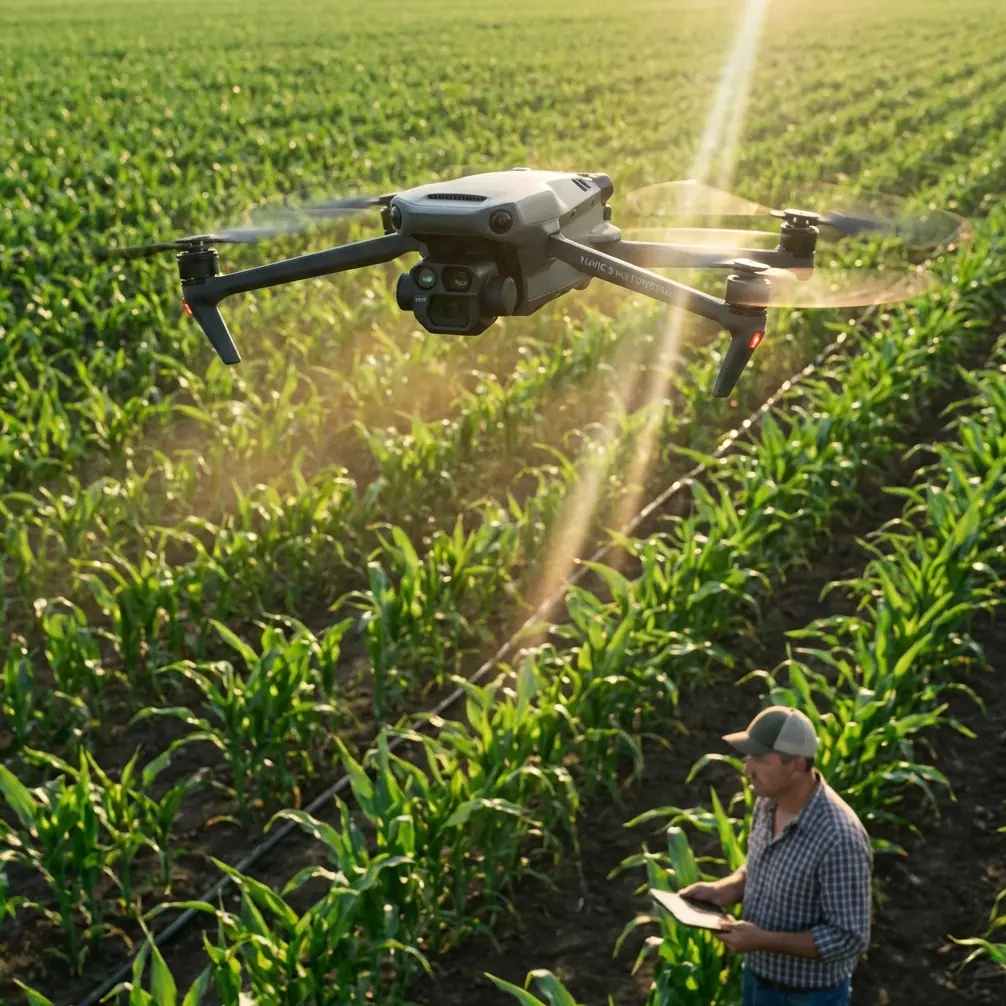
Why a compact UAV makes sense in mountain forest work
One of the most relevant ideas in the source material is the comparison between UAV remote sensing and traditional satellite remote sensing. The advantage is not abstract. It comes down to mobility and response.
A small drone can be transported by vehicle to a staging point near the target area and launched quickly. In a high-altitude forest environment, that matters more than spec-sheet theater. Road access may end abruptly. Weather windows may last an hour, not a day. Teams may need to shift from one slope to another after a visual check of fog, snowmelt, or canopy shadow.
The source also emphasizes route planning, in-flight correction, and precise target measurement as a strength of UAV operations. That directly aligns with a mapping workflow on the Mavic 4 Pro. For forest survey teams, the operational value is straightforward: you can define flight paths before takeoff, then refine execution around terrain, canopy density, and wind behavior instead of improvising the entire mission on site.
That level of control is a big deal in the mountains. A manually improvised flight may look fine on the controller. Later, in stitching or modeling, you discover uneven overlap, weak tie points, or images with inconsistent geometry because the aircraft drifted off line over a ridge.
The quiet pre-flight step that protects your data
Before I talk about image quality or automation, I want to start with something less glamorous: cleaning.
For Mavic 4 Pro operators working in high-altitude forests, a careful pre-flight cleaning step is not optional if you rely on obstacle avoidance and stable autonomous behavior. Pine pollen, trail dust, fine mud spray, condensation residue, and even fingerprints can degrade the performance of vision-based sensing surfaces. In a forest mission, that’s not just a safety concern. It can affect route consistency.
If your obstacle sensing system is reading through a smeared lens cover or debris film, the aircraft may behave more cautiously than expected, brake unexpectedly near branches, or alter its path in ways that reduce the regularity of image capture. For remote sensing jobs, irregular pathing can translate into inconsistent overlap. That becomes a processing problem later.
My own routine is simple: before powering up, inspect and clean the forward, rear, downward, and lateral sensing surfaces, the main camera glass, and any auxiliary optical elements with a proper lens-safe cloth and blower. Then check for moisture at the body seams and gimbal area, especially if the drone came from a warm vehicle into cold mountain air. It takes two minutes. It protects both the aircraft and the dataset.
This is one of those small field habits that separates recreational flying from dependable mapping operations.
Resolution is only useful if the geometry survives the mission
The source document highlights a major advantage of UAV remote sensing: high-resolution image acquisition, including vertical and oblique imaging, with spatial resolution reaching the decimeter level.
That detail deserves attention. Decimeter-level resolution means the imagery can represent ground detail at roughly tenths of a meter. In forest work, that can support tasks such as canopy gap identification, road-edge interpretation, erosion tracing on exposed slopes, and documenting changes around logging tracks, restoration plots, or firebreak maintenance zones.
But there’s a second part in the source that many people skip over: high resolution does not automatically equal easy processing.
The source points out several familiar problems in UAV imagery: small image footprint, large image counts, heavy processing workload, irregular image tilt, inconsistent overlap, and geometric instability caused by platform motion, lens distortion, and terrain relief. That is exactly what high-altitude forest operators should be thinking about when evaluating how to use a Mavic 4 Pro responsibly for mapping.
Forests in steep terrain amplify all of those issues. Wind at ridge level can make flight tracks irregular. The drone platform is inherently less stable than a crewed aircraft. If the aircraft partially departs the intended route, front overlap and side overlap may vary more than planned. Once that happens, extracting clean connection points across heavily textured canopy becomes harder. Dense forest is visually repetitive. Software can struggle when overlap patterns are inconsistent.
So the value of the Mavic 4 Pro is not merely that it can capture sharp images. The real value is whether the aircraft, pilot, and mission design together can preserve enough consistency for reliable downstream modeling.
A realistic forest mapping workflow with the Mavic 4 Pro
Here’s how I’d frame a practical case.
A forestry team needs to map a high-altitude woodland area after seasonal storm damage. The goals are to document access roads, identify canopy blowdown zones, assess exposed slopes, and create updated visual records for planning follow-up field visits.
The Mavic 4 Pro is deployed from a vehicle-accessible trailhead. That matches the source material’s point about ground transport and rapid arrival at the target zone. The team doesn’t need runway infrastructure or a large field crew. They need speed, portability, and enough imaging discipline to bring home usable data.
The first flight is not the mapping flight. It’s a reconnaissance pass.
This is where features often associated with content creation can still help a technical crew if used intelligently. ActiveTrack or subject tracking is not a mapping function by itself, but it can support visual documentation of moving field staff along narrow trails or vehicles entering damaged access routes. Hyperlapse and QuickShots are not core survey tools either, yet they can create clear contextual visuals for client briefings, landowner updates, or progress reporting when used separately from the main photogrammetry mission. The key is separation of purpose: survey data collection should stay disciplined, while communication footage can be gathered afterward.
Obstacle avoidance matters much more directly. Forest edges and uneven terrain create a constant collision risk during setup flights and low-altitude inspection passes. A compact aircraft with strong situational sensing reduces the risk of a mission-ending mistake near branches or terrain breaks. In high-altitude work, where each battery and weather window counts, avoiding unnecessary repositioning or recovery incidents is a real productivity benefit.
Vertical versus oblique capture in mountain woods
The source explicitly mentions both vertical and oblique imaging capability. That distinction matters in forests.
Vertical imagery is still the backbone for most mapping and orthomosaic generation. It provides cleaner geometry for broad-area coverage. But in mountain forestry, oblique views can add interpretive value where slope faces, road cuts, erosion gullies, and stand edges are difficult to read from straight-down imagery alone.
With the Mavic 4 Pro, the smart move is not to treat oblique imagery as a dramatic add-on. It should be a deliberate second layer. First, secure the core vertical dataset with consistent overlap and disciplined altitude control. Then, if conditions allow, capture selected oblique passes over features where canopy structure or slope complexity would benefit from side perspective.
That mirrors the operational reality described in the source: UAVs can gather rich high-resolution imagery, but the more angles and images you introduce, the greater the workload becomes. In other words, oblique capture is useful, but only when the team has a clear reason for collecting it and a processing plan that can handle the extra volume.
The hidden enemy: irregular overlap
This is the issue that ruins more forest mapping jobs than most pilots admit.
The source notes that UAV instability, wind influence, and route deviation can cause irregular forward and side overlap. In forests, that problem gets worse because canopies often lack clean, distinctive manmade reference features. Repetitive treetops are harder for software to reconcile than roofs, roads, and urban edges.
On a Mavic 4 Pro mission, maintaining overlap discipline starts before takeoff. Mission lines should account for terrain, not just horizontal map shape. Flights that look mathematically neat on a flat planning screen may produce inconsistent ground sample coverage when one half of the area climbs sharply in elevation. In mountain forest work, altitude strategy and line orientation should reflect slope behavior and wind exposure.
This is another reason I keep emphasizing the pre-flight cleaning and system check. If obstacle sensing is compromised and the aircraft hesitates or reroutes unpredictably near canopy margins, overlap can break down without the operator realizing it in real time.
Color profiles matter for analysis too
A lot of people hear D-Log and think only about video grading. That’s too narrow.
For forestry documentation, a controlled color profile can be useful when the team needs consistent visual interpretation across different times of day or across repeated monitoring flights. D-Log is not a substitute for calibrated remote sensing workflows, but for visual reporting, restoration tracking, or land-management communication, it can preserve tonal detail in high-contrast mountain scenes where bright sky, dark conifers, and reflective rock all compete in the same frame.
Used properly, that can make post-flight review more informative. You’re better able to distinguish canopy stress, shadowed road conditions, and subtle terrain transitions in exported materials. The point is not cinematic polish. It’s retaining usable visual information.
A compact platform, with grown-up expectations
The source definition of UAV remote sensing is broader than flying a camera. It includes the aircraft, sensors, telemetry, communications, GPS differential positioning concepts, and the complete chain of data processing, modeling, and applied analysis.
That framework is the right way to think about the Mavic 4 Pro.
If you send it into a high-altitude forest expecting a one-click survey miracle, you’ll probably be disappointed. If you use it as part of a disciplined field system—clean sensors, planned routes, terrain-aware mission design, controlled capture strategy, and realistic processing expectations—it becomes a very capable tool for small-area forest mapping and visual documentation.
Its biggest advantage is not that it replaces every other remote sensing option. It’s that it fills the gap between inaccessible satellite timing and heavier airborne operations. For many forestry teams, that gap is where the real work lives.
When the Mavic 4 Pro is the right fit
I would consider it especially well suited for:
- forest access road documentation
- post-storm canopy damage review
- slope and erosion observation
- restoration site progress records
- localized land-resource mapping in hard-to-reach mountain zones
- training teams in practical UAV remote sensing workflows
And I would be cautious if the mission requires large contiguous acreage under difficult wind conditions without a robust overlap strategy, or if the team lacks the processing discipline to handle high image counts and geometric inconsistencies.
That’s not a criticism of the aircraft. It’s respect for the work.
Final field note
The best Mavic 4 Pro forest maps usually come from crews who think like surveyors before they think like pilots.
They understand why rapid deployment matters. They use the drone’s mobility the way the source describes: getting a sensing platform quickly into areas where data demand is high and access is limited. They take advantage of decimeter-level image detail, but they also respect the source’s warning that UAV imagery can become difficult to process when overlap, tilt, and stability are poorly controlled.
And they don’t skip the unglamorous stuff. Clean obstacle sensors. Clean optics. Check for condensation. Confirm route logic. Fly the dataset you need, not the footage that looks exciting on the controller.
If you’re planning a forest mapping workflow around the Mavic 4 Pro and want a second opinion on mission design, terrain strategy, or payload expectations, you can message our field team here: https://wa.me/85255379740
Ready for your own Mavic 4 Pro? Contact our team for expert consultation.