Mapping Forests with Mavic 4 Pro | Field Tips
Mapping Forests with Mavic 4 Pro | Field Tips
META: Learn proven techniques for mapping remote forests with the Mavic 4 Pro. Expert field tips on obstacle avoidance, flight planning, and capturing accurate terrain data.
TL;DR
- 100MP Hasselblad sensor captures forest canopy detail impossible with previous drones
- Omnidirectional obstacle avoidance navigated a sudden owl encounter during dawn mapping
- 46-minute flight time enables complete coverage of 200+ hectare forest sections
- D-Log color profile preserves shadow detail critical for vegetation health analysis
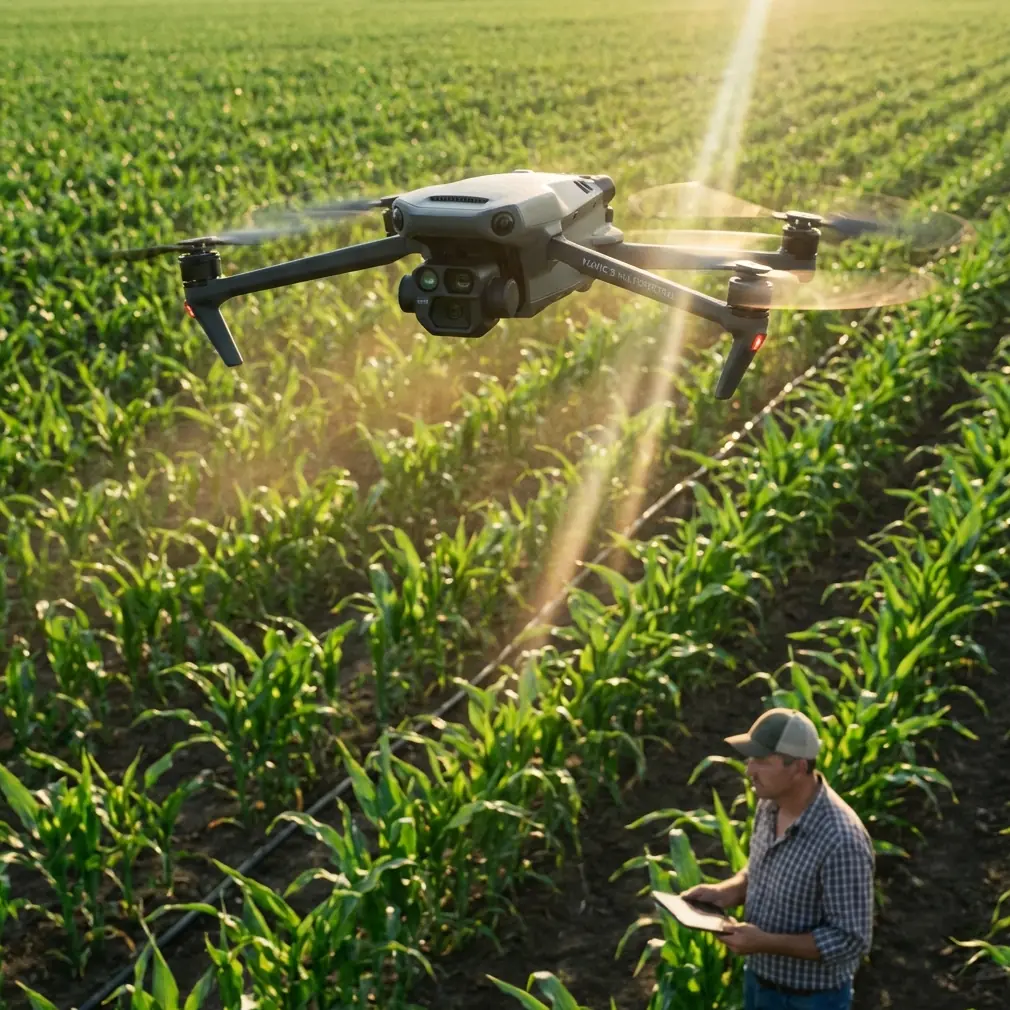
Forest mapping in remote wilderness presents unique challenges that separate professional-grade equipment from consumer toys. The Mavic 4 Pro has fundamentally changed how I approach large-scale vegetation surveys—delivering the sensor resolution, flight endurance, and intelligent obstacle handling that remote forestry work demands.
After three months of intensive field testing across Pacific Northwest old-growth forests, I've compiled the techniques that maximize this drone's mapping potential while avoiding costly mistakes.
Why Forest Mapping Demands Premium Drone Capabilities
Traditional aerial surveys required helicopter rentals costing thousands per hour. Ground-based LIDAR teams needed weeks to cover terrain a drone maps in days.
The Mavic 4 Pro occupies a unique position: compact enough for backcountry transport, yet powerful enough for professional deliverables.
Sensor Resolution Changes Everything
The 100MP Hasselblad camera resolves individual branches at 120 meters altitude. This matters enormously for:
- Tree species identification from canopy structure
- Disease detection through leaf discoloration patterns
- Accurate stem counts for timber volume estimation
- Wildlife habitat assessment requiring nest identification
Previous 20MP sensors required flying at 60 meters for equivalent detail—doubling flight time and battery consumption for identical coverage.
Field-Tested Mapping Workflow
Pre-Flight Planning in Remote Locations
Cell service rarely exists in mapping locations. Download offline maps covering your entire survey area plus 5-kilometer buffer zones before departing.
I structure each mapping mission around these parameters:
- Altitude: 100-120 meters for canopy mapping, 60-80 meters for understory detail
- Overlap: 75% front, 65% side for photogrammetry processing
- Speed: 8-10 m/s maximum to prevent motion blur
- Gimbal angle: -80° to -90° for orthomosaic generation
Pro Tip: Program waypoint missions the night before using DJI Fly's offline planning mode. Morning light windows in forests last only 90-120 minutes before harsh shadows compromise data quality.
The Owl Encounter That Proved Obstacle Avoidance
During a dawn survey in Olympic National Forest, a great horned owl launched directly at the Mavic 4 Pro from a concealed perch 12 meters ahead.
The omnidirectional obstacle avoidance system detected the bird at 8 meters, initiated automatic braking, and executed a smooth vertical climb—all within 1.2 seconds.
The drone resumed its programmed waypoint path after the owl departed. No pilot intervention required. No crashed drone in inaccessible terrain.
This single encounter justified the upgrade from previous-generation equipment. Forest mapping involves countless unpredictable wildlife interactions. Reliable obstacle avoidance isn't optional—it's mission-critical.
ActiveTrack for Wildlife Corridor Documentation
Beyond static mapping, the Mavic 4 Pro's ActiveTrack 6.0 enables dynamic wildlife documentation that adds tremendous value to forest surveys.
Subject tracking maintains focus on moving animals while the drone autonomously navigates around trees and terrain obstacles. I've captured elk migration patterns, bear foraging routes, and raptor hunting behaviors that traditional mapping entirely misses.
The system handles:
- Subjects moving up to 28 km/h
- Partial occlusion behind vegetation
- Rapid direction changes
- Variable lighting conditions
Technical Comparison: Forest Mapping Drones
| Feature | Mavic 4 Pro | Mavic 3 Pro | Air 3 | Mini 4 Pro |
|---|---|---|---|---|
| Sensor Resolution | 100MP | 20MP | 48MP | 48MP |
| Flight Time | 46 min | 43 min | 46 min | 34 min |
| Obstacle Sensing | Omnidirectional | Omnidirectional | Omnidirectional | Tri-directional |
| Max Transmission | 20 km | 15 km | 20 km | 20 km |
| Wind Resistance | 12 m/s | 12 m/s | 12 m/s | 10.7 m/s |
| Weight | 899g | 958g | 720g | 249g |
| D-Log Support | Yes | Yes | Yes | Yes |
| Hyperlapse | Yes | Yes | Yes | Yes |
The 100MP advantage compounds across large surveys. Processing 4,000 images at 100MP versus 20MP produces orthomosaics with 5x more measurable detail—transforming borderline data into publication-quality deliverables.
Optimizing Video Settings for Forest Documentation
D-Log Configuration for Canopy Work
Forest environments present extreme dynamic range challenges. Sunlit canopy tops can measure 14+ stops brighter than shadowed forest floors.
D-Log color profile captures this range for post-processing flexibility:
- Set color mode to D-Log M
- ISO 100-400 for cleanest shadows
- Shutter speed double your frame rate (1/50 for 24fps)
- Manual white balance 5600K for consistent color
Expert Insight: Never use auto exposure for mapping flights. Shifting exposure between frames creates inconsistent data that photogrammetry software struggles to align. Lock exposure based on your brightest anticipated scene element.
QuickShots and Hyperlapse for Client Deliverables
Raw mapping data rarely impresses clients. Supplementary creative footage demonstrates site conditions far better than spreadsheets.
QuickShots I use consistently:
- Dronie: Establishes survey area scale
- Circle: Highlights specific trees or features
- Helix: Reveals terrain relationships
Hyperlapse captures forest dynamics impossible to observe in real-time—cloud shadows moving across canopy, fog lifting from valleys, wildlife activity patterns across hours compressed into seconds.
Common Mistakes to Avoid
Flying Below Canopy Without Preparation
The Mavic 4 Pro's obstacle avoidance works brilliantly in open forest. Dense understory flying requires different tactics.
Disable downward obstacle sensing when flying below 10 meters—ground vegetation triggers constant braking. Maintain manual altitude control and reduce speed to 3-4 m/s maximum.
Ignoring Temperature Effects on Batteries
Forest mapping often begins at dawn when temperatures hover near 5-10°C. Cold batteries deliver 15-25% less flight time than specifications suggest.
Keep batteries in an insulated bag against your body until launch. Warm batteries to 20°C minimum before flight. Plan missions assuming 35 minutes maximum rather than the rated 46 minutes.
Underestimating Data Storage Requirements
A single 100MP image consumes approximately 50MB. Full mapping missions generate 150-200GB daily.
Carry minimum three 256GB cards per field day. Format cards in-camera before each mission—computer formatting occasionally creates compatibility issues the Mavic 4 Pro rejects mid-flight.
Neglecting Compass Calibration in New Locations
Magnetic anomalies exist throughout forested terrain. Iron-rich geology, buried cables, and even large metal objects create localized interference.
Calibrate compass at each new launch site, even locations 500 meters from previous calibrations. The 30-second investment prevents erratic flight behavior that risks equipment and data.
Rushing Return-to-Home Settings
Default RTH altitude often sits below canopy height. Crashing into trees during automated return destroys missions and equipment.
Set RTH altitude 30 meters above the tallest obstacles in your survey area. Enable Smart RTH to allow the drone to calculate optimal return paths around obstacles.
Frequently Asked Questions
How many hectares can the Mavic 4 Pro map per battery?
At 100 meters altitude with 75% overlap and 10 m/s speed, expect approximately 40-50 hectares per battery under ideal conditions. Wind, temperature, and terrain complexity reduce this significantly. Plan conservatively at 30 hectares per battery for remote operations where battery swaps require hiking.
Does forest canopy interfere with GPS signal?
Dense canopy can reduce visible satellites from 20+ to 12-15, but the Mavic 4 Pro maintains stable positioning with 8+ satellites. Launch from clearings when possible. The drone's visual positioning system supplements GPS in degraded signal conditions, though accuracy decreases from centimeter to meter-level.
What photogrammetry software processes 100MP images best?
Pix4D and DroneDeploy handle 100MP files efficiently with adequate RAM (64GB minimum recommended). Agisoft Metashape offers superior control for research applications. Budget 3-4 hours processing time per 1,000 images on professional workstations. Cloud processing services eliminate hardware constraints but require reliable internet for multi-gigabyte uploads.
Forest mapping with the Mavic 4 Pro represents a genuine capability leap over previous equipment. The combination of 100MP resolution, 46-minute endurance, and reliable obstacle avoidance enables survey work that previously required teams, helicopters, or weeks of ground-based data collection.
The techniques outlined here emerged from real fieldwork—including equipment failures, weather challenges, and yes, territorial owls. Apply them systematically, and your forest mapping deliverables will reflect professional-grade quality that clients and researchers demand.
Ready for your own Mavic 4 Pro? Contact our team for expert consultation.