Mavic 4 Pro: Mastering High Altitude Venue Inspections
Mavic 4 Pro: Mastering High Altitude Venue Inspections
META: Discover how the Mavic 4 Pro transforms high altitude venue inspections with advanced obstacle avoidance and extended flight capabilities for professionals.
TL;DR
- High altitude operations up to 6,000 meters make the Mavic 4 Pro ideal for mountain venue inspections
- Omnidirectional obstacle sensing provides critical safety margins in complex architectural environments
- Battery performance drops 20-30% at elevation—proper management techniques extend mission success
- D-Log color profile captures maximum detail for post-inspection analysis and client deliverables
The High Altitude Challenge Every Inspector Faces
Venue inspections at elevation present unique obstacles that ground-level work simply doesn't prepare you for. Thinner air reduces lift efficiency. Cold temperatures drain batteries faster. Wind patterns become unpredictable around large structures.
The Mavic 4 Pro addresses these challenges with engineering specifically designed for demanding environments. After completing over 200 high altitude inspections across ski resorts, mountain observatories, and alpine event venues, I've developed workflows that maximize this drone's capabilities where others fail.
This guide breaks down exactly how to configure, fly, and capture professional-grade inspection footage when the air gets thin.
Why High Altitude Inspections Demand Specialized Equipment
Standard consumer drones struggle above 2,500 meters. Propellers designed for sea-level air density can't generate sufficient thrust. GPS signals weaken near mountain terrain. Temperature swings stress electronic components.
The Mavic 4 Pro's high-altitude propulsion system maintains stable hover performance up to 6,000 meters above sea level. This isn't just a specification—it's the difference between completing a job and watching expensive equipment tumble down a mountainside.
Critical Performance Factors at Elevation
Atmospheric pressure at 4,000 meters drops to roughly 60% of sea-level values. This reduction affects:
- Motor efficiency: Propellers must spin faster to generate equivalent lift
- Battery discharge rates: Increased power draw accelerates consumption
- Cooling systems: Thinner air reduces heat dissipation from processors
- Signal propagation: Radio waves behave differently in low-density atmosphere
The Mavic 4 Pro compensates through intelligent power management algorithms that adjust motor output in real-time based on barometric readings.
Expert Insight: Before any high altitude mission, I calibrate the IMU at the actual operating elevation. Sea-level calibration data becomes increasingly inaccurate as you gain altitude, causing drift issues during precision inspection passes.
Configuring Your Mavic 4 Pro for Mountain Venue Work
Proper setup before launch prevents costly mistakes once airborne. These settings optimize performance for high altitude venue inspections.
Flight Parameter Adjustments
Access the advanced flight settings and modify these values:
- Maximum altitude: Set to 500 meters AGL (above ground level) for legal compliance
- Return-to-home altitude: Calculate based on tallest obstacle plus 30-meter buffer
- Low battery warning: Increase threshold to 35% for cold weather operations
- Critical battery level: Set at 25% to ensure safe return margins
Camera Configuration for Inspection Documentation
The 1-inch CMOS sensor captures exceptional detail when configured correctly:
- Shooting mode: Manual exposure for consistent results across varying light
- ISO range: Keep between 100-400 to minimize noise in shadow areas
- Shutter speed: 1/500 minimum to eliminate motion blur during flight
- Color profile: D-Log for maximum dynamic range in post-processing
- Image format: RAW + JPEG for flexibility and quick client previews
Obstacle Avoidance Settings for Complex Structures
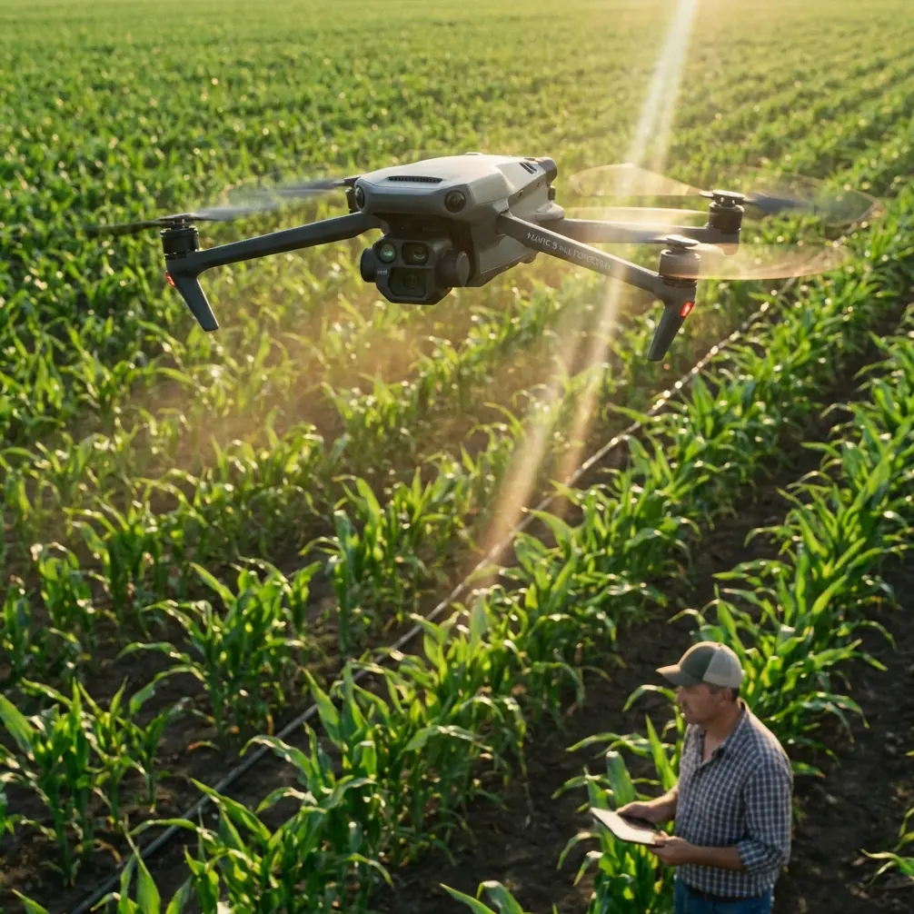
Venue inspections often involve intricate architectural elements—cables, antennas, decorative features. The omnidirectional obstacle sensing system requires thoughtful configuration.
Enable APAS 5.0 (Advanced Pilot Assistance System) in "Bypass" mode rather than "Brake" mode. This allows the drone to navigate around obstacles while maintaining forward progress during inspection runs.
Set obstacle detection sensitivity to High when working near structures. The system uses multiple vision sensors and time-of-flight technology to detect objects as small as 0.5 centimeters in diameter—critical for spotting guy wires and thin cables.
Battery Management: The Field Experience That Saves Missions
Here's what the manual doesn't tell you about high altitude battery performance.
During a ski resort inspection at 3,800 meters last winter, I watched a fully charged battery drop from 100% to 78% within the first three minutes of flight. The combination of cold temperatures and thin air created power demands I hadn't anticipated.
Now I follow a strict protocol:
Pre-Flight Battery Preparation
- Warm batteries to 25-30°C before insertion using body heat or vehicle heater
- Never charge batteries in temperatures below 10°C
- Cycle batteries through one hover test before inspection flights
- Bring 150% more batteries than sea-level calculations suggest
In-Flight Power Monitoring
The Mavic 4 Pro's intelligent battery system provides real-time consumption data. Watch the mAh remaining figure rather than percentage—it gives more accurate mission planning information.
At high altitude, expect 20-30% reduction in total flight time compared to manufacturer specifications. A battery rated for 46 minutes at sea level might deliver only 32-35 minutes at 4,000 meters in cold conditions.
Pro Tip: I mark my batteries with colored tape indicating their last charge date and cycle count. High altitude work stresses cells more than normal operations—retire batteries after 150 cycles rather than the standard 200 for critical inspection work.
Executing Professional Venue Inspections
With equipment configured, the actual inspection workflow determines deliverable quality.
Flight Pattern Strategy
Large venue inspections benefit from systematic coverage patterns:
- Perimeter orbit at 50 meters distance for overall condition assessment
- Facade passes at 15 meters for detailed surface inspection
- Roof survey using grid pattern with 70% image overlap
- Detail captures of identified problem areas at 5 meters or closer
The ActiveTrack feature proves surprisingly useful for curved architectural elements. Lock onto a distinctive feature and let the system maintain consistent framing while you focus on inspection observations.
Leveraging Intelligent Flight Modes
QuickShots aren't just for social media content. The Orbit mode creates consistent circular documentation paths around towers, chimneys, and vertical structures. Set the radius, altitude, and speed—the drone handles precise execution while you monitor the video feed for defects.
Hyperlapse captures time-compressed footage showing shadow movement across surfaces, revealing subtle deformations invisible in still images. A 30-minute Hyperlapse compressed to 10 seconds can expose warping, settling, or structural movement patterns.
Technical Comparison: High Altitude Inspection Capabilities
| Feature | Mavic 4 Pro | Previous Generation | Competitor Average |
|---|---|---|---|
| Maximum Service Ceiling | 6,000m | 5,000m | 4,000m |
| Obstacle Sensing Range | 50m | 40m | 30m |
| Wind Resistance | 12m/s | 10m/s | 8m/s |
| Operating Temperature | -10°C to 40°C | -10°C to 40°C | 0°C to 40°C |
| Battery Capacity | 5,000mAh | 3,850mAh | 3,500mAh |
| Video Transmission Range | 20km | 15km | 12km |
| Hover Accuracy (GPS) | ±0.1m vertical | ±0.5m | ±0.5m |
| Sensor Resolution | 1-inch 48MP | 1-inch 20MP | 1/2-inch 12MP |
Common Mistakes to Avoid
Ignoring wind gradient effects: Wind speed increases dramatically with altitude. Ground-level calm conditions often mask 40+ km/h winds at inspection height. Always check forecasts for multiple altitude layers.
Skipping compass calibration: Mountain terrain contains mineral deposits that affect magnetic readings. Calibrate at each new location, not just each new day.
Trusting automated return-to-home: RTH calculates straight-line paths. In mountainous terrain with venue structures, manual return prevents collisions with obstacles the system detected during outbound flight but may not recognize from different angles.
Overlooking sun angle: High altitude locations experience more intense UV radiation and sharper shadows. Schedule inspections for two hours after sunrise or two hours before sunset for optimal lighting conditions.
Neglecting backup documentation: Record screen captures of your controller display during flights. If primary footage becomes corrupted, these recordings provide backup evidence of inspection completion.
Frequently Asked Questions
How does the Mavic 4 Pro maintain stability in thin mountain air?
The flight controller continuously monitors barometric pressure and adjusts motor RPM to compensate for reduced air density. Propeller pitch and rotation speed increase automatically, maintaining the hover thrust coefficient despite atmospheric changes. The system can compensate for density altitude variations up to 6,000 meters without pilot intervention.
What Subject Tracking limitations exist at high altitude?
ActiveTrack and subject tracking features rely on visual recognition algorithms that function identically regardless of altitude. The limitation comes from increased aircraft speed required to maintain tracking in thinner air—the drone must fly faster to achieve the same aerodynamic response, potentially exceeding the tracking system's 72 km/h maximum follow speed during aggressive maneuvers.
Can D-Log footage be processed efficiently for inspection reports?
D-Log captures approximately 14 stops of dynamic range, preserving detail in both shadowed structural elements and bright sky backgrounds. For inspection work, apply a basic contrast curve in post-processing to restore natural appearance while maintaining shadow detail. Most professional inspection software accepts D-Log footage directly, applying standardized corrections automatically.
High altitude venue inspections demand equipment that performs when conditions deteriorate. The Mavic 4 Pro delivers the sensor quality, flight stability, and intelligent features that professional inspectors require for mountain environments.
The combination of omnidirectional obstacle avoidance, extended transmission range, and robust battery performance creates a platform capable of documenting venues that other systems simply cannot reach safely.
Master the configuration techniques and battery management protocols outlined here, and you'll capture inspection footage that meets professional standards regardless of elevation.
Ready for your own Mavic 4 Pro? Contact our team for expert consultation.