Inspecting Mountain Power Lines with Mavic 4 Pro
Inspecting Mountain Power Lines with Mavic 4 Pro: Practical Flight Altitude, Stability, and What Actually Matters
META: A field-focused case study on using Mavic 4 Pro for mountain power line inspection, with practical altitude strategy, obstacle awareness, wind stability, image workflow, and safer route planning.
Mountain power line inspection looks straightforward on a map. In the air, it rarely is.
Ridges compress wind. Valleys create abrupt downdrafts. Conductors can appear visually simple from a distance, then become hard to read once glare, changing elevation, and background clutter start working against you. For a pilot using the Mavic 4 Pro, the real question is not just whether the aircraft can fly the route. It is whether it can hold a stable observational position long enough to collect footage that inspection teams can trust.
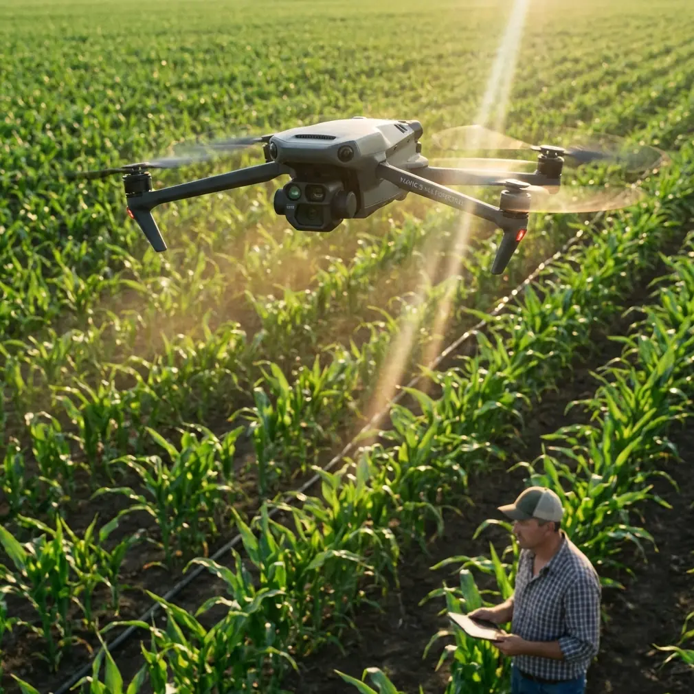
I want to frame this as a case study rather than a product summary. The scenario is specific: a civilian utility inspection mission in mountainous terrain, flown with a Mavic 4 Pro, where the operator needs reliable visuals of poles, towers, insulators, and corridor clearance while managing terrain-induced wind and line-of-sight complexity.
The most useful starting point is not the camera. It is lift and control.
A rotor aircraft stays in hover only when total lift matches its weight. If lift exceeds weight, it climbs. If it falls below, it descends. That sounds basic, but in mountain inspection work it becomes operationally decisive. Small vertical corrections near power infrastructure are never just “up” and “down.” They are constant responses to shifting airflow, especially when wind rolls over a ridgeline or channels through a saddle. The pilot who understands hover as a balance of forces flies more deliberately than the one who thinks only in terms of sticks and menus.
That matters because power line inspection is often a hover-heavy job. You are not just passing by assets. You are stopping, reframing, inching sideways, checking component condition, then holding position again as the background changes. In the reference material, rotorcraft are highlighted for exactly this strength: vertical takeoff, hovering, and strong controllability at low altitude and low speed. For mountain utility work, that is the whole game. The Mavic 4 Pro is valuable here not because it is a general drone, but because this class of multirotor platform is inherently suited to precise, stop-and-check aerial tasks.
The altitude mistake many new inspection teams make
The most common planning error is choosing a single “safe altitude” for the whole corridor.
That approach sounds tidy, but mountain power lines punish it. Terrain rises and falls too quickly, and visual requirements change from one structure to the next. If the aircraft stays too high, you lose the angle needed to judge conductor spacing, attachment hardware, vegetation encroachment, and wear patterns on components. If it flies too low without a reasoned buffer, you reduce reaction time and make terrain, guy wires, and crossarms harder to manage.
For this scenario, the better approach is a layered altitude strategy.
When transiting between inspection points, fly high enough above local terrain to preserve margin over rising ground and to maintain a clean situational view of the corridor. Once you arrive at a pole or tower segment for actual inspection, step down to a working altitude that puts the camera slightly above or level with the component of interest rather than dramatically below it. In mountain conditions, I prefer thinking in terms of relative altitude above the line feature, not a single absolute number for the entire mission.
If the target is conductor alignment across a span, a slightly elevated angle often reveals sag behavior and spacing more clearly than a low side-on pass. If the target is insulator condition or arm hardware on a mountain-facing structure, a near-level inspection angle usually gives more interpretable detail and avoids turning every shot into a silhouette against bright sky.
The operational insight is simple: in this use case, optimal altitude is dynamic, not fixed. It should be adjusted by task phase, terrain contour, and the exact component being documented.
Why wind capability is more than a spec sheet line
The source material includes a detail that is very relevant in the mountains: resistance to level 6 wind, combined with a weather-oriented design approach and a high-strength carbon fiber integrated structure. Even if you are not flying that exact aircraft from the source, this tells us something important about the inspection standard rotorcraft must meet in exposed environments.
On a mountain line route, wind is not just stronger; it is less honest. You can launch in moderate conditions and encounter a completely different air mass 300 meters later near a ridge shoulder. That is why a stable airframe and disciplined hover behavior matter more than headline speed. The pilot needs the aircraft to resist lateral drift while framing narrow infrastructure against a visually noisy background of trees, rock, and sky.
For Mavic 4 Pro operators, this translates into one practical principle: do not use calm launch conditions as proof of calm route conditions. Build your mission around the strongest expected turbulence point, not the parking area where you unfolded the drone.
If your route crosses exposed saddles or crest lines, inspect those sections early, before fatigue and battery compression start influencing decision-making. Which leads to another useful reference detail: 55 minutes of endurance is mentioned in the source material. Whether your actual flight time with payload, wind, and reserve differs, the operational lesson remains the same. Long endurance is not only about covering more distance. It gives you the margin to stop, reassess, and repeat a critical pass without rushing your return leg.
That margin is gold in the mountains.
Transmission range is really about confidence, not distance
The source also cites 20 kilometers of HD video transmission with multi-point reception support. Again, the deeper significance is not the number itself. It is what robust transmission means for work in terrain-fragmented environments.
Mountain inspection often breaks visual and signal geometry in awkward ways. Slopes, tree lines, and tower placement can interrupt what looked clean in planning. A strong transmission system helps preserve decision quality because the pilot and visual observer are working from a stable live image rather than a degraded or hesitant feed.
For Mavic 4 Pro users, the takeaway is this: treat transmission strength as part of inspection integrity. If your image feed stutters at the moment you are checking a damaged insulator string or verifying vegetation clearance, you are not just dealing with inconvenience. You are risking incomplete records and avoidable re-flights.
This is also why I like having a support contact available before a corridor job in demanding terrain. If you need field advice on setup or mission planning, you can message a drone specialist here before you commit the crew to a mountain day.
Obstacle avoidance is helpful, but it does not understand your inspection intent
A lot of buyers assume obstacle avoidance solves infrastructure risk. It does not. It reduces some forms of collision risk, but power line environments remain highly interpretive.
Mountain power lines create layered backgrounds. Conductors can visually blend into terrain. Towers sit against cliff faces. Branches, service roads, and uneven ground can mislead depth perception on screen. In that setting, obstacle sensing is best treated as backup, not authority.
The Mavic 4 Pro’s obstacle avoidance and subject-aware intelligence can still be valuable. They reduce workload during route repositioning and can support smoother pathing when moving around towers or along access corridors. But when you are close to conductors or using a side angle to inspect hardware, manual positioning discipline matters more than automation.
The best operators use obstacle systems to lower workload while keeping decisive control over the aircraft’s exact standoff distance and angle.
ActiveTrack and subject tracking: useful, but with boundaries
The context hints mention Subject tracking and ActiveTrack, and there is a place for them in this workflow. Not on the conductors themselves. On moving support activity.
If a ground crew is traversing an access road below the line corridor, subject tracking can help document approach conditions, right-of-way obstacles, or site logistics. It is also useful for creating contextual footage that shows terrain difficulty to planners and maintenance teams. But for the inspection pass itself, line assets are not the kind of target I would hand over to autonomous tracking in a mountain environment.
This is one of those distinctions that separates promotional flying from utility flying. An inspection mission is not only about cinematic smoothness. It is about repeatability, safety buffer, and image usefulness for downstream review.
Camera workflow: D-Log, QuickShots, and Hyperlapse each have a place
Most inspection teams focus on stills and slow video, which makes sense. But the Mavic 4 Pro’s broader imaging toolkit can be useful if you apply it selectively.
D-Log matters when the corridor includes bright sky, reflective conductors, dark forested slopes, and concrete or galvanized structures in the same frame. That contrast range can destroy detail if you rely on a baked look. A flatter capture profile preserves more flexibility for post-analysis, particularly when teams later need to examine subtle signs of wear or contamination on hardware.
QuickShots are not for the technical inspection record, but they do have value in client reporting and training. A controlled reveal of a tower on a ridge can explain access difficulty and environmental context better than a still image alone. Used carefully, it helps non-pilot stakeholders understand why a certain segment requires more flight time or repeat visits.
Hyperlapse is even more niche, but it can be excellent for corridor context. A compressed visual of weather moving through a mountain span, or changing light across a right-of-way, can support planning discussions around flight windows and terrain exposure. It is not primary inspection evidence. It is situational intelligence.
A field method that works
If I were planning this Mavic 4 Pro mission as Jessica Brown, with a photographer’s eye but an inspection-first mindset, I would split the job into four blocks.
First, a high reconnaissance pass along the corridor edge. Not for detail capture. Just to read terrain, identify turbulence zones, flag access obstacles, and locate structures that need special angles.
Second, a medium-altitude line-following pass to establish the condition narrative of the route: vegetation pressure points, obvious hardware anomalies, slope transitions, and structure spacing.
Third, targeted hover inspections at selected towers or poles, flown at relative altitudes chosen for the exact part being documented. This is where the aircraft’s multirotor hover behavior earns its keep. Small, controlled vertical changes let you compare top hardware, side attachments, and conductor clearances without relocating the entire setup.
Fourth, a contextual media pass if required for reporting. That is where more cinematic modes can support communication without interfering with the technical record.
This sequence works because it respects what rotorcraft do best. The reference material explicitly emphasizes that multirotor platforms are suited to tasks needing low-speed control, vertical takeoff, and hovering. In mountain power line work, those are not side benefits. They are the platform’s reason for being.
The real value of a stable hover near infrastructure
One more point often gets overlooked.
People talk about range, wind resistance, and imaging profiles. Fair enough. But near mountain power lines, the aircraft’s ability to settle into a steady hover after a small correction may be the most valuable trait of all. When airflow shifts, the drone drifts, the pilot counters, and then the aircraft must stop cleanly without overshooting into a new hazard envelope. That micro-behavior determines whether a close visual check feels controlled or tense.
This is where understanding rotor lift is not academic. Every hover is a live balancing act. The pilot is constantly asking the aircraft to produce just enough total lift, just enough lateral authority, and just enough yaw control to remain stable in disturbed air. The better that balance is managed, the more reliable the inspection output becomes.
Final thought for mountain inspection teams
Mavic 4 Pro is most effective in this scenario when flown as a precision observation platform, not as a roaming camera. The aircraft’s value comes from controlled low-speed work, disciplined altitude changes, and the ability to hold useful inspection angles in messy terrain.
If you remember only one thing, let it be this: for mountain power lines, the best altitude is the one that matches the component you need to inspect while preserving terrain and wind margin for the next five seconds, not just the current frame.
That mindset produces better footage, cleaner records, and fewer unnecessary repeat flights.
Ready for your own Mavic 4 Pro? Contact our team for expert consultation.