Mavic 4 Pro on a Broken Ridgeline: A Construction Site Case
Mavic 4 Pro on a Broken Ridgeline: A Construction Site Case Study in Complex Terrain
META: A field-based Mavic 4 Pro case study for construction site inspection in steep, uneven terrain, covering obstacle avoidance, ActiveTrack, D-Log workflows, and sensor performance.
Construction inspection gets difficult fast when the site stops behaving like a flat map.
A graded pad with clean access roads is one thing. A job cut into a ridgeline, bordered by trees, broken rock, drainage channels, and temporary haul routes is another. In that environment, the drone is not there to make pretty footage. It is there to help the team see grade progress, verify edge conditions, document access constraints, and do it without forcing the pilot into a constant fight against terrain, glare, and obstacles.
This is where the Mavic 4 Pro becomes interesting.
Not because it promises some abstract leap forward, but because its practical toolset lines up unusually well with what construction teams actually deal with in complex topography: shifting elevation, inconsistent sightlines, partial GNSS masking near slopes or tree cover, and the need to alternate between wide situational awareness and tighter visual inspection without changing aircraft.
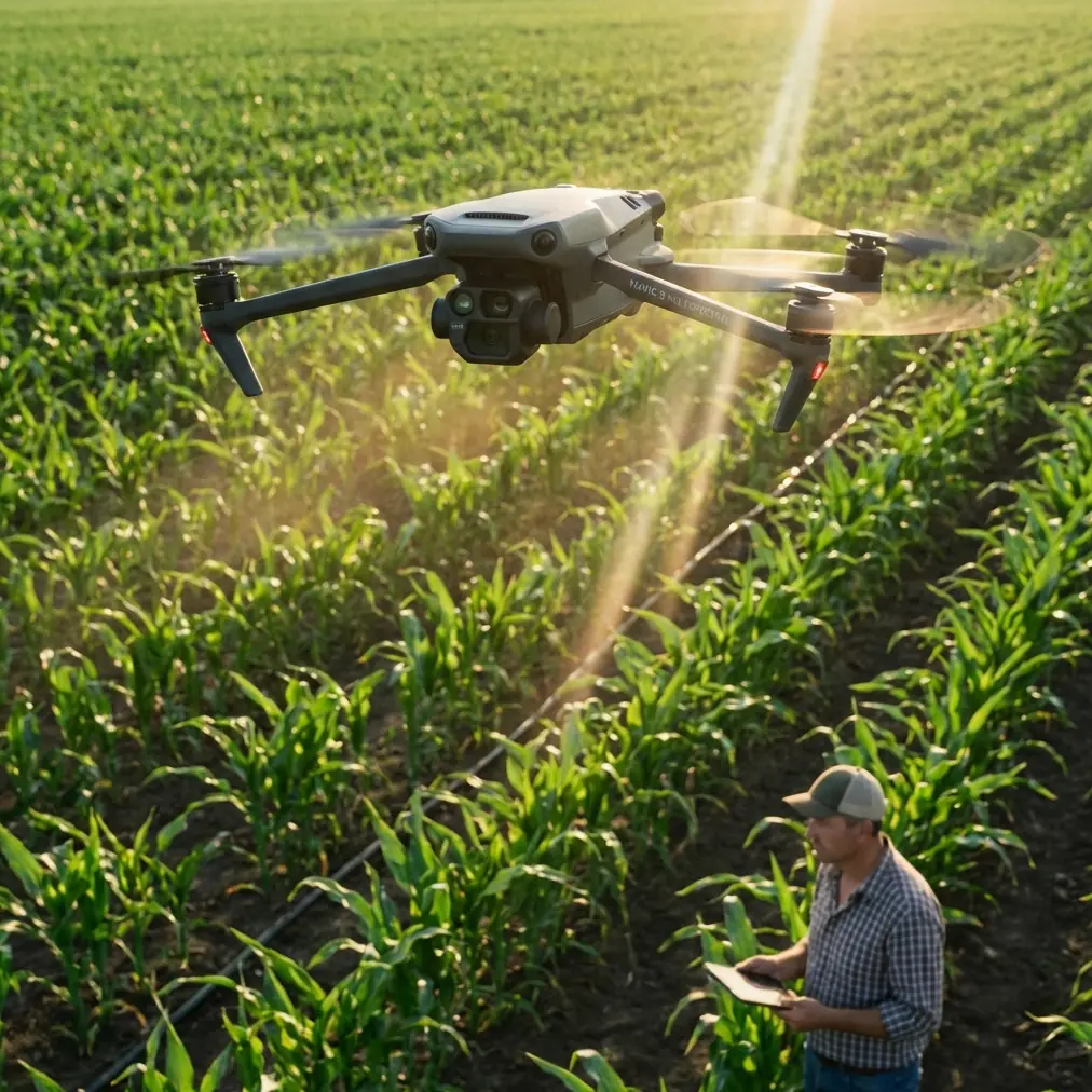
I recently worked through a simulated inspection profile based on a steep, partially forested construction corridor where a retaining system and drainage cut were being tracked over multiple phases. The point was not cinematic output. The point was operational reliability. What follows is the kind of field logic that matters when the Mavic 4 Pro is used as a working inspection platform rather than a hobby aircraft with a project attached.
The Site Problem Was Terrain, Not Distance
The inspection area was not especially large. That is worth stating early, because many people still judge drone suitability by range alone. On this site, distance was secondary. Terrain complexity was the real constraint.
The access road climbed along one side of a cut slope, then dropped behind a berm into a lower staging zone. Material stockpiles shifted weekly. Utility marking flags, temporary fencing, and scattered equipment created small but meaningful hazards for low-altitude flight. A creek corridor with dense vegetation bordered the east side of the project, and the west edge broke toward exposed rock and irregular benches.
This is exactly the sort of site where obstacle avoidance stops being a bullet point and starts becoming a risk-control layer.
With the Mavic 4 Pro, omnidirectional sensing is not just helpful during obvious close calls. Its real value is cumulative. It reduces the pilot’s cognitive load while repositioning around uneven surfaces, cranes, tree lines, and temporary site changes. On a complicated site, that matters because inspection flights are rarely one clean pass. They involve repeated angle adjustments, hovering near grade transitions, backing away from structures, and descending toward details without losing awareness of what sits just outside frame.
On one pass along the drainage channel, the drone was repositioned laterally to keep a line of riprap and culvert entry in view. A deer emerged from brush near the creek edge and crossed beneath the flight path before disappearing into the scrub. That brief wildlife encounter did not become a flight incident because the aircraft’s sensing envelope and controlled braking behavior gave the pilot room to prioritize separation rather than abruptly overcorrect. On real sites near undeveloped land, that kind of moment is not rare. Wildlife, birds, and moving site traffic are part of the environment. A drone that can detect and react smoothly is not just easier to fly; it is easier to trust.
Why Multi-Lens Flexibility Matters on Construction Work
A lot of inspection inefficiency comes from flying the wrong perspective for too long.
Wide views are essential at the beginning of a mission. They establish haul-road condition, spoil placement, drainage patterns, stockpile spread, and overall progress. But once the team spots something worth checking, such as erosion at a channel edge or inconsistent compaction along a bench, the wide camera alone becomes limiting. You either push the aircraft too close for comfort or accept less detail than the engineering team wants.
That is where the Mavic 4 Pro’s multi-camera approach earns its place. A single flight can move from broad context to isolated detail without forcing a landing, aircraft swap, or awkward digital cropping. Operationally, that means fewer interruptions and better continuity in the inspection record.
For a site manager reviewing slope stabilization, this is not a small convenience. It changes how evidence is captured. A wider view shows the relationship between the access road, the retaining zone, and runoff direction. A tighter lens view then isolates the exact section where aggregate appears to have migrated downslope. The result is a more useful visual chain. You are not just showing a defect. You are showing where it sits in the broader construction logic of the site.
That continuity also improves reporting. When field teams compile weekly updates, they need visuals that explain progression, not just isolated close-ups. The Mavic 4 Pro supports that workflow because the operator can capture the site narrative in one connected sequence.
Obstacle Avoidance Is Most Valuable During Slow, Deliberate Work
Fast flight grabs attention in marketing. Slow flight is what inspectors live in.
Construction inspection in complex terrain often means creeping along embankments, easing around drainage structures, and hovering at odd offsets while checking the relationship between two surfaces. This is the exact zone where obstacle avoidance does its best work. Not dramatic emergency saves. Quiet prevention.
On the ridgeline site, several inspection legs required flying parallel to a cut slope with uneven vegetation protruding from the upper edge. Branches were not always obvious from the pilot’s viewpoint because they blended into the background, especially when the sun flattened contrast late in the day. The Mavic 4 Pro’s sensing system gave the pilot more confidence to maintain a consistent lateral corridor rather than drifting excessively wide and losing inspection angle.
That consistency matters. If every pass has a different standoff distance because the pilot is second-guessing nearby obstacles, then comparison footage loses value. A weekly inspection only becomes analytically strong when framing, altitude, and approach remain disciplined. Sensor-assisted stability helps preserve that discipline.
The same logic applies near temporary structures. Construction sites mutate. What was clear air on Tuesday may include stacked forms, parked machinery, or barrier fencing on Friday. A drone used for site inspection must tolerate that uncertainty. Strong obstacle sensing does not replace pilot judgment, but it does reduce the penalty for imperfect knowledge on dynamic sites.
ActiveTrack and Subject Tracking Are More Useful Than People Expect
Many construction teams associate subject tracking with sports or creator workflows. That sells the feature short.
On inspection missions, ActiveTrack can be useful when the “subject” is not a person but a moving operational reference. Think of a haul truck tracing a newly cut route, an excavator repositioning along a trench line, or a superintendent walking a drainage path to point out punch-list items. Used carefully and within safe site procedures, tracking functions can document movement patterns that static overheads fail to communicate.
On this case study site, a superintendent walked the edge of a newly stabilized slope to indicate sections needing closer review. Instead of manually rebuilding the frame every few seconds while also monitoring the terrain behind the aircraft, the pilot used tracking behavior to keep the human reference consistently framed from a safe offset. That freed attention for flight path management and obstacle monitoring.
Operational significance matters here. A drone feature earns respect on a construction site only when it removes workload without creating new uncertainty. ActiveTrack can do that when used in open enough corridors and with disciplined stand-off distances. It is not a substitute for manual control in tight spaces. But on broken terrain where the pilot is balancing line-of-sight, terrain relief, and framing demands, it can improve documentation efficiency in a very practical way.
D-Log Is Not Just for Filmmakers
Construction inspections often happen under ugly light.
Midday glare off pale soil, deep shadow near retaining walls, reflective water in drainage features, and dark tree lines at the project boundary can all exist in a single shot. Standard color profiles may look fine to the naked eye in the field and then fall apart later when the team tries to extract detail from highlights or shadowed edges.
This is where D-Log matters. Not as an artistic flourish, but as a documentation tool.
Capturing in D-Log gives the editor more room to balance exposure extremes and preserve subtle details across mixed lighting conditions. On the ridgeline job, that was especially useful when comparing runoff staining on shaded rock versus brighter graded surfaces nearby. A more flexible file made it easier to create review material that looked neutral and readable rather than contrast-heavy and misleading.
For firms that archive progress imagery over months, consistency is everything. A log workflow can help standardize deliverables across changing weather and sun angle. That in turn improves communication between field teams, PMs, and stakeholders who were not present on site.
The same applies to still extraction from video. If the aircraft captures a clean D-Log sequence during a pass, editors can often pull more usable frame grabs for reports than they could from a compressed, overly contrasty file. That saves time. It also means fewer return flights just to re-document an area that was technically captured but poorly exposed.
QuickShots and Hyperlapse Have a Place, if You Use Them Correctly
These modes are often dismissed on serious work sites, and that is understandable. If used carelessly, they can feel decorative.
But there is a narrow, real use case.
QuickShots can help capture consistent establishing visuals at the start or end of a reporting cycle, especially when the team wants a repeatable perspective of the full site envelope. Hyperlapse can compress visible progress in traffic flow, stockpile shifts, or crane movement patterns over a defined period. The key is restraint. The purpose is not style. The purpose is spatial and temporal clarity.
On this site, a controlled Hyperlapse sequence from a safe, elevated hold point was useful for showing how vehicle movement interacted with a constrained access route during active operations. That kind of clip can communicate bottlenecks faster than a written paragraph. It also becomes valuable in internal reviews when teams are discussing staging revisions or temporary route adjustments.
The Mavic 4 Pro is well suited to this because it is not being forced into a single identity. It can collect technical inspection views, then pivot into a structured overview asset that helps managers explain site behavior to non-pilots.
What Actually Makes the Mavic 4 Pro Effective Here
The real answer is not one feature. It is the stack.
You have obstacle avoidance reducing collision risk in variable terrain. You have subject tracking that can help maintain framing when documenting moving references. You have a multi-camera workflow that preserves context and detail within the same sortie. You have D-Log support for mixed-light sites where shadows and bright aggregate coexist. And you have automated capture modes that, when used carefully, help communicate site conditions beyond a single static image.
Those tools matter more on complex terrain than on flat, open jobs because difficult sites punish weak workflows. They expose every gap in situational awareness, every awkward camera limitation, and every moment where the pilot has to choose between safe standoff and useful detail.
The Mavic 4 Pro does not eliminate those tradeoffs. No aircraft does. What it does is narrow them.
That is the difference between a drone that is merely capable of reaching the site and one that can repeatedly produce inspection-grade results there.
If your team is evaluating whether the platform fits your terrain and reporting workflow, you can message us directly here and compare mission requirements before the next deployment.
For construction professionals inspecting in cut slopes, wooded perimeters, drainage corridors, and uneven haul routes, the Mavic 4 Pro stands out not because it is flashy, but because its flight intelligence and imaging flexibility align with what the job actually demands. On difficult ground, that is the metric that counts.
Ready for your own Mavic 4 Pro? Contact our team for expert consultation.