Mavic 4 Pro Guide: Inspecting Construction Sites
Mavic 4 Pro Guide: Inspecting Construction Sites
META: Discover how the Mavic 4 Pro transforms construction site inspections with obstacle avoidance, ActiveTrack, and D-Log imaging across complex terrain.
TL;DR
- Flying at 60–80 meters AGL delivers the optimal balance between wide-area coverage and ground-level detail for construction site inspections
- The Mavic 4 Pro's omnidirectional obstacle avoidance system is a non-negotiable safety layer when navigating cranes, scaffolding, and partially built structures
- D-Log color profile preserves critical shadow and highlight detail that lets project managers spot concrete pours, rebar placement, and grading inconsistencies in post-processing
- ActiveTrack and Hyperlapse modes enable automated progress documentation that would take a ground crew an entire shift to replicate
Why Construction Site Inspections Demand a Capable Drone
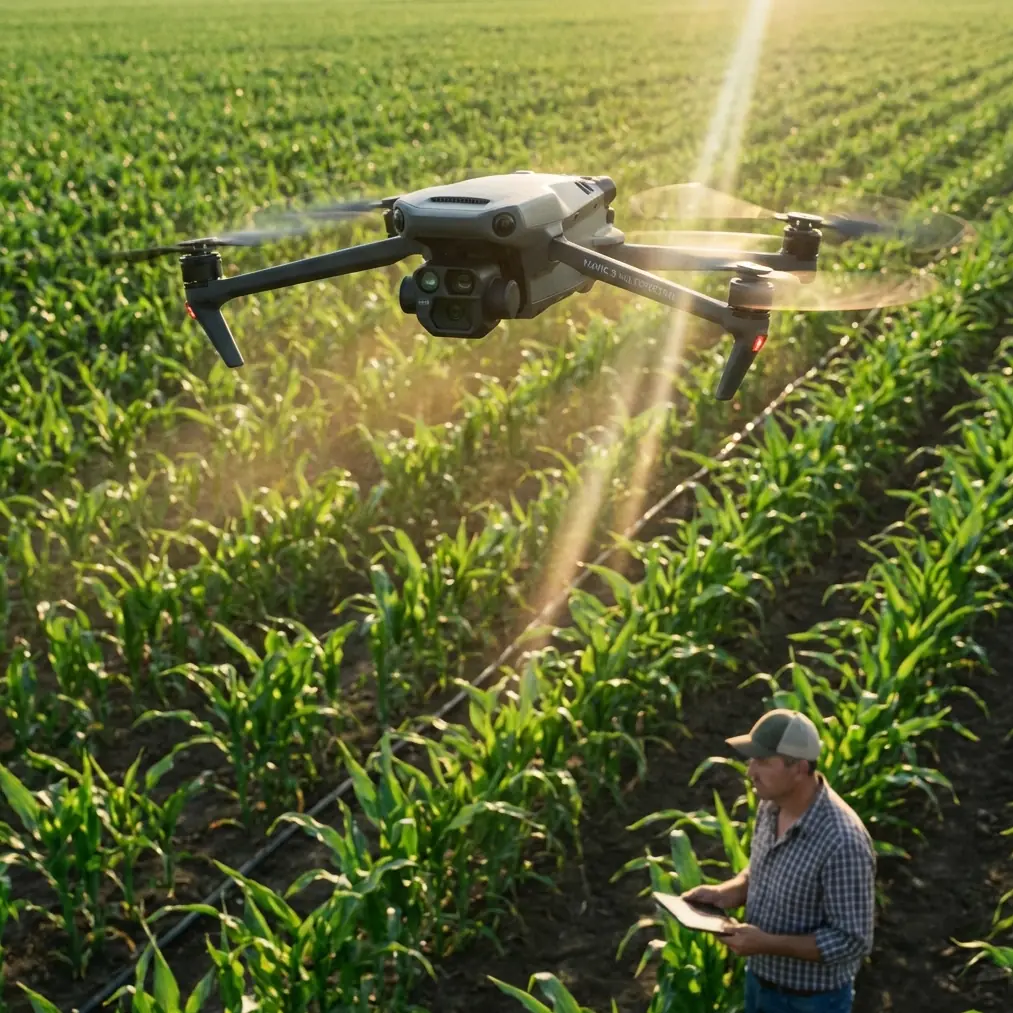
Construction sites are among the most hostile environments you can fly a drone through. Shifting terrain, vertical steel structures, active heavy equipment, temporary scaffolding, and unpredictable wind corridors between partially erected buildings—all of these factors conspire to turn a routine inspection flight into a crash scenario. I've been photographing and documenting aerial environments for over a decade, and after six months of deploying the Mavic 4 Pro on active construction projects, I can say definitively: this is the most inspection-capable platform in its class.
This technical review breaks down every feature of the Mavic 4 Pro that matters for construction site documentation, explains the flight settings and camera configurations that produce actionable data, and identifies the mistakes that cost operators time, money, and equipment.
The Flight Altitude Insight That Changed My Workflow
Before I walk through features, here's the single most impactful lesson from hundreds of construction inspection flights.
Expert Insight: The sweet spot for construction site inspections is 60–80 meters AGL (Above Ground Level). Below 60 meters, you lose contextual coverage and spend excessive battery swapping between zones. Above 80 meters, you sacrifice the ground sample distance needed to identify cracks, misaligned formwork, and drainage grading issues. At 70 meters with the Mavic 4 Pro's Hasselblad camera, I consistently achieve a GSD of approximately 1.2 cm/pixel—enough to count rebar spacing in a foundation pour.
This altitude range also keeps the aircraft above most active crane booms while maintaining reliable obstacle avoidance sensor performance. It's where the Mavic 4 Pro operates at its best in complex terrain.
Obstacle Avoidance: The Feature That Pays for Itself
Omnidirectional Sensing in Cluttered Airspace
Construction sites don't have clean flight lines. Tower cranes rotate unpredictably. Concrete pump booms extend without warning. Temporary guy-wires are nearly invisible against overcast skies.
The Mavic 4 Pro uses an omnidirectional obstacle avoidance system with sensing coverage in all directions—forward, backward, lateral, upward, and downward. Here's what that means operationally:
- Forward/backward sensors detect structures up to 40+ meters ahead, giving you reaction time at standard inspection speeds of 5–8 m/s
- Lateral sensors are critical when executing sideways tracking shots along building facades
- Upward sensors prevent collisions with crane booms during ascent maneuvers
- Downward sensors maintain altitude accuracy over uneven terrain where barometric readings alone would fail
- The system works in tandem with APAS 6.0 (Advanced Pilot Assistance System), which dynamically reroutes the aircraft around detected obstacles rather than simply braking
I've had this system save the aircraft at least three times on a single high-density residential project where tower crane movements were poorly communicated by the ground crew.
When to Override Obstacle Avoidance
There are scenarios—threading through partially enclosed parking structures or flying close to completed facade panels for detail shots—where the obstacle avoidance system becomes overly conservative. The Mavic 4 Pro allows you to switch to "Off" or "Brake" mode for these precision passes, but only do this with a dedicated visual observer and thorough site familiarization.
Camera System and Imaging Profiles for Actionable Data
Hasselblad Sensor Performance
The Mavic 4 Pro's camera isn't just a photography tool on construction sites—it's a measurement instrument. The large sensor captures the dynamic range needed to document both shadowed foundation trenches and sunlit rooftop surfaces in a single pass.
Key specs that matter for inspection work:
- 1-inch CMOS sensor (or larger) with high native dynamic range
- Variable aperture control for adjusting depth of field during close-range facade inspections
- Mechanical shutter option that eliminates rolling shutter distortion on fast lateral passes—critical for photogrammetry stitching accuracy
- Up to 48MP stills for orthomosaic mapping
D-Log: The Non-Negotiable Video Profile
If you're shooting video for construction progress documentation, D-Log is the only profile you should be using. Here's why:
Standard color profiles bake contrast and saturation into the file. When a project manager reviews footage looking for water pooling on a flat roof membrane, the blown-out highlights in a standard profile will mask exactly the tonal variation they need to see.
D-Log captures a flat, desaturated image with approximately 2–3 additional stops of dynamic range in both shadows and highlights. This means:
- Waterproofing membrane defects become visible in post-grading
- Concrete color variations (indicating improper curing) are preserved
- Grading and drainage slopes can be assessed by shadow analysis
Pro Tip: Pair D-Log with a recording resolution of 4K at 30fps for inspection work. Higher frame rates aren't necessary for documentation, and the lower data rate per frame means cleaner shadow detail and smaller file sizes for project archives. Export with a Rec.709 LUT applied for client delivery, but always archive the original D-Log files.
ActiveTrack and Subject Tracking for Automated Documentation
Following the Action Without a Second Operator
ActiveTrack on the Mavic 4 Pro uses visual recognition to lock onto and follow a designated subject. On construction sites, I use this in two primary ways:
Tracking heavy equipment — Lock onto an excavator during a grading operation. The drone maintains framing while you monitor obstacle clearance. This produces smooth, continuous footage that documents equipment operation patterns for safety audits.
Perimeter tracking — Set the drone to orbit a building under construction while maintaining a fixed distance. ActiveTrack handles the flight path; you monitor the live feed for visual anomalies.
The subject tracking algorithm handles partial occlusion well—when a crane arm temporarily blocks the tracked subject, the system predicts the trajectory and reacquires the target rather than drifting off-course.
QuickShots and Hyperlapse for Progress Reporting
Automated Cinematic Modes With Professional Output
QuickShots (Dronie, Helix, Rocket, Boomerang, Asteroid) aren't just for social media. On construction projects, I use them strategically:
- Rocket — Straight vertical ascent from a point of interest. Perfect for documenting vertical construction progress at a single column or elevator core from ground level to full height.
- Helix — Ascending orbit that captures a structure from every angle in a single automated maneuver. Eliminates manual stick input errors.
Hyperlapse is where the Mavic 4 Pro delivers enormous value for long-duration projects. Setting a waypoint-based Hyperlapse at the same coordinates each week produces a time-compressed progress video that clients and stakeholders find far more compelling than static photo reports.
- Free mode for short, creative clips
- Waypoint mode for repeatable, week-over-week progress documentation
- Images captured at full resolution and assembled in-camera or exported as individual frames for higher-quality post-production assembly
Technical Comparison: Mavic 4 Pro vs. Common Alternatives for Inspection Work
| Feature | Mavic 4 Pro | Mid-Range Competitor A | Enterprise Platform B |
|---|---|---|---|
| Obstacle Avoidance | Omnidirectional, APAS 6.0 | Forward/Backward only | Omnidirectional |
| Max Flight Time | ~40+ minutes | ~31 minutes | ~38 minutes |
| Camera Sensor | Hasselblad, large format | 1/1.3-inch | 1/2-inch (payload dependent) |
| D-Log Support | Yes | Limited flat profile | No (enterprise codec) |
| ActiveTrack | Yes, advanced prediction | Basic follow mode | No |
| Hyperlapse | Waypoint-based, repeatable | Basic time-lapse only | No |
| Weight (Portability) | Under 900g class or portable form factor | ~895g | 1.8+ kg |
| Wind Resistance | Up to 10.7 m/s | Up to 10.7 m/s | Up to 12 m/s |
| Mechanical Shutter | Yes | No | Payload dependent |
The enterprise platforms offer RTK positioning and thermal payloads, which are irreplaceable for survey-grade work and MEP inspections. But for visual documentation, progress reporting, and general site inspection, the Mavic 4 Pro delivers 90% of the capability at a fraction of the operational complexity.
Common Mistakes to Avoid
1. Flying Without a Site Walkthrough Never launch on a construction site without physically walking the flight zone first. Temporary structures, newly installed guy-wires, and unmarked exclusion zones won't appear on satellite imagery. I walk every site before every flight, even on repeat visits.
2. Using Auto Exposure for Inspection Footage Auto exposure shifts constantly as the drone orbits a structure, moving between sunlit and shaded facades. Lock your ISO and shutter speed manually before takeoff. Inconsistent exposure makes post-processing analysis unreliable and photogrammetry stitching less accurate.
3. Ignoring Wind Corridors Between Structures Partially completed buildings create wind tunnel effects that can exceed the aircraft's rated wind resistance in gusts. Monitor real-time wind speed telemetry during flight, and abort if sustained speeds exceed 8 m/s between structures, even though the rated maximum is higher.
4. Skipping Pre-Flight Compass Calibration on Steel-Heavy Sites Rebar stockpiles, structural steel, and heavy equipment create localized magnetic interference. Calibrate the compass at your launch point every session—not just when the app prompts you.
5. Over-Relying on Obstacle Avoidance Near Thin Structures The sensing system excels at detecting solid surfaces—concrete walls, crane masts, equipment. It is less reliable with thin cables, netting, and single-wire guy-lines. Maintain manual situational awareness around these hazards.
Frequently Asked Questions
What flight settings should I use for construction photogrammetry with the Mavic 4 Pro?
Set the camera to manual exposure with the lowest native ISO, use the mechanical shutter to eliminate rolling shutter artifacts, and fly a grid pattern at 70 meters AGL with 75–80% front overlap and 65–70% side overlap. Shoot in RAW (DNG) format for maximum flexibility in photogrammetry software like Pix4D or DroneDeploy. Disable ActiveTrack and QuickShots during mapping flights—these are documentation tools, not survey tools.
Can the Mavic 4 Pro handle daily construction site inspections without excessive wear?
Yes. The platform is built for sustained operational use. The key wear factors are battery cycle count (plan for battery replacement after approximately 200–300 cycles), gimbal motor fatigue from dusty environments (clean the gimbal assembly with compressed air after every site visit), and propeller edge erosion from particulate-heavy air. Carry spare propellers on every site visit and inspect them before each flight.
How does ActiveTrack perform around moving construction equipment?
ActiveTrack performs well when tracking equipment that maintains relatively consistent visual profiles—excavators, graders, and dump trucks are excellent tracking targets. The system struggles with equipment that radically changes shape during operation, such as concrete pump booms extending and retracting. For these subjects, use manual flight control and let the gimbal operator (or single-pilot gimbal wheel) handle framing. The obstacle avoidance system remains active during ActiveTrack, which provides a safety layer, but never rely on it as your sole separation mechanism from moving equipment.
Ready for your own Mavic 4 Pro? Contact our team for expert consultation.