Inspecting Construction Sites with Mavic 4 Pro | Guide
Inspecting Construction Sites with Mavic 4 Pro | Guide
META: Master high-altitude construction site inspections with the Mavic 4 Pro. Learn antenna positioning, obstacle avoidance settings, and pro techniques for reliable surveys.
TL;DR
- Antenna positioning at 45-degree angles maximizes signal strength for high-altitude construction inspections above 2,000 meters
- Omnidirectional obstacle avoidance requires specific calibration for scaffolding and crane-dense environments
- D-Log color profile captures critical structural details often missed in standard video modes
- ActiveTrack 6.0 enables hands-free perimeter surveys while maintaining safe distances from active work zones
Why High-Altitude Construction Inspections Demand Specialized Techniques
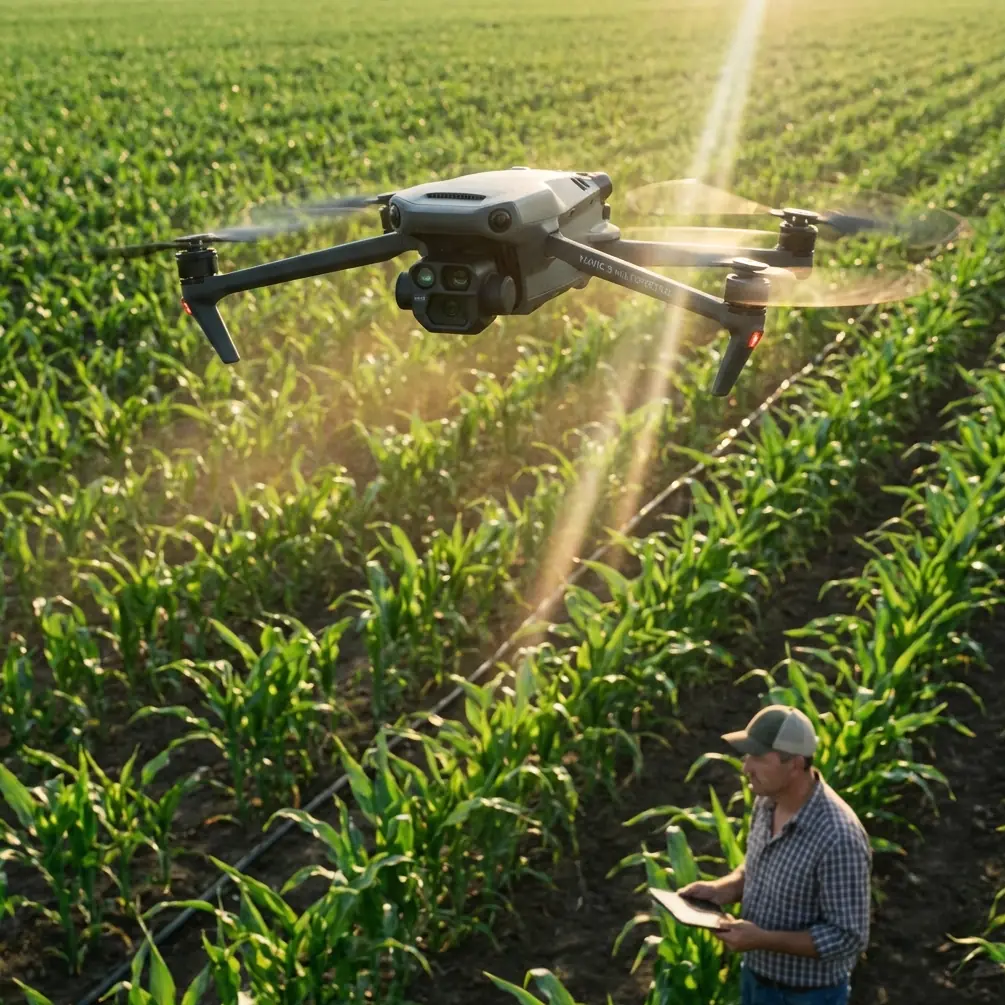
Construction site inspections at elevation present unique challenges that ground-level surveys never encounter. The Mavic 4 Pro's 100-meter obstacle sensing range and 54-minute maximum flight time make it the current standard for professional site documentation—but only when configured correctly.
This tutorial covers the exact settings, flight patterns, and antenna techniques that separate amateur footage from inspection-grade documentation. You'll learn the specific adjustments needed when atmospheric pressure drops, signal interference increases, and wind patterns become unpredictable.
Understanding High-Altitude Flight Dynamics
Atmospheric Considerations Above 2,000 Meters
Thin air affects drone performance in ways many pilots underestimate. The Mavic 4 Pro compensates automatically, but understanding these adjustments helps you plan more effective inspection routes.
At 3,000 meters elevation, air density drops approximately 30% compared to sea level. This reduction means:
- Propellers generate less lift per rotation
- Motors work harder to maintain hover stability
- Battery consumption increases by 15-20%
- Maximum payload capacity decreases
The Mavic 4 Pro's flight controller adjusts motor RPM automatically, but you should reduce your expected flight time from 46 minutes (real-world average) to approximately 35-38 minutes at high altitude.
Wind Pattern Recognition on Construction Sites
Construction sites create their own microclimate. Tall structures generate downdrafts, scaffolding creates turbulence corridors, and crane movements displace significant air volumes.
Before launching, observe these indicators:
- Dust movement patterns across the site
- Flag or tarp behavior on scaffolding
- Crane operator activity levels
- Cloud movement direction and speed
Expert Insight: Position your launch point upwind from the primary inspection area. This ensures your return flight benefits from tailwind assistance when battery reserves are lowest.
Antenna Positioning for Maximum Range
The 45-Degree Rule
Your remote controller's antennas function as directional transmitters. Pointing them directly at the drone—a common instinct—actually minimizes signal reception.
For optimal connectivity during high-altitude inspections:
- Angle both antennas at 45 degrees from vertical
- Keep the flat antenna faces oriented toward the drone
- Maintain controller position perpendicular to your flight path
- Avoid body blocking by holding the controller away from your chest
This positioning creates an overlapping signal pattern that maintains strong connectivity even when the drone moves laterally across the construction site.
Signal Interference Mitigation
Construction sites contain numerous interference sources:
- Active welding equipment generates electromagnetic noise
- Two-way radios operate on adjacent frequencies
- Power distribution panels create localized interference zones
- Metal scaffolding reflects and distorts signals
Switch to manual channel selection in the Mavic 4 Pro's transmission settings. Scan available channels before flight and select one showing minimal interference. Channels 1, 6, and 11 typically offer the cleanest signals in congested RF environments.
Configuring Obstacle Avoidance for Construction Environments
Sensor Calibration for Complex Structures
The Mavic 4 Pro's omnidirectional sensing system uses LIDAR, visual cameras, and infrared sensors working in concert. Construction sites challenge this system with:
- Thin cables and guy-wires below sensor detection thresholds
- Reflective surfaces that confuse visual positioning
- Dust particles that trigger false proximity warnings
- Moving equipment that creates unpredictable obstacles
Access Settings > Safety > Advanced Obstacle Sensing and configure:
| Setting | Standard Value | Construction Site Value |
|---|---|---|
| Obstacle Avoidance Action | Brake | Bypass |
| Sensing Range | 50m | 100m (maximum) |
| Warning Distance | 10m | 20m |
| Braking Distance | 5m | 12m |
| Downward Sensing | Normal | Enhanced |
When to Disable Obstacle Avoidance
Certain inspection tasks require temporarily disabling obstacle avoidance. Documenting interior structural elements, flying through scaffolding gaps, or capturing close-range detail shots may trigger constant braking.
Pro Tip: Create a custom flight mode called "Close Inspection" with obstacle avoidance set to "Warning Only." This maintains situational awareness through audio alerts while allowing precise manual positioning within 3 meters of structures.
Leveraging ActiveTrack for Perimeter Surveys
Subject Tracking Configuration
ActiveTrack 6.0 enables automated perimeter documentation while you focus on visual assessment. For construction site boundaries:
- Draw a tracking box around a distinctive site feature (corner post, equipment, or marking)
- Set orbit radius to maintain safe distance from active work zones
- Configure altitude hold to prevent automatic terrain following
- Enable Spotlight mode for fixed-heading orbits
The system maintains subject tracking accuracy within 2 degrees even during moderate wind conditions, producing smooth perimeter footage suitable for progress documentation.
Combining ActiveTrack with Hyperlapse
Construction progress documentation benefits from time-compressed footage. Configure Hyperlapse in Circle mode while ActiveTrack maintains subject focus:
- Interval: 2 seconds for daily progress shots
- Duration: 15-20 seconds output length
- Resolution: 4K for maximum detail retention
- Speed: 30x compression for weekly comparison videos
Capturing Inspection-Grade Footage with D-Log
Color Profile Selection
Standard color profiles optimize for immediate viewing but sacrifice dynamic range. Construction inspections require maximum detail capture for later analysis.
D-Log retains 14+ stops of dynamic range, preserving:
- Shadow detail in structural recesses
- Highlight information on reflective surfaces
- Color accuracy for material identification
- Subtle texture variations indicating wear or damage
Exposure Settings for Structural Documentation
Manual exposure control ensures consistent footage across varying lighting conditions:
- ISO: 100-400 (never auto)
- Shutter Speed: 1/50 for 25fps, 1/60 for 30fps
- Aperture: f/4.0-f/5.6 for maximum sharpness
- ND Filter: Variable ND for maintaining proper shutter speed
QuickShots for Standardized Documentation
Creating Repeatable Flight Patterns
QuickShots provide consistent camera movements that simplify before/after comparisons. For construction documentation, prioritize:
Dronie: Establishes site context with backward-ascending movement Circle: Documents 360-degree structural condition Helix: Combines orbit with altitude gain for comprehensive coverage Rocket: Vertical ascent revealing site layout and surroundings
Save QuickShot waypoints for each inspection location. Repeating identical flight paths across multiple site visits creates directly comparable footage.
Common Mistakes to Avoid
Launching from unstable surfaces: Construction sites rarely offer flat, stable launch areas. Carry a portable landing pad and verify level positioning before takeoff.
Ignoring compass calibration warnings: Metal-rich construction environments frequently trigger calibration requests. Complete calibration away from rebar stockpiles and heavy equipment.
Flying during active concrete pours: Concrete dust damages gimbal mechanisms and sensor lenses. Schedule inspections during non-pour periods.
Neglecting battery temperature: High-altitude environments often feature significant temperature variations. Pre-warm batteries to 20°C minimum before flight.
Overlooking airspace restrictions: Many construction sites fall within controlled airspace near urban centers. Verify authorization requirements before every inspection.
Frequently Asked Questions
How does wind affect Mavic 4 Pro performance at construction sites?
The Mavic 4 Pro maintains stable flight in winds up to 12 m/s (Level 6). However, construction site turbulence creates localized gusts exceeding ambient conditions. Reduce maximum speed settings by 30% when flying near tall structures and maintain manual control readiness during automated flight modes.
What backup procedures should I establish for high-altitude inspections?
Configure Return-to-Home altitude 50 meters above the tallest site structure. Set low-battery RTH threshold to 30% rather than the default 20% to compensate for increased power consumption at elevation. Always maintain visual line of sight and designate an emergency landing zone clear of workers and equipment.
Can the Mavic 4 Pro capture thermal data for construction inspections?
The standard Mavic 4 Pro lacks thermal imaging capability. For thermal inspections requiring heat signature detection—identifying insulation gaps, electrical hotspots, or moisture intrusion—consider the Mavic 4 Thermal variant or pair visual inspections with a dedicated thermal platform.
Ready for your own Mavic 4 Pro? Contact our team for expert consultation.