Mavic 4 Pro for Coastal Inspections: A Field Case Study
Mavic 4 Pro for Coastal Inspections: A Field Case Study on Height Stability, Safer Flight Paths, and Cleaner Data
META: A real-world case study on using Mavic 4 Pro for coastline inspections, with a focus on height control, obstacle awareness, sensor cleaning, and why fused altitude data matters near cliffs, surf, and sea spray.
Coastline inspection looks simple from the shore. It never feels simple in the air.
You launch over a beach, push toward a rock face, and suddenly the environment starts arguing with your flight plan. Wind rolls off the cliff. Salt haze softens contrast. Waves create a moving visual texture below the aircraft. If you are documenting erosion, drainage outlets, retaining walls, stair access, or shoreline assets, the challenge is not just getting a pretty aerial angle. It is maintaining stable, believable vertical positioning while collecting footage and stills that can actually support decisions later.
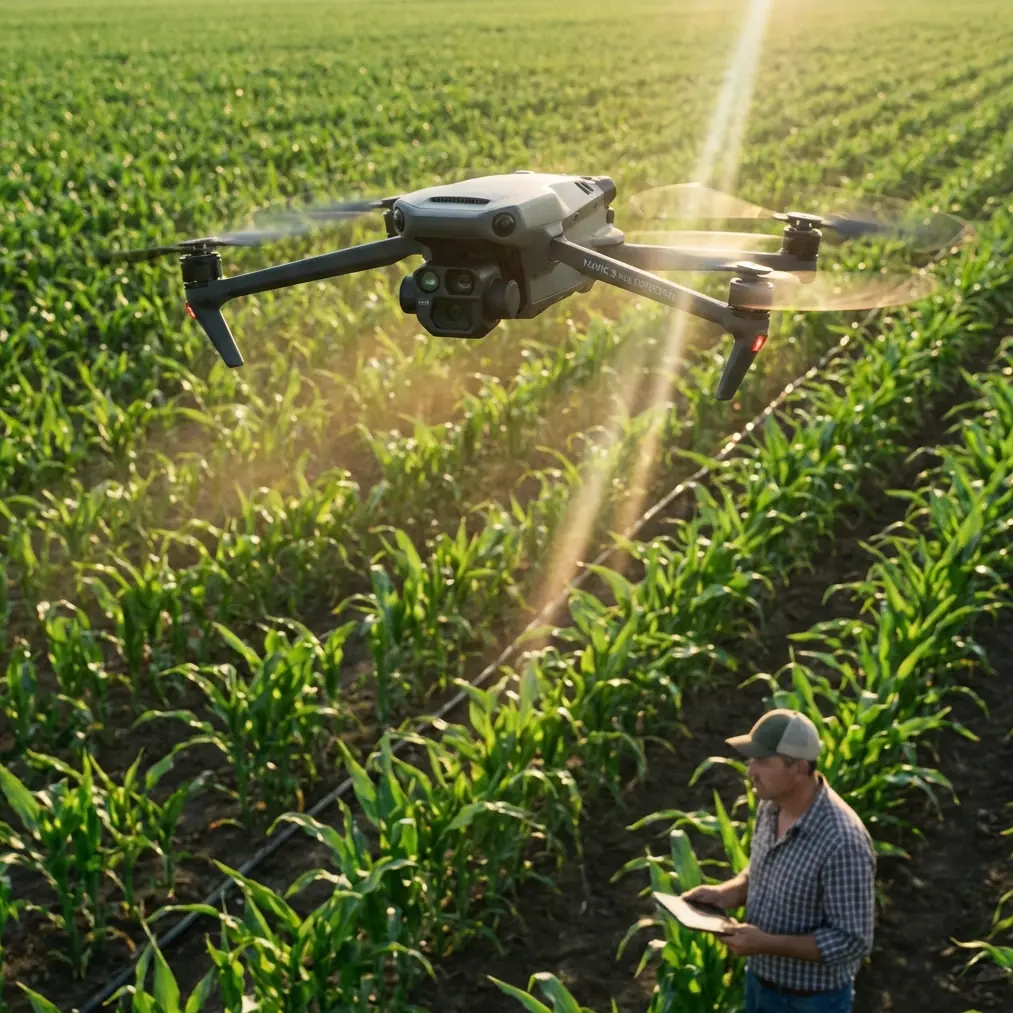
That is where the Mavic 4 Pro becomes interesting—not as a generic camera drone, but as a practical inspection tool when the operator understands what matters most in a coastal workflow.
I approach this as a photographer first, but on shoreline jobs the camera is only half the story. The other half is height discipline.
Why altitude behavior matters more on the coast than most pilots expect
A useful clue comes from older UAV and sensor design research rather than marketing copy. One hexacopter design study from Harbin Institute of Technology discusses a compact, low-power height-sensing approach that combines an accelerometer with a barometric sensor to obtain precise vertical height information. That pairing matters because each sensor solves the other’s weakness.
The accelerometer responds quickly, which is great when the aircraft is moving dynamically along uneven terrain or reacting to wind. The downside is drift. If you double-integrate acceleration over time, small errors grow into large altitude mistakes. The barometer is much better at stabilizing long-term height behavior, but atmospheric conditions and local pressure changes can introduce their own problems. The study’s core point is operationally significant for drone work: fusing these inputs improves relative altitude tracking, especially when what you care about is change in height rather than a perfectly correct absolute elevation.
That sounds technical, but on a coastline it is deeply practical.
When you are flying parallel to a cliff band or tracing the contour of a sea wall, relative height consistency is often more valuable than a single absolute number. You need to know that your aircraft is holding a dependable vertical relationship to the feature being inspected. If the drone wanders up and down while you think you are flying a flat pass, your comparison images become less useful, your overlap can suffer, and defect visibility changes frame to frame.
The same research also notes that GPS can help reduce absolute altitude error caused by atmospheric pressure variation, while a reference barometer can reduce weather-related influence. For a coastal operator, that reinforces a simple field truth: no single sensor should be trusted in isolation, especially where sea breeze, pressure shifts, and terrain-driven airflow all stack up at once.
The Mavic 4 Pro advantage in a coastline workflow
The Mavic 4 Pro’s value for this kind of work is not one headline feature. It is the combination: dependable flight behavior, obstacle awareness, strong imaging options, and the ability to keep an inspection line smooth when the environment is messy.
On a recent shoreline documentation assignment, I was asked to capture a stretch of coastal infrastructure that included stair access, exposed drainage points, a broken edge along a pedestrian path, and rock shelves that disappeared under high spray. This was not a mapping mission in the pure survey sense, and it was not a cinematic shoot either. It sat in the middle. The client needed visual evidence, repeatable passes, and enough grading flexibility in post to handle bright water and shadowed rock in the same sequence.
That is where D-Log became useful. Coastal scenes are contrast traps. White foam, reflective water, dark crevices, and pale concrete can all sit in one frame. Shooting in D-Log gave me more room to hold tonal separation without blowing out highlights in the surf line. For inspection work, this is less about style and more about visibility. Texture in cracked surfaces and runoff staining is easier to preserve when your source footage is not clipped.
Just as important was obstacle avoidance. Along coastlines, hazards are not limited to obvious structures. You have protruding railings, uneven cliff faces, signposts, overhead utility crossings near access roads, and occasional birds riding the same uplift you want to use. A system that helps detect and react to obstacles gives you more margin when flying side-on inspection lines close to terrain. It does not replace judgment, but it buys time.
ActiveTrack and subject tracking also have a place here, though not in the obvious way. I do not rely on tracking for every inspection pass. Still, when documenting a moving maintenance team on a coastal path or following a utility vehicle to show access conditions, intelligent tracking can maintain framing while freeing attention for terrain and flight path monitoring. It becomes a workflow tool rather than a novelty.
The pre-flight step many pilots skip—and should not
Before any shoreline launch, I clean the aircraft. Not casually. Intentionally.
Sea spray leaves more than visible droplets. It deposits salt, and salt changes how things behave. On a drone with obstacle avoidance sensors, that matters. A fine film on the sensing surfaces can reduce confidence in what the aircraft “sees,” especially early in the morning when humidity is already working against contrast. The same applies to camera glass, of course, but on a coastal mission I treat the safety systems with the same respect as the lens.
My pre-flight routine for the Mavic 4 Pro starts with a soft inspection cloth and a close check of the vision and obstacle sensing areas. I am looking for salt spots, haze, fingerprints, and dried spray residue. Then I check the gimbal movement, arm joints, battery seating, and propeller condition. If the drone was flown near surf on the previous job, I pay even more attention. Tiny contamination is easy to dismiss on land. Near cliffs and unstable wind, small preventable issues become operational ones.
That simple cleaning step supports every smart feature people like to talk about—obstacle avoidance, subject tracking, ActiveTrack, and automated modes. Dirty sensors can degrade confidence in the data those features rely on. On a coastline, where surfaces can already confuse visual systems, giving the aircraft the cleanest possible starting point is basic professionalism.
Holding a consistent line over uneven terrain
One challenge on this assignment was a stepped coastline. The path sat above the beach in some sections, then dropped toward a concrete access ramp, then rose again along a revetment. Flying it at a visually consistent height was harder than it looked from the ground.
This is exactly why the sensor-fusion idea from the reference material matters. The study describes how a low-cost attitude reference system with built-in GPS, combined with a barometric altimeter, can preserve dynamic height measurement while stabilizing the double integration of acceleration. In plain language: responsive motion sensing needs a stabilizing partner. That principle remains relevant when operating a modern camera drone in a place where vertical cues are constantly changing.
With the Mavic 4 Pro, I flew repeated passes focused on relative height consistency against the path edge and rock line, not the water surface. Water is a poor visual and operational reference because it is always moving, and wave height can distort your perception. By anchoring the inspection logic to the infrastructure and landform instead, I got cleaner comparison shots and more reliable frame-to-frame continuity.
This also helped when creating Hyperlapse segments for broader site context. Hyperlapse is usually discussed as a creative mode, but it can serve an inspection purpose when used carefully. A controlled elevated Hyperlapse along the shoreline can reveal drainage patterns, access constraints, and the relationship between structures and erosion zones in a way single stills cannot. The key is that the underlying flight path must be stable enough to make the motion legible rather than distracting.
QuickShots are not just for social clips
QuickShots tend to be dismissed by serious operators, which is a mistake. For client communication, especially with non-technical stakeholders, a short automated reveal around a coastal structure can explain the problem faster than a folder of flat images.
I used QuickShots on this project for one reason: orientation. A local facilities team needed to understand how a damaged stair section related to the adjacent retaining edge and the beach access below. A compact, controlled automated move established that relationship clearly. It was not the primary inspection record, but it improved the usefulness of the deliverable.
That is the larger point with the Mavic 4 Pro in inspection work. Features marketed as creative can become informational when they are used with intent.
Wind, cliffs, and the hidden cost of vertical error
The coastal environment punishes sloppy altitude handling. If the aircraft gains height unexpectedly near a cliff face, your lateral framing changes and any small surface defects become harder to judge. If it drops unexpectedly near surf, you may not just lose a shot—you may put the aircraft in moisture-heavy air where visibility and sensor performance can degrade.
The research extract mentions that the system was focused on accurately measuring relative height change rather than absolute height, and that attitude error can influence height estimation. That is an underrated insight for field operators. On a shoreline, pitch and roll are constantly being nudged by turbulent air. Any error in how the aircraft interprets or compensates for that motion can show up as altitude inconsistency at exactly the wrong time.
Practically, this means a coastline operator should avoid overconfidence in automation alone. Use the Mavic 4 Pro’s intelligence, but fly with a strong visual reference plan:
- choose a fixed shoreline feature for height consistency
- avoid using the waterline as your primary vertical cue
- repeat key passes from the same direction when wind shifts
- review early clips in the field before moving on
That last point saves jobs. If the first pass shows subtle height oscillation against the target structure, correct it while you are still on site.
Image quality is only valuable if the data is usable later
As a photographer, I care about the look of the file. As an inspection operator, I care more about whether the image stands up under scrutiny a week later.
The Mavic 4 Pro is at its best on coastal jobs when you pair its imaging flexibility with disciplined capture. D-Log helps preserve tonal information. Stable obstacle awareness reduces avoidable interruptions near complex terrain. Tracking tools can support contextual shots involving crews or moving vehicles. Hyperlapse and QuickShots can become communication tools rather than gimmicks. But none of that rescues a mission flown without a plan for height control.
That is why I keep coming back to the sensor principle embedded in the reference material: high-performance vertical measurement depends on combining fast response with long-term stability. The Harbin study even cites the use of an Xsens MTi-G sensor in the system architecture, reinforcing the broader engineering lesson that attitude and altitude quality are tightly linked. For coastal inspection, that connection is not academic. It is visible in every pass you make along a cliff, sea wall, or elevated walkway.
A better way to think about the Mavic 4 Pro on coastal jobs
If you are considering the Mavic 4 Pro for shoreline inspections, do not frame the decision around headline specs alone. Ask a harder question: can this aircraft help you maintain safe separation, reliable relative height, and post-production-ready files in an environment full of spray, glare, wind shear, and irregular terrain?
For me, the answer depends as much on method as on hardware.
Clean the aircraft before launch, especially the obstacle sensing surfaces. Build your pass plan around fixed land references. Use D-Log where the contrast demands it. Treat ActiveTrack and QuickShots as optional tools for communication, not substitutes for manual precision. And understand that stable vertical performance is not a luxury feature on the coast—it is the backbone of credible inspection output.
If you are refining a Mavic 4 Pro workflow for this kind of work and want to compare notes on aircraft setup, route planning, or coastal capture practices, you can message the flight team here.
Coastline inspections reward operators who think like both pilots and documentarians. The Mavic 4 Pro can do the job well, but only when the person behind the sticks respects how much the shoreline asks of altitude control, sensor clarity, and repeatable flight discipline.
Ready for your own Mavic 4 Pro? Contact our team for expert consultation.