How I Use the Mavic 4 Pro to Film Solar Farms at High Altitu
How I Use the Mavic 4 Pro to Film Solar Farms at High Altitude
META: A practical expert guide to filming solar farms in high altitude conditions with the Mavic 4 Pro, covering wind, obstacle avoidance, ActiveTrack, D-Log, Hyperlapse, and mid-flight weather changes.
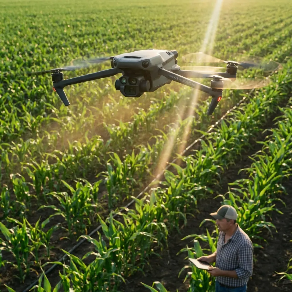
Filming a solar farm in the mountains looks straightforward on paper. Wide rows. Repeating geometry. Clean lines. Then you get on site and reality starts pushing back.
The air is thinner. Wind behaves differently over ridgelines and panel arrays. Light changes fast because clouds move hard and shadows travel across reflective surfaces in minutes, sometimes seconds. On top of that, solar facilities are full of visual traps for a camera crew: glare, repetitive patterns, access roads that look identical from altitude, and long distances that can make even a well-planned shoot feel disorganized.
This is exactly where the Mavic 4 Pro earns its place in a real commercial workflow.
I’m approaching this as a photographer and field operator, not as someone reciting a spec sheet. If your job is to film a high-altitude solar site for asset documentation, investor visuals, construction progress, operations reporting, or branded content, the aircraft has to do more than fly nicely on a calm morning. It has to stay predictable when the weather shifts, preserve highlight detail on reflective infrastructure, and help you bring back usable footage without wasting battery cycles repositioning over a massive site.
Here’s how I plan and fly the Mavic 4 Pro for that kind of work.
Start with the problem the site gives you
A solar farm is not an ordinary landscape subject.
At ground level, it feels expansive. In the air, it becomes a grid. That matters because repetitive geometry can make footage feel flat unless you build movement and perspective changes into every sequence. At high altitude, another issue shows up: conditions often change mid-flight. You can launch in bright sun and be dealing with broken cloud, gusts, and a sharp temperature shift a few minutes later.
That happened to me on a mountain installation where the first pass looked perfect. The sky was clean, panel reflections were controlled, and I was setting up a slow lateral reveal over the upper rows. Halfway through the flight, weather rolled across the ridge. Light dropped, the wind picked up, and the contrast profile of the whole site changed almost immediately.
This is where the Mavic 4 Pro’s obstacle avoidance and flight stability tools stop being marketing vocabulary and become operationally useful. On a solar farm, you’re often flying near inverter stations, perimeter fencing, access poles, substation structures, maintenance vehicles, and occasionally uneven terrain that rises faster than it appears on your display. A drone that can continuously interpret the environment while you’re also reacting to changing light gives you margin. Margin is what saves a shoot.
Pre-flight at elevation: simplify your mission
High-altitude work punishes overcomplicated plans. I keep the shot list compact and purpose-driven:
- One establishing orbit or rising reveal
- Two directional passes showing panel scale
- One low-angle route along service roads or row corridors
- One tracking shot of maintenance activity if permitted
- One Hyperlapse sequence for cloud movement or shifting light
The reason is simple. Battery planning matters more when the site is large and weather is unstable. I’m not trying to collect every possible angle. I’m trying to return with a complete visual story.
Before launch, I look at three things first:
- Wind direction relative to the panel rows
- Cloud movement over surrounding terrain
- Reflective angle off the panels during the scheduled flight window
At solar farms, reflections can destroy footage faster than camera settings can fix it. If you fly the wrong heading at the wrong moment, entire sections of the array can clip into bright glare. That’s one reason I prefer to capture in D-Log when the light is uncertain. The operational significance is not abstract. D-Log gives me more room to manage the tension between bright panel reflections and darker terrain or equipment zones in post. On high-altitude sites, where sunlight can feel harsher and cloud breaks can produce sudden contrast spikes, that flexibility is often the difference between salvageable footage and throwaways.
Use obstacle avoidance as a planning tool, not a crutch
People hear “obstacle avoidance” and think it’s there for beginners. That’s the wrong frame.
On industrial sites, obstacle sensing is best treated as a second layer of risk management. Solar farms can look open from above, but the useful flight paths are often not fully open. If I want a low tracking move that follows the contour of panel rows and then lifts toward an inverter yard, I’m relying on precise pilot input first. The sensing system is there to support that plan when depth perception gets tricky or when terrain rises unexpectedly.
This matters even more in high-altitude terrain. Slope changes can compress visually on the screen, especially when you’re concentrating on framing. A drone with strong obstacle avoidance lets you keep your attention on composition longer without giving up safety discipline. It also helps when weather changes mid-flight. Gusts can nudge the aircraft off line just enough to create a problem near fixed site structures. Extra environmental awareness buys time.
I still avoid flying aggressively close to critical infrastructure. That’s not what commercial solar clients need. They need clean, readable footage collected responsibly.
Mid-flight weather change: how the Mavic 4 Pro helps you adapt
The most useful thing about the Mavic 4 Pro on a mountain solar site is not one individual feature. It’s how several features stack together when conditions go sideways.
On that ridge job I mentioned, the weather shifted during a planned lateral sweep. As the cloud bank arrived, light flattened, the wind turned inconsistent, and the shot I originally wanted no longer matched the mood of the site. Instead of fighting for the same movement, I changed the mission.
I switched from a broad cinematic pass to tighter, more controlled sequences that used the lower contrast to my advantage. Reflective hotspots on the panels dropped because the direct sun was gone. That opened up better detail across the array. I then captured a Hyperlapse from a safer stand-off position to show cloud movement wrapping around the hillside and changing the visual rhythm of the facility.
That’s a practical use of Hyperlapse on a commercial site, not a novelty shot. It can document how weather travels across a high-altitude installation, which is useful for storytelling, investor communications, and even project context when presenting challenging operating environments. A static scene becomes informative once time compression reveals the site’s interaction with terrain and atmosphere.
At the same time, the aircraft’s stability and sensing let me work more conservatively while the air became less predictable. I shortened my routes, avoided long upwind extensions, and prioritized shots with clear return paths. Good drone work is often about abandoning the original plan fast enough.
ActiveTrack and subject tracking on a solar farm
A solar farm is mostly stationary, but that doesn’t mean tracking modes are irrelevant. They’re valuable when the site story includes people or vehicles.
If a technician vehicle is moving along the service road, or a maintenance crew is walking a row for inspection visuals, ActiveTrack and subject tracking can save time and improve consistency. The operational advantage is that I can build a smoother follow shot while maintaining more attention on framing, separation, and the surrounding site layout.
That matters because industrial environments create distraction overload. You’re checking panel geometry, road alignment, shadows, equipment yards, and crew spacing all at once. A reliable tracking mode reduces one layer of manual workload.
I don’t use ActiveTrack blindly. On a solar farm, repetitive lines can confuse visual composition even if the tracking itself holds. So I use it for short, intentional segments:
- A lead shot of a utility vehicle entering the array
- A trailing follow of a technician walking between rows
- A diagonal reveal where the subject provides scale against the installation
Those shots do something that empty aerial passes often fail to do. They explain the size of the site.
QuickShots are useful if you treat them like building blocks
I’m usually wary of automated shot modes on commercial assignments because they can feel generic. But QuickShots have a place when time is tight or weather is unstable.
At high altitude, especially when clouds are moving fast, there are moments when you need one efficient, repeatable move before the light disappears. A short automated reveal or pullback can get you a dependable transitional shot while you preserve battery and focus for the more important manual sequences.
The key is not to let QuickShots define the entire visual language of the project. They work best as inserts. A quick rise over a panel block can bridge two manually flown scenes. A controlled pullback can establish scale before you cut into lower passes and detail shots.
Used that way, they save time without making the final edit feel machine-made.
Camera approach: expose for the panels, protect the sky later
High-altitude solar filming is really a highlight-management exercise.
The panels are dark, but they can throw hard reflections. The sky can be bright and structured one minute, then muted and heavy the next. If I expose too generously for the shadows, I risk losing the reflective detail that makes the site look premium and technically precise. If I overprotect the highlights, the terrain and service areas can sink.
So my rule is simple: protect the panel reflections first, then use D-Log to recover balance in grading. This is one of the strongest reasons to choose a robust camera platform for solar work. You want flexibility when the scene contains both mirror-like surfaces and dark structural elements.
When weather changed on that ridge flight, D-Log gave me continuity across radically different light conditions. The sunny opening footage and the cloud-covered later passes were not identical, but they could be brought into the same visual story without breaking apart in post. That’s not glamorous, but it’s exactly what a client notices in the final deliverable.
Flight paths that work well over large solar sites
If you’re filming a mountain solar farm with the Mavic 4 Pro, these are the paths I return to most often:
1. Contour-following lateral
Fly parallel to the rows while matching terrain rise. This emphasizes the scale of the array and the topography it sits on.
2. Low-to-high reveal
Begin near the service road or panel edge, then climb to expose the full footprint. This works especially well when the site is tucked into a valley or hillside.
3. Diagonal cross-grid pass
A diagonal line across the array prevents the geometry from looking too static. It creates depth and makes the repeating rows feel intentional rather than monotonous.
4. Human-scale track
Use ActiveTrack or careful manual flight to follow a vehicle or worker briefly. This gives the viewer a size reference.
5. Weather-response Hyperlapse
If cloud movement starts changing the site mood, stop forcing conventional cinematic passes and capture the transformation instead.
That last one is often overlooked. On high-altitude sites, weather is not always an interruption. Sometimes it is the story.
A note on communication in the field
Solar clients usually care about three things: safety, clarity, and usefulness.
They don’t necessarily want the most dramatic shot. They want footage that represents the site accurately and attractively, without reckless flying around infrastructure or crews. I explain my plan before launch, especially if I expect weather to shift. If the conditions change, I tell them what I’m changing and why.
That builds trust. It also avoids the common trap of chasing a shot that looked good in your head but doesn’t fit the day.
If you’re coordinating a similar project and need to compare field setups or workflows, I’ve found that a quick message through WhatsApp works well for pre-shoot planning.
What the Mavic 4 Pro does well for this exact job
For high-altitude solar farm filming, the Mavic 4 Pro stands out not because one feature dominates, but because its toolset aligns with the actual demands of the assignment.
- Obstacle avoidance helps maintain safer, more controlled flight around industrial structures and variable terrain.
- ActiveTrack and subject tracking support cleaner worker or vehicle sequences that add scale and context.
- QuickShots can secure efficient transitional footage when light is changing quickly.
- Hyperlapse turns weather movement into a useful visual asset.
- D-Log provides the grading latitude needed for reflective panels, bright skies, and fast contrast shifts.
That combination matters on a mountain solar site because conditions rarely stay consistent from takeoff to landing. You need a drone that lets you adapt without losing the assignment’s core purpose.
My best flights at solar farms have not been the ones where everything stayed perfect. They were the ones where conditions changed, the plan evolved, and the aircraft gave me enough control to turn a problem into a stronger visual narrative.
That’s the real test.
Ready for your own Mavic 4 Pro? Contact our team for expert consultation.