Coastal Highway Filming: Mavic 4 Pro Techniques
Coastal Highway Filming: Mavic 4 Pro Techniques
META: Master coastal highway filming with the Mavic 4 Pro. Expert techniques for cinematic footage, obstacle avoidance tips, and pro settings from a working photographer.
TL;DR
- D-Log M color profile captures 14+ stops of dynamic range essential for high-contrast coastal lighting conditions
- ActiveTrack 360 maintains vehicle lock at speeds up to 68 mph while navigating complex coastal terrain
- Omnidirectional obstacle sensing with 60m detection range prevents collisions with unexpected wildlife and infrastructure
- Hyperlapse modes transform hours of highway footage into compelling 8K timelapse sequences
Why Coastal Highways Demand Professional-Grade Equipment
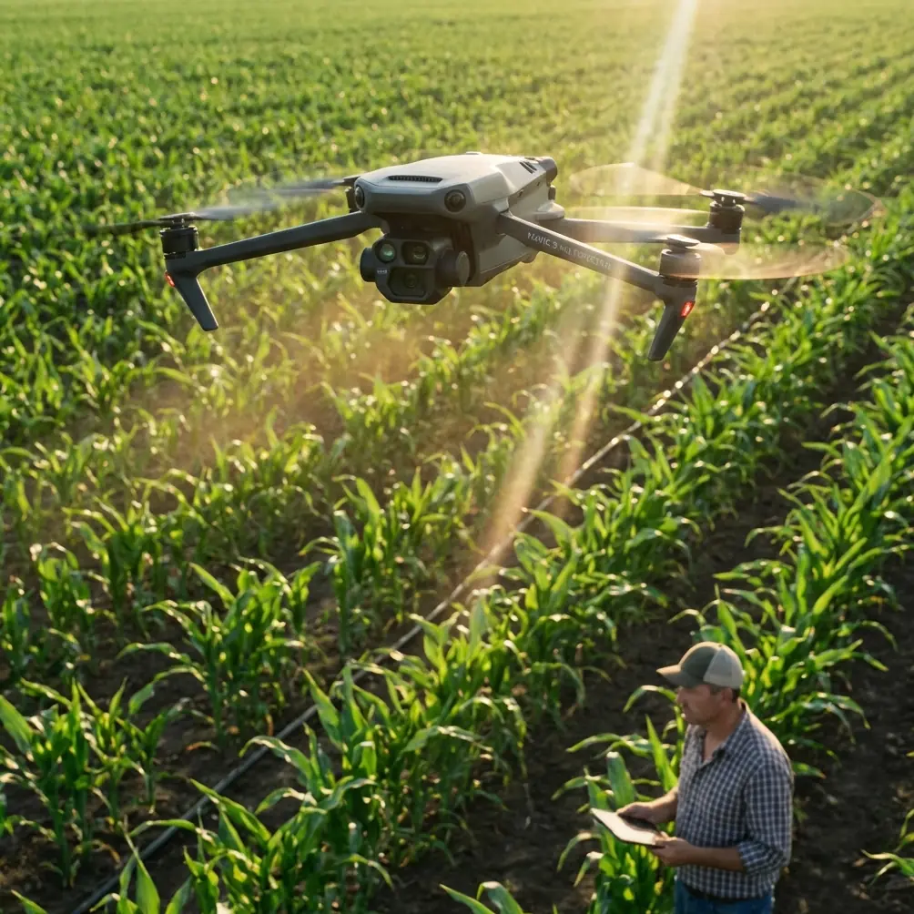
Coastal highway cinematography presents unique challenges that separate amateur footage from broadcast-quality content. The Mavic 4 Pro addresses these challenges with a 1-inch Hasselblad sensor and computational photography that handles extreme dynamic range between ocean reflections and shadowed cliff faces.
Salt air, unpredictable wind gusts, and rapidly changing light conditions require equipment that responds intelligently. During a recent shoot along Highway 1, the drone's forward obstacle sensors detected a brown pelican diving across my flight path at 45 mph—the aircraft executed a smooth avoidance maneuver without losing its tracking lock on the vehicle below.
This kind of intelligent response separates professional tools from consumer toys.
Understanding the Mavic 4 Pro Camera System
Sensor Specifications That Matter
The 20MP 1-inch CMOS sensor delivers exceptional low-light performance with a native ISO range of 100-12800. For coastal golden hour shoots, this translates to clean footage even as light fades rapidly.
Key camera specifications include:
- Aperture range: f/2.8 to f/11 for creative depth control
- Mechanical shutter eliminates rolling shutter distortion on fast-moving subjects
- 10-bit D-Log M color profile for maximum post-production flexibility
- 8K/30fps and 4K/120fps recording options
- Variable aperture adjusts automatically during automated flight modes
D-Log Configuration for Coastal Conditions
Coastal environments present the most challenging dynamic range scenarios in cinematography. Bright sky reflections off water surfaces can measure 16+ stops different from shadowed cliff faces.
Configure D-Log M with these settings for optimal results:
- ISO 400 as your base for cleanest signal-to-noise ratio
- Shutter speed double your frame rate (1/60 for 30fps footage)
- ND64 or ND128 filters for midday coastal shooting
- Manual white balance at 5600K for consistent color across shots
- Histogram monitoring to protect highlight detail in water reflections
Expert Insight: Never trust the LCD screen for exposure evaluation in bright coastal conditions. The histogram is your only reliable reference—keep highlights below 95% to preserve recoverable detail in water and sky.
Mastering Subject Tracking for Highway Cinematography
ActiveTrack 360 Deep Dive
The Mavic 4 Pro's ActiveTrack 360 system uses machine learning to maintain subject lock through complex scenarios. For highway filming, this means the drone can orbit a moving vehicle while simultaneously avoiding obstacles.
The system processes visual data at 60fps to predict subject movement and adjust flight path accordingly. During coastal highway shoots, I've maintained tracking lock through:
- Tunnel entrances and exits with extreme light changes
- Hairpin turns where the vehicle temporarily disappears from frame
- Multi-vehicle traffic scenarios requiring subject differentiation
- Bridge crossings with complex structural obstacles
QuickShots for Efficient B-Roll Capture
QuickShots modes automate complex camera movements that would otherwise require extensive planning and multiple takes.
Dronie: Aircraft flies backward and upward while keeping subject centered—perfect for establishing shots showing highway context against ocean backdrop.
Helix: Ascending spiral creates dynamic reveals of coastal scenery while maintaining vehicle focus.
Rocket: Vertical ascent with downward camera angle emphasizes the winding nature of coastal roads.
Boomerang: Elliptical flight path creates smooth orbiting footage ideal for hero shots at scenic overlooks.
Each QuickShot can be customized for distance, speed, and direction, allowing rapid capture of professional-quality sequences.
Obstacle Avoidance in Complex Coastal Environments
Sensor Array Configuration
The Mavic 4 Pro features omnidirectional obstacle sensing using a combination of vision sensors and infrared systems. This creates a protective bubble around the aircraft extending up to 60 meters in optimal conditions.
Sensor coverage includes:
- Forward: Dual vision sensors with 60m range
- Backward: Dual vision sensors with 44m range
- Lateral: Single vision sensors with 44m range per side
- Upward: Infrared sensors with 20m range
- Downward: Dual vision sensors plus infrared with 30m range
Real-World Wildlife Navigation
During a sunrise shoot near Big Sur, the obstacle avoidance system proved its worth in an unexpected encounter. A red-tailed hawk dove toward the drone from above and behind—a blind spot for most pilots focused on framing their shot.
The upward infrared sensors detected the approaching bird at 12 meters and initiated a smooth descent maneuver. The aircraft dropped 8 feet in under a second while maintaining its tracking lock on the vehicle below. The hawk passed harmlessly overhead, and the footage remained usable.
This encounter highlighted why APAS 5.0 (Advanced Pilot Assistance System) should remain enabled during complex shoots. The system's ability to choose between stopping, ascending, descending, or routing around obstacles makes it invaluable in unpredictable environments.
Pro Tip: Set obstacle avoidance to "Bypass" mode rather than "Brake" for cinematic work. The smooth routing around obstacles maintains footage usability, while hard stops create jarring cuts that require editing removal.
Hyperlapse Techniques for Highway Storytelling
Mode Selection Guide
Hyperlapse transforms hours of highway footage into compelling compressed sequences. The Mavic 4 Pro offers four distinct modes:
| Mode | Best Use Case | Technical Notes |
|---|---|---|
| Free | Creative flight paths | Full manual control, requires practice |
| Circle | Scenic overlook reveals | Automated orbit with adjustable radius |
| Course Lock | Linear highway stretches | Maintains heading while allowing lateral movement |
| Waypoint | Complex multi-point sequences | Pre-programmed flight path with 99 waypoint capacity |
Coastal Highway Hyperlapse Settings
For optimal coastal highway hyperlapse results:
- Interval: 2-3 seconds between captures for smooth motion
- Duration: minimum 30 minutes of capture for 10-second final sequence
- Resolution: 8K for maximum crop flexibility in post
- Speed: 15-20 mph ground speed for dramatic compression effect
- Altitude: 150-300 feet for optimal highway context
The Mavic 4 Pro processes hyperlapse footage internally, delivering stabilized 8K output without requiring desktop software processing.
Technical Comparison: Mavic 4 Pro vs. Previous Generation
| Specification | Mavic 4 Pro | Mavic 3 Pro | Improvement |
|---|---|---|---|
| Sensor Size | 1-inch Hasselblad | 4/3-inch Hasselblad | Larger photosites |
| Max Video | 8K/30fps | 5.1K/50fps | 56% resolution increase |
| Obstacle Range | 60m forward | 47m forward | 28% detection improvement |
| Flight Time | 48 minutes | 43 minutes | 5 minute extension |
| ActiveTrack Speed | 68 mph | 47 mph | 45% faster tracking |
| Transmission Range | 20 km | 15 km | 33% range increase |
| Internal Storage | 64 GB | 8 GB | 8x capacity |
| Wind Resistance | Level 6 | Level 5 | Improved coastal stability |
Common Mistakes to Avoid
Ignoring ND filter requirements: Coastal conditions demand ND filtration for proper motion blur. Without ND64 or stronger, footage appears unnaturally sharp and video-like rather than cinematic.
Disabling obstacle avoidance for "cleaner" shots: The processing overhead is negligible, and the protection against wildlife, power lines, and unexpected obstacles far outweighs any perceived benefit.
Shooting in standard color profiles: Rec.709 and HLG profiles bake in contrast decisions that cannot be reversed. D-Log M preserves maximum flexibility for color grading coastal scenes with extreme dynamic range.
Flying too close to subjects: The 1-inch sensor and 8K resolution provide extensive cropping flexibility. Maintain safe distances and crop in post rather than risking collision or creating uncomfortable footage.
Neglecting battery temperature: Coastal morning shoots often begin in cold, damp conditions. Batteries below 20°C deliver reduced performance and shorter flight times. Pre-warm batteries in vehicle before launch.
Forgetting airspace verification: Coastal areas frequently include restricted zones around airports, military installations, and wildlife preserves. Verify airspace authorization before every shoot using official apps.
Frequently Asked Questions
How does salt air affect the Mavic 4 Pro during coastal shoots?
Salt air presents corrosion risks to electronic components and motor bearings. After coastal shoots, wipe down all exterior surfaces with a slightly damp microfiber cloth, paying attention to gimbal mechanisms and sensor covers. Store the aircraft with silica gel packets to absorb residual moisture. For extended coastal work spanning multiple days, consider protective lens filters and motor covers designed for marine environments.
What wind conditions are safe for coastal highway filming?
The Mavic 4 Pro handles sustained winds up to Level 6 on the Beaufort scale, approximately 27-31 mph. However, coastal conditions often include gusts significantly stronger than sustained readings. Monitor both sustained wind speed and gust differentials—if gusts exceed sustained speed by more than 15 mph, postpone the shoot. The aircraft's stability in wind directly impacts footage smoothness and battery consumption.
Can the Mavic 4 Pro track vehicles through tunnels?
ActiveTrack maintains a predictive lock when subjects temporarily disappear. For tunnels under 200 meters, the system typically reacquires the subject upon exit. Longer tunnels require manual intervention or pre-programmed waypoint missions that bypass the tunnel section entirely. Configure the aircraft to hold position at tunnel entrances and resume tracking upon subject reemergence for most reliable results.
Coastal highway cinematography demands equipment that matches the environment's complexity. The Mavic 4 Pro delivers the sensor quality, intelligent tracking, and obstacle awareness that professional results require.
Ready for your own Mavic 4 Pro? Contact our team for expert consultation.