Mavic 4 Pro Field Report: Filming a Mountain Construction
Mavic 4 Pro Field Report: Filming a Mountain Construction Site When the Weather Turned
META: A real-world field report on using the Mavic 4 Pro for mountain construction filming, covering obstacle avoidance, ActiveTrack, D-Log workflow, Hyperlapse capture, and how it handled changing weather on site.
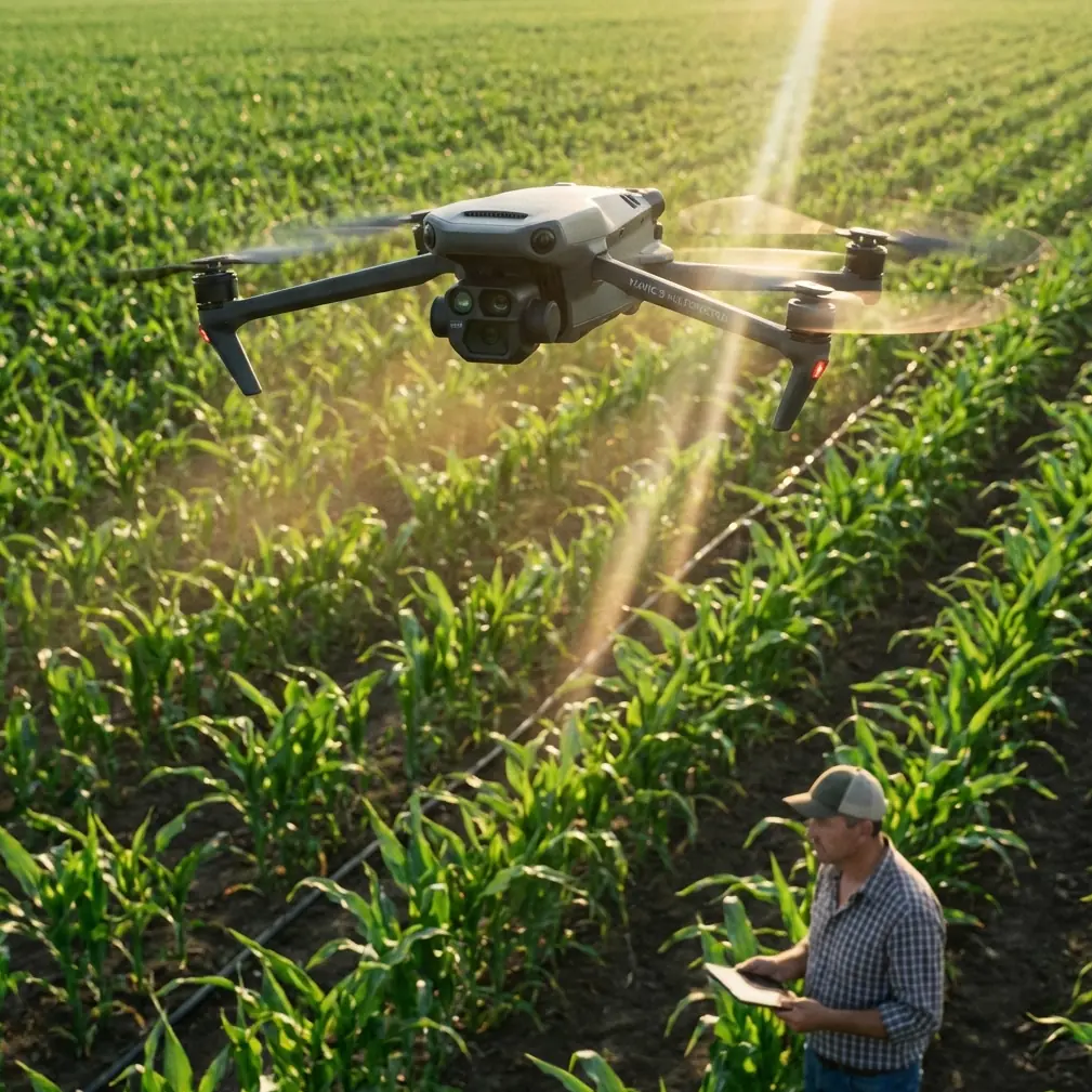
I took the Mavic 4 Pro into the mountains for a construction documentation job that looked simple on paper: capture weekly progress, build a clean visual record for stakeholders, and come back with footage that could serve both engineering review and client-facing updates.
The site itself had other ideas.
Mountain construction work creates one of the trickiest environments for aerial filming because the terrain is never just a backdrop. It affects signal paths, wind behavior, visibility, and how confidently you can fly around partially built structures. Add moving vehicles, tower cranes, exposed rebar, uneven ridgelines, and weather that changes by the quarter hour, and a drone stops being just a camera in the sky. It becomes a workflow decision.
That is where the Mavic 4 Pro stands out. Not because it promises a flawless day. No aircraft can do that. It stands out because so many of the features that sound like marketing shorthand on a spec sheet become operationally useful once the conditions start shifting.
The assignment: more than pretty footage
This was not a tourism shoot and not a cinematic vanity pass over a dramatic ridge. The client needed three things from the flight.
First, accurate visual progress documentation across multiple elevations of the site.
Second, smooth tracking footage of haul routes and equipment movement without distracting jerks or repeated resets.
Third, enough image latitude for post-production so that footage captured in broken cloud and shifting sunlight could still match in the final edit.
That combination matters. A mountain construction site is rarely lit evenly. One minute the concrete forms are under hard sun, the next minute low cloud flattens the entire scene. If you are filming only for social clips, you can sometimes work around that. If you are filming for ongoing project records, consistency matters more.
This is why D-Log recording was not just a creative choice. It was a practical one.
Why D-Log mattered on this job
When weather changes mid-flight, exposure changes with it. On a mountain slope, those changes can happen fast because the light is being interrupted not only by clouds but by terrain angles and reflective surfaces on machinery and building materials.
Shooting in D-Log gave me room to hold detail across those transitions. The flat profile is not exciting straight out of camera, but on a site like this it gives you a much better chance of matching a bright establishing pass with a later shot taken under a cooler, muted sky. For construction clients, that is valuable. They want to compare conditions, surfaces, and progress without every sequence feeling like it came from a different day.
There is a secondary benefit too. On active job sites, safety vests, machinery paint, exposed soil, concrete, and vegetation all compete visually. D-Log helps preserve separation between those elements so the footage can later be graded for clarity rather than merely for mood.
That sounds like a post-production concern, but it starts in the field. The Mavic 4 Pro made that choice easy because I knew I would need the flexibility before I even launched.
The first hour: stable light, clean passes, efficient tracking
The morning began with mild wind and sharp visibility across the valley. I opened with broad orbiting passes to establish the site’s footprint against the mountain grade. This is where obstacle avoidance earned its keep immediately.
Construction sites are messy in three dimensions. You are not just avoiding buildings. You are working around temporary structures, cable runs, crane booms, scaffolding, and elevation changes that can distort your depth judgment when you are focused on framing. Obstacle avoidance is often discussed as a beginner safety net. In this setting, it is better understood as cognitive relief for experienced pilots.
That distinction matters. When you are trying to maintain line, speed, and framing while also monitoring workers, equipment movement, and wind gusts curling off the slope, every bit of spatial assistance helps preserve margin. The value is not laziness. The value is bandwidth.
I also leaned on ActiveTrack during vehicle movement shots along a rough access road. Tracking a subject on a mountain construction route is different from following a cyclist on an open trail. Trucks disappear behind retaining piles, emerge into bright patches of sun, and move through changing elevation with a background that can confuse less capable subject tracking.
ActiveTrack reduced the number of restarts I would normally expect. That translated into fewer repeated runs for site staff and less time hovering near work activity. Operationally, that is one of the underrated strengths of reliable subject tracking: it respects the jobsite schedule. You are not constantly asking the ground team to do another take because the drone drifted off the subject as the terrain changed.
Then the weather changed
Around midday, the mountain did what mountain weather does. A bank of cloud moved in faster than forecast, and the wind shifted from a manageable cross-breeze to gusts that were less predictable because they were being funneled by the ridge line.
This is where field reports separate themselves from brochure copy.
The Mavic 4 Pro did not make the weather disappear. What it did was give me enough confidence and enough information to make smart adjustments quickly. I cut some of the wider exposed passes, moved lower where terrain shielding reduced the worst of the gusts, and prioritized shorter, more deliberate flight segments over long cinematic runs.
The obstacle avoidance system became even more useful once visibility and contrast changed. In bright, stable weather, a skilled pilot can judge distance around steel and concrete fairly intuitively. In flatter light, with cloud shadow swallowing detail, the same objects become less legible through the live view. The aircraft’s situational awareness helped maintain safer spacing when visual cues became less forgiving.
This is an operational point worth emphasizing for anyone filming construction in mountain terrain: weather changes do not only affect aircraft stability. They also affect depth perception, scene readability, and decision fatigue. A drone that supports you in all three areas is more than a capture tool. It becomes part of your risk management approach.
How the drone handled the moment that mattered
The most telling sequence of the day came when I was capturing a diagonal reveal from a lower staging area up toward the main structure. The original plan was to rise gradually, clear a line of equipment, then pan into the upper terraces with the mountain backdrop visible in the gap between cloud bands.
Halfway through the shot, the wind shifted. You could see it in the vegetation and feel it in the aircraft response. At the same time, the contrast dropped because the sun disappeared behind thick cloud. This is exactly the kind of moment when rushed stick inputs ruin the shot and create unnecessary risk.
Instead of forcing the move, I let the aircraft settle, adjusted the angle, and used the drone’s stability and obstacle awareness to reshape the pass into something tighter and more useful. The final result was actually better for the client. Rather than a wide hero reveal, the footage emphasized the relationship between the access road, material staging zone, and upper build platform. For progress documentation, that told a clearer story.
This is one of the reasons I trust aircraft like the Mavic 4 Pro for mixed cinematic and industrial work. They allow you to recover creatively when conditions change. You are not trapped into either abandoning the shot or taking chances to save it.
QuickShots and Hyperlapse were not just extras
Features like QuickShots are easy to dismiss if you only think of them as social-media shortcuts. On professional site work, though, they can serve a different purpose: repeatability.
When a client wants recurring monthly visuals from the same location, having a reliable way to execute consistent movement patterns can be useful. You are not replacing manual piloting. You are creating a visual rhythm across multiple visits so decision-makers can compare change over time.
Hyperlapse was especially valuable near the end of the session as the cloud deck kept breaking and reforming over the site. A mountain construction project is shaped not just by the built environment but by how weather interacts with it. Condensation patterns, moving shadow lines, and traffic flow around temporary work zones all become easier to communicate in a compressed time sequence.
That kind of clip is not decorative fluff. It can help project teams explain logistics, weather delay impact, and site complexity to people who may never physically visit the location.
Image quality is only useful if it survives real work
A lot of drone conversations get stuck on image specs in the abstract. For this assignment, image quality mattered because the footage had to do several jobs at once. It needed to look polished enough for external presentations, neutral enough for internal reporting, and flexible enough to cut together despite changing weather.
That is where the whole package mattered: D-Log for grading latitude, stable tracking for smoother movement, obstacle avoidance for tighter work around site structures, and intelligent modes for repeatable capture.
None of these features alone defines the aircraft. Together, they reduce friction. On a mountain construction shoot, friction is what wastes battery, burns daylight, and increases the chances of going home with footage that looks fragmented.
What I would tell other operators planning a similar shoot
If you are taking the Mavic 4 Pro to a mountain construction site, plan the flight around the site’s operational reality, not around a cinematic wish list.
Scout for terrain-driven wind behavior before launch. Identify crane positions, temporary obstructions, and haul-road rhythms. Decide in advance which shots truly require altitude and which are better captured lower and closer to the geometry of the work.
Use ActiveTrack selectively, especially for predictable equipment movement where you need smooth follow footage without repeated manual corrections. Keep obstacle avoidance on your side, especially once the light goes flat or the site gets visually cluttered. And if the weather is unstable, record in D-Log from the start. You may think the morning sun is there to stay. In the mountains, that assumption rarely survives lunch.
One more practical note: clients often do not know exactly what they need until they see examples. If you are coordinating a construction documentation workflow and want to compare flight approaches or shot planning for a similar environment, you can send site details here: message the project desk directly.
The real takeaway from this field session
The Mavic 4 Pro impressed me most not in perfect weather, but in unstable weather on a complex site. That is where good drone systems justify themselves.
It tracked moving subjects without turning the shoot into a series of retries. It gave me obstacle-awareness support when the terrain and the site itself were competing for my attention. It preserved enough image flexibility through D-Log to make mixed-light footage usable in a professional edit. And when the mountain weather turned mid-flight, it let me scale the mission intelligently rather than simply scrap it.
For photographers and drone operators working construction, especially in elevated terrain, that is the difference that matters. Not whether a drone can make one beautiful clip on a calm morning. Whether it can stay useful when the environment stops cooperating.
That is the standard I use in the field. On this job, the Mavic 4 Pro met it.
Ready for your own Mavic 4 Pro? Contact our team for expert consultation.