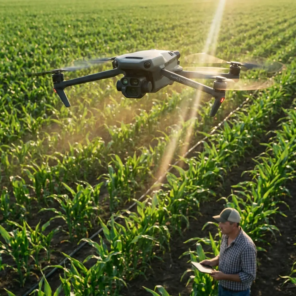
Filming Dusty Coastlines With Mavic 4 Pro
Filming Dusty Coastlines With Mavic 4 Pro: What Actually Matters When Conditions Turn Mid-Flight
META: A field-tested look at using Mavic 4 Pro for dusty coastline filming, with practical insights on flight planning, image consistency, obstacle awareness, and why photogrammetry-grade workflow lessons still matter.
Coastlines look cinematic from the ground. From the air, they become difficult.
You are dealing with glare off the water, shifting wind over cliffs, airborne grit, uneven terrain, and light that can swing from clean and contrasty to flat in minutes. Add dust to the mix and the challenge changes again. Fine particles reduce clarity, complicate landing, and punish rushed decisions. If you are flying a Mavic 4 Pro in that environment, the drone’s headline features matter less than how well you adapt your workflow when the scene stops cooperating.
That is where an older but surprisingly relevant UAV mapping case becomes useful.
A 2015 Chinese study on UAV aerial photogrammetry for rural land-rights confirmation documented a PPSG UAV operating over a 2.5 km² pilot area near Shuangyashan. The aircraft used a non-metric camera to collect low-altitude remote sensing data, then processed the imagery with professional aerial triangulation software to produce DOM and DSM outputs. The important part is not the acronyms alone. It is that the resulting accuracy met the mapping standard for 1:1,000 scale deliverables.
Why should a Mavic 4 Pro pilot filming coastlines care about that?
Because the study highlights two truths that still define successful drone work today. First, useful aerial results do not depend exclusively on exotic sensor hardware. Second, disciplined capture and processing can turn a flexible field platform into a precision tool. That applies just as much to a creator trying to hold visual consistency along a dusty shoreline as it did to a survey team documenting land parcels.
The real problem on coastlines is not just wind
Most pilots prepare for coastal wind. Fewer prepare for the combination of dust, salt haze, changing sunlight, and terrain-driven turbulence.
A coastline in dry conditions can behave like three locations at once. The beach throws bright reflected light. The rock line creates broken airflow and irregular shadows. Inland sections may be dusty and flatter, with warm-toned particulate hanging in the air. On a clean morning, the Mavic 4 Pro can give you beautifully structured footage with deep tonal separation. Then the weather shifts. A wind change lifts dust from the access road. Contrast drops. The water loses its crisp edge. Subject tracking that looked easy over open sand becomes more complicated when you move near scrub, outcrops, and footpaths.
This is exactly where pilot judgment outranks spec-sheet reading.
The old PPSG UAV paper pointed out several operational advantages of small UAV photogrammetry systems: low cost, strong mobility, fewer site restrictions, no need for a dedicated takeoff and landing field, and the ability to fly with a standard digital camera instead of a specialized metric unit. It also noted that camera settings such as aperture, shutter, ISO, and focal length could be adjusted flexibly, with software used afterward to refine color, contrast, and brightness in order to reduce dependence on lighting conditions.
That is not just survey language. It is a field strategy.
For Mavic 4 Pro coastline work, that means building your shoot around controllable variables before the weather forces your hand.
What the Mavic 4 Pro should be doing for you in dusty coastal work
The Mavic 4 Pro is at its best when you treat it as a stabilized aerial platform with smart assistance, not a machine that can rescue poor planning. Obstacle avoidance, ActiveTrack-style subject tracking, QuickShots, Hyperlapse, and flatter color profiles such as D-Log all have value here, but only if each one is used deliberately.
Obstacle avoidance matters most along irregular coastlines where rock stacks, cliff edges, poles, and stray branches can enter a route faster than they appear on a tablet preview. In clean air, line definition is obvious. In dusty haze, depth perception gets weaker, especially when the light softens and the scene becomes lower contrast. A strong avoidance system gives you a margin, but it does not replace route discipline. Build wider paths than you think you need.
Subject tracking is useful on beaches, trails, and shoreline roads, yet coastal dust can interfere with visual separation. A tracked runner in a dark jacket against pale sand is easy. The same person against scrub and weathered stone, with haze moving through the frame, can produce less stable lock. The operational lesson is simple: let the drone track movement, but choose backgrounds that help the system. If the weather changes mid-flight, reposition before the algorithm starts struggling.
D-Log matters more than many pilots admit. Coastal footage often contains bright water highlights and dark recesses in the same frame. Add dust and the scene can flatten suddenly. A log profile preserves flexibility when you later need to recover highlight detail without making the image look brittle. The paper’s discussion of adjusting color, contrast, and brightness in software to reduce lighting dependence is very relevant here. Good aerial work is rarely finished in the air.
QuickShots and Hyperlapse can work beautifully by the sea, but they are the first features I scale back when conditions turn. Automated motion paths assume the environment is still readable and predictable. Once dust intensifies or crosswind becomes inconsistent, I would rather fly a simpler manual arc and keep the aircraft in cleaner air than insist on a flashy automated move that no longer suits the scene.
A mid-flight weather shift: where the shoot is won or lost
Here is the version of the day most pilots recognize.
You launch in stable light. The first pass along the coast is sharp. Sand texture reads well, the surf line is defined, and your tracking shot down the bluff path looks smooth. Ten minutes later the weather changes. Wind rotates slightly inland. Dust starts lifting from a parking pull-off and the access track behind you. The sunlight, previously direct, goes thin behind a high cloud layer.
Nothing dramatic happened. Yet the whole flight just changed.
This is when the Mavic 4 Pro should not be asked to pretend conditions are unchanged.
First, stop chasing the original shot list. Dusty air reduces microcontrast, and lower contrast makes both obstacle reading and subject separation harder. Shift to compositions with cleaner geometry: lateral shoreline passes, higher-altitude reveals, or slower push-ins over water-facing terrain. These give the aircraft more room and preserve the image.
Second, review exposure strategy immediately. If the atmosphere is thickening, the image can look flatter but also more deceptive, because glare patches on water may still clip. Keep shutter discipline for your intended motion look, then protect highlights. D-Log gives you room later, but only if you do not overcook reflective surfaces during the transition.
Third, reconsider subject tracking. A moving person or vehicle along the coast may still be trackable, but the practical question is whether the resulting shot will look intentional. In dusty changing light, I often prefer to use tracking only for short, clean segments rather than entire runs.
Fourth, think about landing before you need to. Dusty coastlines punish last-second recoveries. The older UAV photogrammetry study emphasized that these systems do not require professional runways or dedicated launch infrastructure. That flexibility is real, but it cuts both ways. Just because you can launch from almost anywhere does not mean you should recover anywhere. On a dusty shoreline, your landing zone becomes part of image quality and aircraft longevity. Find firmer, less exposed ground early, not when the battery is already pushing your decision window.
Why a mapping study still teaches creative pilots something useful
The Shuangyashan case is valuable because it proves a method, not because it resembles a travel video.
The team captured low-altitude imagery over 2.5 km², processed it with aerial triangulation software, and achieved 1:1,000 mapping accuracy using a non-metric camera. Operationally, that says disciplined overlap, careful flight design, and rigorous post-processing can overcome equipment limitations that many people assume are decisive.
For a Mavic 4 Pro user filming coastlines, the parallel is clear.
You do not need to obsess over whether every frame was gathered under perfect golden-hour conditions. You need repeatable capture. You need stable path planning. You need settings that can survive changing atmosphere. You need enough margin in both flight route and grading workflow to normalize the visual differences that coastal weather introduces.
That is also why I advise pilots to think like surveyors for a moment, even on cinematic jobs. Decide what must remain consistent. Altitude? Lens choice? Direction of travel? Subject spacing? Ground speed? Once those are locked, the Mavic 4 Pro becomes easier to trust when the environment drifts away from your ideal plan.
Practical coastline workflow for dusty conditions
My own preference is to break the mission into three layers.
1. Secure the baseline footage first
Get the essential establishing passes while the air is cleanest. Wide coast reveals, shoreline parallels, and any route where terrain complexity is moderate should come first. If the weather turns later, you still have the structural footage that defines the piece.
2. Use intelligent features selectively
Obstacle avoidance stays valuable throughout the flight, especially near cliffs and uneven terrain. ActiveTrack-style subject following is best reserved for sections with strong visual separation. QuickShots are great when the air is stable and the space is open. Hyperlapse should be used only when the atmosphere is not actively degrading, because haze shifts become very obvious in accelerated footage.
3. Grade with the weather change in mind
Dust does not just lower contrast. It changes color relationships. Sand can warm up while the sea goes gray-green and the sky loses saturation. A flatter capture profile gives you room to restore separation carefully rather than forcing sharpness into a soft scene. The paper’s point about using software to adjust color, contrast, and brightness remains spot on. Post is not rescue. It is part of the plan.
If you are planning a coastline shoot and want a field-minded second opinion on setup, route logic, or how to handle changing conditions, you can message the team here: https://wa.me/85255379740
The biggest mistake people make with dusty shoreline flights
They assume the challenge is airborne.
Often it starts on the ground.
A poor launch position sends grit into the aircraft before the first shot. A rushed hand catch near blowing sand contaminates the gimbal area. A landing zone chosen only for convenience may sit in the exact spot where wind funnels debris. None of that shows up on a feature list, but all of it affects reliability.
The same old UAV photogrammetry logic applies: mobility is an advantage only when paired with discipline. The ability to operate without a formal airfield is useful because it expands options. It does not excuse bad site selection.
For Mavic 4 Pro pilots, that means scouting access points with recovery in mind, not just takeoff. Coastal content creators are often so focused on the hero shot that they ignore where the aircraft will come down if the weather turns. Plan the exit before the entrance.
Final take
The most useful lesson from that 2015 PPSG UAV land-rights project is not historical. It is practical. A flexible small drone, even with a non-metric camera, can produce high-quality, standard-meeting outputs when the operator respects workflow, image discipline, and processing.
That same mindset makes the Mavic 4 Pro far more effective on dusty coastlines.
Yes, obstacle avoidance matters. Yes, subject tracking and D-Log are valuable. But the real edge comes from knowing how to respond when the light softens, the dust lifts, and the original plan stops fitting the air. On those days, the strongest pilots are not the ones forcing every feature into the mission. They are the ones simplifying quickly, protecting image consistency, and bringing the aircraft home clean.
Ready for your own Mavic 4 Pro? Contact our team for expert consultation.