Mavic 4 Pro for Remote Vineyards: What the Old
Mavic 4 Pro for Remote Vineyards: What the Old Photogrammetry Rules Still Teach Us
META: A technical review of Mavic 4 Pro for remote vineyard work, linking modern flight features with classic 1:2000 photogrammetry control standards and practical field safety.
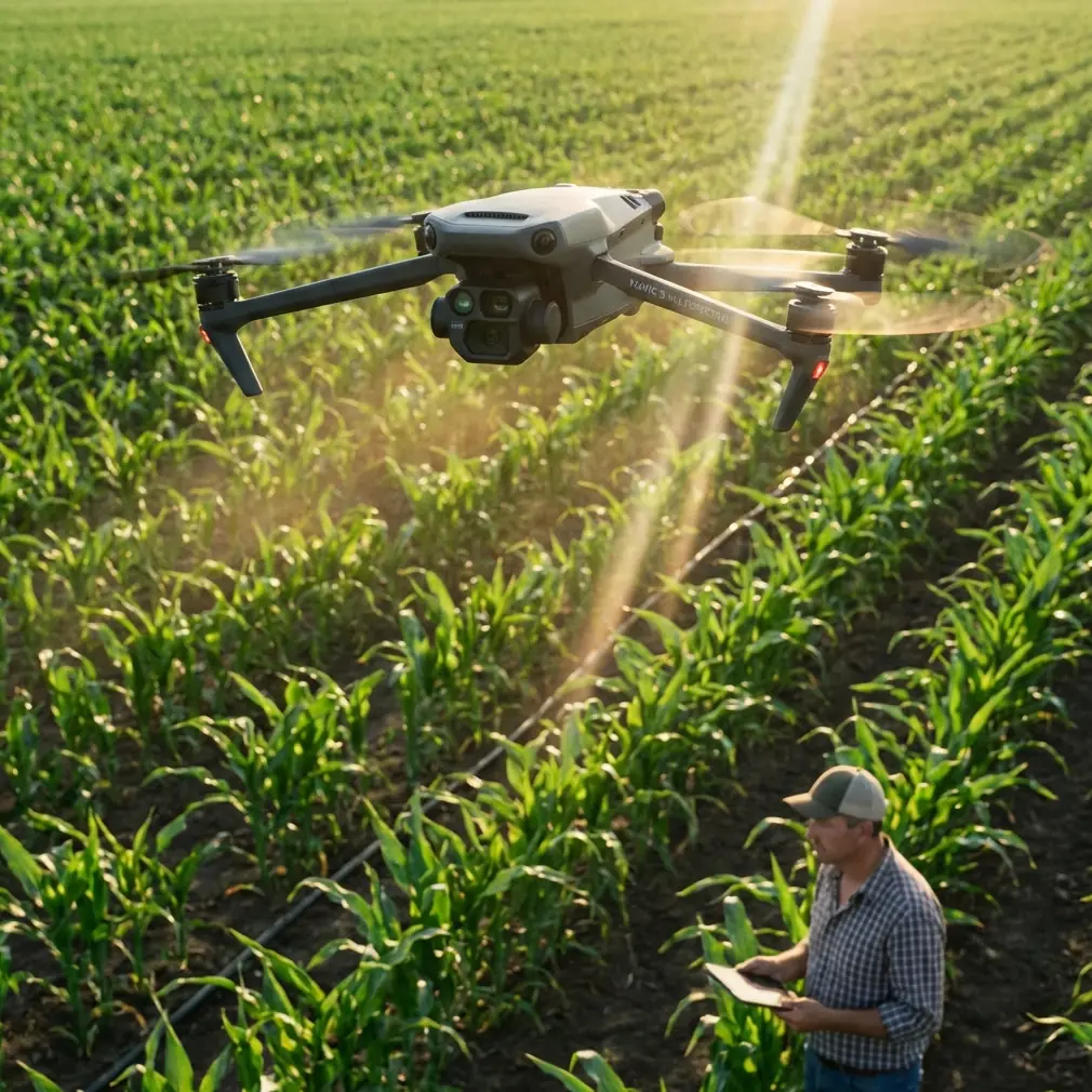
Remote vineyard operations punish sloppy drone planning.
That is true whether the job is crop observation, terrain modeling, drainage review, access-road checks, or documenting trellis conditions across steep rows. A polished aircraft with strong obstacle sensing and clean footage means very little if the mission design falls apart once you need repeatable mapping accuracy over uneven ground.
That is why an older low-altitude digital aerial photogrammetry standard is still worth revisiting when evaluating the Mavic 4 Pro. The reference here is CH/Z 3004—2010, specifically the section on 1:2,000 mapping scale and the baseline span of elevation control points under two image-orientation conditions: when the short edge of the image is parallel to the flight direction and when it is perpendicular to the flight direction. At first glance, that sounds far removed from a modern vineyard operator deciding whether to trust obstacle avoidance, ActiveTrack, or D-Log capture. It is not. Those old tables reveal something current drone users still underestimate: camera geometry and flight layout shape the workload on the ground.
Why this matters for vineyards, not just survey textbooks
A vineyard in remote terrain is rarely a neat, flat agricultural block. It is a layered environment. Narrow access tracks. Slope breaks. Wind channels. Utility poles near service buildings. Row repetition that can confuse visual judgment. Seasonal canopy changes that alter the way the site “looks” to both the pilot and the aircraft.
The Mavic 4 Pro sits in a category where users often want one aircraft to do two jobs at once: produce cinema-grade visuals and deliver practical field intelligence. That dual role is attractive in vineyards because managers often need both. A block supervisor may want a smooth Hyperlapse pass to show seasonal development, while an agronomy or operations team wants consistent imagery for identifying washout, patchy vigor zones, or irrigation anomalies. But mixed-purpose use only works if the platform can transition between creative capture and disciplined data collection without introducing hidden errors.
This is where the photogrammetry reference becomes unexpectedly useful. The standard’s tables for 1:2,000 output scale are not casual suggestions. They indicate that the spacing and number of baselines tied to elevation control vary with image format and orientation. The extracted data includes practical distance figures such as 750 m, 923 m, 1,094 m, and 1,471 m across different camera configurations. Even with the messy OCR, the operational message is clear: the acceptable control-point span is not one-size-fits-all. It changes with the camera setup and the relationship between image short edge and flight direction.
For a remote vineyard operator using a modern compact drone, that principle remains vital. You cannot assume that because a drone is smart, your ground control demands disappear.
The hidden lesson: geometry beats convenience
A lot of drone users working in agriculture fall into a familiar trap. They focus on battery endurance, automated tracking, or obstacle avoidance first, then treat mapping geometry as something software will sort out later. The old standard says otherwise.
The distinction between short-edge parallel to flight direction and short-edge perpendicular to flight direction is not academic. It affects stereo geometry, overlap behavior, and the spacing logic for elevation control. In simple terms, how the camera “frames” the terrain while moving forward changes how robust your elevation interpretation can be. On terraced or sloped vineyard sites, that difference becomes more pronounced because the land itself exaggerates weak mission design.
For Mavic 4 Pro users, this means the aircraft’s intelligence should support geometry, not replace it. If you are documenting vineyard blocks for terrain-sensitive analysis—say, runoff patterns after heavy rain or grading around new road access—you want your flight direction, image overlap, and control strategy to be deliberate. A modern aircraft can hold stable flight lines better than older systems, but stability does not automatically equal valid mapping structure.
Those 750 m to 1,471 m span figures from the standard are a reminder that control spacing has to be matched to imaging conditions. In vineyard terms, if you stretch a mission too far across ridges or segmented blocks without enough elevation control logic, you may get a beautiful mosaic that is less trustworthy than it looks.
Mavic 4 Pro’s role in that workflow
The value of the Mavic 4 Pro in a remote vineyard is not just image quality. It is how much friction it removes from technically disciplined flying.
Obstacle avoidance matters here, but not in the generic “safer drone” sense. Vineyard sites often force low-altitude transitions near tree lines, netting structures, sheds, and uneven topography. If the sensing system is dependable, the operator can devote more attention to line discipline and image consistency rather than spending all cognitive bandwidth on immediate collision risk. That matters most during repeated passes when you are trying to preserve a clean acquisition pattern over several blocks.
But there is a catch. Obstacle sensing only works as intended if the aircraft is physically clean and optically unobstructed. Before any vineyard mission, I would make one step non-negotiable: clean the vision and obstacle sensing surfaces before takeoff. Dust from dry access roads, pollen, fine spray residue, and dried water spots are normal in vineyard environments. A smeared sensor window can degrade how the aircraft interprets branches, wires, poles, and row ends. On a mission where you are flying close to terrain or relying on smart tracking around a property boundary, that is not a cosmetic issue. It is a flight-performance issue.
The same pre-flight cleaning discipline applies to the main imaging optics. If you intend to use D-Log for later grading or need consistent tonal information across a large site, haze from a dirty front element can quietly wreck your footage and reduce image interpretability.
ActiveTrack, QuickShots, and Hyperlapse in a vineyard context
These features are often discussed as if they belong only to creators. That is too narrow.
ActiveTrack can be useful in civilian estate operations when documenting a utility vehicle route through vineyard roads, checking edge conditions, or producing training footage for new staff who need a visual understanding of site circulation. The real benefit is consistency of framing while the pilot maintains attention on airspace, terrain, and signal quality. In a remote location, that reduction in manual camera workload helps.
QuickShots have a place too, but not because they are flashy. They can generate repeatable overview visuals for progress documentation—especially when a vineyard is adding infrastructure like water storage, fencing, or service paths. A standardized reveal shot captured at intervals through the season gives managers a fast visual archive. The Mavic 4 Pro becomes not just a camera, but a documentation tool.
Hyperlapse is particularly useful for showing environmental movement across a property: fog clearing from low rows, morning labor setup, vehicle circulation, or changing shadow patterns on steep blocks. For vineyard businesses that host investors, agronomists, consultants, or export partners remotely, this kind of time-compressed context can explain site conditions faster than a written memo.
Still, these automated features should not bleed into mapping flights. This is where many mixed-use operators go wrong. The Mavic 4 Pro can absolutely switch between cinematic and analytical tasks, but the pilot should mentally separate those modes. A survey-structured block capture is one thing. A storytelling pass is another.
D-Log and the value of disciplined color capture
D-Log is not just for people who enjoy grading footage.
In vineyard operations, subtle tonal separation can matter when reviewing canopy uniformity, soil exposure, drainage staining, and infrastructure condition under harsh light. A flatter profile preserves more headroom for post-processing, which can help when the property includes bright reflective soil, pale road surfaces, deep shadow under rows, and glint from irrigation hardware all in the same frame.
That does not turn the Mavic 4 Pro into a scientific multispectral platform, of course. But it does make it a stronger tool for management-grade visual analysis when handled correctly. The key is consistency: same time window where possible, similar altitude, similar camera settings, and careful note-taking about environmental conditions.
Again, this loops back to the reference standard. If classic aerial photogrammetry devoted such attention to orientation and control spacing for 1:2,000 mapping, it tells us something broader: reliable interpretation starts with controlled acquisition. Fancy post tools cannot rescue weak capture logic.
What the old baseline tables imply for Mavic 4 Pro mission design
Let’s pull the reference into field language.
The standard distinguishes baseline span recommendations based on image orientation and camera characteristics, including values tied to setups like Canon EOS 5D and other camera formats. Even if you are not flying those exact cameras, the principle transfers. Different imaging systems support different control spacing expectations. That matters because compact drone sensors, lens behavior, and flight altitudes all influence reconstruction quality.
Operationally, for a remote vineyard, I would draw three lessons from those tables:
Do not overextend control assumptions across long, broken terrain.
If the old standard discusses spans like 923 m, 1,094 m, and 1,471 m under specific conditions, then your own mission should also be condition-specific. A vineyard split by slope changes or access gullies should not be treated as a single uniform block without checking how terrain affects your model.Flight direction is a technical choice, not just a convenience choice.
Flying with the image short edge effectively aligned one way versus another changes how the terrain is sampled. In vineyards, row direction often tempts operators to fly whichever path feels easiest. That may not be the path that best supports elevation interpretation.Modern autonomy does not remove the need for ground truth.
The Mavic 4 Pro may make flight execution smoother, but if the job requires credible topographic output, you still need a rational control approach. The standard’s focus on elevation control point baseline span is a direct reminder.
Practical pre-flight routine for vineyard operators
Before launching a Mavic 4 Pro at a remote vineyard, I would keep the routine blunt and repeatable:
- Clean obstacle sensing windows and camera glass.
- Check for dust or moisture residue after transport on unsealed roads.
- Confirm return path logic for terrain and tree-line clearance.
- Decide whether this is a mapping flight, a monitoring flight, or a creative flight.
- Match flight direction to the terrain question you need answered.
- Avoid mixing automated cinematic moves into structured image acquisition.
- Record weather, especially crosswind behavior along row corridors.
If your team is building repeatable operational procedures around vineyard drone work, it helps to compare workflows with specialists who understand both aircraft capability and field deployment realities. One direct way to do that is through vineyard drone workflow support.
Final assessment
The Mavic 4 Pro makes sense for remote vineyards because it can cover multiple civilian roles without forcing operators into separate platforms for every task. It can document, inspect, communicate, and monitor. Its obstacle avoidance, subject tracking, QuickShots, Hyperlapse options, and D-Log workflow all have legitimate value on agricultural estates when used with discipline.
But the strongest takeaway from the reference material is less glamorous and more useful. The old CH/Z 3004—2010 standard, with its 1:2,000 scale control guidance and its orientation-specific baseline spans, reminds us that image capture geometry still governs outcome quality. The aircraft may be newer. The principle is not.
For vineyard operators, that means the Mavic 4 Pro is at its best when paired with two habits: clean sensors before every launch, and design flights as if geometry still matters—because it does.
Ready for your own Mavic 4 Pro? Contact our team for expert consultation.