Mavic 4 Pro Tips for Coastal Solar Farm Work
Mavic 4 Pro Tips for Coastal Solar Farm Work: What Stability Really Means When the Weather Turns
META: Practical Mavic 4 Pro guidance for coastal solar farm missions, with a focus on stability, obstacle avoidance, tracking, D-Log workflows, and how aircraft design principles matter when wind shifts mid-flight.
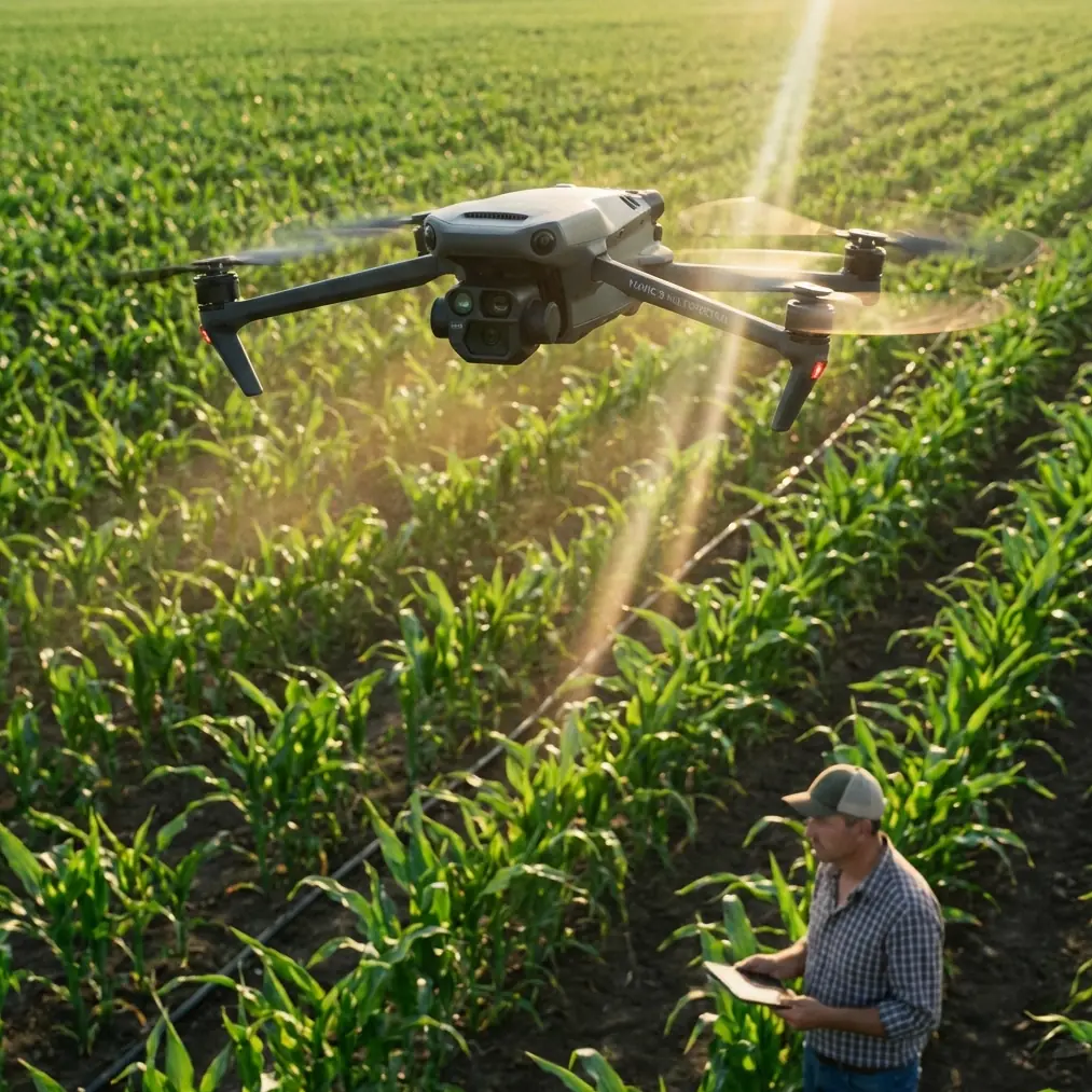
Coastal solar farms expose a drone pilot very quickly. Wide open ground, reflective panels, sea wind that looks harmless until it cuts across the array, and inspection routes that reward precision rather than speed. That is exactly why the Mavic 4 Pro conversation should not start with buzzwords. It should start with flight behavior.
If you are using a Mavic 4 Pro for solar farm delivery, documentation, progress checks, thermal-adjacent visual surveying, or client reporting in coastal conditions, the real question is simple: how well does the aircraft hold its plan when the environment stops cooperating?
That question has deeper roots than one product cycle. A useful reference comes from a Harbin Institute of Technology undergraduate design paper on hexacopter aircraft, which discusses DJI’s S800 and why its rotor arrangement mattered for professional aerial imaging. The paper points to two design ideas worth paying attention to: first, the S800 used a separated rotor layout with a certain inward rotor angle to improve stability; second, compared with a quadcopter of similar size, a hexacopter could use structural space more effectively, increase rotor count, raise payload capacity, and improve maximum thrust without a dramatic increase in total weight. Those are not antique engineering trivia points. They explain what serious operators still care about today: thrust margin, control accuracy, and stable image capture when the aircraft is working in less-than-ideal air.
The Mavic 4 Pro is not an S800, and it should not be judged like one. But the same operational logic still applies. On a coastal solar site, the difference between a useful mission and a compromised one often comes down to thrust reserve, control confidence, and how predictably the aircraft reacts when the wind shifts across long rows of panels.
Why coastal solar work is harder than it looks
From the ground, a solar farm seems easy. It is open. It is flat. There are long sightlines and repeatable rows. In practice, the site creates its own problems.
Panel surfaces throw light back at the camera. Perimeter fencing and cable infrastructure add low-level hazards. Maintenance roads tempt pilots to fly too low for too long. Wind accelerates through open lanes and changes character near embankments, substations, and shoreline edges. You may take off in calm air and be dealing with a noticeably different aircraft response six minutes later.
That is where a Mavic 4 Pro setup has to be treated like a workflow platform, not just a camera drone.
For delivery and inspection-adjacent tasks at solar farms, your priorities usually stack up like this:
- predictable takeoff and hover behavior
- safe low-altitude transit along rows
- accurate subject or route continuity
- clean image acquisition for reporting
- enough margin to adapt when weather shifts mid-flight
Those five points sound basic, but they are exactly where many missions degrade.
The old hexacopter lesson that still matters for Mavic 4 Pro users
The reference material on the S800 is valuable because it makes an engineering point many operators feel but do not always articulate. Stability is not just “less shake.” It is the product of layout, thrust availability, and control authority.
The paper specifically notes that the S800’s rotor arrangement and inward-angled rotors improved system stability. It also explains that adding rotor count in a similarly sized aircraft can improve load capacity and increase maximum thrust without a major weight penalty, which then improves thrust-to-weight ratio. Why does that matter? Because control system performance is strongly affected by thrust-to-weight ratio.
Operationally, this is huge.
A drone with stronger thrust reserve is not only better at carrying weight. It is better at correcting itself. It can respond faster to gusts, hold position with less drama, and recover cleaner after a disturbance. In aerial imaging, that translates to steadier footage. In site work, it means fewer ugly corrections near obstacles and more confidence when pausing for documentation over a designated point.
You are not flying a hexacopter when you use a Mavic 4 Pro. But if you want to get the best from it, think like an operator who understands why the S800 was built the way it was. Respect stability as a mission-critical resource. Do not spend it carelessly.
A practical coastal setup for Mavic 4 Pro missions
When I brief teams for solar farm work, I tell them to build the flight around changing conditions, not average conditions. Coastal weather is famous for giving you ten calm minutes and then asking whether your planning was serious.
1. Start with a route that avoids long crosswind legs at the worst moment
If the wind is building, a long return leg directly across open panel fields can become the least efficient part of the mission. Plan your route so that the farthest point is reached early, while battery state is strongest and the air is usually still more manageable.
This matters even more if your job involves carrying a small site item, documenting a repair delivery, or producing synchronized visual records for maintenance teams. The mission is not only about getting there. It is about getting back with enough control margin left.
2. Use obstacle avoidance as a buffer, not a substitute for judgment
Solar farms can look obstacle-light from altitude, but low-level operations are different. Fencing, utility poles, maintenance sheds, cable trays, and occasional service vehicles create fragmented risk. Obstacle avoidance is valuable here, especially when moving along rows or repositioning around infrastructure.
But reflective surfaces can complicate perception. Keep obstacle avoidance active where appropriate, yet maintain manual spacing discipline. On these sites, the best pilots use the system as an extra layer, not a crutch.
3. Treat ActiveTrack and subject tracking as tools for repeatability
If your operation includes following a maintenance cart, a technician walking a fault line, or creating progress footage for a client update, ActiveTrack can be useful. The key is not to let the feature dictate the mission.
In a solar farm, the background pattern is repetitive. Rows can confuse your visual sense of motion, and sudden wind changes may widen turns or alter the aircraft’s line. Subject tracking works best when you already know the safe corridor and have enough vertical separation to absorb an unplanned correction.
That makes tracking operationally relevant, not just visually attractive. It reduces pilot workload during routine follow sequences, provided you stay ahead of the environment.
4. Use D-Log when the site’s contrast is fighting you
Coastal solar farms often produce ugly lighting extremes: bright panel reflections, pale sky, darker service lanes, and hard transitions when clouds move in. If your footage is meant for client communication, project updates, or detailed review, D-Log gives you more flexibility to recover those tonal differences later.
This is one of the easiest ways to make Mavic 4 Pro footage more useful in a professional workflow. Not prettier for its own sake. More usable. That distinction matters.
5. Keep QuickShots and Hyperlapse for the end, not the core mission
QuickShots and Hyperlapse can be effective for stakeholder presentations. A timed pass over an inverter block or a clean reveal of the site edge can help explain scale and progress. But these should come after the core operational capture is complete.
On a day when weather may turn, it is a mistake to spend early battery and attention budget on cinematic extras. Get the mission-critical material first. If the wind stays cooperative, then build your visual layer.
What happened when the weather changed mid-flight
On one coastal-style solar assignment, the first half of the sortie was almost too easy. Light breeze. Stable hover. Straight passes over the service corridor with clean framing. Then the weather shifted in the way coastal weather often does: not with rain, not with drama, just with a noticeable lateral push that appeared from the shoreline side and started stretching every correction.
This is where aircraft character shows up.
The Mavic 4 Pro did not become unusable. But the mission had to change immediately. Active tracking on a moving ground subject was no longer the smartest mode for the next segment, because the extra environmental load narrowed the comfort margin. Low-angle cinematic passes were dropped. Altitude was adjusted slightly to reduce the most turbulent surface interaction. Return routing was tightened. Camera priorities shifted from “ideal composition” to “clean evidence and safe continuity.”
That decision-making is the whole point of flying professionally.
The old S800 reference becomes surprisingly relevant here. The paper’s thrust-to-weight discussion explains why operators care so much about control reserve in unstable air. The stronger the aircraft’s available corrective authority relative to its current demand, the more composed it feels when conditions deteriorate. Even though the Mavic 4 Pro belongs to a different class, the lesson transfers cleanly: once the environment starts consuming your control margin, simplify the mission before the aircraft has to prove too much.
The footage from that flight still worked. The reporting package still got delivered. What changed was not the drone’s usefulness, but the pilot’s priorities.
How to fly smarter over solar rows
A few habits consistently improve results with the Mavic 4 Pro on solar sites:
Fly offset, not directly over every target
A slight lateral offset often gives better visual readability of panel condition, cable routing, and service activity than a dead-center top-down approach. It also gives you more room to react if the aircraft gets nudged sideways.
Pause before every critical capture
Do not rush from movement into image acquisition. Let the aircraft settle, verify horizon and framing, then record. In gusty conditions, this one habit improves usable footage more than most people expect.
Watch groundspeed changes as a warning signal
If your aircraft is suddenly working harder to maintain the same track, that is your early indicator that the air mass is changing. Respond while you still have options.
Preserve battery for the unplanned part
The biggest mistake on neat-looking solar sites is assuming the route will remain neat. Leave capacity for one extra reposition, one extra hover verification, and one weather-driven reroute.
Build a communication path for field changes
If the site team needs a revised pass, a re-drop, or a new documentation angle, make that call early. For operators coordinating fast with a field contact, a direct line like message the site support team here can save more time than any automated shot mode.
Why Mavic 4 Pro fits this kind of work
The Mavic 4 Pro makes sense for coastal solar missions because the job usually needs a balance of mobility, imaging intelligence, and controlled adaptability. You want a platform light enough to deploy quickly between sectors, smart enough to support obstacle-aware movement and subject continuity, and capable enough to capture usable footage in difficult light.
That is why the old multirotor design principles matter so much. The S800 example in the reference material was built for professional aerial imaging, and its design choices were directly tied to stability and control precision. Those same concerns are still what separate hobby flying from commercial output.
For a solar farm operator, “stable” means:
- the drone holds a hover cleanly enough to inspect and document
- the camera remains reliable when light and wind both become messy
- automated features help but do not trap the pilot into rigid behavior
- the aircraft remains predictable when a routine pass turns into a weather-management exercise
That is the standard the Mavic 4 Pro has to meet in real field use.
Final advice for coastal solar deployments
If you are preparing a Mavic 4 Pro workflow for solar farms near the coast, think less about features in isolation and more about what they let you preserve under stress. Obstacle avoidance preserves spacing discipline. ActiveTrack preserves repeatability when used carefully. D-Log preserves image flexibility under harsh contrast. QuickShots and Hyperlapse preserve presentation value once the actual work is done.
And above all, preserve control margin.
That is the enduring lesson behind the hexacopter reference. The Harbin Institute paper did not praise the S800 simply because it flew. It highlighted rotor arrangement, inward rotor angle, and improved thrust characteristics because those choices affected stability, control precision, and professional image quality. Those are still the right things to care about when your Mavic 4 Pro is crossing a coastal solar field and the wind decides to rewrite your plan.
Ready for your own Mavic 4 Pro? Contact our team for expert consultation.